Snodberry Cleugh

Valley in Durham

England

Snodberry Cleugh

Heading away from Killhope Law A hill walker heading along the broad moorland ridge separating Weardale lying to the right, and West Allendale. Killhope Law's summit is around 300 metres behind the camera position.
Heading away from Killhope Law Credit: Trevor Littlewood

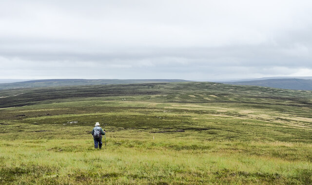
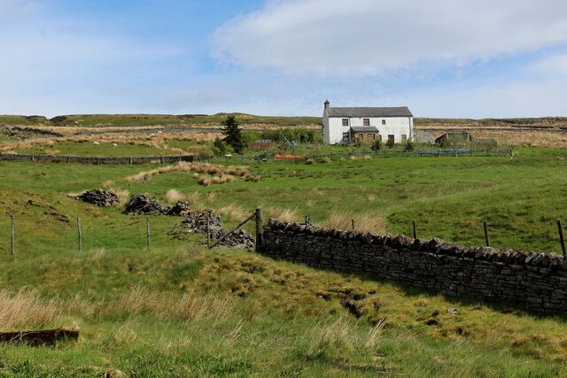
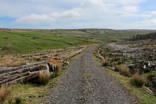
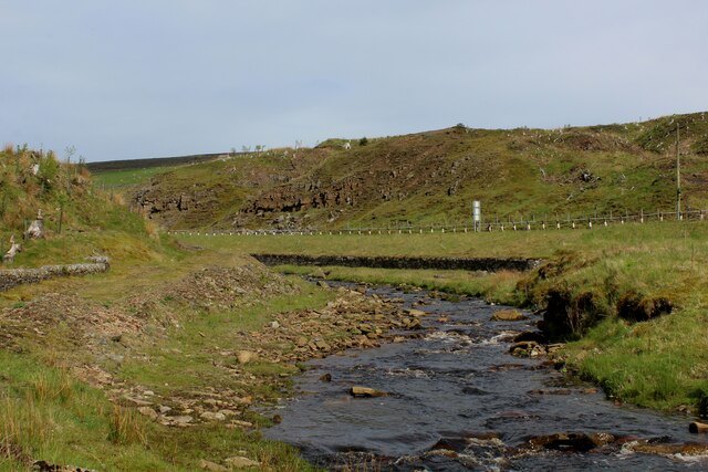
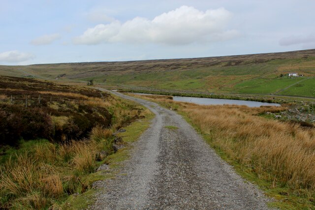
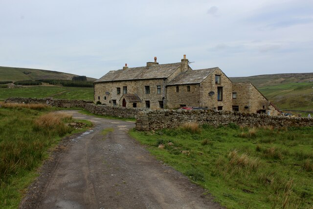
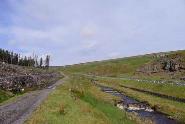
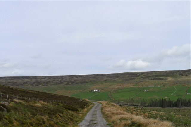
Snodberry Cleugh is a picturesque valley located in Durham, England. Situated amidst rolling green hills and meandering streams, it is a haven for nature enthusiasts and those seeking tranquility away from the bustling city life. The valley is renowned for its breathtaking beauty and offers a wide range of outdoor activities.

Covered in lush vegetation, Snodberry Cleugh is home to an array of flora and fauna. The valley is particularly famous for its vibrant wildflowers, which create a colorful tapestry during the spring and summer months. The diverse wildlife in the area includes various species of birds, small mammals, and butterflies, making it a perfect spot for birdwatchers and wildlife photographers.

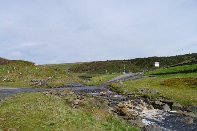
The valley is crisscrossed by several walking trails, allowing visitors to explore the natural wonders at their own pace. These trails offer stunning views of the surrounding countryside and lead to hidden gems such as waterfalls and ancient ruins. For those seeking a more adventurous experience, Snodberry Cleugh also offers opportunities for cycling, horseback riding, and fishing in its crystal-clear streams.

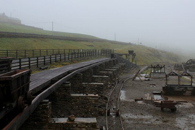
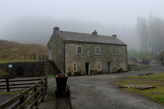
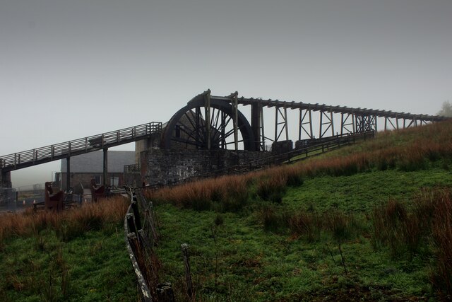
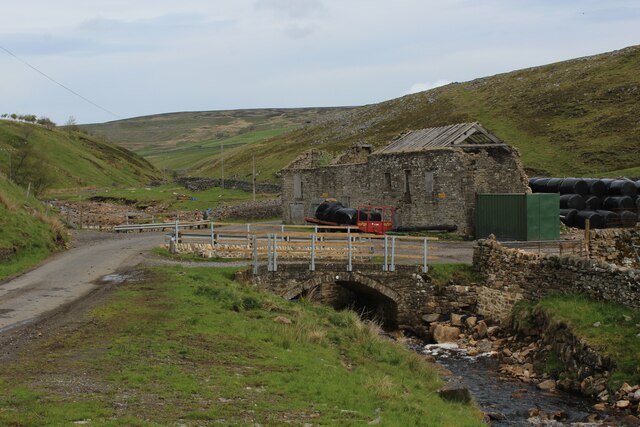
History buffs will delight in the rich heritage of Snodberry Cleugh. The valley is dotted with remnants of its past, including old stone bridges, crumbling mills, and remnants of iron mines. These historical sites provide a glimpse into the area's industrial past and offer a fascinating insight into the lives of the people who once inhabited the valley.

Overall, Snodberry Cleugh is a captivating destination that seamlessly blends natural beauty with historical significance. Whether it's for a leisurely stroll, a family picnic, or an exploration of the area's rich history, this valley has something to offer for everyone.

If you have any feedback on the listing, please let us know in the comments section below.

Snodberry Cleugh Images

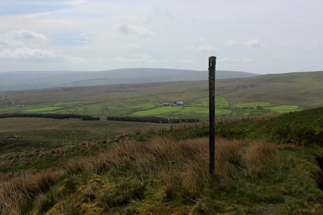
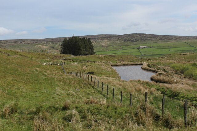
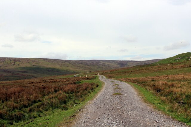
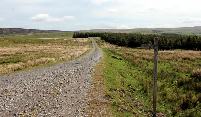
Images are sourced within 2km of 54.783613/-2.2599268 or Grid Reference NY8343. Thanks to Geograph Open Source API. All images are credited.

Heading away from Killhope Law A hill walker heading along the broad moorland ridge separating Weardale lying to the right, and West Allendale. Killhope Law's summit is around 300 metres behind the camera position.
Heading away from Killhope Law
A hill walker heading along the broad moorland ridge separating Weardale lying to the right, and West Allendale. Killhope Law's summit is around 300 metres behind the camera position.
Washing Floor at the Killhope Lead Mining Museum At the time of my visit, entrance was free to this well preserved lead mining museum.
This shows the washing floor where trucks full of ore were wheeled out of the Park Level Mine to be processed beside the track.
Washing Floor at the Killhope Lead Mining Museum
At the time of my visit, entrance was free to this well preserved lead mining museum. This shows the washing floor where trucks full of ore were wheeled out of the Park Level Mine to be processed beside the track.
Mine Shop at Killhope Part of the restored Killhope Lead Mining Museum, the Mine Shop provided accommodation for workers in this remote location.
At the time of my visit - entry to the exhibits and location was free.
Mine Shop at Killhope
Part of the restored Killhope Lead Mining Museum, the Mine Shop provided accommodation for workers in this remote location. At the time of my visit - entry to the exhibits and location was free.
Killhope Water Wheel Part of the Killhope Lead Mining Museum is this fully restored 10 metre waterwheel.
Unfortunately on my visit the Jigger House, Buddle House and wheel were temporarily closed - though entrance to the museum was free.
Killhope Water Wheel
Part of the Killhope Lead Mining Museum is this fully restored 10 metre waterwheel. Unfortunately on my visit the Jigger House, Buddle House and wheel were temporarily closed - though entrance to the museum was free.
White Hall Remote dwelling as seen from the A689, beside the upper reaches of the Killhope Burn
White Hall
Remote dwelling as seen from the A689, beside the upper reaches of the Killhope Burn
Weardale Way descending towards Killhope Lead Mining Museum This is very close to the western terminus of the Weardale Way. 
The track is in the Weardale Forest, which has been recently been felled in this location.
Weardale Way descending towards Killhope Lead Mining Museum
This is very close to the western terminus of the Weardale Way. The track is in the Weardale Forest, which has been recently been felled in this location.
Upper Reaches of the Killhope Burn As seen from the ford which serves the access track for the Killhope Lead Mining Museum.
The A689 Alston/Upper Weardale Road can be seen on the far side of the watercourse.
Upper Reaches of the Killhope Burn
As seen from the ford which serves the access track for the Killhope Lead Mining Museum. The A689 Alston/Upper Weardale Road can be seen on the far side of the watercourse.
Weardale Way approaching Kidd's Dam The long distance footpath in a felled portion of the Weardale Forest - approaching a small reservoir, a relic from the long passed lead mining activities that once thrived here.
Weardale Way approaching Kidd's Dam
The long distance footpath in a felled portion of the Weardale Forest - approaching a small reservoir, a relic from the long passed lead mining activities that once thrived here.
Fingerpost in Weardale Forest Passed by on the Weardale Way long distance footpath as it makes its way through the stumps of a felled forest plantation
Fingerpost in Weardale Forest
Passed by on the Weardale Way long distance footpath as it makes its way through the stumps of a felled forest plantation
Weardale Way approaching Quarry Hill The small reservoir passed by on the Weardale Way is probably associated with the long ceased lead mining operations that prevailed in this location.
Weardale Way approaching Quarry Hill
The small reservoir passed by on the Weardale Way is probably associated with the long ceased lead mining operations that prevailed in this location.
Track over Limekiln Hill
Weardale Way heading for the Plantation on Garrick's Hags A 77 mile route following the River Wear from the sea at the Lindesfarne Memorial, Sunderland to the headwaters in the east Pennines, keeping as close as is possible to the river. It visits Lumley Castle, Durham (where the Castle and Cathedral forms a World Heritage Site), Bishop Auckland and Stanhope. After Stanhope the Way makes a northward loop to Rookhope to take in part of a tributary, Rookhope Burn.
Weardale Way heading for the Plantation on Garrick's Hags
A 77 mile route following the River Wear from the sea at the Lindesfarne Memorial, Sunderland to the headwaters in the east Pennines, keeping as close as is possible to the river. It visits Lumley Castle, Durham (where the Castle and Cathedral forms a World Heritage Site), Bishop Auckland and Stanhope. After Stanhope the Way makes a northward loop to Rookhope to take in part of a tributary, Rookhope Burn.
Ruin by Killhopeburn Bridge Substantial ruin beside the Killhope Burn
Ruin by Killhopeburn Bridge
Substantial ruin beside the Killhope Burn
Blakely Field Looks to have been recently refurbished into a private dwelling. Passed by on the Weardale Way long distance footpath
Blakely Field
Looks to have been recently refurbished into a private dwelling. Passed by on the Weardale Way long distance footpath
Ford at the entrance to the Killhope Lead Mining Museum The ford crosses Killhope Burn, with visitors to this free attraction entering from the  A689 (by the sign to the right).
Ford at the entrance to the Killhope Lead Mining Museum
The ford crosses Killhope Burn, with visitors to this free attraction entering from the A689 (by the sign to the right).
Start of the Weardale Way The western end of the Way starts by heading further west!
Start of the Weardale Way
The western end of the Way starts by heading further west!
The Weardale Way alongside Killhope Burn, starting its circuit around the Killhope plantation Much of the western end of the plantation has been felled.
The Weardale Way alongside Killhope Burn, starting its circuit around the Killhope plantation
Much of the western end of the plantation has been felled.
Track carrying the Weardale Way along the south-west side of the Killhope plantation Looking towards White Hall on the opposite hillside
Track carrying the Weardale Way along the south-west side of the Killhope plantation
Looking towards White Hall on the opposite hillside
Show me another place!

Snodberry Cleugh is located at Grid Ref: NY8343 (Lat: 54.783613, Lng: -2.2599268)

Unitary Authority: County Durham

Police Authority: Durham

What 3 Words

///frantic.surfacing.outgrown. Near Alston, Cumbria

Nearby Locations

Snodberry Cleugh

Related Wikis

Killhope

Killhope is a small settlement at the very highest end of Weardale in the civil parish of Stanhope, in County Durham, England. Killhope Pass, the road...

Old Moss Lead Vein

Old Moss Lead Vein, also known as Killhope Head, is a Site of Special Scientific Interest in the Wear Valley district of County Durham, England. It consists...

Lanehead

Lanehead is a hamlet in the civil parish of Stanhope, in County Durham, England. It lies at the head of Weardale, approximately 2 km west of Cowshill....

Cornriggs Meadows

Cornriggs Meadows is a Site of Special Scientific Interest in Upper Weardale in north-west County Durham, England. It consists of a group of fields, located...

Nearby Amenities

Located within 500m of 54.783613,-2.2599268
Snodbury
Place: locality
Lat/Long: 54.7803036/-2.2634617
Clevision Currick
Place: locality
Lat/Long: 54.7829321/-2.2526323
Turning Circle
Lat/Long: 54.7841858/-2.2628299
Ford: yes
Lat/Long: 54.7843095/-2.2617099
Barrier: entrance
Lat/Long: 54.7800509/-2.2631435
Barrier: entrance
Lat/Long: 54.7826616/-2.2614945
Barrier: entrance
Lat/Long: 54.7799527/-2.2604907
Barrier: entrance
Lat/Long: 54.7796627/-2.2619364
Hunting Stand
Hunting Stand: grouse_butt
Lat/Long: 54.7871652/-2.2552845
Hunting Stand
Hunting Stand: grouse_butt
Lat/Long: 54.7868358/-2.2557539
Hunting Stand
Hunting Stand: grouse_butt
Lat/Long: 54.7865048/-2.2562313
Hunting Stand
Hunting Stand: grouse_butt
Lat/Long: 54.7861862/-2.256698
Hunting Stand
Hunting Stand: grouse_butt
Lat/Long: 54.7858304/-2.2571835
Hunting Stand
Hunting Stand: grouse_butt
Lat/Long: 54.7855056/-2.2576717
Hunting Stand
Hunting Stand: grouse_butt
Lat/Long: 54.7850927/-2.2582644
Archaeological Site: mineral_extraction
Historic: mine_shaft
Source: NLS-OS-NatGrid-110k-1940-60
Lat/Long: 54.7811243/-2.2638209
Archaeological Site: mineral_extraction
Historic: mine_shaft
Source: NLS-OS-NatGrid-110k-1940-60
Lat/Long: 54.7808898/-2.2644453
Archaeological Site: mineral_extraction
Historic: mine_shaft
Source: NLS-OS-NatGrid-110k-1940-60
Lat/Long: 54.7815327/-2.2627952
Archaeological Site: mineral_extraction
Historic: mine_shaft
Source: NLS-OS-NatGrid-110k-1940-60
Lat/Long: 54.7812728/-2.2633746
Archaeological Site: mineral_extraction
Historic: mine_shaft
Source: NLS-OS-NatGrid-110k-1940-60
Lat/Long: 54.7811868/-2.2641664
The data included in this document is from www.openstreetmap.org. The data is made available under ODbL.

Have you been to Snodberry Cleugh?

Leave your review of Snodberry Cleugh below (or comments, questions and feedback).