Tory Log Clough

Valley in Yorkshire Ribble Valley

England

Tory Log Clough

Cold Weather House The farm in the middle distance is well named for this December view. Further ahead, a temperature inversion leaves Ribblesdale filled with low cloud.
Cold Weather House Credit: Stephen Craven

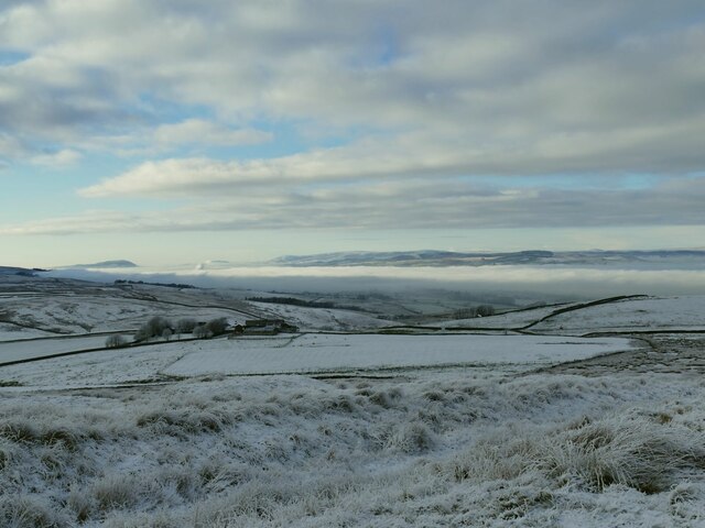
Tory Log Clough is a picturesque valley located in Yorkshire, England. Nestled amidst the rolling hills and verdant landscapes, this idyllic valley offers visitors a serene and tranquil escape from the bustling city life.

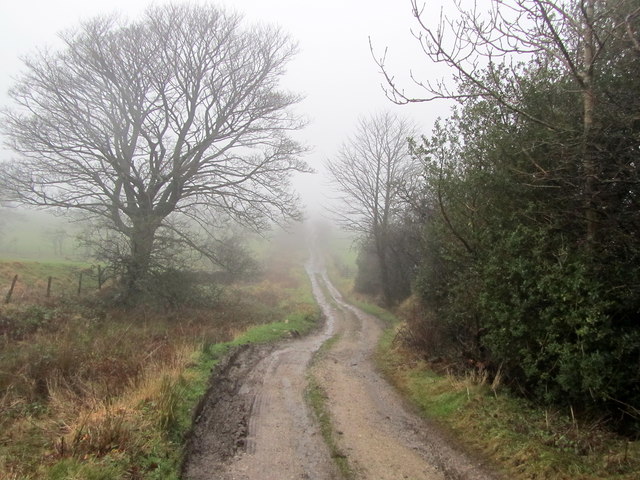
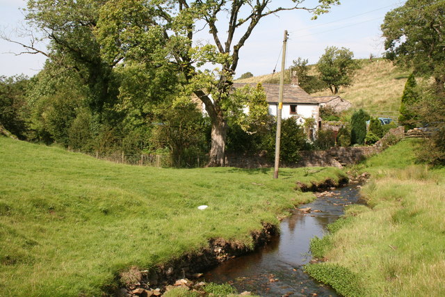
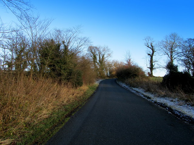
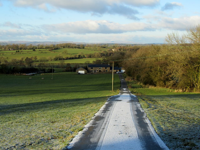
The valley is characterized by its lush greenery, with thick forests and meandering streams that add to its natural beauty. It is dotted with numerous walking trails, making it a popular destination for nature enthusiasts and hikers. The trails meander through the valley, offering breathtaking views of the surrounding countryside and the opportunity to explore the diverse flora and fauna that call this place home.

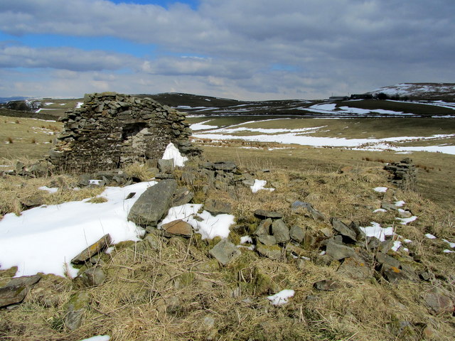
Tory Log Clough is also known for its rich historical significance. The valley has been inhabited for centuries, and evidence of ancient settlements can still be found in the form of stone circles and burial mounds. These remnants of the past add an air of mystery and intrigue to the valley, attracting history buffs and archaeology enthusiasts.

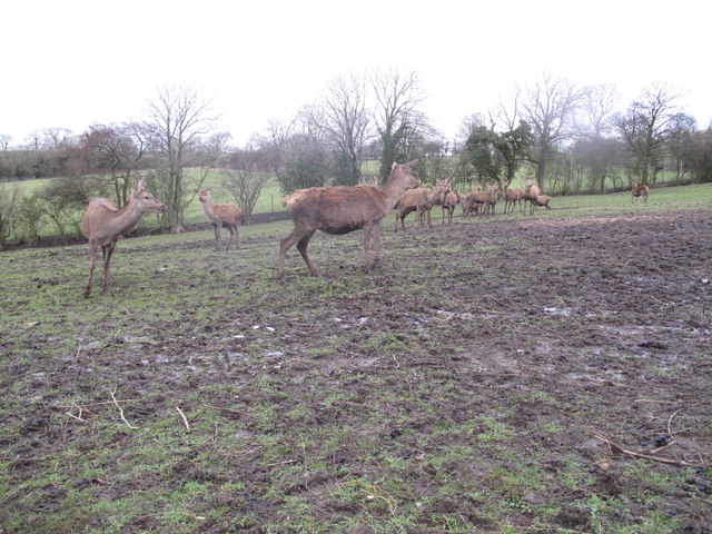
For those seeking outdoor activities, Tory Log Clough provides ample opportunities for fishing, bird watching, and picnicking. The streams are known for their abundance of trout, making it a popular spot for anglers. The valley is also home to a variety of bird species, including kingfishers, herons, and owls, which can be spotted throughout the year.

Overall, Tory Log Clough is a hidden gem in the heart of Yorkshire, offering visitors a chance to immerse themselves in the natural beauty and rich history of the region.

If you have any feedback on the listing, please let us know in the comments section below.

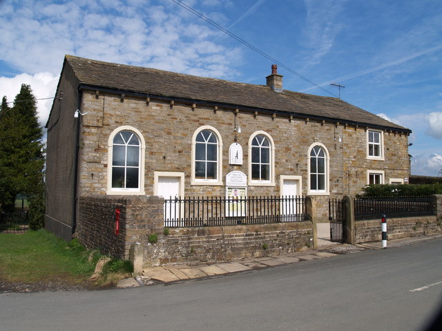
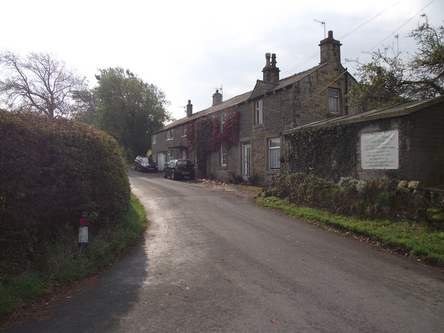
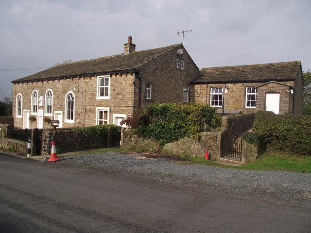
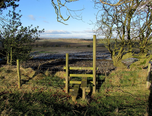
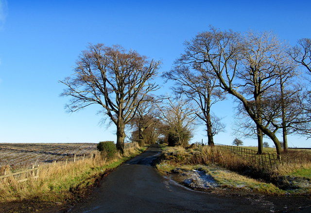
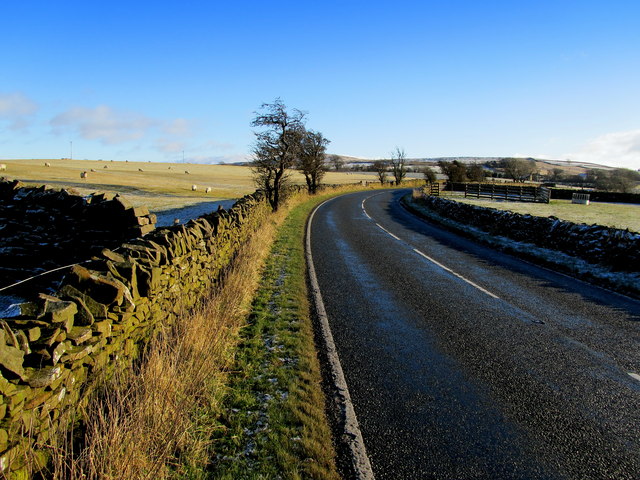
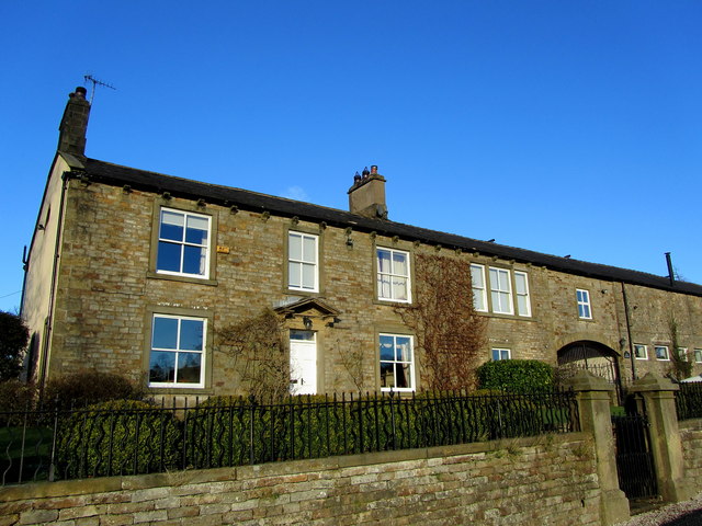
Tory Log Clough Images

Images are sourced within 2km of 53.89793/-2.2546215 or Grid Reference SD8344. Thanks to Geograph Open Source API. All images are credited.

Cold Weather House The farm in the middle distance is well named for this December view. Further ahead, a temperature inversion leaves Ribblesdale filled with low cloud.
Cold Weather House
The farm in the middle distance is well named for this December view. Further ahead, a temperature inversion leaves Ribblesdale filled with low cloud.
Salem Congregational Chapel The Chapel at the junction of Long Lover Lane,Martin Top lane and Newby Lane, the post box can just be seen, it is built into the wall on the left.
Salem Congregational Chapel
The Chapel at the junction of Long Lover Lane,Martin Top lane and Newby Lane, the post box can just be seen, it is built into the wall on the left.
Cottages on Martin Top Lane At the junction of Stopper Lane and Martin Top Lane.
Cottages on Martin Top Lane
At the junction of Stopper Lane and Martin Top Lane.
Salem Congregational Church and Manse At Martin Top near Newby.
Salem Congregational Church and Manse
At Martin Top near Newby.
Coal Pit Lane Unmetalled Lane descending gradually towards the Ribble Valley, recently adopted by the Pennine Bridleway.
Coal Pit Lane
Unmetalled Lane descending gradually towards the Ribble Valley, recently adopted by the Pennine Bridleway.
Rimington:  Salem Congregational  Chapel Built in 1861.  The far end of the building is actually the manse, while a small Sunday School (out of view) adjoins the far end.  The chapel is still in use.  The road in front of the chapel has the name 'Long Lover's Lane', which must rank high in my order of favourite road names, after Hull's 'Land of Green Ginger'.
Rimington: Salem Congregational Chapel
Built in 1861. The far end of the building is actually the manse, while a small Sunday School (out of view) adjoins the far end. The chapel is still in use. The road in front of the chapel has the name 'Long Lover's Lane', which must rank high in my order of favourite road names, after Hull's 'Land of Green Ginger'.
Rimington:  Salem Sunday School Built in 1906 at the eastern end of the chapel/manse building.
Rimington: Salem Sunday School
Built in 1906 at the eastern end of the chapel/manse building.
The Ancient Border - lest we forget This small stream is Ings Beck and along it runs the ancient boundary between Lancashire (Twiston Parish) and Yorkshire (Rimington Parish).  But in 1974, faceless timeservers in Whitehall tampered with boundaries so that now both these parishes are administered by Lancashire County Council.  The cottage is, by rights, just in Yorkshire.  Its name is Mines Cottage, reflecting small scale lead mining activity that once took place at the York and Lancaster Mine, which was just on the Yorkshire side of the beck, beyond the cottage. There was also another small lead mine at Skeleron, just a little further down the beck. Also, even further down, but on the Lancashire side this time, there was once a barytes mine.  Barytes is actually barium sulphate, and is very rare - I know of no other barytes mine in Lancashire or Yorkshire.
The Ancient Border - lest we forget
This small stream is Ings Beck and along it runs the ancient boundary between Lancashire (Twiston Parish) and Yorkshire (Rimington Parish). But in 1974, faceless timeservers in Whitehall tampered with boundaries so that now both these parishes are administered by Lancashire County Council. The cottage is, by rights, just in Yorkshire. Its name is Mines Cottage, reflecting small scale lead mining activity that once took place at the York and Lancaster Mine, which was just on the Yorkshire side of the beck, beyond the cottage. There was also another small lead mine at Skeleron, just a little further down the beck. Also, even further down, but on the Lancashire side this time, there was once a barytes mine. Barytes is actually barium sulphate, and is very rare - I know of no other barytes mine in Lancashire or Yorkshire.
Footpath leading North from Great Todber The path leaves over a stile into a procession of ploughed fields - ploughed against the grain of the route, which makes progress difficult
Footpath leading North from Great Todber
The path leaves over a stile into a procession of ploughed fields - ploughed against the grain of the route, which makes progress difficult
Howgill Lane Quiet road leading from the A682 to Coal Pit Lane
Howgill Lane
Quiet road leading from the A682 to Coal Pit Lane
Beside the A682 Part of the A682 between Gisburn and Nelson - dubbed Britain's most dangerous road.
Beside the A682
Part of the A682 between Gisburn and Nelson - dubbed Britain's most dangerous road.
Howgill Farm Dwellings on Howgill Lane near Rimington
Howgill Farm
Dwellings on Howgill Lane near Rimington
On Howgill Lane The lane climbing up towards the A682 road
On Howgill Lane
The lane climbing up towards the A682 road
Salem Congregational Chapel at Martin Top The chapel and manse living quarters are combined in one building.
Salem Congregational Chapel at Martin Top
The chapel and manse living quarters are combined in one building.
Access Lane to Rakes Barn A frosty scene near Martin Top, Rimington
Access Lane to Rakes Barn
A frosty scene near Martin Top, Rimington
Series of Gates at Ox Close Farm Three gates lead into a muddy trackway - one of them allowing a public footpath from the fields to enter the confines of the farmyard
Series of Gates at Ox Close Farm
Three gates lead into a muddy trackway - one of them allowing a public footpath from the fields to enter the confines of the farmyard
Deer Farming Near Gisburn Deer farming near Gisburn, now where is their dry lying area ?
Deer Farming Near Gisburn
Deer farming near Gisburn, now where is their dry lying area ?
Ruins of Craven Laithe The ordnance survey map shows two "Craven Laithes" within close proximity to each other - the other is a substantial farm.
This one is the remains of a stone barn, with barely one wall left standing.
Ruins of Craven Laithe
The ordnance survey map shows two "Craven Laithes" within close proximity to each other - the other is a substantial farm. This one is the remains of a stone barn, with barely one wall left standing.
Show me another place!

Tory Log Clough is located at Grid Ref: SD8344 (Lat: 53.89793, Lng: -2.2546215)

Division: West Riding

Administrative County: Lancashire

District: Ribble Valley

Police Authority: Lancashire

What 3 Words

///youngest.forgotten.buying. Near Barnoldswick, Lancashire

Related Wikis

Middop

Middop is a rural hamlet and civil parish in Lancashire, England. It is in Ribble Valley district. Middop is near the villages of Rimington and Gisburn...

Twiston

Twiston is a village and a civil parish in the Ribble Valley District, in the English county of Lancashire. It is near the town of Clitheroe and the village...

Weets Hill

Weets Hill is a hill in the West Craven area of Pendle, Lancashire, England. It is 2+1⁄2 miles (4.0 km) south-west of the town of Barnoldswick and is 4...

Rimington

Rimington is a rural village and civil parish in the Ribble Valley, Lancashire, England. The population of the civil parish was 382 at the 2001 Census...

Have you been to Tory Log Clough?

Leave your review of Tory Log Clough below (or comments, questions and feedback).