Harelaw Cleugh

Valley in Northumberland

England

Harelaw Cleugh

Little Sills Burn With sheepfold by the burn and destroyed target 'tank' on the horizon.
Little Sills Burn Credit: Russel Wills

The requested URL returned error: 429 Too Many Requests

If you have any feedback on the listing, please let us know in the comments section below.

Harelaw Cleugh Images

Images are sourced within 2km of 55.297224/-2.268096 or Grid Reference NT8300. Thanks to Geograph Open Source API. All images are credited.
Little Sills Burn With sheepfold by the burn and destroyed target 'tank' on the horizon.
Little Sills Burn
With sheepfold by the burn and destroyed target 'tank' on the horizon.
Looking up the valley of the Sills Burn With the devastation of the woods at Featherwood.
Looking up the valley of the Sills Burn
With the devastation of the woods at Featherwood.
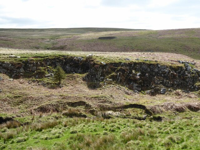
Sheep walk on the edge of the crag Over the Little Sills Burn.
A fine sheepfold on the hill beyond.
Sheep walk on the edge of the crag
Over the Little Sills Burn. A fine sheepfold on the hill beyond.
Sheep and sheepfold Across the Little Sills Burn.
Sheep and sheepfold
Across the Little Sills Burn.
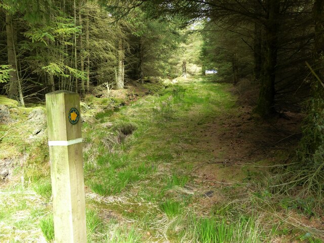
Footpath leading out of the forest Towards Corby Pike.
Footpath leading out of the forest
Towards Corby Pike.
Trig point on Corby Pike At 368m with flush bracket number S7922.
Looking up the valley of Sills Burn towards Featherwood, in the trees.
Trig point on Corby Pike
At 368m with flush bracket number S7922. Looking up the valley of Sills Burn towards Featherwood, in the trees.
A shelter on Corby Pike Just a few metres NE of the trig point this appears a shelter for walkers rather than a dilapidated sheepfold.
A shelter on Corby Pike
Just a few metres NE of the trig point this appears a shelter for walkers rather than a dilapidated sheepfold.
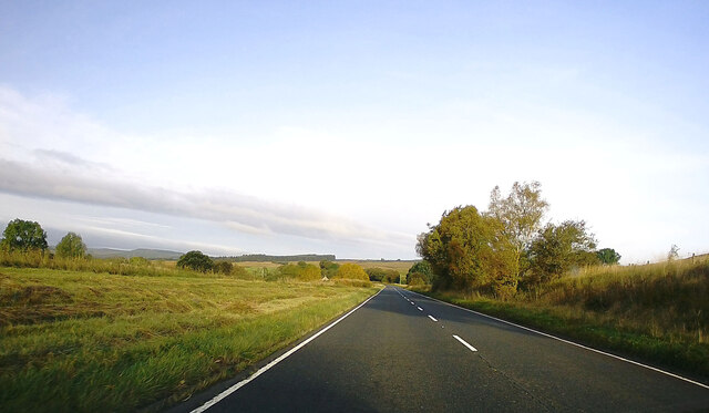
A68 towards Jedburgh
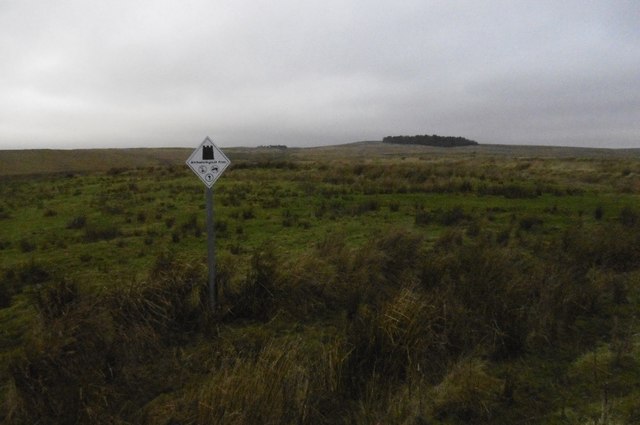
Archeological area sign, Otterburn Ranges Possibly a replacement for the familiar white star signs - this one is on the site of a Roman camp one of several along Dere Street.
Archeological area sign, Otterburn Ranges
Possibly a replacement for the familiar white star signs - this one is on the site of a Roman camp one of several along Dere Street.
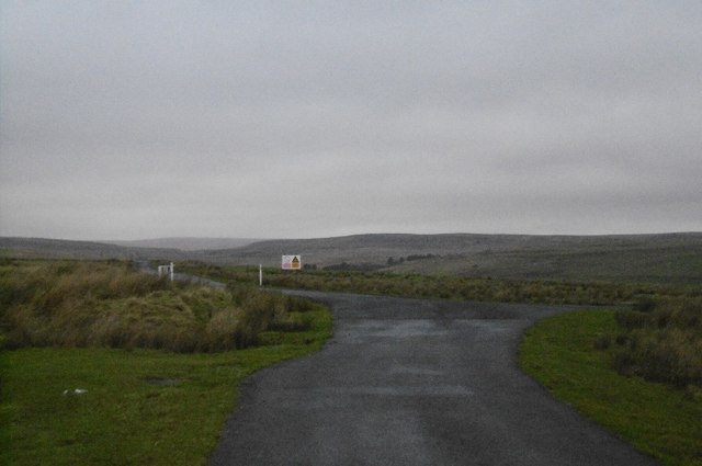
Junction, Otterburn Ranges A road junction - straight on is really straight on as it is on the site of Dere Street, a Roman road heading for the Firth of Forth.
Junction, Otterburn Ranges
A road junction - straight on is really straight on as it is on the site of Dere Street, a Roman road heading for the Firth of Forth.
Dere Street Road on Otterburn Ranges on the site of a Roman road.
Dere Street
Road on Otterburn Ranges on the site of a Roman road.
Monthilly Beyond the clearance cairn, across the Sills Burn is the site of a farm, shown on an 1899 map as a ruin.
Monthilly
Beyond the clearance cairn, across the Sills Burn is the site of a farm, shown on an 1899 map as a ruin.
Dere Street Tarred road on the course of a Roman road to the Firth of Forth.
Dere Street
Tarred road on the course of a Roman road to the Firth of Forth.
Tussock hell, Otterburn Ranges Horrendous ground beside Dere Street.
Tussock hell, Otterburn Ranges
Horrendous ground beside Dere Street.
Dere Street Downhill view down the Roman road.
Dere Street
Downhill view down the Roman road.
Pity Me Range sign opposite a shed on Dere Street.  An 1899 map shows a house called Pity Me near here.
Pity Me
Range sign opposite a shed on Dere Street. An 1899 map shows a house called Pity Me near here.
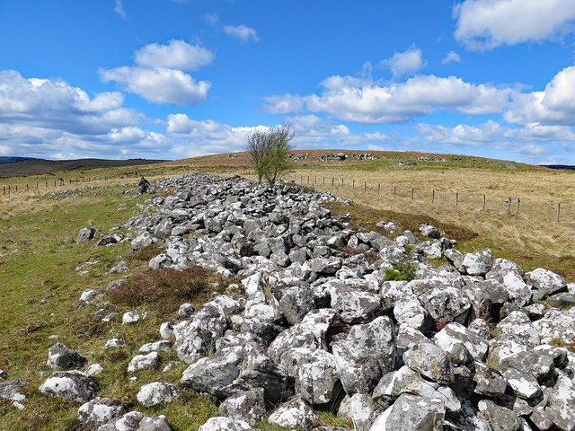
Bellshiel Long Cairn A Long Cairn occupies the crest of a narrow ridge in open moorland (fenced after scheduling) at about 300m above sea level. Orientated at an angle of 279 degrees, it is partially earth covered on the north side. It has a maximum height of 1.6m, length of 109m, and varies in breadth between 15m in the east and 8.8m in the west. The cairn was excavated in 1935 when a possible cist and a rock cut grave were found and cup marked stones noted nearby (later described only as water-worn depressions). Little was found and the excavator called the mound a 'monster of degeneracy'. It was not possible to date it securely to the Neolithic period.

A stone-walled enclosure attached to the S side of the cairn is a later feature re-using stones from the cairn.

Long cairns are the burial places of Britain's early farming communities and, as such, are amongst the oldest field monuments surviving visibly in the present landscape. Where investigated, they appear to have been used for communal burial, often with only parts of the human remains having been selected for interment.
Pastscape: <span class="nowrap"><a title="http://www.pastscape.org.uk/hob.aspx?hob_id=263" rel="nofollow ugc noopener" href="http://www.pastscape.org.uk/hob.aspx?hob_id=263">Link</a><img style="margin-left:2px;" alt="External link" title="External link - shift click to open in new window" src="https://s1.geograph.org.uk/img/external.png" width="10" height="10"/></span> <span class="nowrap"><a title="https://web.archive.org/web/20170426091052/http://www.pastscape.org.uk/hob.aspx?hob_id=263" rel="nofollow ugc noopener" href="https://web.archive.org/web/20170426091052/http://www.pastscape.org.uk/hob.aspx?hob_id=263">Archive Link</a><img style="margin-left:2px;" alt="External link" title="External link - shift click to open in new window" src="https://s1.geograph.org.uk/img/external.png" width="10" height="10"/></span>
Historic England: <span class="nowrap"><a title="https://historicengland.org.uk/listing/the-list/list-entry/1009459" rel="nofollow ugc noopener" href="https://historicengland.org.uk/listing/the-list/list-entry/1009459">Link</a><img style="margin-left:2px;" alt="External link" title="External link - shift click to open in new window" src="https://s1.geograph.org.uk/img/external.png" width="10" height="10"/></span> <span class="nowrap"><a title="https://web.archive.org/web/20170426091412/https://historicengland.org.uk/listing/the-list/list-entry/1009459" rel="nofollow ugc noopener" href="https://web.archive.org/web/20170426091412/https://historicengland.org.uk/listing/the-list/list-entry/1009459">Archive Link</a><img style="margin-left:2px;" alt="External link" title="External link - shift click to open in new window" src="https://s1.geograph.org.uk/img/external.png" width="10" height="10"/></span>
Bellshiel Long Cairn
A Long Cairn occupies the crest of a narrow ridge in open moorland (fenced after scheduling) at about 300m above sea level. Orientated at an angle of 279 degrees, it is partially earth covered on the north side. It has a maximum height of 1.6m, length of 109m, and varies in breadth between 15m in the east and 8.8m in the west. The cairn was excavated in 1935 when a possible cist and a rock cut grave were found and cup marked stones noted nearby (later described only as water-worn depressions). Little was found and the excavator called the mound a 'monster of degeneracy'. It was not possible to date it securely to the Neolithic period. A stone-walled enclosure attached to the S side of the cairn is a later feature re-using stones from the cairn. Long cairns are the burial places of Britain's early farming communities and, as such, are amongst the oldest field monuments surviving visibly in the present landscape. Where investigated, they appear to have been used for communal burial, often with only parts of the human remains having been selected for interment. Pastscape: LinkExternal link Archive LinkExternal link Historic England: LinkExternal link Archive LinkExternal link
The Cheviot Hills from the air The south end of the range. The small circular woodland in the foreground is at Long Cairn.
The Cheviot Hills from the air
The south end of the range. The small circular woodland in the foreground is at Long Cairn.
Show me another place!

Harelaw Cleugh is located at Grid Ref: NT8300 (Lat: 55.297224, Lng: -2.268096)

Unitary Authority: Northumberland

Police Authority: Northumbria

What 3 Words

///tiny.unusable.sweep. Near Rochester, Northumberland

Nearby Locations

Harelaw Cleugh

Related Wikis

Bremenium

Bremenium (High Rochester) is an ancient Roman fort (castrum) located at Rochester, Northumberland, England. The fort is part of the defensive system built...

Rochester, Northumberland

Rochester is a small village and civil parish in north Northumberland, England. It is 5 miles (8 km) north-west of Otterburn on the A68 road between Corbridge...

A68 road

The A68 is a major road in the United Kingdom, running from Darlington in England to the A720 in Edinburgh, the capital of Scotland. It crosses the Anglo...

Northumberland National Park

Northumberland National Park is the northernmost national park in England. It covers an area of more than 1,050 square kilometres (410 sq mi) between the...

Nearby Amenities

Located within 500m of 55.297224,-2.268096
Silloaks Sills
Place: locality
Lat/Long: 55.2992401/-2.2727134
The data included in this document is from www.openstreetmap.org. The data is made available under ODbL.

Have you been to Harelaw Cleugh?

Leave your review of Harelaw Cleugh below (or comments, questions and feedback).