How Cleugh

Valley in Northumberland

England

How Cleugh

Descending Acton Moor
Descending Acton Moor Credit: Clive Nicholson

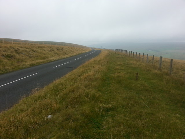
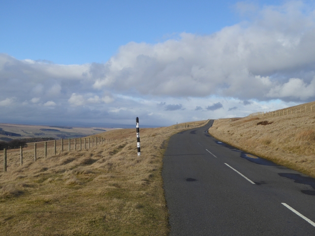
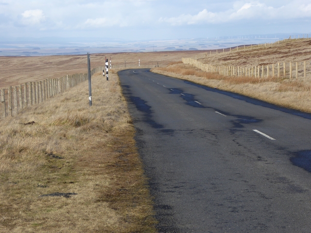
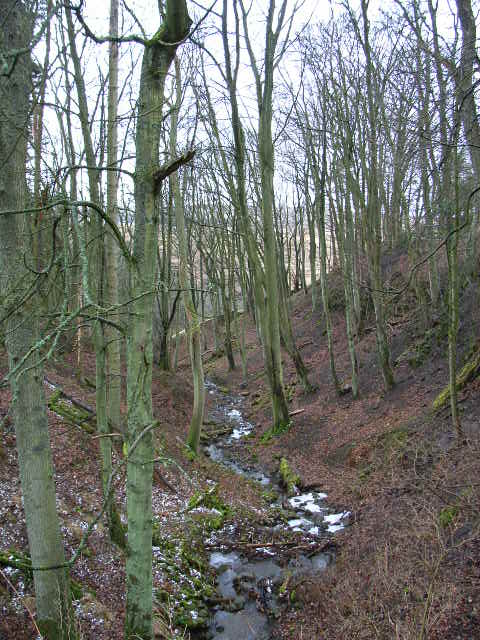
Cleugh, Northumberland, is a picturesque valley located in the northernmost county of England. Situated within the North Pennines Area of Outstanding Natural Beauty, Cleugh boasts breathtaking views and an abundance of natural wonders.

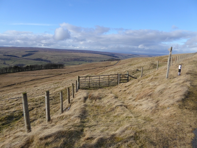
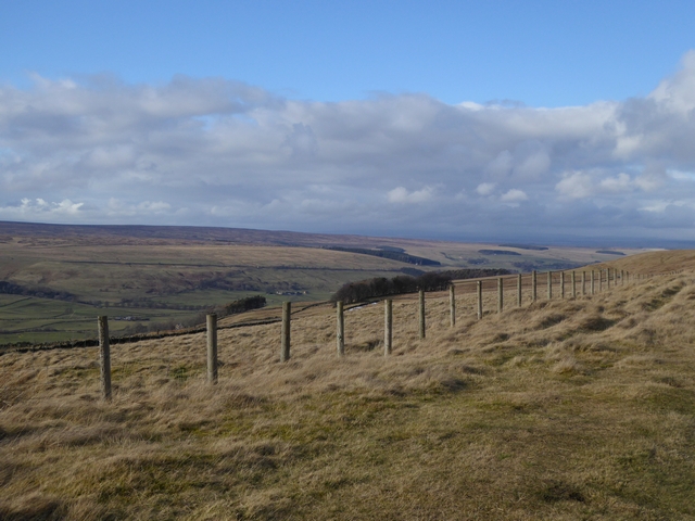
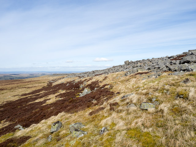
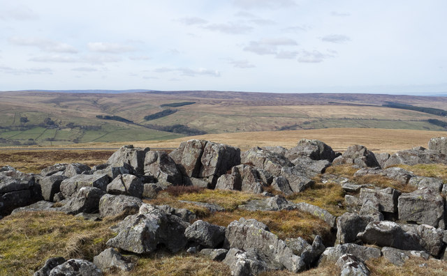
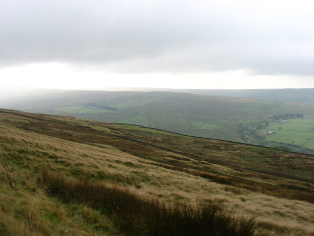
The valley is characterized by its rolling hills, meandering streams, and lush green fields, creating a tranquil and idyllic environment. Visitors to Cleugh can expect to be enveloped by the peacefulness and serenity of the countryside.

The region is home to diverse flora and fauna, making it a haven for nature enthusiasts and wildlife lovers. Rare bird species, such as the red grouse and curlew, can be spotted in the area, along with a variety of wildflowers during the summer months.

Cleugh also offers numerous walking and hiking trails, allowing visitors to explore the valley's beauty at their own pace. The Cleugh Trail, a popular route, offers stunning views of the surrounding landscape and takes hikers through ancient woodlands and along the banks of the River Allen.

In addition to its natural attractions, Cleugh is steeped in history. The valley is dotted with remnants of its past, including historic farmsteads, stone walls, and traditional cottages. These remnants provide a glimpse into the rural way of life in Northumberland throughout the centuries.

Overall, Cleugh, Northumberland, is a hidden gem that showcases the beauty of the North Pennines. With its breathtaking scenery, rich wildlife, and historical charm, it is a must-visit destination for those seeking a peaceful and immersive experience in the heart of nature.

If you have any feedback on the listing, please let us know in the comments section below.

How Cleugh Images

Images are sourced within 2km of 54.848288/-2.2919415 or Grid Reference NY8150. Thanks to Geograph Open Source API. All images are credited.

Descending Acton Moor
Path to Taylorburn On the hillside above West Allendale. Compare with the snowy scene at <a href="https://www.geograph.org.uk/photo/1705418">NY7950 : Path to Taylorburn</a>.
Path to Taylorburn
On the hillside above West Allendale. Compare with the snowy scene at NY7950 : Path to Taylorburn.
Moorland road to Allendale This moorland road linking the upper end of West Allendale with Allendale Town rises to almost 500 metres above sea level.
Moorland road to Allendale
This moorland road linking the upper end of West Allendale with Allendale Town rises to almost 500 metres above sea level.
Fence line above West Allendale
Gate and fence above West Allendale
Moorland road to Allendale This moorland road linking Carrshield and Allendale Town rises to almost 500 metres above sea level.
Moorland road to Allendale
This moorland road linking Carrshield and Allendale Town rises to almost 500 metres above sea level.
Greenleycleugh Crags Greenleycleugh Crags is a long, low band of rock on the flank of Brownley Hill overlooking West Allendale. The rock is broken into blocks with little in the way of any continuous rock face.
Greenleycleugh Crags
Greenleycleugh Crags is a long, low band of rock on the flank of Brownley Hill overlooking West Allendale. The rock is broken into blocks with little in the way of any continuous rock face.
Rocks of Greenleycleugh Crags Greenleycleugh Crags is a long, low band of rock on the flank of Brownley Hill overlooking West Allendale which is the valley beyond the blocks. The distant ground is Whitfield Moor.
Rocks of Greenleycleugh Crags
Greenleycleugh Crags is a long, low band of rock on the flank of Brownley Hill overlooking West Allendale which is the valley beyond the blocks. The distant ground is Whitfield Moor.
On Kevelin Moor Looking down into West Allen Dale.
On Kevelin Moor
Looking down into West Allen Dale.
Old Milestone on the Allendale to Carrshield road The Milestone is located by the road.  Parish of West Allen (Tynedale District). Carved stone post, Haydon Bridge stone design, erected by the Alston turnpike trust in the 18th century.


Inscription reads:-  
Allendale 6 / (Coalcleugh 2¾) 

Milestone Society National ID: NB_ALCO06
Old Milestone on the Allendale to Carrshield road
The Milestone is located by the road.  Parish of West Allen (Tynedale District). Carved stone post, Haydon Bridge stone design, erected by the Alston turnpike trust in the 18th century. Inscription reads:- Allendale 6 / (Coalcleugh 2¾) Milestone Society National ID: NB_ALCO06
Wolf Cleugh Viewed from the road bridge over it. The road hairpins to achieve the crossing.
Wolf Cleugh
Viewed from the road bridge over it. The road hairpins to achieve the crossing.
Wolfcleugh Farm The lids of the brightly painted beehives are well weighted down (for good reason).
Wolfcleugh Farm
The lids of the brightly painted beehives are well weighted down (for good reason).
Waterfall West Allen River It's a little difficult to get to  but at this location the River Allen runs through a small canyon.

See a 360 degree panorama - <span class="nowrap"><a title="http://www.jaydax.co.uk/showcase/panorama/riverallen/Janorama.htm" rel="nofollow ugc noopener" href="http://www.jaydax.co.uk/showcase/panorama/riverallen/Janorama.htm">Link</a><img style="margin-left:2px;" alt="External link" title="External link - shift click to open in new window" src="https://s1.geograph.org.uk/img/external.png" width="10" height="10"/></span>
Waterfall West Allen River
It's a little difficult to get to but at this location the River Allen runs through a small canyon. See a 360 degree panorama - LinkExternal link
Wolf Cleugh
Wolf Cleugh
Wolf Cleugh (2)
Wolf Cleugh (2)
The (former) Jubilee Sunday School, Limestone Brae
Date stone on the (former) Jubilee Sunday School, Limestone Brae See <a href="https://www.geograph.org.uk/photo/1751518">NY7949 : The (former) Jubilee Sunday School, Limestone Brae</a>.
Date stone on the (former) Jubilee Sunday School, Limestone Brae
Old chapel at Limestone Brae The inscription above the door of this old chapel in the remote valley of West Allendale reads "Jubilee Sunday School 1875". The chapel does not appear to be linked  to the Buddhist Abbey and Retreat Centre at Throssel Hole next door.
Old chapel at Limestone Brae
The inscription above the door of this old chapel in the remote valley of West Allendale reads "Jubilee Sunday School 1875". The chapel does not appear to be linked to the Buddhist Abbey and Retreat Centre at Throssel Hole next door.
Show me another place!

How Cleugh is located at Grid Ref: NY8150 (Lat: 54.848288, Lng: -2.2919415)

Unitary Authority: Northumberland

Police Authority: Northumbria

What 3 Words

///broached.useful.briefer. Near Alston, Cumbria

Nearby Locations

Ropy Cleugh How Cleugh

Related Wikis

Throssel Hole Buddhist Abbey

Throssel Hole Buddhist Abbey is a Buddhist monastery and retreat centre located in Northumberland, in northern England. The monastic order is equally for...

Allendale Moors

Allendale Moors is a Site of Special Scientific Interest (SSSI) in Northumberland, England. The upland moorland ridge site is listed for its heath, flush...

Acton, Northumberland

Acton is a small hamlet in Northumberland, north-east England, about 3 miles (5 km) south of Allendale Town. Acton is usually Anglo-Saxon Old English...

Carr Shield

Carrshield is a village in Northumberland, in England. It is situated in the Pennines approximately between Penrith and Hexham. It is a small village with...

Sinderhope

Sinderhope is a hamlet situated on the east Allen Valley in south-west Northumberland. The population is spread over farms in an area approximately 25...

Ninebanks

Ninebanks is a small village in south west Northumberland, England in the North Pennines Area of Outstanding Natural Beauty 8 miles (13 km) north-east...

Ouston, Ninebanks

Ouston is a small settlement in south west Northumberland, England in the North Pennines Area of Outstanding Natural Beauty 8 miles (13 km) north-east...

Coalcleugh

Coalcleugh is a hamlet in Northumberland, England. It is situated in the Pennines between Penrith and Hexham. In the past it was well known as a lead mining...

Related Videos

Have you been to How Cleugh?

Leave your review of How Cleugh below (or comments, questions and feedback).