Leddington

Settlement in Gloucestershire Forest of Dean

England

Leddington

Former railway bridge, Tillers Green Beautifully constructed on a slight skew of brick and stone, this bridge took a farm track over the former GWR branch from Ledbury to Gloucester and may one day straddle the rebuilt Hereford to Gloucester canal, which the railway replaced.
Former railway bridge, Tillers Green Credit: Philip Pankhurst

Leddington is a charming village nestled in the picturesque county of Gloucestershire, England. Situated in the South West of the country, Leddington is known for its idyllic countryside setting and rich historical heritage. The village is located just a few miles away from the bustling market town of Cheltenham, offering residents a perfect balance between rural tranquility and urban convenience.

Leddington boasts a population of around 500 residents, giving it a close-knit community feel. The village is characterized by its traditional stone-built houses, which add to its timeless charm. The surrounding landscape is a patchwork of rolling green hills, lush meadows, and meandering streams, making it a haven for nature lovers and outdoor enthusiasts.

The village is home to St. Mary's Church, a stunning medieval structure that dates back to the 12th century. Its beautiful architecture and serene atmosphere make it a popular destination for visitors. Leddington also benefits from a local primary school, providing education for the village's children.

Although Leddington may be small, it offers a range of amenities for its residents. The village has a cozy pub, The Leddington Arms, serving up delicious meals and refreshing drinks. The nearby town of Cheltenham provides additional options for shopping, dining, and entertainment.

Overall, Leddington, Gloucestershire, offers a peaceful and picturesque retreat from the hustle and bustle of modern life. With its stunning natural surroundings, rich history, and welcoming community, it is a place that truly captures the essence of rural England.

If you have any feedback on the listing, please let us know in the comments section below.
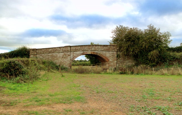
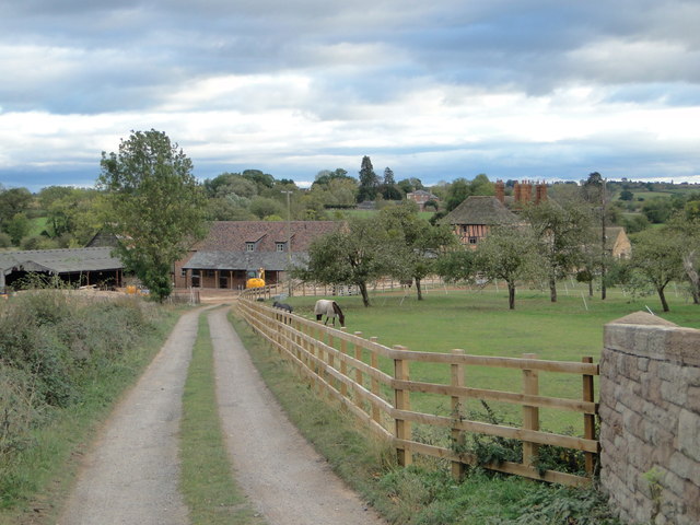
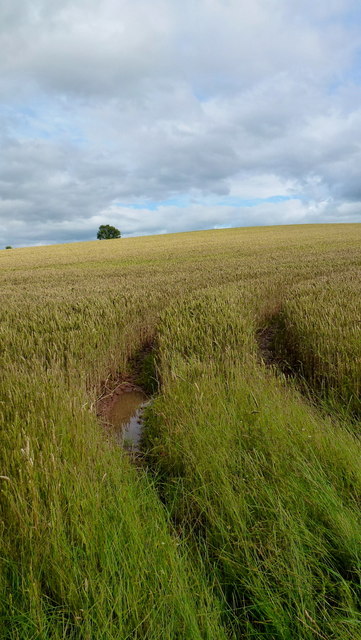
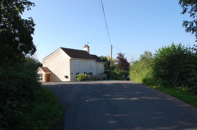
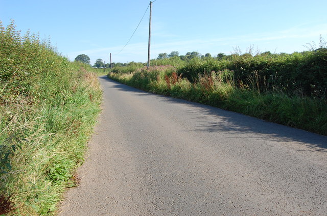
Leddington Images

Images are sourced within 2km of 52.007957/-2.446508 or Grid Reference SO6934. Thanks to Geograph Open Source API. All images are credited.

Former railway bridge, Tillers Green Beautifully constructed on a slight skew of brick and stone, this bridge took a farm track over the former GWR branch from Ledbury to Gloucester and may one day straddle the rebuilt Hereford to Gloucester canal, which the railway replaced.
Former railway bridge, Tillers Green
Beautifully constructed on a slight skew of brick and stone, this bridge took a farm track over the former GWR branch from Ledbury to Gloucester and may one day straddle the rebuilt Hereford to Gloucester canal, which the railway replaced.
The lane to Pound Farm, Tillers Green Pound Farm dates from the 16th century and is seen from the former GWR railway bridge at Tillers Green.
The lane to Pound Farm, Tillers Green
Pound Farm dates from the 16th century and is seen from the former GWR railway bridge at Tillers Green.
Wheat field at Leddington A shallow bowl of land looking east towards the Ledbury Hills.
Wheat field at Leddington
A shallow bowl of land looking east towards the Ledbury Hills.
Wheat field near Leddington A damp but familiar sight in the summer of 2012.
Wheat field near Leddington
A damp but familiar sight in the summer of 2012.
Dome of wheat The field near Leddington is nearing maturity; the farmer will now be praying for an end to the rain.
Dome of wheat
The field near Leddington is nearing maturity; the farmer will now be praying for an end to the rain.
Footpath and lane The Poet's Path No. 2 diverges from the lane to head off left, north-west, towards Preston.
Footpath and lane
The Poet's Path No. 2 diverges from the lane to head off left, north-west, towards Preston.
St John the Baptist, Preston At the rear of Preston Court and invisible from the Newent road.
St John the Baptist, Preston
At the rear of Preston Court and invisible from the Newent road.
St John the Baptist, Preston  Charming small church in the shadow of Preston Court, containing some notable Norman work.
St John the Baptist, Preston
Charming small church in the shadow of Preston Court, containing some notable Norman work.
St John the Baptist, Preston
St John the Baptist, Preston The tympanum over the North doorway, an Agnus Dei with a Maltese cross rather than the usual flag. Dates from the late 11th century, according to David Verey's Pevsner volume.
St John the Baptist, Preston
The tympanum over the North doorway, an Agnus Dei with a Maltese cross rather than the usual flag. Dates from the late 11th century, according to David Verey's Pevsner volume.
St John the Baptist, Preston The Nave and the Victorian South aisle.
St John the Baptist, Preston
The Nave and the Victorian South aisle.
St John the Baptist, Preston The interior looking East. The arcade and the South aisle are Victorian additions, dating from 1859.
St John the Baptist, Preston
The interior looking East. The arcade and the South aisle are Victorian additions, dating from 1859.
St John the Baptist, Preston The delectable Gothick furnishings, strangely not worthy of a mention in David Verey's first edition of Pevsner.
St John the Baptist, Preston
The delectable Gothick furnishings, strangely not worthy of a mention in David Verey's first edition of Pevsner.
St John the Baptist, Preston Exquisite 14th century Crucifixion scene in the South aisle.
St John the Baptist, Preston
Exquisite 14th century Crucifixion scene in the South aisle.
A449 near Ludstock Bridge
A449 Ross Road looking east
House near Tillers Green
Unnamed Lane towards Drew's Farm
Show me another place!

Leddington is located at Grid Ref: SO6934 (Lat: 52.007957, Lng: -2.446508)

Administrative County: Gloucestershire

District: Forest of Dean

Police Authority: Gloucestershire

What 3 Words

///hiring.sized.enable. Near Donnington, Herefordshire

Nearby Locations

Leddington

Related Wikis

Greenway Halt railway station (Gloucestershire)

Greenway Halt was a request stop on the former Ledbury and Gloucester Railway. It opened on 1st April 1937 and closed in 1959 when the line was closed...

Donnington, Herefordshire

Donnington is a village and civil parish near Ledbury. == Parish church == The parish church is dedicated to Saint Mary. Donnington Hall is located here...

Preston, Forest of Dean

Preston is a village, former manor, civil and ecclesiastical parish in the Forest of Dean in Gloucestershire, England. It is situated 22 km north-west...

Ledbury Town F.C.

Ledbury Town Football Club is a football club based in Ledbury, Herefordshire, England. They are currently members of the Herefordshire League Premier...

Nearby Amenities

Located within 500m of 52.007957,-2.446508
Power: pole
Lat/Long: 52.004032/-2.4458718
Power: pole
Lat/Long: 52.0046649/-2.4459087
Power: pole
Lat/Long: 52.00523/-2.4459371
Fixme: continue
Lat/Long: 52.0060619/-2.4487021
Power: pole
Lat/Long: 52.0060625/-2.4459789
Haytraps
Power: pole
Transformer: distribution
Voltage Primary: 11000
Lat/Long: 52.006624/-2.446429
Power: pole
Lat/Long: 52.0071576/-2.446879
Power: pole
Lat/Long: 52.0077534/-2.4473636
Power: pole
Lat/Long: 52.0081632/-2.4476913
Power: pole
Lat/Long: 52.0086291/-2.4486392
Power: pole
Lat/Long: 52.0087835/-2.4497093
Power: pole
Lat/Long: 52.0089175/-2.4506837
Power: pole
Lat/Long: 52.0090703/-2.4517524
Power: pole
Lat/Long: 52.0092599/-2.4530137
Barrier: stile
Lat/Long: 52.0102198/-2.4516715
Barrier: stile
Lat/Long: 52.0102952/-2.4520361
Post Box
Collection Times: Mo-Fr 10:15; Sa 10:15
Description: in wall on left hand side
Post Box Type: wall
Ref: GL18 316
Source: survey
Lat/Long: 52.007015/-2.4483286
Power: pole
Lat/Long: 52.0041536/-2.4497118
Power: pole
Lat/Long: 52.0046312/-2.4482446
Sword Farm
Power: pole
Transformer: distribution
Voltage Primary: 11000
Lat/Long: 52.0044186/-2.4474091
Power: pole
Lat/Long: 52.0042116/-2.4466088
Upham Farm
Power: pole
Transformer: distribution
Voltage Primary: 11000
Lat/Long: 52.0048049/-2.4437385
Power: pole
Lat/Long: 52.0050307/-2.4449271
The data included in this document is from www.openstreetmap.org. The data is made available under ODbL.

Have you been to Leddington?

Leave your review of Leddington below (or comments, questions and feedback).