Grainings Clough

Valley in Yorkshire Ribble Valley

England

Grainings Clough

Ordnance Survey Cut Mark This mark can be found on the wall of a roadside barn at Grunsagill.
The benchmark has a recorded height of 175.6426 metres above sea level.
For more detail see : <span class="nowrap"><a title="https://www.bench-marks.org.uk/bm152220" rel="nofollow ugc noopener" href="https://www.bench-marks.org.uk/bm152220">Link</a><img style="margin-left:2px;" alt="External link" title="External link - shift click to open in new window" src="https://s1.geograph.org.uk/img/external.png" width="10" height="10"/></span>
Ordnance Survey Cut Mark Credit: Peter Wood

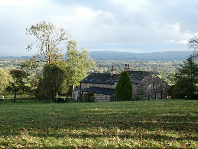
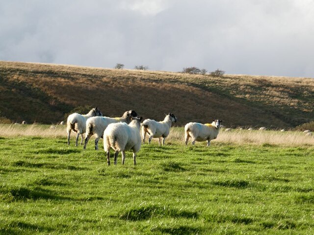
Grainings Clough is a picturesque valley located in the county of Yorkshire, England. Nestled within the beautiful countryside, this valley is known for its stunning natural landscapes and rich biodiversity. It is situated near the village of Grainings, offering visitors and locals alike a tranquil and idyllic escape from the hustle and bustle of city life.

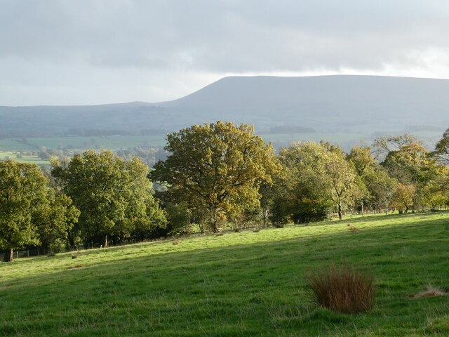
The valley is characterized by its rolling hills, lush green meadows, and meandering streams that flow through the landscape. These streams provide a vital water source for the diverse array of plant and animal species that call Grainings Clough home.

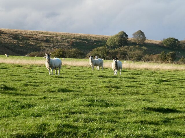
Nature enthusiasts will be delighted by the variety of flora and fauna found in this valley. The area is rich in wildflowers, with vibrant colors dotting the landscape during the spring and summer months. The valley is also home to several species of birds, including robins, blackbirds, and thrushes, providing a harmonious soundtrack to the scenic surroundings.

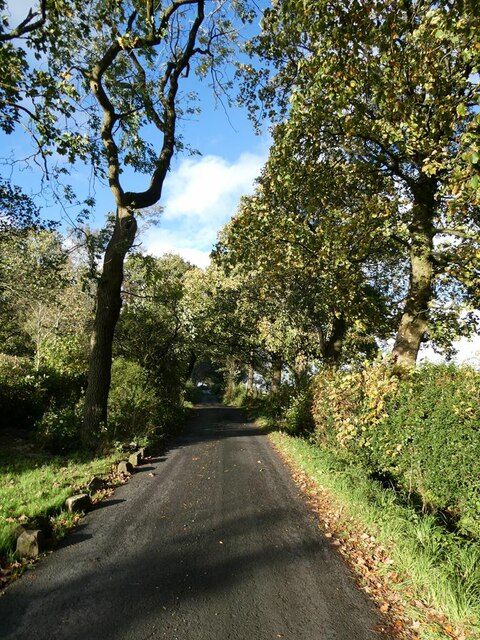
For those seeking outdoor activities, Grainings Clough offers ample opportunities for hiking and walking. The valley is crisscrossed by numerous footpaths and trails, allowing visitors to explore its beauty at their own pace. These paths lead to breathtaking viewpoints, providing panoramic vistas of the valley and its surroundings.

Overall, Grainings Clough in Yorkshire is a haven for nature lovers and those seeking a peaceful retreat. Its natural beauty, diverse wildlife, and serene atmosphere make it a must-visit destination for anyone exploring the Yorkshire countryside.

If you have any feedback on the listing, please let us know in the comments section below.

Grainings Clough Images

Images are sourced within 2km of 53.970842/-2.3275085 or Grid Reference SD7852. Thanks to Geograph Open Source API. All images are credited.

Ordnance Survey Cut Mark This mark can be found on the wall of a roadside barn at Grunsagill.
The benchmark has a recorded height of 175.6426 metres above sea level.
For more detail see : <span class="nowrap"><a title="https://www.bench-marks.org.uk/bm152220" rel="nofollow ugc noopener" href="https://www.bench-marks.org.uk/bm152220">Link</a><img style="margin-left:2px;" alt="External link" title="External link - shift click to open in new window" src="https://s1.geograph.org.uk/img/external.png" width="10" height="10"/></span>
Ordnance Survey Cut Mark
This mark can be found on the wall of a roadside barn at Grunsagill. The benchmark has a recorded height of 175.6426 metres above sea level. For more detail see : LinkExternal link
Ordnance Survey Cut Mark This mark can be found on the parapet wall of a road bridge at Grunasgill.
The benchmark has a recorded height of 184.7302 metres above sea level.
For more detail see : <span class="nowrap"><a title="https://www.bench-marks.org.uk/bm152234" rel="nofollow ugc noopener" href="https://www.bench-marks.org.uk/bm152234">Link</a><img style="margin-left:2px;" alt="External link" title="External link - shift click to open in new window" src="https://s1.geograph.org.uk/img/external.png" width="10" height="10"/></span>
Ordnance Survey Cut Mark
This mark can be found on the parapet wall of a road bridge at Grunasgill. The benchmark has a recorded height of 184.7302 metres above sea level. For more detail see : LinkExternal link
Ash tree, cabin and sheep Near Springside Farm on Knotts Lane.
Ash tree, cabin and sheep
Near Springside Farm on Knotts Lane.
Knotts Lane near Varley's Farm A very minor road running up the west side of the valley of Holden Beck.
Knotts Lane near Varley's Farm
A very minor road running up the west side of the valley of Holden Beck.
Broad Ing Farm Commanding an extensive view over the valley of the Holden Beck.
Broad Ing Farm
Commanding an extensive view over the valley of the Holden Beck.
Sheep in field beside Knotts Lane Near Witton's Farm
Sheep in field beside Knotts Lane
Near Witton's Farm
View south from Knotts Lane Pendle Hill <a href="https://www.geograph.org.uk/gridref/SD7754">SD7754</a> dominates the skyline.
View south from Knotts Lane
Pendle Hill SD7754 dominates the skyline.
Knotts Lane Sunny intervals and black clouds looming.
Knotts Lane
Sunny intervals and black clouds looming.
Field beside Knotts Lane On the lower slopes of Knotts Hill.
Field beside Knotts Lane
On the lower slopes of Knotts Hill.
Wary sheep In a field beside Knotts Lane.
Wary sheep
In a field beside Knotts Lane.
A very effective road block A hay bale has been strategically placed across the top of this footpath to Wittons Farm to prevent access by motor vehicles.
A very effective road block
A hay bale has been strategically placed across the top of this footpath to Wittons Farm to prevent access by motor vehicles.
Bin day At the head of the drive to Little Holme Farm and Big Holme Farm on Knotts Lane.
Bin day
At the head of the drive to Little Holme Farm and Big Holme Farm on Knotts Lane.
Wittons Farm Wittons Farm below the field. Ray Head Farm beyond and to the left.
Wittons Farm
Wittons Farm below the field. Ray Head Farm beyond and to the left.
View from Knotts Lane Looking across the broad valley of the Holden Beck.
View from Knotts Lane
Looking across the broad valley of the Holden Beck.
Trees beside Knotts Lane
Highland cow Boococks Farm in the background.
Highland cow
Boococks Farm in the background.
Highland cattle near Boococks Farm
New Laithe Looking West towards New Laithe
New Laithe
Looking West towards New Laithe
Show me another place!

Grainings Clough is located at Grid Ref: SD7852 (Lat: 53.970842, Lng: -2.3275085)

Division: West Riding

Administrative County: Lancashire

District: Ribble Valley

Police Authority: Lancashire

What 3 Words

///defenders.flopping.custard. Near Hellifield, North Yorkshire

Related Wikis

Manor House, Gisburn Forest

Manor House is an historic building in Gisburn Forest, Lancashire, England. It was built in the early 18th century, but contains a section that is believed...

Gisburn Forest

Gisburn Forest is a civil parish in the Ribble Valley, in Lancashire, England. Mainly lying within the Forest of Bowland Area of Outstanding Natural Beauty...

Bolton-by-Bowland

Bolton-by-Bowland is a village and civil parish in the Ribble Valley district of Lancashire, England. Before 1974, the village was part of Bowland Rural...

St Peter and St Paul's Church, Bolton-by-Bowland

St Peter and St Paul's Church is in Gisburn Road, Bolton-by-Bowland, Lancashire, England. It is an active Anglican parish church in the deanery of Whalley...

Tosside

Tosside is a small village on the modern border of North Yorkshire and Lancashire in Northern England. It lies within the Forest of Bowland, and is between...

Paythorne

Paythorne is a small village and civil parish in Ribble Valley, Lancashire, England. It is situated alongside the River Ribble, north-east of Clitheroe...

Wigglesworth

Wigglesworth is a village and civil parish in the Craven district of North Yorkshire, England. The population of the civil parish taken at the 2011 Census...

Stock Beck

Stock Beck is a minor river in the West Craven area of Pendle, Lancashire (formerly in Yorkshire). It is 8.25 miles (13.27 km) long and has a catchment...

Nearby Amenities

Located within 500m of 53.970842,-2.3275085
Turn Greece Wood
Natural: woodland
Source: OS OpenData StreetView
Lat/Long: 53.9670799/-2.3274695
Blue Scar Wood
Natural: woodland
Source: OS OpenData StreetView
Lat/Long: 53.9702733/-2.3292934
Power: pole
Lat/Long: 53.9690234/-2.3213527
Power: pole
Lat/Long: 53.9691654/-2.3231658
Power: pole
Lat/Long: 53.9692743/-2.3241019
Power: pole
Lat/Long: 53.9694857/-2.3259178
Power: pole
Lat/Long: 53.9695961/-2.3268646
Power: pole
Lat/Long: 53.9680152/-2.3223048
Power: pole
Lat/Long: 53.969055/-2.3222458
Power: pole
Lat/Long: 53.9699164/-2.3221949
Power: pole
Lat/Long: 53.9707794/-2.3221466
Power: pole
Lat/Long: 53.9714294/-2.3215807
Power: pole
Lat/Long: 53.9720494/-2.3210201
The data included in this document is from www.openstreetmap.org. The data is made available under ODbL.

Have you been to Grainings Clough?

Leave your review of Grainings Clough below (or comments, questions and feedback).