Dobson's Clough

Valley in Yorkshire Ribble Valley

England

Dobson's Clough

Ordnance Survey Cut Mark This mark can be found on the wall of a roadside barn at Grunsagill.
The benchmark has a recorded height of 175.6426 metres above sea level.
For more detail see : <span class="nowrap"><a title="https://www.bench-marks.org.uk/bm152220" rel="nofollow ugc noopener" href="https://www.bench-marks.org.uk/bm152220">Link</a><img style="margin-left:2px;" alt="External link" title="External link - shift click to open in new window" src="https://s1.geograph.org.uk/img/external.png" width="10" height="10"/></span>
Ordnance Survey Cut Mark Credit: Peter Wood

Dobson's Clough is a picturesque valley located in the county of Yorkshire, England. Nestled within the beautiful landscape of the Yorkshire Dales National Park, this valley offers visitors a tranquil and scenic retreat.

The valley is named after a prominent landowner, Mr. Dobson, who owned the land in the early 19th century. With its lush green meadows, rolling hills, and meandering streams, Dobson's Clough is a haven for nature enthusiasts and hikers. The valley is renowned for its diverse wildlife, including rare species of birds, mammals, and plants.

A network of well-maintained footpaths and trails crisscrosses the valley, allowing visitors to explore its natural wonders at their own pace. One of the most popular routes is the Clough Circuit, which takes hikers on a circular journey through the valley, offering stunning views of cascading waterfalls, rocky outcrops, and ancient woodlands.

The valley also boasts several historic landmarks, such as Dobson's Mill, a restored watermill that dates back to the 18th century. The mill provides a fascinating insight into the area's industrial past and offers guided tours for visitors.

For those seeking a peaceful retreat, Dobson's Clough offers several picnic spots and camping areas, where visitors can relax and immerse themselves in the tranquil surroundings. The valley is also a popular spot for wildlife photography, as it provides ample opportunities to capture stunning shots of rare birds and other fauna.

Overall, Dobson's Clough is a true gem of Yorkshire, offering visitors a chance to reconnect with nature and experience the natural beauty that this region has to offer.

If you have any feedback on the listing, please let us know in the comments section below.

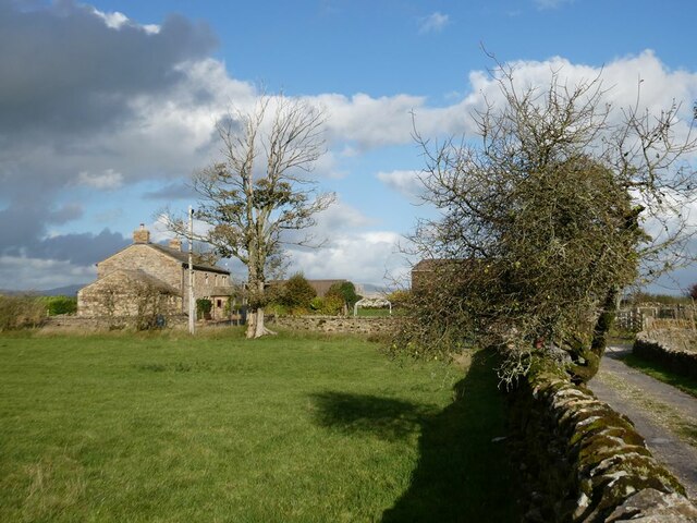
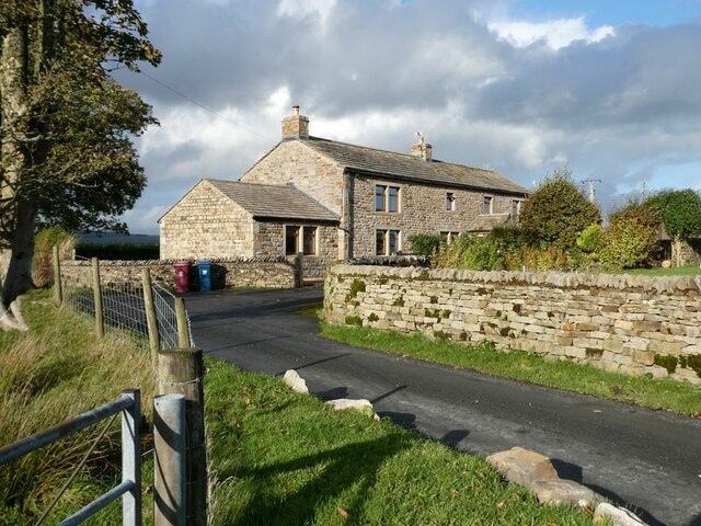
Dobson's Clough Images

Images are sourced within 2km of 53.985746/-2.3330851 or Grid Reference SD7854. Thanks to Geograph Open Source API. All images are credited.

Ordnance Survey Cut Mark This mark can be found on the wall of a roadside barn at Grunsagill.
The benchmark has a recorded height of 175.6426 metres above sea level.
For more detail see : <span class="nowrap"><a title="https://www.bench-marks.org.uk/bm152220" rel="nofollow ugc noopener" href="https://www.bench-marks.org.uk/bm152220">Link</a><img style="margin-left:2px;" alt="External link" title="External link - shift click to open in new window" src="https://s1.geograph.org.uk/img/external.png" width="10" height="10"/></span>
Ordnance Survey Cut Mark
This mark can be found on the wall of a roadside barn at Grunsagill. The benchmark has a recorded height of 175.6426 metres above sea level. For more detail see : LinkExternal link
Ordnance Survey Cut Mark This mark can be found on the parapet wall of a road bridge at Grunasgill.
The benchmark has a recorded height of 184.7302 metres above sea level.
For more detail see : <span class="nowrap"><a title="https://www.bench-marks.org.uk/bm152234" rel="nofollow ugc noopener" href="https://www.bench-marks.org.uk/bm152234">Link</a><img style="margin-left:2px;" alt="External link" title="External link - shift click to open in new window" src="https://s1.geograph.org.uk/img/external.png" width="10" height="10"/></span>
Ordnance Survey Cut Mark
This mark can be found on the parapet wall of a road bridge at Grunasgill. The benchmark has a recorded height of 184.7302 metres above sea level. For more detail see : LinkExternal link
Field near Pendle View Farm As its name implies, Pendle View Farm (shown on the map as Cracoe Hill Farm) has a cracking view of Pendle Hill <a href="https://www.geograph.org.uk/gridref/SD8041">SD8041</a> seen on the horizon.
Field near Pendle View Farm
As its name implies, Pendle View Farm (shown on the map as Cracoe Hill Farm) has a cracking view of Pendle Hill SD8041 seen on the horizon.
The road to Tosside Looking north.
The road to Tosside
Looking north.
Knotts Rest Self-catering accommodation in barn conversion at Knotts Farm.
Knotts Rest
Self-catering accommodation in barn conversion at Knotts Farm.
Field with sheep behind Knotts Farm Under a threatening sky.
Field with sheep behind Knotts Farm
Under a threatening sky.
Moor Stones Barn Farm On Knotts Lane, seen from the drive to Knotts Farm.
Moor Stones Barn Farm
On Knotts Lane, seen from the drive to Knotts Farm.
Moor Stones Barn Farm On Knotts Lane.
Moor Stones Barn Farm
On Knotts Lane.
Knotts Farm
Knotts Farm
Ash tree, cabin and sheep Near Springside Farm on Knotts Lane.
Ash tree, cabin and sheep
Near Springside Farm on Knotts Lane.
Knotts Lane Sunny intervals and black clouds looming.
Knotts Lane
Sunny intervals and black clouds looming.
View from Knotts Lane Looking across the broad valley of the Holden Beck.
View from Knotts Lane
Looking across the broad valley of the Holden Beck.
Trees beside Knotts Lane
Highland cow Boococks Farm in the background.
Highland cow
Boococks Farm in the background.
Highland cattle near Boococks Farm
This way to Wigglesworth The B6478 viewed near Bowland Fell Holiday Park.
This way to Wigglesworth
The B6478 viewed near Bowland Fell Holiday Park.
To Bowland Fell The access road for this Yorkshire holiday park.
To Bowland Fell
The access road for this Yorkshire holiday park.
Tosside, gatepost on B6478 The benchmark is cut into a field gatepost on the south side of B6478, and to the east of Tosside.
Tosside, gatepost on B6478
The benchmark is cut into a field gatepost on the south side of B6478, and to the east of Tosside.
Show me another place!

Dobson's Clough is located at Grid Ref: SD7854 (Lat: 53.985746, Lng: -2.3330851)

Division: West Riding

Administrative County: Lancashire

District: Ribble Valley

Police Authority: Lancashire

What 3 Words

///scrolled.goats.down. Near Hellifield, North Yorkshire

Related Wikis

Manor House, Gisburn Forest

Manor House is an historic building in Gisburn Forest, Lancashire, England. It was built in the early 18th century, but contains a section that is believed...

Gisburn Forest

Gisburn Forest is a civil parish in the Ribble Valley, in Lancashire, England. Mainly lying within the Forest of Bowland Area of Outstanding Natural Beauty...

Tosside

Tosside is a small village on the modern border of North Yorkshire and Lancashire in Northern England. It lies within the Forest of Bowland, and is between...

Wigglesworth

Wigglesworth is a village and civil parish in the Craven district of North Yorkshire, England. The population of the civil parish taken at the 2011 Census...

Easington, Lancashire

Easington () is a civil parish within the Ribble Valley district of Lancashire, England, with a population in 2001 of 52. The Census 2011 population details...

Bolton-by-Bowland

Bolton-by-Bowland is a village and civil parish in the Ribble Valley district of Lancashire, England. Before 1974, the village was part of Bowland Rural...

St Peter and St Paul's Church, Bolton-by-Bowland

St Peter and St Paul's Church is in Gisburn Road, Bolton-by-Bowland, Lancashire, England. It is an active Anglican parish church in the deanery of Whalley...

Paythorne

Paythorne is a small village and civil parish in Ribble Valley, Lancashire, England. It is situated alongside the River Ribble, north-east of Clitheroe...

Nearby Amenities

Located within 500m of 53.985746,-2.3330851
Grunsagill
Place: hamlet
Source: OSOpenDataStreetView
Lat/Long: 53.983708/-2.3337481
Generator Method: wind_turbine
Generator Source: wind
Power: generator
Lat/Long: 53.989717/-2.3358026
The data included in this document is from www.openstreetmap.org. The data is made available under ODbL.

Have you been to Dobson's Clough?

Leave your review of Dobson's Clough below (or comments, questions and feedback).