Black Cleugh

Valley in Northumberland

England

Black Cleugh

Ruin south of Fairplay
Ruin south of Fairplay Credit: Mike Quinn

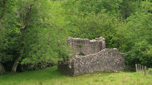
Black Cleugh is a picturesque valley located in the county of Northumberland, in the northeastern region of England. Situated amidst the stunning landscape of the North Pennines Area of Outstanding Natural Beauty, Black Cleugh is renowned for its scenic charm and tranquility.

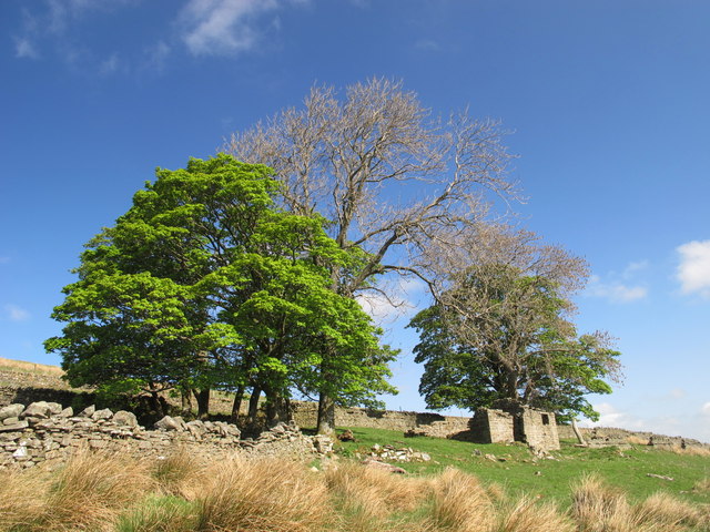
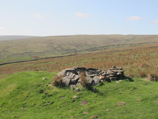
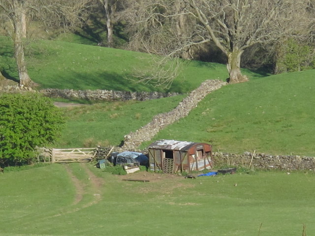
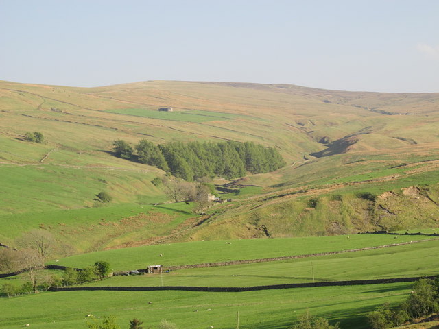
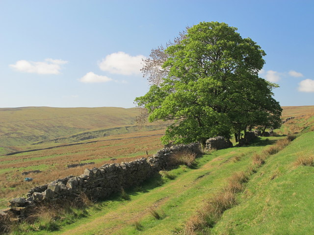
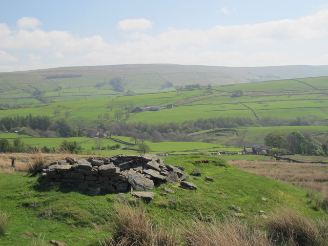
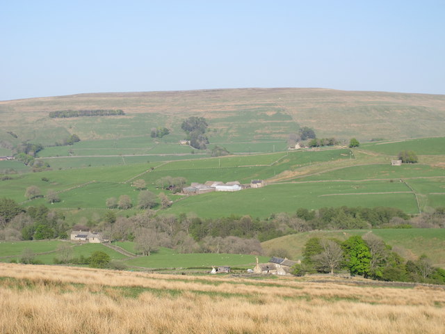
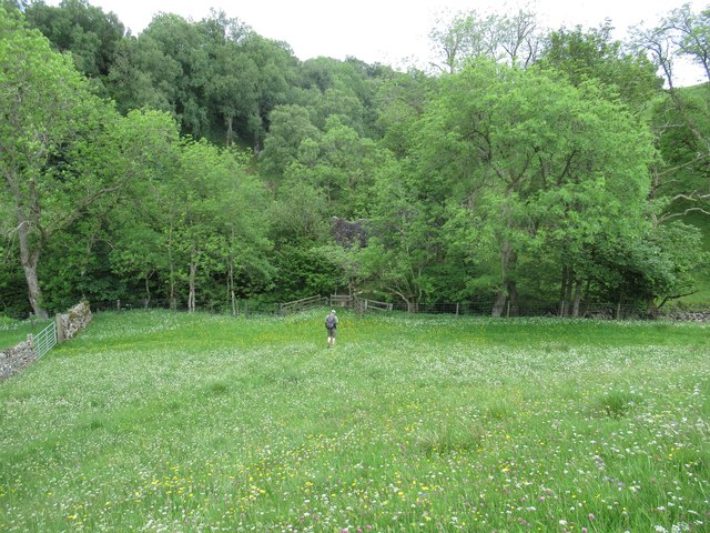
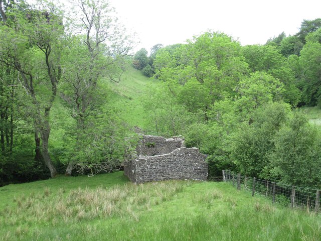
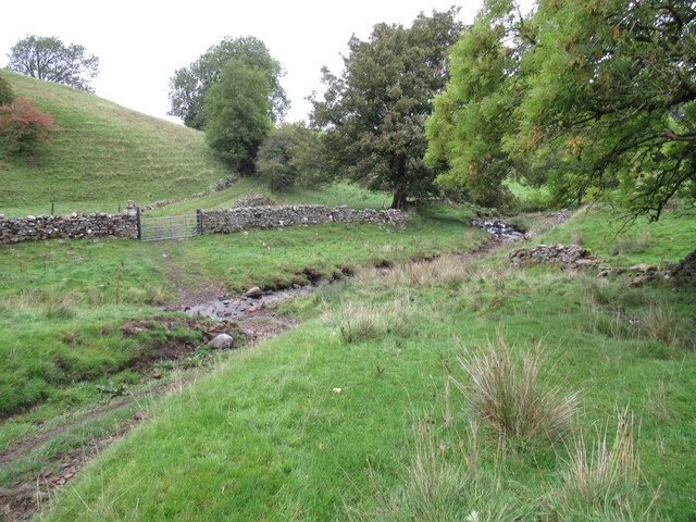
The valley is characterized by its lush green meadows, rolling hills, and meandering streams, which contribute to its natural beauty. It is surrounded by dense woodlands, adding an enchanting element to the area. Black Cleugh is also known for its diverse wildlife, including various bird species, mammals, and butterflies, making it a haven for nature enthusiasts and birdwatchers.

The valley offers numerous opportunities for outdoor activities and exploration. There are several walking and hiking trails that wind their way through the valley, providing breathtaking views of the surrounding countryside. Adventure seekers can also indulge in mountain biking and off-road cycling on the challenging terrains of the area. Fishing is another popular activity, with the streams in Black Cleugh teeming with trout.

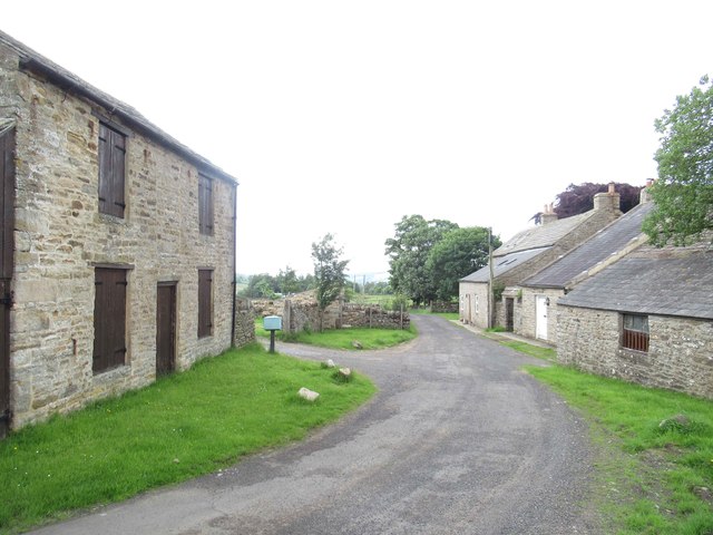
Although primarily a rural area, Black Cleugh is in close proximity to several charming villages and towns, allowing visitors to explore the local culture and heritage. The nearby market towns offer a range of amenities, including quaint cafes, traditional pubs, and shops selling local produce.

Overall, Black Cleugh, Northumberland, with its stunning landscapes, abundant wildlife, and ample outdoor opportunities, is a hidden gem that showcases the natural beauty of the region.

If you have any feedback on the listing, please let us know in the comments section below.

Black Cleugh Images

Images are sourced within 2km of 54.829475/-2.3543202 or Grid Reference NY7748. Thanks to Geograph Open Source API. All images are credited.

Ruin south of Fairplay
Disused mine shaft south of Fairplay
Old railway goods van near Mohope Head (2) See also <a href="https://www.geograph.org.uk/photo/692103">NY7750 : Old railway goods van near Mohope Head</a>.
Old railway goods van near Mohope Head (2)
The upper Mohope valley Shows the location of <a href="https://www.geograph.org.uk/photo/2384495">NY7750 : Old railway goods van near Mohope Head (2)</a>. In the middle distance (centre) is <a href="https://www.geograph.org.uk/photo/136467">NY7749 : Appletree Shield</a> and on the far side of the valley above the woodland is <a href="https://www.geograph.org.uk/photo/135202">NY7848 : New House</a> (both photographed by Andrew Smith).
The upper Mohope valley
Shows the location of NY7750 : Old railway goods van near Mohope Head (2). In the middle distance (centre) is NY7749 : Appletree Shield and on the far side of the valley above the woodland is NY7848 : New House (both photographed by Andrew Smith).
Ruined building at confluence of Mohope and Wellhope Burns The Mohope Burn is below to the left, the Wellhope to the right. The ruin is in the angle of the confluence; its purpose unknown.
Ruined building at confluence of Mohope and Wellhope Burns
The Mohope Burn is below to the left, the Wellhope to the right. The ruin is in the angle of the confluence; its purpose unknown.
Mohope Head Shows the location of <a href="https://www.geograph.org.uk/photo/2384495">NY7750 : Old railway goods van near Mohope Head (2)</a> (just right of centre, at the far end of the field beyond the line of trees).
Mohope Head
Shows the location of NY7750 : Old railway goods van near Mohope Head (2) (just right of centre, at the far end of the field beyond the line of trees).
Track and rough pastures south of Fairplay With Mohope Moor beyond. For a view back from the other side of the trees, see <a href="https://www.geograph.org.uk/photo/2383721">NY7650 : Ruin south of Fairplay</a>.
Track and rough pastures south of Fairplay
With Mohope Moor beyond. For a view back from the other side of the trees, see NY7650 : Ruin south of Fairplay.
Old mine shaft above Mohope Head Looking across the Mohope valley towards <a href="https://www.geograph.org.uk/photo/413226">NY7750 : Hesleywell Farm</a>.
Old mine shaft above Mohope Head
Looking across the Mohope valley towards NY7750 : Hesleywell Farm.
Mohope Head (2) Looking across the valley towards <a href="https://www.geograph.org.uk/photo/413226">NY7750 : Hesleywell Farm</a>.
Mohope Head (2)
Looking across the valley towards NY7750 : Hesleywell Farm.
Southern House at Nether House (West Allen) The southern house at Nether House, Mo Hope, was built in the 18th century and extended in the early 19th century. This is a Grade II Listed Building protected by law.
<span class="nowrap"><a title="http://www.keystothepast.info/article/10339/Site-Details?PRN=N18798" rel="nofollow ugc noopener" href="http://www.keystothepast.info/article/10339/Site-Details?PRN=N18798">Link</a><img style="margin-left:2px;" alt="External link" title="External link - shift click to open in new window" src="https://s1.geograph.org.uk/img/external.png" width="10" height="10"/></span>
Southern House at Nether House (West Allen)
The southern house at Nether House, Mo Hope, was built in the 18th century and extended in the early 19th century. This is a Grade II Listed Building protected by law. LinkExternal link
Footpath towards the Wellhope Burn
Appletree Shield Chapel (West Allen) This chapel is shown on early OS maps.
Hard to see why this chapel was needed or who attended since there are two chapels nearby at Mohope and Hesleywell.
This Methodist Chapel stands in an unusual position on a tongue of land at the junction of two shallow gorges, each crossed by a footbridge. It is rectangular in shape, but it is now badly ruined.
<span class="nowrap"><a title="http://www.keystothepast.info/article/10339/Site-Details?PRN=N6453" rel="nofollow ugc noopener" href="http://www.keystothepast.info/article/10339/Site-Details?PRN=N6453">Link</a><img style="margin-left:2px;" alt="External link" title="External link - shift click to open in new window" src="https://s1.geograph.org.uk/img/external.png" width="10" height="10"/></span>
Appletree Shield Chapel (West Allen)
This chapel is shown on early OS maps. Hard to see why this chapel was needed or who attended since there are two chapels nearby at Mohope and Hesleywell. This Methodist Chapel stands in an unusual position on a tongue of land at the junction of two shallow gorges, each crossed by a footbridge. It is rectangular in shape, but it is now badly ruined. LinkExternal link
Ford through the Mohope Burn
View towards Mohope Valley and Mohope Head
Ruined Farmhouse
Ruined Farmhouse
Hesleywell
Hesleywell
Middle
Middle
Footpath through Middle
Show me another place!

Black Cleugh is located at Grid Ref: NY7748 (Lat: 54.829475, Lng: -2.3543202)

Unitary Authority: Northumberland

Police Authority: Northumbria

What 3 Words

///outfit.wiping.starlight. Near Alston, Cumbria

Related Wikis

Throssel Hole Buddhist Abbey

Throssel Hole Buddhist Abbey is a Buddhist monastery and retreat centre located in Northumberland, in northern England. The monastic order is equally for...

Carr Shield

Carrshield is a village in Northumberland, in England. It is situated in the Pennines approximately between Penrith and Hexham. It is a small village with...

Ouston, Ninebanks

Ouston is a small settlement in south west Northumberland, England in the North Pennines Area of Outstanding Natural Beauty 8 miles (13 km) north-east...

Coalcleugh

Coalcleugh is a hamlet in Northumberland, England. It is situated in the Pennines between Penrith and Hexham. In the past it was well known as a lead mining...

Allendale Moors

Allendale Moors is a Site of Special Scientific Interest (SSSI) in Northumberland, England. The upland moorland ridge site is listed for its heath, flush...

Rampghill mine

Rampgill mine is a disused lead mine at Nenthead, Alston Moor, Cumbria, England UK Grid Reference: NY78184351It was one of the most extensive and productive...

Nenthead

Nenthead ( NENT-hed) in the county of Cumbria is one of England's highest villages, at around 1,437 feet (438 m). It was not built until the middle of...

Ninebanks

Ninebanks is a small village in south west Northumberland, England in the North Pennines Area of Outstanding Natural Beauty 8 miles (13 km) north-east...

Nearby Amenities

Located within 500m of 54.829475,-2.3543202
Broad Meadows
Place: locality
Lat/Long: 54.8307408/-2.3607495
Note: Something here?
Source: Bing
Lat/Long: 54.8269616/-2.3491636
The data included in this document is from www.openstreetmap.org. The data is made available under ODbL.

Have you been to Black Cleugh?

Leave your review of Black Cleugh below (or comments, questions and feedback).