Horse Cleugh

Valley in Berwickshire

Scotland

Horse Cleugh

Eye Water viewed from the road bridge near to Paitshill Looking south-westward.
Eye Water viewed from the road bridge near to Paitshill Credit: Peter Wood

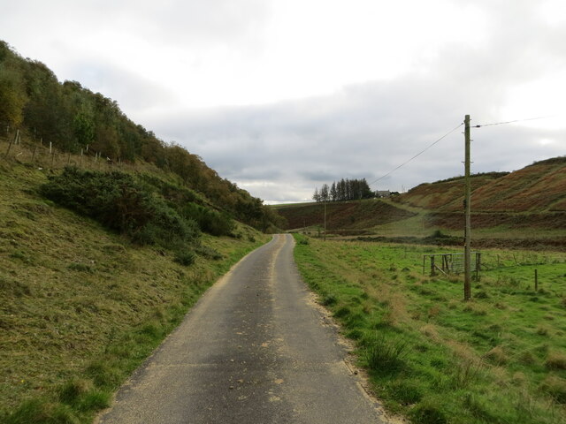
Horse Cleugh is a picturesque valley located in the region of Berwickshire, Scotland. Nestled amidst rolling hills and lush greenery, it is renowned for its natural beauty and tranquility. The valley stretches for several miles, creating a serene and idyllic setting that attracts nature enthusiasts and hikers alike.

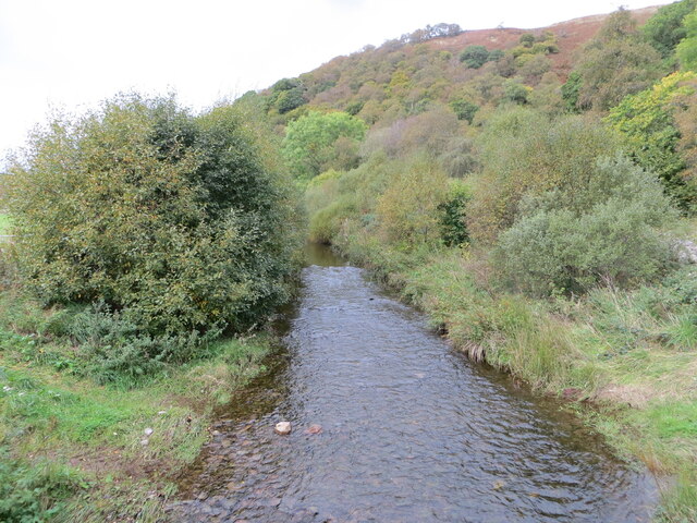
One of the most striking features of Horse Cleugh is the crystal-clear stream that meanders through the valley, adding a touch of serenity to the landscape. The stream is surrounded by an abundance of wildflowers and native plant species, creating a vibrant and colorful environment. Additionally, the valley is home to a diverse range of wildlife, including deer, foxes, and various bird species, making it a popular spot for wildlife enthusiasts.

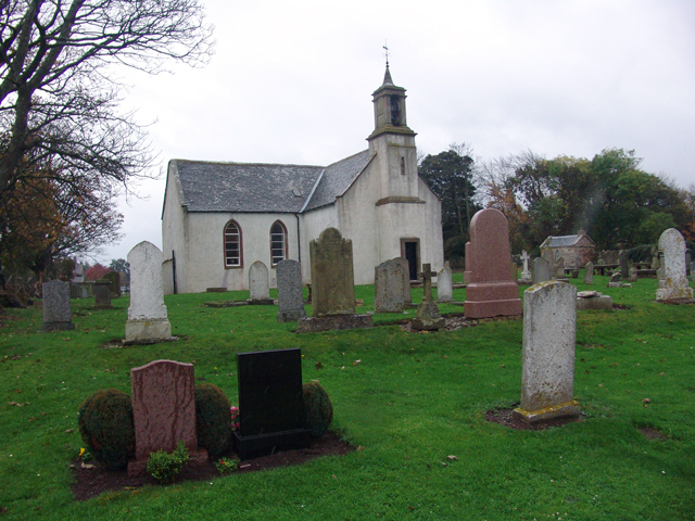
Horse Cleugh is also known for its rich history, with several historic sites dotting the area. The remains of ancient settlements and stone circles can be found, providing a glimpse into the region's past. These archaeological sites have attracted researchers and history enthusiasts, who are fascinated by the valley's intriguing past.

Visitors to Horse Cleugh can enjoy a variety of outdoor activities, such as hiking, cycling, and picnicking. The valley offers numerous walking trails, ranging from easy strolls to more challenging hikes, catering to all levels of fitness and experience. With its breathtaking scenery and peaceful atmosphere, Horse Cleugh offers a perfect escape from the hustle and bustle of modern life.

In conclusion, Horse Cleugh is a picturesque valley in Berwickshire, Scotland, renowned for its natural beauty, rich history, and diverse wildlife. Whether it is exploring the ancient ruins, enjoying a leisurely walk, or simply immersing oneself in the tranquility of nature, Horse Cleugh offers a captivating experience for all who visit.

If you have any feedback on the listing, please let us know in the comments section below.

Horse Cleugh Images

Images are sourced within 2km of 55.879388/-2.4206031 or Grid Reference NT7365. Thanks to Geograph Open Source API. All images are credited.

Eye Water viewed from the road bridge near to Paitshill Looking south-westward.
Eye Water viewed from the road bridge near to Paitshill
Looking south-westward.
Sheep pasture and woodland near Corse Law Looking south-eastward.
Sheep pasture and woodland near Corse Law
Looking south-eastward.
Sheep pens and woodland near Corse Law Looking southward.
Sheep pens and woodland near Corse Law
Looking southward.
Track for access to Middle Monynut Looking north-westward in the direction of some of the Aikengall II Community Wind Farm turbines.
Track for access to Middle Monynut
Looking north-westward in the direction of some of the Aikengall II Community Wind Farm turbines.
Minor road and buildings at Nether Monynut Looking southward.
Minor road and buildings at Nether Monynut
Looking southward.
Minor road following the course of Monynut Water down the valley Looking southward.
Minor road following the course of Monynut Water down the valley
Looking southward.
Monynut Water viewed from Bushelhill Farm Bridge Looking north-westward upstream.
Monynut Water viewed from Bushelhill Farm Bridge
Looking north-westward upstream.
Ordnance Survey Cut Mark This mark can be found on the wall of a building at Nether Monynut.
The recorded details give a height of 235.1105 metres above sea level.
For more detail see : <span class="nowrap"><a title="https://www.bench-marks.org.uk/bm208282" rel="nofollow ugc noopener" href="https://www.bench-marks.org.uk/bm208282">Link</a><img style="margin-left:2px;" alt="External link" title="External link - shift click to open in new window" src="https://s1.geograph.org.uk/img/external.png" width="10" height="10"/></span>
Ordnance Survey Cut Mark
This mark can be found on the wall of a building at Nether Monynut. The recorded details give a height of 235.1105 metres above sea level. For more detail see : LinkExternal link
Cattle near Abbey St Bathans The large field is being grazed by a herd of what looks like Aberdeen Angus cattle.
Cattle near Abbey St Bathans
The large field is being grazed by a herd of what looks like Aberdeen Angus cattle.
Clearing and Brush Wood under Laughing Law on a by road from Abbey St Bathans to Ecclaw
Clearing and Brush Wood
under Laughing Law on a by road from Abbey St Bathans to Ecclaw
Nasty bit of road nr Moneynut Water the hill is part of Laughing Law
Nasty bit of road nr Moneynut Water
the hill is part of Laughing Law
Cattle Grid and long view towards Ecclaw looking towards the North Sea at Pease Bay
Cattle Grid and long view towards Ecclaw
looking towards the North Sea at Pease Bay
Flocks, looking to Fannanside I centred this on the foreground rather but Fannanside is in the same square so the exact location can be amended if required.
Flocks, looking to Fannanside
I centred this on the foreground rather but Fannanside is in the same square so the exact location can be amended if required.
Lammermuir Road Road from Ecclaw to Nether Monynut. Whareburn runs through the valley.
Lammermuir Road
Road from Ecclaw to Nether Monynut. Whareburn runs through the valley.
Middle Monynut, Lammermuirs View over Skinner Burn.
Middle Monynut, Lammermuirs
View over Skinner Burn.
Trees Birch trees growing at strange angle on Laughing Law at Nether Monynut, Lammermuirs
Trees
Birch trees growing at strange angle on Laughing Law at Nether Monynut, Lammermuirs
Forest behind Dunglass Common
Foul Rig Farmland won from Lammermuir moorland. Grazed by sheep.
Foul Rig
Farmland won from Lammermuir moorland. Grazed by sheep.
Show me another place!

Horse Cleugh is located at Grid Ref: NT7365 (Lat: 55.879388, Lng: -2.4206031)

Unitary Authority: The Scottish Borders

Police Authority: The Lothians and Scottish Borders

What 3 Words

///rave.grove.somewhere. Near Duns, Scottish Borders

Nearby Locations

Horse Cleugh

Related Wikis

Abbey St Bathans

Abbey St Bathans (Scottish Gaelic: Abaid Bhaoithin) is a parish in the Lammermuir district of Berwickshire, in the eastern part of the Scottish Borders...

Oldhamstocks

Oldhamstocks or Aldhamstocks ("old dwelling place") is a civil parish and small village in the east of East Lothian, Scotland, adjacent to the Scottish...

Crystal Rig Wind Farm

Crystal Rig Wind Farm is an operational onshore wind farm located on the Lammermuir Hills in the Scottish Borders region of Scotland. When phase 1 was...

Bothwell Water

The Bothwell Water is a river in the Scottish Borders area of Scotland. It rises in the Lammermuir Hills near Caldercleugh and continues past the Upper...

Have you been to Horse Cleugh?

Leave your review of Horse Cleugh below (or comments, questions and feedback).