Robber's Cleugh

Valley in Berwickshire

Scotland

Robber's Cleugh

Ellemhaugh Beside Whiteadder Water.
Ellemhaugh Credit: Russel Wills

Robber's Cleugh is a picturesque valley located in Berwickshire, a historic county in the Scottish Borders region of Scotland. The valley is nestled between the rolling hills, offering stunning views of the surrounding countryside. It is situated near the village of Cockburnspath, approximately 10 miles south of Dunbar.

Robber's Cleugh is renowned for its natural beauty and tranquility. The valley is adorned with lush greenery, including dense woodlands and meandering streams. The terrain is varied, with gentle slopes, rocky outcrops, and small waterfalls, adding to its charm.

The name "Robber's Cleugh" originates from its association with a notorious highwayman named Rob Roy. Legend has it that he used the valley as a hiding spot after his criminal activities. This historical connection adds an air of mystery and intrigue to the area.

The valley is a haven for wildlife enthusiasts and nature lovers. It is home to a diverse range of flora and fauna, including several species of birds, mammals, and wildflowers. Hiking trails and footpaths crisscross the valley, providing opportunities for visitors to explore its natural wonders.

Robber's Cleugh offers a peaceful retreat for those seeking solace in nature. The serene atmosphere and breathtaking scenery make it an ideal destination for picnics, photography, and leisurely walks. It also attracts artists and painters who are inspired by its idyllic landscapes.

Overall, Robber's Cleugh is a hidden gem in Berwickshire, offering a perfect blend of history, natural beauty, and tranquility. It is a must-visit destination for anyone looking to immerse themselves in Scotland's enchanting countryside.

If you have any feedback on the listing, please let us know in the comments section below.

Robber's Cleugh Images

Images are sourced within 2km of 55.83536/-2.4208619 or Grid Reference NT7360. Thanks to Geograph Open Source API. All images are credited.

Ellemhaugh Beside Whiteadder Water.
Ellemhaugh
Beside Whiteadder Water.
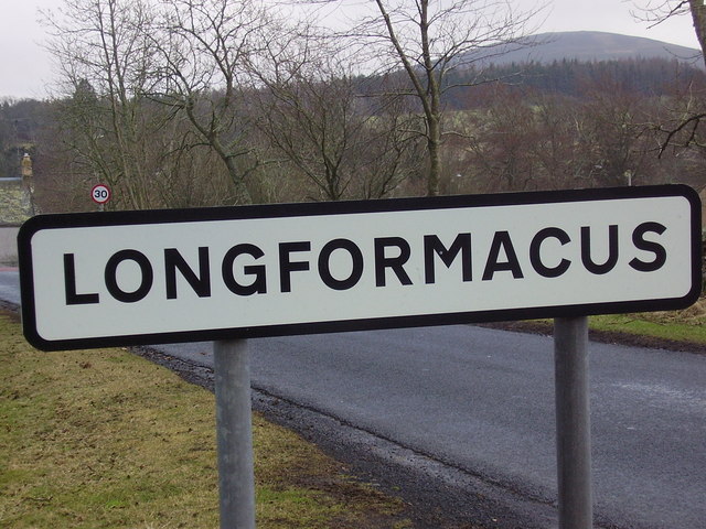
Telephone box, bus shelter, road sign and info board, Ellemford There is also a road junction here, with the sign pointing to the villages of Whitchester and Longformaus.
Telephone box, bus shelter, road sign and info board, Ellemford
There is also a road junction here, with the sign pointing to the villages of Whitchester and Longformaus.
Track into Lodge Wood A coniferous plantation.
Track into Lodge Wood
A coniferous plantation.
Pastures at Windshiel The lower slopes of the southern flank of Abbey Hill [Outer].
Pastures at Windshiel
The lower slopes of the southern flank of Abbey Hill [Outer].
Red barn at Windshiel Farm buildings, hillside pasture and Windshiel Plantation.
Red barn at Windshiel
Farm buildings, hillside pasture and Windshiel Plantation.
Red barn at Windshiel With Windshiel Plantation on the southern edge of Abbey Hill [Outer].
Red barn at Windshiel
With Windshiel Plantation on the southern edge of Abbey Hill [Outer].
Upland pasture in The Scottish Borders With some pig arks in the distance.
Upland pasture in The Scottish Borders
With some pig arks in the distance.
Track in Hen Toe Burn Wood The footpath through the forest ride further west reaches this track for the descent to the Abbey St Bathans road.
Track in Hen Toe Burn Wood
The footpath through the forest ride further west reaches this track for the descent to the Abbey St Bathans road.
Forest track meets the road to Abbey St Bathans This track through Hen Toe Burn Wood is signposted as an Abbey St Bathans path.
Forest track meets the road to Abbey St Bathans
This track through Hen Toe Burn Wood is signposted as an Abbey St Bathans path.
Gorse near Abbey St Bathans Heaths and hills are turned to a glorious yellow by the flowers of gorse in March or even earlier after a mild winter.  A member of the pea family, it is also known as furze and, in Scotland, as whin.

The 2-6ft bushes are useful as well as beautiful being planted for hedges in Ireland.  In Scotland the young shoots used to be crushed in whinmills and fed to cattle.  I myself often gave sprigs of gorse to my horses as a treat.

Whinbark is still used for a yellow dye in the manufacture of tartan cloth.
An old country saying is that when gorse is out of bloom kissing is out of fashion.  Common gorse ceases to flower in June, but lovers are safe because there are two rarer species which ensure that there are some flowers throughout the year.
Gorse near Abbey St Bathans
Heaths and hills are turned to a glorious yellow by the flowers of gorse in March or even earlier after a mild winter. A member of the pea family, it is also known as furze and, in Scotland, as whin. The 2-6ft bushes are useful as well as beautiful being planted for hedges in Ireland. In Scotland the young shoots used to be crushed in whinmills and fed to cattle. I myself often gave sprigs of gorse to my horses as a treat. Whinbark is still used for a yellow dye in the manufacture of tartan cloth. An old country saying is that when gorse is out of bloom kissing is out of fashion. Common gorse ceases to flower in June, but lovers are safe because there are two rarer species which ensure that there are some flowers throughout the year.
Gorse by Eller Burn Gorse (Ulex europaeus) is a common spiny shrub which grows up to 2 metres high to form dense thickets.  The mature plant has no flat leaves but bears sharp, branched, furrowed spines.  Coconut-scented flowers bloom in spring, followed by black, hairy seedpods.
Gorse by Eller Burn
Gorse (Ulex europaeus) is a common spiny shrub which grows up to 2 metres high to form dense thickets. The mature plant has no flat leaves but bears sharp, branched, furrowed spines. Coconut-scented flowers bloom in spring, followed by black, hairy seedpods.
New hedge near Abbey St Bathans Many of our hedge rows have been lost in recent decades as agricultural practice favoured larger and larger fields to cultivate. There are now grants available to farmers to replant hedgerows, where before, ironically, there were grants to grub them out!
New hedge near Abbey St Bathans
Many of our hedge rows have been lost in recent decades as agricultural practice favoured larger and larger fields to cultivate. There are now grants available to farmers to replant hedgerows, where before, ironically, there were grants to grub them out!
Woodland track near Abbey St Bathans The track heads through forestry towards Hen Toe Bog.
Woodland track near Abbey St Bathans
The track heads through forestry towards Hen Toe Bog.
Fire beaters, Hen Toe Wood The fire beaters are set beside the track and the minor road.
Fire beaters, Hen Toe Wood
The fire beaters are set beside the track and the minor road.
Seat, Ellemford Bridge The seat is near the bridge.
Seat, Ellemford Bridge
The seat is near the bridge.
Whiteadder Water from Ellemford Bridge The Whiteadder rises in the Lammermuir Hills and flows into the River Tweed two miles west of Berwick upon Tweed.

Looking upstream.
Whiteadder Water from Ellemford Bridge
The Whiteadder rises in the Lammermuir Hills and flows into the River Tweed two miles west of Berwick upon Tweed. Looking upstream.
Whiteadder Water from Ellemford Bridge The Whiteadder rises in the Lammermuir Hills and flows into the River Tweed two miles west of Berwick upon Tweed.

Looking downstream.
Whiteadder Water from Ellemford Bridge
The Whiteadder rises in the Lammermuir Hills and flows into the River Tweed two miles west of Berwick upon Tweed. Looking downstream.
Bench Mark, Ellemford Bridge The Ordnance Survey bench mark is to be found on the northern end of the west parapet.  For a few of the bridge <a href="https://www.geograph.org.uk/photo/2621325">NT7260 : Corner of Ellemford Bridge</a> and for further information on the cut mark and others in the area <span class="nowrap"><a title="http://www.bench-marks.org.uk/bm39667" rel="nofollow ugc noopener" href="http://www.bench-marks.org.uk/bm39667">Link</a><img style="margin-left:2px;" alt="External link" title="External link - shift click to open in new window" src="https://s1.geograph.org.uk/img/external.png" width="10" height="10"/></span>
Bench Mark, Ellemford Bridge
The Ordnance Survey bench mark is to be found on the northern end of the west parapet. For a few of the bridge NT7260 : Corner of Ellemford Bridge and for further information on the cut mark and others in the area LinkExternal link
Show me another place!

Robber's Cleugh is located at Grid Ref: NT7360 (Lat: 55.83536, Lng: -2.4208619)

Unitary Authority: The Scottish Borders

Police Authority: The Lothians and Scottish Borders

What 3 Words

///careful.documents.pins. Near Duns, Scottish Borders

Related Wikis

Dye Water

The Dye Water (Scottish Gaelic: Uisge DhĂ idh) is a river in the Lammermuir Hills in the Scottish Borders area of Scotland. It rises in the Hope Hills,...

Abbey St Bathans

Abbey St Bathans (Scottish Gaelic: Abaid Bhaoithin) is a parish in the Lammermuir district of Berwickshire, in the eastern part of the Scottish Borders...

Cockburn Tower

Cockburn Tower was a small fortified house in Berwickshire, Scotland. Now little more than the outline of a foundation, it occupied a site on the southern...

Longformacus House

Longformacus House is a mansion near the village of Longformacus, Scottish Borders, Scotland. == History == The estate was once owned by the Earls of...

Bothwell Water

The Bothwell Water is a river in the Scottish Borders area of Scotland. It rises in the Lammermuir Hills near Caldercleugh and continues past the Upper...

Longformacus

Longformacus (Scottish Gaelic: Longphort Mhacais) is a small village in Berwickshire in the Scottish Borders area of Scotland. It is around 10 kilometres...

Cranshaws Castle

Cranshaws Castle or Cranshaws Tower is a privately owned 15th-century pele situated by the village of Cranshaws in Berwickshire, Scotland. The building...

Preston, Scottish Borders

Preston is a small village in the ancient county of Berwickshire, now an administrative area of the Scottish Borders region of Scotland. It lies within...

Related Videos

Green Hope

Self catering holiday place hear Abbey St Bathans.

Nearby Amenities

Located within 500m of 55.83536,-2.4208619
The data included in this document is from www.openstreetmap.org. The data is made available under ODbL.

Have you been to Robber's Cleugh?

Leave your review of Robber's Cleugh below (or comments, questions and feedback).