Lyscombe Bottom

Valley in Dorset

England

Lyscombe Bottom

Cross dyke on Higher Hill Cross dykes apparently formed prehistoric land boundaries. There are quite a few on this ridgeway in this beautiful part of Dorset.
Cross dyke on Higher Hill Credit: Becky Williamson

Lyscombe Bottom is a picturesque valley located in the county of Dorset, England. Situated in the heart of the West Dorset Area of Outstanding Natural Beauty, this idyllic valley is a haven for nature lovers and those seeking tranquility away from the hustle and bustle of city life.

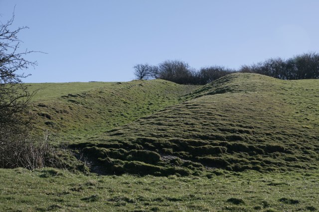
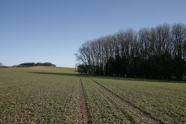
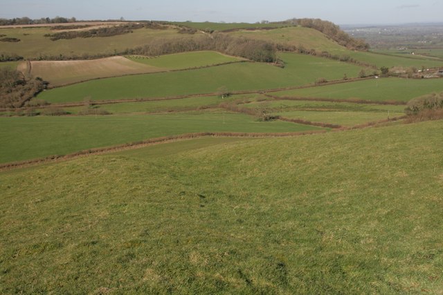
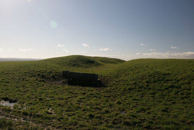
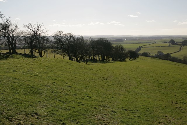
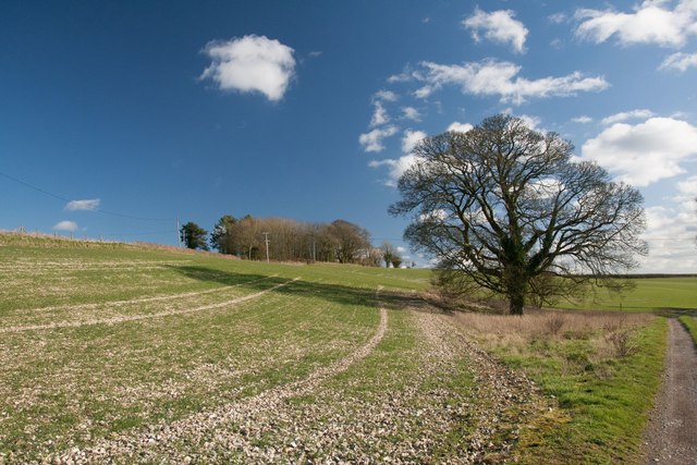
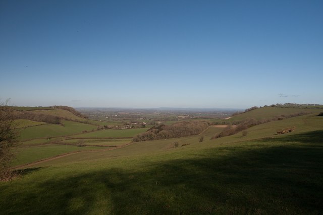
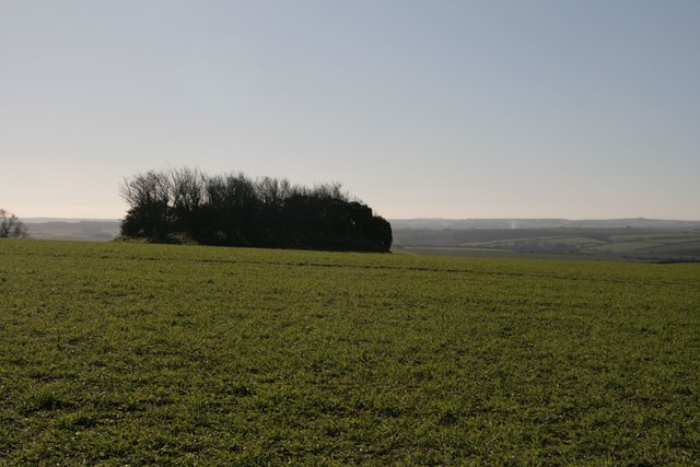
The valley is characterized by its rolling green hills, dense woodlands, and meandering streams, all of which contribute to its breathtaking beauty. Lyscombe Bottom is renowned for its rich biodiversity, with a wide variety of plant and animal species calling the valley home. Rare orchids, wildflowers, and ancient oak trees can be found scattered throughout the area, creating a vibrant tapestry of colors and textures.

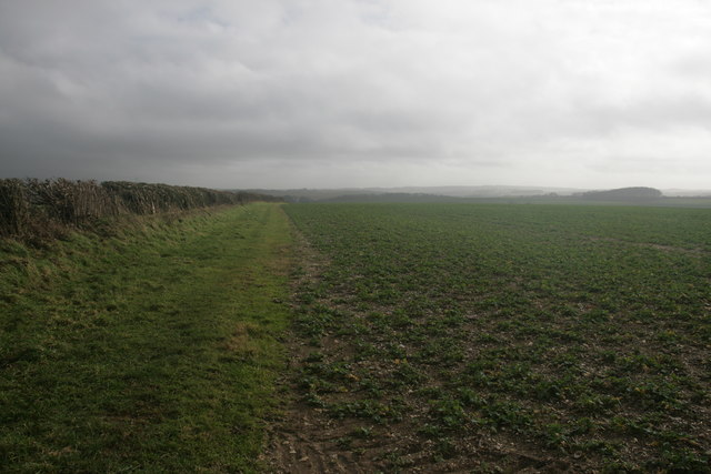
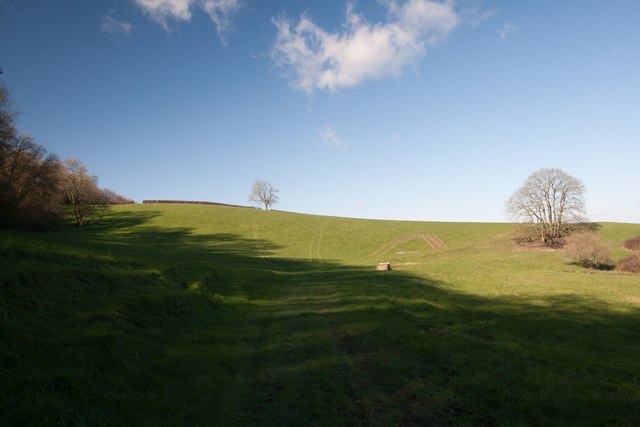
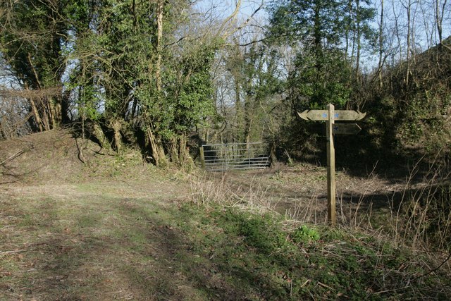
The valley is crisscrossed by a network of footpaths and bridleways, making it a popular destination for hikers and horse riders. These trails offer visitors the opportunity to explore the valley's diverse landscapes, from open fields to thick woodlands, and to enjoy stunning views of the surrounding countryside.

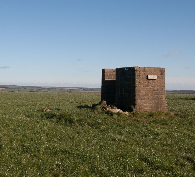
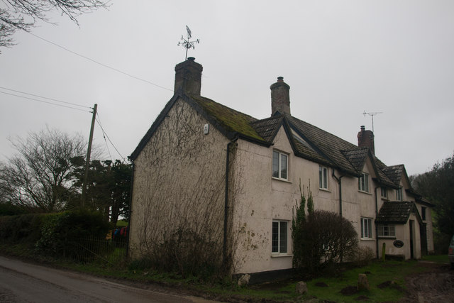
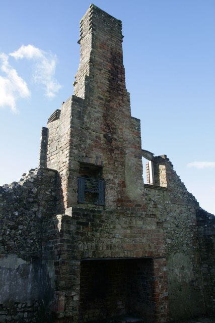
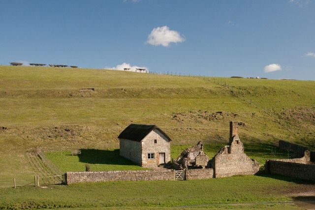
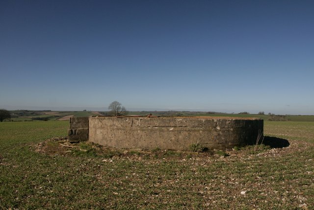
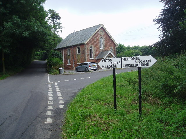
Lyscombe Bottom is also home to a number of historic sites and landmarks. The remains of an Iron Age hillfort can be found on one of the valley's hilltops, providing a glimpse into the area's ancient past. Additionally, the valley is dotted with charming country cottages and farms, adding to its rural charm and creating a sense of timelessness.

Overall, Lyscombe Bottom is a hidden gem in Dorset, offering visitors a chance to escape into nature and experience the beauty of the English countryside. Whether it's a leisurely stroll, a challenging hike, or simply a moment of peace and serenity, this valley has something to offer everyone.

If you have any feedback on the listing, please let us know in the comments section below.

Lyscombe Bottom Images

Images are sourced within 2km of 50.817178/-2.3770689 or Grid Reference ST7302. Thanks to Geograph Open Source API. All images are credited.

Cross dyke on Higher Hill Cross dykes apparently formed prehistoric land boundaries. There are quite a few on this ridgeway in this beautiful part of Dorset.
Cross dyke on Higher Hill
Cross dykes apparently formed prehistoric land boundaries. There are quite a few on this ridgeway in this beautiful part of Dorset.
Benchmark, St John the Baptist Church, Plush Ordnance Survey benchmark, described on database at <span class="nowrap"><a title="http://www.bench-marks.org.uk/bm73594" rel="nofollow ugc noopener" href="http://www.bench-marks.org.uk/bm73594">Link</a><img style="margin-left:2px;" alt="External link" title="External link - shift click to open in new window" src="https://s1.geograph.org.uk/img/external.png" width="10" height="10"/></span>. See also <a href="https://www.geograph.org.uk/photo/4833952">ST7102 : St John the Baptist Church, Plush</a>.
Benchmark, St John the Baptist Church, Plush
Ordnance Survey benchmark, described on database at LinkExternal link. See also ST7102 : St John the Baptist Church, Plush.
St John the Baptist Church, Plush I'm not sure if this building is still used as a place of worship, but it can also be used as a concert hall and venue for weddings etc.
St John the Baptist Church, Plush
I'm not sure if this building is still used as a place of worship, but it can also be used as a concert hall and venue for weddings etc.
Triangle of trees on Plush Hill The footpath wends its way through this arable field, past a water tank and on to the trig point at Higher Hill.
Triangle of trees on Plush Hill
The footpath wends its way through this arable field, past a water tank and on to the trig point at Higher Hill.
Cross dyke on Higher Hill Another prehistoric land boundary on this beautiful ridge.
Cross dyke on Higher Hill
Another prehistoric land boundary on this beautiful ridge.
Funny building at footpath crossroads on Nettlecombe Tout This building appears to have no other purpose than being a place to put footpath signs, but maybe I'm missing something.
Funny building at footpath crossroads on Nettlecombe Tout
This building appears to have no other purpose than being a place to put footpath signs, but maybe I'm missing something.
Cross dyke near Higher Melcombe A prehistoric land boundary. There is a plethora of these in the area.
Cross dyke near Higher Melcombe
A prehistoric land boundary. There is a plethora of these in the area.
Bridleway, Thorncombe Farm
Hedge on Hog Hill
Hedge on Hog Hill
Bridleway near Thorncombe Farm
View north from Higher Hill Nettlecombe Tout visible on the left of the photo.
View north from Higher Hill
Nettlecombe Tout visible on the left of the photo.
Erstwhile Fox Inn, Folly Now a private residence, one of the only ones in the hamlet of Folly and situated between Plush and Mappowder.
Erstwhile Fox Inn, Folly
Now a private residence, one of the only ones in the hamlet of Folly and situated between Plush and Mappowder.
Ruined cottage, Lyscombe It is unusual to see an upper storey fireplace intact like this one. this cottage would have accommodated the priest for the adjacent chapel, which was restored in 2005 and is now maintained by the Dorset Historic Churches Trust.
Ruined cottage, Lyscombe
It is unusual to see an upper storey fireplace intact like this one. this cottage would have accommodated the priest for the adjacent chapel, which was restored in 2005 and is now maintained by the Dorset Historic Churches Trust.
Lyscombe Chapel and cottage The chapel dates from the 12th century and is situated in the bowl of a beautiful valley, Lyscombe Bottom in the heartland of Dorset. It is built of flint, stone and rock chalk and was part of the endowment of nearby Milton Abbey. The chapel is thought to have become a dwelling place in the 17th century, then a farm-worker's cottage and then a bake house. It is now cared for by the Dorset Historic Churches Trust, and has been beautifully restored to retain some of its original features.
Lyscombe Chapel and cottage
The chapel dates from the 12th century and is situated in the bowl of a beautiful valley, Lyscombe Bottom in the heartland of Dorset. It is built of flint, stone and rock chalk and was part of the endowment of nearby Milton Abbey. The chapel is thought to have become a dwelling place in the 17th century, then a farm-worker's cottage and then a bake house. It is now cared for by the Dorset Historic Churches Trust, and has been beautifully restored to retain some of its original features.
Tumulus, Plush Hill
Tumulus, Plush Hill
Eastern flanks of Nettlecombe Tout
Signpost at Dorsetshire Gap This ancient intersection has a visitors' book for passers-by to sign as they pass through.
Signpost at Dorsetshire Gap
This ancient intersection has a visitors' book for passers-by to sign as they pass through.
Water tank, Plush Hill There is supposed to be an Ordnance Survey benchmark on this structure, but i couldn't find it. It has perhaps got destroyed as parts of the rendering have crumbled.
Water tank, Plush Hill
There is supposed to be an Ordnance Survey benchmark on this structure, but i couldn't find it. It has perhaps got destroyed as parts of the rendering have crumbled.
Show me another place!

Lyscombe Bottom is located at Grid Ref: ST7302 (Lat: 50.817178, Lng: -2.3770689)

Unitary Authority: Dorset

Police Authority: Dorset

What 3 Words

///crossings.grow.deprives. Near Puddletown, Dorset

Related Wikis

Lyscombe Hill

Lyscombe Hill (262 metres, 860 feet high) is a hill near Melcombe Bingham about 14 kilometres north-northeast of Dorchester in the county of Dorset, England...

Melcombe Horsey

Melcombe Horsey is a civil parish in the county of Dorset in South West England. It contains the small settlements of Melcombe Bingham, Bingham's Melcombe...

Ball Hill, Dorset

At 251 metres, Ball Hill is one of the highest hills in the county of Dorset, England, and is on the Wessex Ridgeway. == Location == The summit of Ball...

Plush, Dorset

Plush is a small village in the English county of Dorset. It lies within the civil parish of Piddletrenthide in the west of the county, and is approximately...

Doles Ash

Doles Ash is a farm in Dorset, England, a few kilometers east of Piddletrenthide and south of Plush. The farm features in Thomas Hardy's Tess of the D...

Ansty Cross

Ansty Cross is a village in Dorset, England.

Aller, Dorset

Aller is a village in Dorset, England.

Cheselbourne

Cheselbourne (sometimes spelled Chesilborne or Cheselborne) is a village and civil parish in Dorset, England, situated in the Dorset Downs, 7 miles (11...

Have you been to Lyscombe Bottom?

Leave your review of Lyscombe Bottom below (or comments, questions and feedback).