Barrow upon Trent

Settlement in Derbyshire South Derbyshire

England

Barrow upon Trent

Trent & Mersey Canal towards bridge #17
Trent & Mersey Canal towards bridge #17 Credit: Ian S

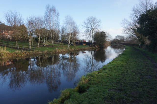
Barrow upon Trent is a small village located in the southern part of Derbyshire, England. Situated on the banks of the River Trent, it is approximately 6 miles southwest of the city of Derby. With a population of around 800 people, the village offers a peaceful and picturesque setting for residents and visitors alike.

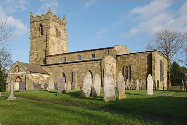
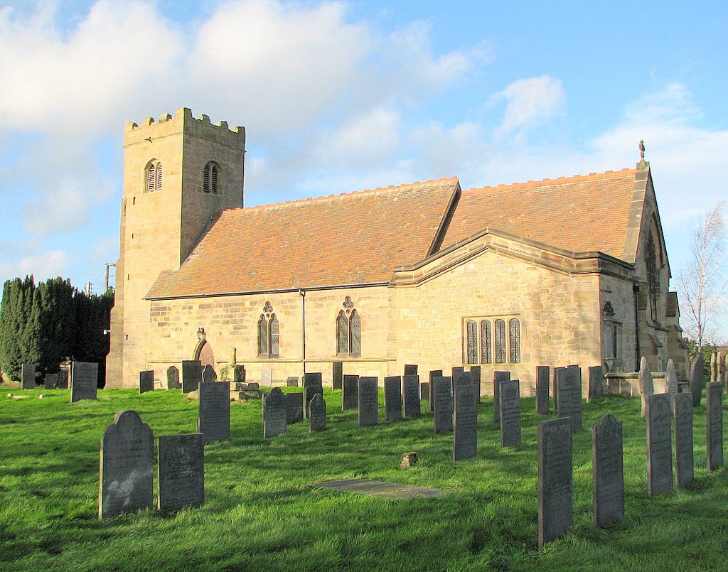
The history of Barrow upon Trent dates back to the medieval period, and evidence of this can be seen in the architecture and layout of the village. The centerpiece is the All Saints Church, which is a Grade I listed building and features stunning stained glass windows and intricate stonework.

Despite its small size, Barrow upon Trent has a strong sense of community and offers a range of amenities and services. The village has a primary school, a village hall, and a local pub, which serves as a popular gathering spot for locals. Additionally, there are several sports clubs and recreational facilities, including a cricket pitch and a tennis court, providing opportunities for outdoor activities.

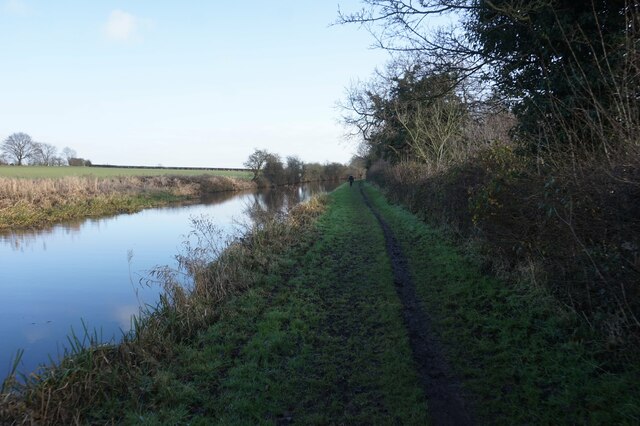
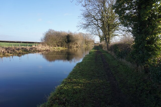
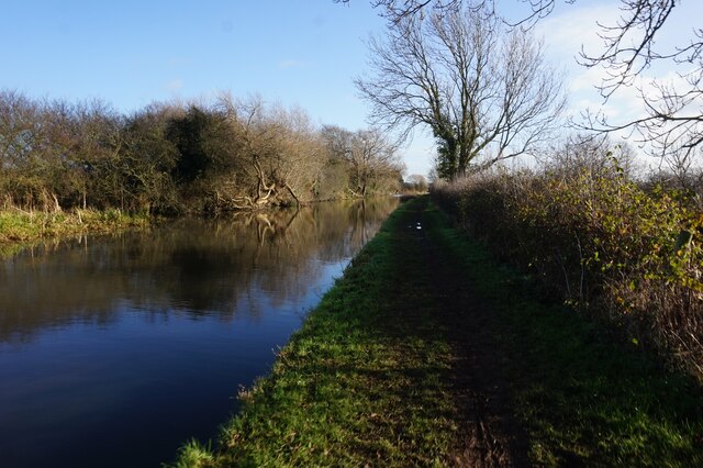
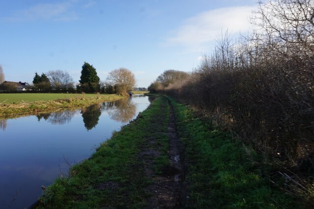
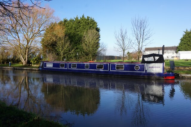
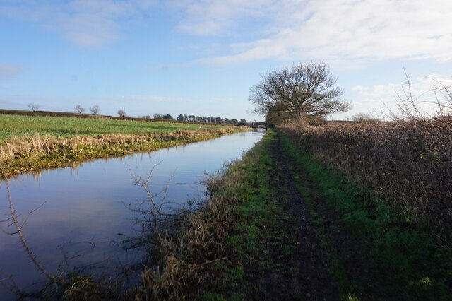
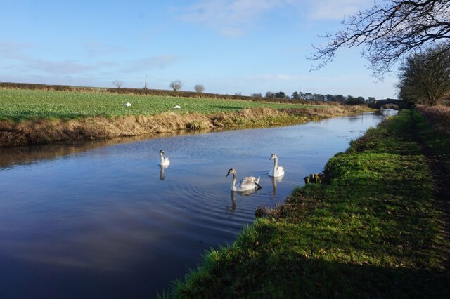
The surrounding countryside offers ample opportunities for nature lovers and outdoor enthusiasts. The River Trent provides a scenic backdrop for walks and picnics, and there are several walking and cycling trails that meander through the nearby countryside. The village is also conveniently located near the National Forest and the Peak District National Park, providing easy access to stunning landscapes and outdoor pursuits.

Overall, Barrow upon Trent is a charming village that combines a rich history with modern amenities, making it an attractive place to live or visit for those seeking a peaceful and picturesque escape in Derbyshire.

If you have any feedback on the listing, please let us know in the comments section below.

Barrow upon Trent Images

Images are sourced within 2km of 52.853235/-1.47692 or Grid Reference SK3528. Thanks to Geograph Open Source API. All images are credited.

Trent & Mersey Canal towards bridge #17
Canal boat Mompesson, Trent & Mersey Canal
Trent & Mersey Canal towards bridge #17
Trent & Mersey Canal at bridge #17
Trent & Mersey Canal towards bridge #16
Trent & Mersey Canal at bridge #16
Trent & Mersey Canal towards bridge #15
Memorial to Lynn Siddons Details can be googled.
Memorial to Lynn Siddons
Details can be googled.
Memorial to Lynn Siddons Details can be Googled.
Memorial to Lynn Siddons
Details can be Googled.
Show me another place!

Barrow upon Trent is located at Grid Ref: SK3528 (Lat: 52.853235, Lng: -1.47692)

Administrative County: Derbyshire

District: South Derbyshire

Police Authority: Derbyshire

What 3 Words

///laser.golf.mavericks. Near Sinfin, Derbyshire

Nearby Locations

Barrow upon Trent

Related Wikis

Barrow upon Trent

Barrow upon Trent is a village and civil parish in the South Derbyshire district of Derbyshire, England with a business park planned for the outskirts...

St Wilfrid's Church, Barrow-upon-Trent

St Wilfrid’s Church, Barrow upon Trent is a Grade I listed parish church in the Church of England in Barrow upon Trent, Derbyshire. == History == The Church...

Ingleby, Derbyshire

Ingleby is a hamlet and civil parish in South Derbyshire, England, situated to the south of the River Trent on a rise between Stanton by Bridge and Repton...

Swarkestone

Swarkestone is a village and civil parish in the South Derbyshire district of Derbyshire, England. The population at the 2011 Census was 187.Swarkestone...
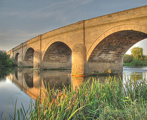
Swarkestone Bridge

Swarkestone Bridge is a medieval bridge crossing the River Trent between the villages of Swarkestone and Stanton by Bridge, about 6 miles south of Derby...

St James' Church, Swarkestone

St James’ Church, Swarkestone is a Grade II* listed parish church in the Church of England in Swarkestone, Derbyshire. == History == The church dates from...

Anchor Church

Anchor Church is the name given to a series of caves in a Keuper Sandstone (Triassic conglomerate) outcrop, close to the village of Ingleby, Derbyshire...

Arleston

Arleston is a hamlet in the South Derbyshire district of Derbyshire, England, about 4 miles (6.4 km) south of the centre of Derby. It is located 1.2 miles...

Nearby Amenities

Located within 500m of 52.853235,-1.47692
Barrier: stile
Ele: 41
Lat/Long: 52.8516145/-1.4779022
Barrier: stile
Ele: 41
Lat/Long: 52.8514072/-1.4796273
Turning Circle
Lat/Long: 52.8516614/-1.4765285
Post Box
Operator: Royal Mail
Post Box Type: lamp
Ref: DE73 636
Royal Cypher: EIIR
Royal Cypher Wikidata: Q33102113
Lat/Long: 52.8535509/-1.4714847
Post Box
Operator: Royal Mail
Post Box Type: wall
Ref: DE73 244
Royal Cypher: GR
Royal Cypher Wikidata: Q33102273
Lat/Long: 52.8533309/-1.4775822
Barrow upon Trent
Place: village
Lat/Long: 52.8523148/-1.4787951
Barrier: stile
Steps: 1
Stile: stepover
Lat/Long: 52.8541714/-1.4738391
Barrier: stile
Steps: 3
Stile: stepover
Lat/Long: 52.8526775/-1.4742079
Defibrillator
Access: yes
Booth: K6
Covered: booth
Defibrillator Location: In old Red telephone box on Twyford Road
Disused Amenity: telephone
Emergency: defibrillator
Man Made: telephone_box
Ref: CHT-10-357
Lat/Long: 52.8532637/-1.4788512
Give Way
Direction: backward
Lat/Long: 52.8572136/-1.4741289
Childcare
Sale and Davys Playgroup
Addr City: Derby
Addr Postcode: DE73 7HA
Addr Street: Twyford Road
Addr Village: Barrow upon Trent
Fhrs Id: 621046
Lat/Long: 52.8535078/-1.4814628
Direction: SSW
Generator Method: photovoltaic
Generator Output Electricity: yes
Generator Solar Modules: 12
Generator Source: solar
Generator Type: solar_photovoltaic_panel
Location: roof
Power: generator
Lat/Long: 52.854042/-1.478689
Direction: ESE
Generator Method: photovoltaic
Generator Output Electricity: yes
Generator Solar Modules: 9
Generator Source: solar
Generator Type: solar_photovoltaic_panel
Location: roof
Power: generator
Lat/Long: 52.8540242/-1.4787668
Direction: SSE
Generator Method: photovoltaic
Generator Output Electricity: yes
Generator Solar Modules: 15
Generator Source: solar
Generator Type: solar_photovoltaic_panel
Location: roof
Power: generator
Lat/Long: 52.8542265/-1.4778685
Direction: ESE
Generator Method: photovoltaic
Generator Output Electricity: yes
Generator Solar Modules: 10
Generator Source: solar
Generator Type: solar_photovoltaic_panel
Location: roof
Power: generator
Lat/Long: 52.8538205/-1.4770276
Entrance: gate
Material: wood
Lat/Long: 52.8522336/-1.4774958
Waste Basket
Colour: green
Operator: South Derbyshire District Council
Waste: dog_excrement
Lat/Long: 52.8532328/-1.4812795
Waste Basket
Colour: green
Operator: South Derbyshire District Council
Waste: dog_excrement
Lat/Long: 52.8523633/-1.4822003
Waste Basket
Colour: green
Operator: South Derbyshire District Council
Waste: dog_excrement
Lat/Long: 52.8511599/-1.4762945
Waste Basket
Colour: green
Operator: South Derbyshire District Council
Waste: dog_excrement
Lat/Long: 52.8520129/-1.4715232
Waste Basket
Colour: black
Material: metal
Operator: South Derbyshire District Council
Waste: trash
Lat/Long: 52.8532319/-1.4813504
Waste Basket
Colour: green
Material: metal
Operator: South Derbyshire District Council
Waste: trash
Lat/Long: 52.8519489/-1.4823254
Waste Basket
Colour: green
Material: plastic
Operator: South Derbyshire District Council
Waste: trash
Lat/Long: 52.8524564/-1.478138
Waste Basket
Colour: black
Material: metal
Operator: South Derbyshire District Council
Waste: trash
Lat/Long: 52.8533272/-1.4774017
Waste Basket
Colour: black
Material: metal
Operator: South Derbyshire District Council
Waste: trash
Lat/Long: 52.8527013/-1.4748122
Waste Basket
Colour: black
Material: metal
Operator: South Derbyshire District Council
Waste: trash
Lat/Long: 52.8547469/-1.4749831
Waste Basket
Colour: black
Material: metal
Operator: South Derbyshire District Council
Waste: trash
Lat/Long: 52.8535736/-1.4715397
Barrier: height_restrictor
Maxheight: 2
Lat/Long: 52.8532441/-1.4812263
Bus Stop
Primary School
Public Transport: platform
Lat/Long: 52.8533173/-1.4773741
Bus Stop
Walnut Close
Public Transport: platform
Lat/Long: 52.8533975/-1.4794951
Bus Stop
Sinfin Lane
Public Transport: platform
Lat/Long: 52.8545685/-1.4747992
Bus Stop
Sinfin Lane
Public Transport: platform
Lat/Long: 52.8545985/-1.4759982
Bus Stop
71 Swarkestone Road
Public Transport: platform
Lat/Long: 52.8535311/-1.4714934
Bus Stop
71 Swarkestone Road
Public Transport: platform
Lat/Long: 52.8533238/-1.4710696
The data included in this document is from www.openstreetmap.org. The data is made available under ODbL.

Have you been to Barrow upon Trent?

Leave your review of Barrow upon Trent below (or comments, questions and feedback).