Leasingham

Settlement in Lincolnshire North Kesteven

England

Leasingham

Posing sheep near Hall Farm
Posing sheep near Hall Farm Credit: Jonathan Thacker

Leasingham is a small village located in the district of North Kesteven in the county of Lincolnshire, England. Situated approximately 3 miles north of Sleaford, it has a population of around 1,600 residents. The village is nestled in the heart of the Lincolnshire countryside, surrounded by picturesque farmland and open fields.

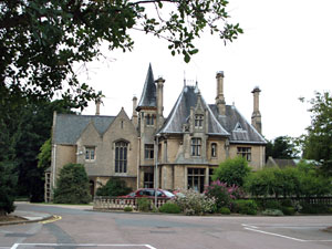
Leasingham has a rich history dating back to the Roman period, with evidence of a Roman settlement found in the area. The village grew in importance during the medieval period, with the construction of Leasingham Manor, a historic building that still stands today.

The village boasts a range of amenities for its residents, including a primary school, a post office, a village hall, and a number of local shops and pubs. The community is close-knit and friendly, with various social events and clubs taking place throughout the year.

Leasingham is well-connected to the surrounding areas, with good road links to Sleaford and nearby towns such as Lincoln and Grantham. The village also benefits from a regular bus service, providing convenient transport options for residents.

The countryside surrounding Leasingham offers opportunities for outdoor activities, such as walking, cycling, and horse riding. The nearby Sleaford Golf Club is a popular destination for golf enthusiasts.

Overall, Leasingham is a charming village that combines a rural setting with modern amenities, making it an attractive place to live for those seeking a peaceful and community-oriented lifestyle.

If you have any feedback on the listing, please let us know in the comments section below.
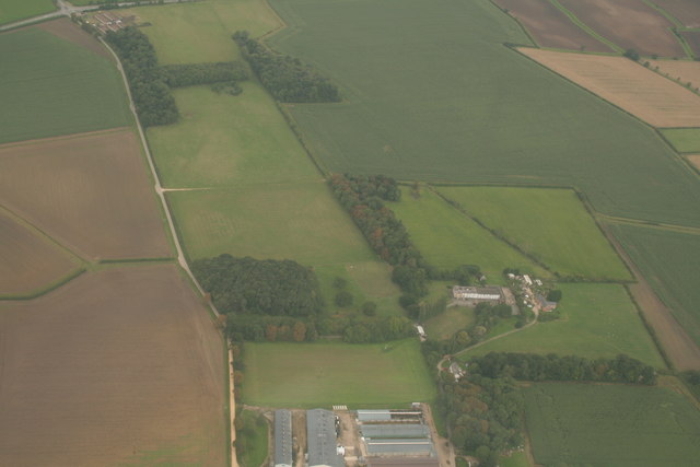
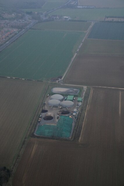
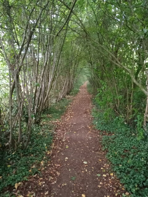
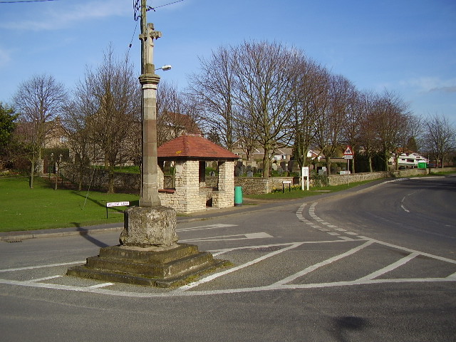
Leasingham Images

Images are sourced within 2km of 53.026477/-0.428746 or Grid Reference TF0548. Thanks to Geograph Open Source API. All images are credited.

Posing sheep near Hall Farm
Farm track at Roxholme The material heaped by the side of the track is barley that has been grown for forage. Presumably this was a loading point.
Farm track at Roxholme
The material heaped by the side of the track is barley that has been grown for forage. Presumably this was a loading point.
Former Methodist church, Roxholme Now a dwelling.
Former Methodist church, Roxholme
Now a dwelling.
Remains of ridge and furrow near Roxholme Hall: aerial 2020
Road to Roxholm This road to Roxholm Hall is also a bridleway.
Road to Roxholm
This road to Roxholm Hall is also a bridleway.
Roxholm Hall This Hall is used as a care centre.
Roxholm Hall
This Hall is used as a care centre.
Crossroads Showing Road/Bridleway in the distance leading to Roxholm Hall
Crossroads
Showing Road/Bridleway in the distance leading to Roxholm Hall
Small Church and Graveyard Roxholme near Leasingham There is no sign on this Church but it is still in use
Small Church and Graveyard Roxholme near Leasingham
There is no sign on this Church but it is still in use
House beside Church on Leasingham / Bloxholme Road
Lane to Leasingham Lane to Leasingham by The Cottage
Lane to Leasingham
Lane to Leasingham by The Cottage
Holdingham Biogas: aerial 2022 Commercial anaerobic digestion facility. See <span class="nowrap"><a title="https://www.holdinghambiogas.co.uk/" rel="nofollow ugc noopener" href="https://www.holdinghambiogas.co.uk/">Link</a><img style="margin-left:2px;" alt="External link" title="External link - shift click to open in new window" src="https://s1.geograph.org.uk/img/external.png" width="10" height="10"/></span>
Holdingham Biogas: aerial 2022
Commercial anaerobic digestion facility. See LinkExternal link
Natural arch Not a coastal arch, but a woodland arch comprising the public footpath to the east of the A15 as it nears the roundabout at Holdingham.
Natural arch
Not a coastal arch, but a woodland arch comprising the public footpath to the east of the A15 as it nears the roundabout at Holdingham.
Roadway to Highfield House The first part of this roadway (as far as the bend) follows the course of the former military railway to Cranwell <span class="nowrap"><a title="https://en.wikipedia.org/wiki/Cranwell_branch" rel="nofollow ugc noopener" href="https://en.wikipedia.org/wiki/Cranwell_branch">Link</a><img style="margin-left:2px;" alt="External link" title="External link - shift click to open in new window" src="https://s1.geograph.org.uk/img/external.png" width="10" height="10"/></span>
Roadway to Highfield House
The first part of this roadway (as far as the bend) follows the course of the former military railway to Cranwell LinkExternal link
Grass track to the A17 This is a continuation of a bridleway which ends at the Leasingham/Sleaford parish boundary. There is no indication that the bridleway has ended and I suspect it is frequently used by walkers and horse riders.
Grass track to the A17
This is a continuation of a bridleway which ends at the Leasingham/Sleaford parish boundary. There is no indication that the bridleway has ended and I suspect it is frequently used by walkers and horse riders.
Farm track to Westfield Farm
Field edge near Hall Farm. Leasingham
Study of a Gasoline Station BP, Sleaford.

 This photograph is part of a series taken in homage to the American artist Ed Ruscha's 1963 publication of 'Twentysix Gasoline Stations'.
 More properly known as filling stations in the UK, I am attempting to photograph as many as possible to mark the sixty year anniversary.
Study of a Gasoline Station
BP, Sleaford. This photograph is part of a series taken in homage to the American artist Ed Ruscha's 1963 publication of 'Twentysix Gasoline Stations'. More properly known as filling stations in the UK, I am attempting to photograph as many as possible to mark the sixty year anniversary.
Vehicle Testing Area As well a providing parking in the lay-by on the A17 the area behind the barriers is a vehicle testing area.
Vehicle Testing Area
As well a providing parking in the lay-by on the A17 the area behind the barriers is a vehicle testing area.
Show me another place!

Leasingham is located at Grid Ref: TF0548 (Lat: 53.026477, Lng: -0.428746)

Division: Parts of Kesteven

Administrative County: Lincolnshire

District: North Kesteven

Police Authority: Lincolnshire

What 3 Words

///richest.suspends.discouraged. Near Leasingham, Lincolnshire

Nearby Locations

Leasingham

Related Wikis

Leasingham

Leasingham is a village and civil parish in the North Kesteven district of Lincolnshire, England. It is situated less than 2 miles (3 km) north from Sleaford...

Cranwell

Cranwell is a village in the civil parish of Cranwell, Brauncewell and Byard's Leap, in the North Kesteven district of Lincolnshire, England. It is situated...

Carre's Grammar School

Carre's Grammar School is a selective secondary school for boys in Sleaford, a market town in Lincolnshire, England. Founded on 1 September 1604 by an...

Westholme House

Westholme House is a historic building in the English market town of Sleaford in Lincolnshire, set in 32 acres of parkland and school grounds. Built around...

Nearby Amenities

Located within 500m of 53.026477,-0.428746
Leasingham
Is In: Lincolnshire, England, UK
Place: village
Source: npe
Lat/Long: 53.0260911/-0.4249358
Bus Stop
11 Washdyke Lane
Naptan AtcoCode: 270000008369
Naptan Bearing: S
Naptan CommonName: 11 Washdyke Lane
Naptan Indicator: opp
Naptan Landmark: Number 11
Naptan NaptanCode: lingptjt
Naptan Street: Washdyke Lane
Naptan Verified: no
Source: naptan_import
Lat/Long: 53.0238103/-0.4229594
Bus Stop
11 Washdyke Lane
Naptan AtcoCode: 270000008370
Naptan Bearing: N
Naptan CommonName: 11 Washdyke Lane
Naptan Indicator: adj
Naptan Landmark: Number 11
Naptan NaptanCode: lingptjw
Naptan Street: Washdyke Lane
Naptan Verified: no
Source: naptan_import
Lat/Long: 53.0241088/-0.4230976
Bus Stop
St Andrews Crescent
Naptan AtcoCode: 270000008371
Naptan Bearing: S
Naptan CommonName: St Andrews Crescent
Naptan Indicator: opp
Naptan Landmark: St Andrews Crescent
Naptan NaptanCode: lingptma
Naptan Street: Washdyke Lane
Naptan Verified: no
Source: naptan_import
Lat/Long: 53.0260831/-0.4228318
Bus Stop
Post Office
Naptan AtcoCode: 270000008372
Naptan Bearing: E
Naptan CommonName: Post Office
Naptan Indicator: opp
Naptan Landmark: Post Office
Naptan NaptanCode: lingptmd
Naptan Street: Chapel Lane
Naptan Verified: no
Source: naptan_import
Lat/Long: 53.0269685/-0.4258713
Bus Stop
The Square
Naptan AtcoCode: 270000008373
Naptan Bearing: NE
Naptan CommonName: The Square
Naptan Indicator: opp
Naptan Landmark: The Square
Naptan NaptanCode: lingptmg
Naptan Street: Lincoln Road
Naptan Verified: no
Source: naptan_import
Lat/Long: 53.0259282/-0.428787
Bus Stop
Blacksmiths Shop
Naptan AtcoCode: 2700LLBS2496
Naptan Bearing: NW
Naptan CommonName: Blacksmiths Shop
Naptan Indicator: adj
Naptan Landmark: Blacksmiths Shop
Naptan NaptanCode: linatdaw
Naptan Street: Lincoln Road
Naptan Verified: no
Source: naptan_import
Lat/Long: 53.0256476/-0.4293191
Lincoln Road
Naptan AtcoCode: 2700LLL00468
Naptan Bearing: SE
Naptan BusStopType: CUS
Naptan CommonName: Lincoln Road
Naptan Indicator: opp
Naptan Landmark: Duke of Wellington PH
Naptan NaptanCode: linadpwp
Naptan Street: Lincoln Road
Naptan Verified: no
Source: naptan_import
Lat/Long: 53.0253025/-0.4283773
Bus Stop
Village Entrance
Naptan AtcoCode: 2700LLMR2676
Naptan Bearing: S
Naptan CommonName: Village Entrance
Naptan Indicator: adj
Naptan Landmark: Village Entrance
Naptan NaptanCode: linatjpw
Naptan Street: Main Road
Naptan Verified: no
Source: naptan_import
Lat/Long: 53.02626/-0.43213
Bus Stop
Post Office
Naptan AtcoCode: 2700LLP03137
Naptan Bearing: W
Naptan CommonName: Post Office
Naptan Indicator: adj
Naptan Landmark: Post Office
Naptan NaptanCode: linawmaw
Naptan Street: Chapel Lane
Naptan Verified: no
Source: naptan_import
Lat/Long: 53.0269296/-0.425649
Leasingham Hall
Naptan AtcoCode: 2700LLWA5102
Naptan Bearing: NW
Naptan BusStopType: CUS
Naptan CommonName: Leasingham Hall
Naptan Indicator: o/s
Naptan Landmark: Leasingham Hall
Naptan NaptanCode: lindptdt
Naptan Street: Captains Hill
Naptan Verified: no
Source: naptan_import
Lat/Long: 53.0226732/-0.4260276
Bus Stop
St Andrews Crescent
Naptan AtcoCode: 2700LLWL3039
Naptan Bearing: N
Naptan CommonName: St Andrews Crescent
Naptan Indicator: adj
Naptan Landmark: St Andrews Crescent
Naptan NaptanCode: linawgmt
Naptan Street: Washdyke Lane
Naptan Verified: no
Source: naptan_import
Lat/Long: 53.0261029/-0.4229652
Bus Stop
Village Entrance
Naptan AtcoCode: 2700LSW02233
Naptan Bearing: N
Naptan CommonName: Village Entrance
Naptan Indicator: opp
Naptan Landmark: Village Entrance
Naptan NaptanCode: linapmap
Naptan Street: Main Road
Naptan Verified: no
Source: naptan_import
Lat/Long: 53.0263351/-0.4323659
Telephone
Defibrillator
Booth: KX100
Covered: booth
Defibrillator Location: inside phone box on Washdyke Lane, Leasingham
Ele: 18.0000000
Emergency: defibrillator
Man Made: telephone_box
Lat/Long: 53.0261716/-0.4229887
Post Box
Ele: 20.0000000
Lat/Long: 53.0289366/-0.4229458
Historic: memorial
Source: Bing
Lat/Long: 53.0236084/-0.4263669
West Lodge
Place: isolated_dwelling
Source: Bing
Lat/Long: 53.0265523/-0.4354913
Crescent Stores
Shop: convenience
Lat/Long: 53.0255734/-0.4239847
Post Office
Leasingham Post Office and Store
Shop: convenience
Lat/Long: 53.0266624/-0.426689
Power: pole
Lat/Long: 53.0276808/-0.4358053
Power: pole
Lat/Long: 53.0281583/-0.4346949
Power: pole
Lat/Long: 53.0285841/-0.4336113
Power: pole
Lat/Long: 53.0290164/-0.4325196
Power: pole
Lat/Long: 53.0295036/-0.4312724
Power: pole
Lat/Long: 53.0299633/-0.430111
Power: pole
Lat/Long: 53.0305134/-0.4291615
Addr Housenumber: 12
Lat/Long: 53.0260482/-0.4239959
Addr Housenumber: 34
Lat/Long: 53.0260419/-0.4297709
Addr Housenumber: 67
Lat/Long: 53.0243925/-0.4271138
Generator Method: photovoltaic
Generator Output Electricity: yes
Generator Source: solar
Generator Type: solar_photovoltaic_panel
Location: roof
Power: generator
Lat/Long: 53.0283664/-0.4285406
Generator Method: photovoltaic
Generator Output Electricity: yes
Generator Source: solar
Generator Type: solar_photovoltaic_panel
Location: roof
Power: generator
Lat/Long: 53.027659/-0.4296255
Generator Method: photovoltaic
Generator Output Electricity: yes
Generator Source: solar
Generator Type: solar_photovoltaic_panel
Location: roof
Power: generator
Lat/Long: 53.0280405/-0.426423
Generator Method: photovoltaic
Generator Output Electricity: yes
Generator Source: solar
Generator Type: solar_photovoltaic_panel
Location: roof
Power: generator
Lat/Long: 53.0282567/-0.4264404
Generator Method: photovoltaic
Generator Output Electricity: yes
Generator Source: solar
Generator Type: solar_photovoltaic_panel
Location: roof
Power: generator
Lat/Long: 53.028205/-0.427013
Generator Method: photovoltaic
Generator Output Electricity: yes
Generator Source: solar
Generator Type: solar_photovoltaic_panel
Location: roof
Power: generator
Lat/Long: 53.0284002/-0.4274529
Generator Method: photovoltaic
Generator Output Electricity: yes
Generator Source: solar
Generator Type: solar_photovoltaic_panel
Location: roof
Power: generator
Lat/Long: 53.028839/-0.4265772
Generator Method: photovoltaic
Generator Output Electricity: yes
Generator Source: solar
Generator Type: solar_photovoltaic_panel
Location: roof
Power: generator
Lat/Long: 53.0288059/-0.4239701
Generator Method: photovoltaic
Generator Output Electricity: yes
Generator Source: solar
Generator Type: solar_photovoltaic_panel
Location: roof
Power: generator
Lat/Long: 53.0288898/-0.4236107
Generator Method: photovoltaic
Generator Output Electricity: yes
Generator Source: solar
Generator Type: solar_photovoltaic_panel
Location: roof
Power: generator
Lat/Long: 53.0285833/-0.422696
Generator Method: photovoltaic
Generator Output Electricity: yes
Generator Source: solar
Generator Type: solar_photovoltaic_panel
Location: roof
Power: generator
Lat/Long: 53.0285656/-0.422751
Generator Method: photovoltaic
Generator Output Electricity: yes
Generator Source: solar
Generator Type: solar_photovoltaic_panel
Location: roof
Power: generator
Lat/Long: 53.0277759/-0.4235624
Generator Method: photovoltaic
Generator Output Electricity: yes
Generator Source: solar
Generator Type: solar_photovoltaic_panel
Location: roof
Power: generator
Lat/Long: 53.0277679/-0.4236254
Generator Method: photovoltaic
Generator Output Electricity: yes
Generator Source: solar
Generator Type: solar_photovoltaic_panel
Location: roof
Power: generator
Lat/Long: 53.0283478/-0.4254667
Generator Method: photovoltaic
Generator Output Electricity: yes
Generator Source: solar
Generator Type: solar_photovoltaic_panel
Location: roof
Power: generator
Lat/Long: 53.0283599/-0.4253648
Generator Method: photovoltaic
Generator Output Electricity: yes
Generator Source: solar
Generator Type: solar_photovoltaic_panel
Location: roof
Power: generator
Lat/Long: 53.0285204/-0.424194
Generator Method: photovoltaic
Generator Output Electricity: yes
Generator Source: solar
Generator Type: solar_photovoltaic_panel
Location: roof
Power: generator
Lat/Long: 53.028514/-0.4243067
Generator Method: photovoltaic
Generator Output Electricity: yes
Generator Source: solar
Generator Type: solar_photovoltaic_panel
Location: roof
Power: generator
Lat/Long: 53.0285043/-0.4248954
Generator Method: photovoltaic
Generator Output Electricity: yes
Generator Source: solar
Generator Type: solar_photovoltaic_panel
Location: roof
Power: generator
Lat/Long: 53.0281776/-0.4248834
Generator Method: photovoltaic
Generator Output Electricity: yes
Generator Source: solar
Generator Type: solar_photovoltaic_panel
Location: roof
Power: generator
Lat/Long: 53.0280228/-0.4248284
Generator Method: photovoltaic
Generator Output Electricity: yes
Generator Source: solar
Generator Type: solar_photovoltaic_panel
Location: roof
Power: generator
Lat/Long: 53.0280074/-0.4248753
Generator Method: photovoltaic
Generator Output Electricity: yes
Generator Source: solar
Generator Type: solar_photovoltaic_panel
Location: roof
Power: generator
Lat/Long: 53.0276856/-0.4245146
Generator Method: photovoltaic
Generator Output Electricity: yes
Generator Source: solar
Generator Type: solar_photovoltaic_panel
Location: roof
Power: generator
Lat/Long: 53.0279235/-0.4264364
Generator Method: photovoltaic
Generator Output Electricity: yes
Generator Source: solar
Generator Type: solar_photovoltaic_panel
Location: roof
Power: generator
Lat/Long: 53.026854/-0.42925
Generator Method: photovoltaic
Generator Output Electricity: yes
Generator Source: solar
Generator Type: solar_photovoltaic_panel
Location: roof
Power: generator
Lat/Long: 53.0269113/-0.429187
Generator Method: photovoltaic
Generator Output Electricity: yes
Generator Source: solar
Generator Type: solar_photovoltaic_panel
Location: roof
Power: generator
Lat/Long: 53.0269113/-0.42741
Generator Method: photovoltaic
Generator Output Electricity: yes
Generator Source: solar
Generator Type: solar_photovoltaic_panel
Location: roof
Power: generator
Lat/Long: 53.0269064/-0.427473
Generator Method: photovoltaic
Generator Output Electricity: yes
Generator Source: solar
Generator Type: solar_photovoltaic_panel
Location: roof
Power: generator
Lat/Long: 53.0267564/-0.4256827
Generator Method: photovoltaic
Generator Output Electricity: yes
Generator Source: solar
Generator Type: solar_photovoltaic_panel
Location: roof
Power: generator
Lat/Long: 53.0267177/-0.4256371
Generator Method: photovoltaic
Generator Output Electricity: yes
Generator Source: solar
Generator Type: solar_photovoltaic_panel
Location: roof
Power: generator
Lat/Long: 53.025657/-0.4231104
Generator Method: photovoltaic
Generator Output Electricity: yes
Generator Source: solar
Generator Type: solar_photovoltaic_panel
Location: roof
Power: generator
Lat/Long: 53.0262305/-0.4243067
Generator Method: photovoltaic
Generator Output Electricity: yes
Generator Source: solar
Generator Type: solar_photovoltaic_panel
Location: roof
Power: generator
Lat/Long: 53.0246487/-0.4260434
Generator Method: photovoltaic
Generator Output Electricity: yes
Generator Source: solar
Generator Type: solar_photovoltaic_panel
Location: roof
Power: generator
Lat/Long: 53.0248044/-0.4262097
Generator Method: photovoltaic
Generator Output Electricity: yes
Generator Source: solar
Generator Type: solar_photovoltaic_panel
Location: roof
Power: generator
Lat/Long: 53.0248028/-0.4261266
Generator Method: photovoltaic
Generator Output Electricity: yes
Generator Source: solar
Generator Type: solar_photovoltaic_panel
Location: roof
Power: generator
Lat/Long: 53.0252343/-0.4260072
Generator Method: photovoltaic
Generator Output Electricity: yes
Generator Source: solar
Generator Type: solar_photovoltaic_panel
Location: roof
Power: generator
Lat/Long: 53.0252505/-0.425912
Generator Method: photovoltaic
Generator Output Electricity: yes
Generator Source: solar
Generator Type: solar_photovoltaic_panel
Location: roof
Power: generator
Lat/Long: 53.0252827/-0.4251127
Generator Method: photovoltaic
Generator Output Electricity: yes
Generator Source: solar
Generator Type: solar_photovoltaic_panel
Location: roof
Power: generator
Lat/Long: 53.025261/-0.4248351
Generator Method: photovoltaic
Generator Output Electricity: yes
Generator Source: solar
Generator Type: solar_photovoltaic_panel
Location: roof
Power: generator
Lat/Long: 53.0249036/-0.4246406
Generator Method: photovoltaic
Generator Output Electricity: yes
Generator Source: solar
Generator Type: solar_photovoltaic_panel
Location: roof
Power: generator
Lat/Long: 53.0249609/-0.4243805
Generator Method: photovoltaic
Generator Output Electricity: yes
Generator Source: solar
Generator Type: solar_photovoltaic_panel
Location: roof
Power: generator
Lat/Long: 53.0255763/-0.4218297
Generator Method: photovoltaic
Generator Output Electricity: yes
Generator Source: solar
Generator Type: solar_photovoltaic_panel
Location: roof
Power: generator
Lat/Long: 53.0245213/-0.4221354
Generator Method: photovoltaic
Generator Output Electricity: yes
Generator Source: solar
Generator Type: solar_photovoltaic_panel
Location: roof
Power: generator
Lat/Long: 53.024143/-0.4243845
Generator Method: photovoltaic
Generator Output Electricity: yes
Generator Source: solar
Generator Type: solar_photovoltaic_panel
Location: roof
Power: generator
Lat/Long: 53.0234734/-0.4252924
Generator Method: photovoltaic
Generator Output Electricity: yes
Generator Source: solar
Generator Type: solar_photovoltaic_panel
Location: roof
Power: generator
Lat/Long: 53.0230943/-0.4238306
Generator Method: photovoltaic
Generator Output Electricity: yes
Generator Source: solar
Generator Type: solar_photovoltaic_panel
Location: roof
Power: generator
Lat/Long: 53.0261878/-0.4288973
Generator Method: photovoltaic
Generator Output Electricity: yes
Generator Source: solar
Generator Type: solar_photovoltaic_panel
Location: roof
Power: generator
Lat/Long: 53.0261918/-0.4289858
Generator Method: photovoltaic
Generator Output Electricity: yes
Generator Source: solar
Generator Type: solar_photovoltaic_panel
Location: roof
Power: generator
Lat/Long: 53.026024/-0.4298213
Generator Method: photovoltaic
Generator Output Electricity: yes
Generator Source: solar
Generator Type: solar_photovoltaic_panel
Location: roof
Power: generator
Lat/Long: 53.0272202/-0.4305455
Generator Method: photovoltaic
Generator Output Electricity: yes
Generator Source: solar
Generator Type: solar_photovoltaic_panel
Location: roof
Power: generator
Lat/Long: 53.0280607/-0.4312174
The data included in this document is from www.openstreetmap.org. The data is made available under ODbL.

Have you been to Leasingham?

Leave your review of Leasingham below (or comments, questions and feedback).