Partan Cleugh

Valley in East Lothian

Scotland

Partan Cleugh

Aikengall IIa Community Wind Farm A new crop of wind turbines on Monynut edge, an extension of Aikengall I and II wind farms; construction began in May 2021.
Aikengall IIa Community Wind Farm Credit: M J Richardson

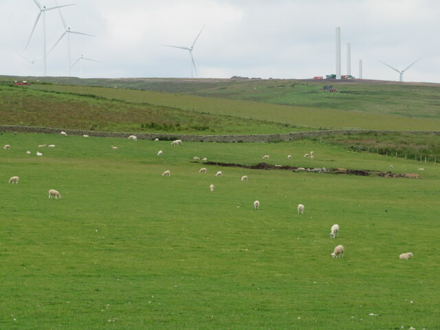
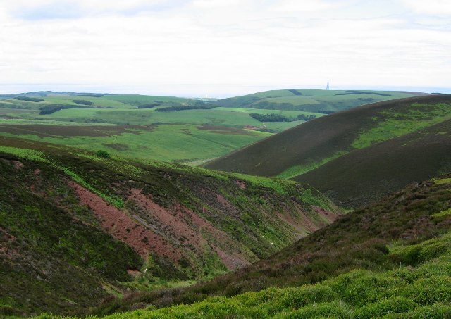
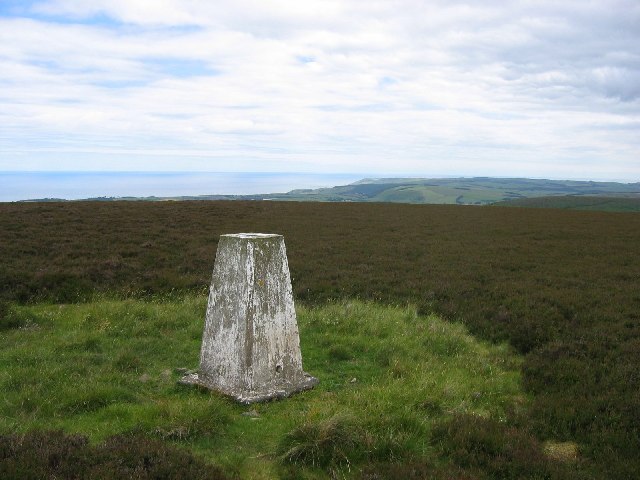
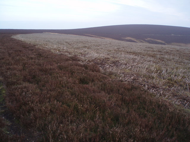
Partan Cleugh is a picturesque valley located in East Lothian, Scotland. Nestled between rolling hills and lush green fields, this valley is known for its stunning natural beauty and rich historical significance.

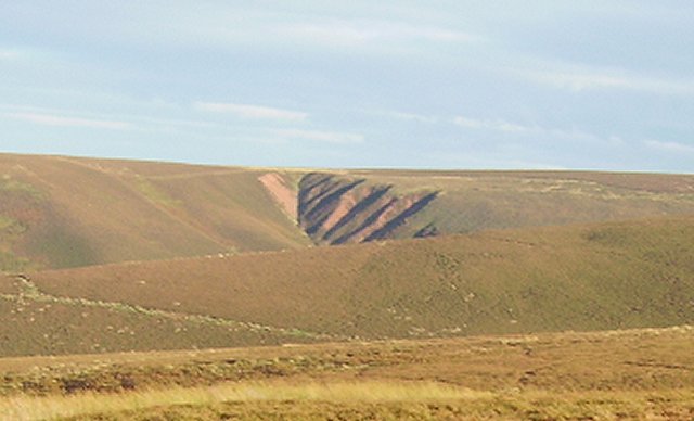
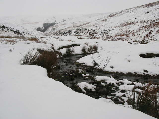
The valley gets its name from the Scottish term "Partan," which means crab, and "Cleugh," which means gorge. This name is derived from the shape of the valley, resembling a crab's claw. The area is home to a diverse range of flora and fauna, making it popular among nature enthusiasts and bird watchers. The valley is also crisscrossed by several streams and rivers, adding to its scenic charm.

Partan Cleugh has a long and intriguing history. It was once inhabited by early settlers, and remnants of their ancient dwellings can still be found in the surrounding area. The valley also played a significant role during the medieval period, serving as a route for trade and communication for nearby settlements. Today, visitors can explore the remains of old castles and archaeological sites that dot the landscape, providing a glimpse into the valley's past.

Apart from its natural and historical attractions, Partan Cleugh offers various recreational activities. Hiking and walking trails wind through the valley, providing breathtaking views of the surrounding countryside. The area is also known for its fishing spots, where anglers can try their luck in the clear, babbling streams.

Overall, Partan Cleugh in East Lothian is a haven for nature lovers and history enthusiasts, offering a serene escape from the hustle and bustle of modern life. Its stunning landscapes, rich heritage, and range of outdoor activities make it a must-visit destination in Scotland.

If you have any feedback on the listing, please let us know in the comments section below.

Partan Cleugh Images

Images are sourced within 2km of 55.902974/-2.4507984 or Grid Reference NT7167. Thanks to Geograph Open Source API. All images are credited.

Aikengall IIa Community Wind Farm A new crop of wind turbines on Monynut edge, an extension of Aikengall I and II wind farms; construction began in May 2021.
Aikengall IIa Community Wind Farm
A new crop of wind turbines on Monynut edge, an extension of Aikengall I and II wind farms; construction began in May 2021.
East Lammermuir Deans Steepsided eroded gullies that are home to lime loving plants. A Scottish Wildlife Trust reserve.
East Lammermuir Deans
Steepsided eroded gullies that are home to lime loving plants. A Scottish Wildlife Trust reserve.
Wester Dod Trig point on the eastern edge of Lammermuir moorland. View to the east coast.
Wester Dod
Trig point on the eastern edge of Lammermuir moorland. View to the east coast.
Wester Dod Gullying on the side of Wester Dod, Lammermuir Hills.
Wester Dod
Gullying on the side of Wester Dod, Lammermuir Hills.
Kaills Burn
Kaills Burn
Man Made Lochan
Man Made Lochan
Trees Not a lot in this hard to get to square. In the background is the boundary between forest and land on the side of Elly Cleugh.
Trees
Not a lot in this hard to get to square. In the background is the boundary between forest and land on the side of Elly Cleugh.
Looking down water course Great view from high in the Lammermuirs all the way down to the Berwickshire coast
Looking down water course
Great view from high in the Lammermuirs all the way down to the Berwickshire coast
Grazing land, trees in distance
Abandoned Shooting Ground Buildings Nasty little corner. Used to be a shooting ground. Prefab building has rotten floors, lots of other debris.
Abandoned Shooting Ground Buildings
Nasty little corner. Used to be a shooting ground. Prefab building has rotten floors, lots of other debris.
Moorland Track - Heart Law More or less the boundary between Scottish Borders and East Lothian on Heart Law west of Cockburnspath - on a lovely day with a bitterly cold wind.
Moorland Track - Heart Law
More or less the boundary between Scottish Borders and East Lothian on Heart Law west of Cockburnspath - on a lovely day with a bitterly cold wind.
Gully Looking down Yearn Gill across to Monynut Edge with Crystal Rig windfarm just about visible- East Lothian.
Gully
Looking down Yearn Gill across to Monynut Edge with Crystal Rig windfarm just about visible- East Lothian.
Burnt Heather Good example of old and new heather with mature in foreground and new shoots coming up just beyond having been burnt presumably in the autumn.
Near summit of Monynut Edge looking to Wester Dod - exactly the same height at 412m - East Lothian.
Burnt Heather
Good example of old and new heather with mature in foreground and new shoots coming up just beyond having been burnt presumably in the autumn. Near summit of Monynut Edge looking to Wester Dod - exactly the same height at 412m - East Lothian.
Long Crib Burn High up in the Lammermuirs - East Lothian - looking up Long Crib Burn towards the lower slopes of Wester Dod.
Long Crib Burn
High up in the Lammermuirs - East Lothian - looking up Long Crib Burn towards the lower slopes of Wester Dod.
Wide Hope, near to Oldhamstocks Tributary of Oldhamstocks Burn runs through the valley of Wide Hope, on the eastern side of the Lammermuir Hills.
Wide Hope, near to Oldhamstocks
Tributary of Oldhamstocks Burn runs through the valley of Wide Hope, on the eastern side of the Lammermuir Hills.
Flock of Sheep in Yearn Hope, near to Oldhamstocks Sheep heading up the more easterly of the two tight valleys at the end of Yearn Hope.
Flock of Sheep in Yearn Hope, near to Oldhamstocks
Sheep heading up the more easterly of the two tight valleys at the end of Yearn Hope.
Yearn Hope, Lammermuirs Small calley and burn off from the main valley in Yearn Hope, at the eastern end of the Lammermuirs.
Yearn Hope, Lammermuirs
Small calley and burn off from the main valley in Yearn Hope, at the eastern end of the Lammermuirs.
Yearn Hope, near Oldhamstocks Burn and valley of Yearn Hope, at the eastern end of the Lammermuir Hills.
Yearn Hope, near Oldhamstocks
Burn and valley of Yearn Hope, at the eastern end of the Lammermuir Hills.
Show me another place!

Partan Cleugh is located at Grid Ref: NT7167 (Lat: 55.902974, Lng: -2.4507984)

Unitary Authority: East Lothian

Police Authority: The Lothians and Scottish Borders

What 3 Words

///umbrellas.piston.hits. Near Dunbar, East Lothian

Nearby Locations

Partan Cleugh

Related Wikis

Crystal Rig Wind Farm

Crystal Rig Wind Farm is an operational onshore wind farm located on the Lammermuir Hills in the Scottish Borders region of Scotland. When phase 1 was...

Oldhamstocks

Oldhamstocks or Aldhamstocks ("old dwelling place") is a civil parish and small village in the east of East Lothian, Scotland, adjacent to the Scottish...

Blackcastle Hill, East Lothian

Blackcastle Hill is an Iron Age hill fort south of Innerwick, East Lothian, Scotland. It is near Cocklaw in the Lammermuir Hills at grid reference NT729724...

Thornton Castle

Thornton Castle was a Scottish fortress belonging to the Montgomery family and subsequently Lord Home near Innerwick in East Lothian. Thornton Castle...

Innerwick

Innerwick (Scottish Gaelic: Inbhir Mhuice) is a coastal civil parish and small village, which lies in the east of East Lothian, five miles (eight kilometres...

Innerwick Castle

Innerwick Castle is a ruined castle in East Lothian, Scotland, near the village of Innerwick, 5 miles (8.0 km) from Dunbar, on the Thornton Burn, and overlooking...

Dunglass Castle, East Lothian

Dunglass Castle was a castle at Dunglass in East Lothian, Scotland. It was a seat of the Home family and frequently visited by the Stewart kings. A fortification...

Dunglass Collegiate Church

Dunglass Collegiate Church is situated in south-east East Lothian just off the old A1 highway, one mile north of Cockburnspath in Berwickshire, Scotland...

Nearby Amenities

Located within 500m of 55.902974,-2.4507984
Generator Method: wind_turbine
Generator Source: wind
Generator Type: horizontal_axis
Power: generator
Lat/Long: 55.9043529/-2.4497795
Generator Method: wind_turbine
Generator Source: wind
Generator Type: horizontal_axis
Power: generator
Lat/Long: 55.9016523/-2.445885
Generator Method: wind_turbine
Generator Source: wind
Generator Type: horizontal_axis
Power: generator
Lat/Long: 55.9000765/-2.4532879
The data included in this document is from www.openstreetmap.org. The data is made available under ODbL.

Have you been to Partan Cleugh?

Leave your review of Partan Cleugh below (or comments, questions and feedback).