Crow Cleugh

Valley in East Lothian

Scotland

Crow Cleugh

East Lammermuir Deans Steepsided eroded gullies that are home to lime loving plants. A Scottish Wildlife Trust reserve.
East Lammermuir Deans Credit: Richard Webb

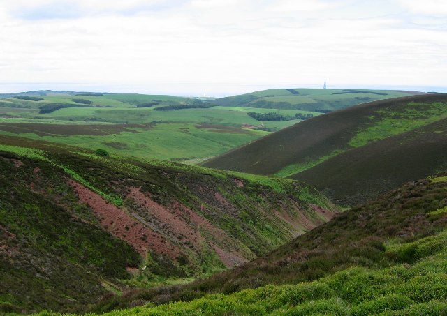
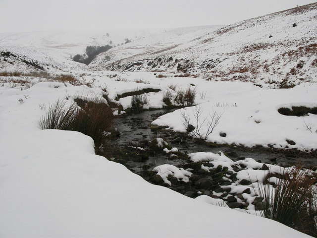
Crow Cleugh is a picturesque valley located in East Lothian, Scotland. Nestled amidst the rolling hills and lush greenery, this area is renowned for its natural beauty and tranquil surroundings. The name "Crow Cleugh" is derived from the Old English words "crow" meaning "crow" and "cleugh" meaning "a narrow valley or ravine," which accurately describes the landscape of this charming location.

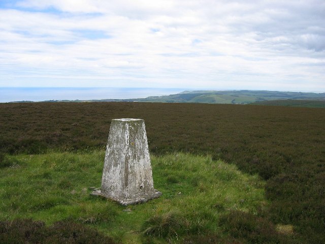
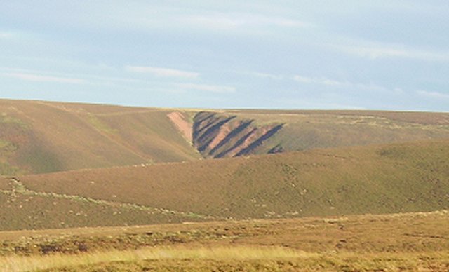
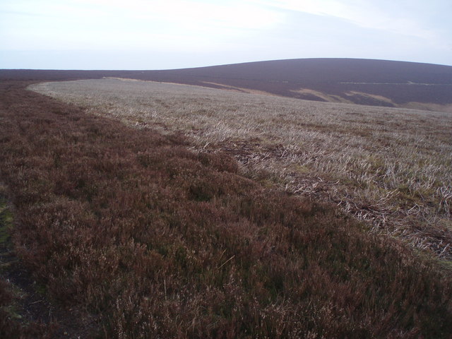
The valley is characterized by its idyllic scenery, with meandering streams, woodland areas, and open fields dominating the landscape. It is a haven for nature lovers and outdoor enthusiasts, offering numerous opportunities for hiking, birdwatching, and exploring the great outdoors. The diverse range of flora and fauna found in Crow Cleugh is a testament to its ecological significance and has made it a designated conservation area.

Crow Cleugh is also steeped in history, with several ancient ruins and archaeological sites scattered throughout the valley. These remnants provide insight into the area's rich past, including its occupation during the Iron Age and Roman period.

Located in close proximity to the small town of Haddington, Crow Cleugh offers a peaceful retreat from the hustle and bustle of city life. Its proximity to the coast and nearby attractions such as the famous Tantallon Castle and the John Muir Way make it an ideal destination for day trips or longer stays.

In summary, Crow Cleugh is a stunning valley in East Lothian, Scotland, known for its natural beauty, diverse wildlife, and historical significance. Whether one seeks tranquility, outdoor adventures, or a glimpse into the past, this enchanting location has something to offer for everyone.

If you have any feedback on the listing, please let us know in the comments section below.

Crow Cleugh Images

Images are sourced within 2km of 55.910542/-2.4549174 or Grid Reference NT7168. Thanks to Geograph Open Source API. All images are credited.

East Lammermuir Deans Steepsided eroded gullies that are home to lime loving plants. A Scottish Wildlife Trust reserve.
East Lammermuir Deans
Steepsided eroded gullies that are home to lime loving plants. A Scottish Wildlife Trust reserve.
Wester Dod Trig point on the eastern edge of Lammermuir moorland. View to the east coast.
Wester Dod
Trig point on the eastern edge of Lammermuir moorland. View to the east coast.
Wester Dod Gullying on the side of Wester Dod, Lammermuir Hills.
Wester Dod
Gullying on the side of Wester Dod, Lammermuir Hills.
Man Made Lochan
Man Made Lochan
Trees Not a lot in this hard to get to square. In the background is the boundary between forest and land on the side of Elly Cleugh.
Trees
Not a lot in this hard to get to square. In the background is the boundary between forest and land on the side of Elly Cleugh.
Looking down water course Great view from high in the Lammermuirs all the way down to the Berwickshire coast
Looking down water course
Great view from high in the Lammermuirs all the way down to the Berwickshire coast
Grazing land, trees in distance
Abandoned Shooting Ground Buildings Nasty little corner. Used to be a shooting ground. Prefab building has rotten floors, lots of other debris.
Abandoned Shooting Ground Buildings
Nasty little corner. Used to be a shooting ground. Prefab building has rotten floors, lots of other debris.
Gully Looking down Yearn Gill across to Monynut Edge with Crystal Rig windfarm just about visible- East Lothian.
Gully
Looking down Yearn Gill across to Monynut Edge with Crystal Rig windfarm just about visible- East Lothian.
Burnt Heather Good example of old and new heather with mature in foreground and new shoots coming up just beyond having been burnt presumably in the autumn.
Near summit of Monynut Edge looking to Wester Dod - exactly the same height at 412m - East Lothian.
Burnt Heather
Good example of old and new heather with mature in foreground and new shoots coming up just beyond having been burnt presumably in the autumn. Near summit of Monynut Edge looking to Wester Dod - exactly the same height at 412m - East Lothian.
Long Crib Burn High up in the Lammermuirs - East Lothian - looking up Long Crib Burn towards the lower slopes of Wester Dod.
Long Crib Burn
High up in the Lammermuirs - East Lothian - looking up Long Crib Burn towards the lower slopes of Wester Dod.
Wide Hope, near to Oldhamstocks Tributary of Oldhamstocks Burn runs through the valley of Wide Hope, on the eastern side of the Lammermuir Hills.
Wide Hope, near to Oldhamstocks
Tributary of Oldhamstocks Burn runs through the valley of Wide Hope, on the eastern side of the Lammermuir Hills.
Lammermuir Hills, near Oldhamstocks View from the top of the hill between the two valleys of Yearn Hope and Wide Hope. Although Wide Hope can not be seen from this view, the more westerly narrow valley of Ling Hope can be seen.
Lammermuir Hills, near Oldhamstocks
View from the top of the hill between the two valleys of Yearn Hope and Wide Hope. Although Wide Hope can not be seen from this view, the more westerly narrow valley of Ling Hope can be seen.
Flock of Sheep in Yearn Hope, near to Oldhamstocks Sheep heading up the more easterly of the two tight valleys at the end of Yearn Hope.
Flock of Sheep in Yearn Hope, near to Oldhamstocks
Sheep heading up the more easterly of the two tight valleys at the end of Yearn Hope.
Oldhamstocks Burn The burn running down the Lammermuir valley of Wide Hope joins Oldhamstocks Burn at this point. The view is towards Aikengall.
Oldhamstocks Burn
The burn running down the Lammermuir valley of Wide Hope joins Oldhamstocks Burn at this point. The view is towards Aikengall.
Yearn Hope, Lammermuirs Small calley and burn off from the main valley in Yearn Hope, at the eastern end of the Lammermuirs.
Yearn Hope, Lammermuirs
Small calley and burn off from the main valley in Yearn Hope, at the eastern end of the Lammermuirs.
Yearn Hope, near Oldhamstocks Burn and valley of Yearn Hope, at the eastern end of the Lammermuir Hills.
Yearn Hope, near Oldhamstocks
Burn and valley of Yearn Hope, at the eastern end of the Lammermuir Hills.
Wide Hope, near Oldhamstocks Burn running through the Lammermuir valley of Wide Hope, eventually joining with Oldhamstocks Burn <a href="https://www.geograph.org.uk/photo/335121">NT7169 : Oldhamstocks Burn</a>.
Wide Hope, near Oldhamstocks
Burn running through the Lammermuir valley of Wide Hope, eventually joining with Oldhamstocks Burn NT7169 : Oldhamstocks Burn.
Show me another place!

Crow Cleugh is located at Grid Ref: NT7168 (Lat: 55.910542, Lng: -2.4549174)

Unitary Authority: East Lothian

Police Authority: The Lothians and Scottish Borders

What 3 Words

///carriage.stands.hikes. Near Dunbar, East Lothian

Nearby Locations

Crow Cleugh

Related Wikis

Crystal Rig Wind Farm

Crystal Rig Wind Farm is an operational onshore wind farm located on the Lammermuir Hills in the Scottish Borders region of Scotland. When phase 1 was...

Oldhamstocks

Oldhamstocks or Aldhamstocks ("old dwelling place") is a civil parish and small village in the east of East Lothian, Scotland, adjacent to the Scottish...

Blackcastle Hill, East Lothian

Blackcastle Hill is an Iron Age hill fort south of Innerwick, East Lothian, Scotland. It is near Cocklaw in the Lammermuir Hills at grid reference NT729724...

Innerwick

Innerwick (Scottish Gaelic: Inbhir Mhuice) is a coastal civil parish and small village, which lies in the east of East Lothian, five miles (eight kilometres...

Have you been to Crow Cleugh?

Leave your review of Crow Cleugh below (or comments, questions and feedback).