Watcombe Bottom

Valley in Dorset

England

Watcombe Bottom

Cross dyke on Higher Hill Cross dykes apparently formed prehistoric land boundaries. There are quite a few on this ridgeway in this beautiful part of Dorset.
Cross dyke on Higher Hill Credit: Becky Williamson

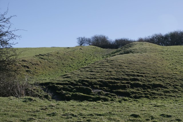
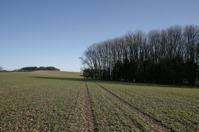
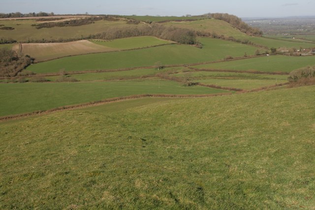
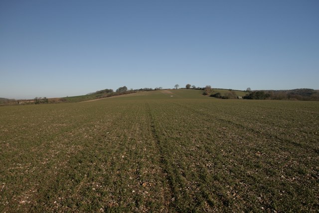
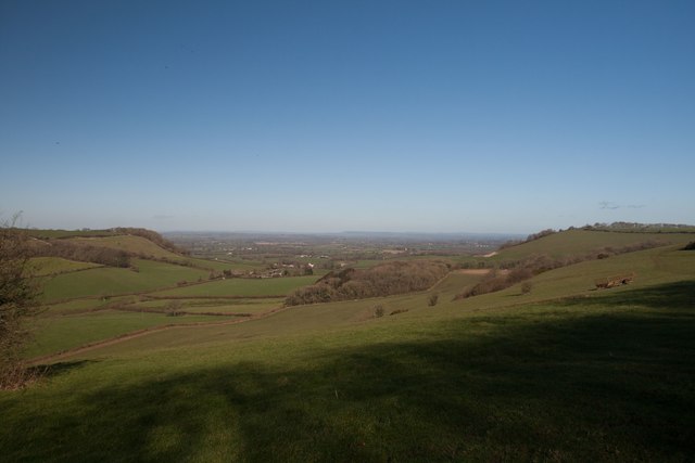
Watcombe Bottom is a picturesque valley located in the county of Dorset, England. Situated in the heart of the rolling hills and verdant countryside, this valley offers a tranquil and idyllic setting for nature lovers and hikers alike.

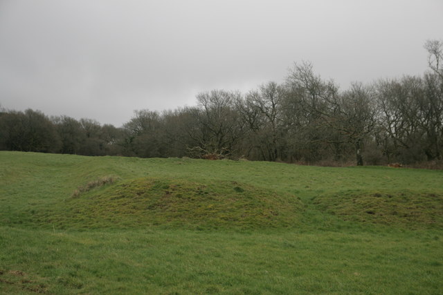
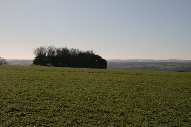
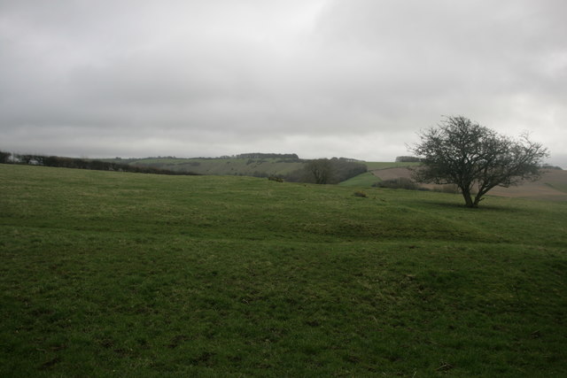
The valley is characterized by its lush greenery, with dense woodlands covering its slopes. The diverse range of trees, such as oak, beech, and ash, create a vibrant and colorful landscape throughout the seasons. The valley floor is adorned with a carpet of wildflowers, further enhancing its natural beauty.

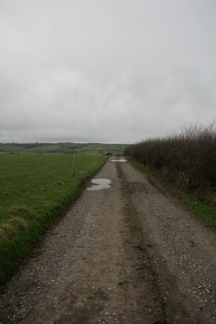
Watcombe Bottom is intersected by a gentle stream, which meanders through the valley, adding a soothing and peaceful ambiance to the surroundings. The stream is home to a variety of wildlife, including ducks, kingfishers, and otters, making it a haven for birdwatchers and nature enthusiasts.

For those seeking outdoor activities, the valley offers a network of walking trails, ranging from easy strolls to more challenging hikes. These paths wind through the woods and along the stream, providing breathtaking views of the valley and its surrounding hills. The valley is also a popular spot for picnics, with several designated areas offering scenic spots to enjoy a meal amidst nature.

Watcombe Bottom is easily accessible, with a car park located nearby, making it an ideal destination for day trips or weekend getaways. Its serene and unspoiled setting makes it a true gem of Dorset, allowing visitors to immerse themselves in the beauty and tranquility of the English countryside.

If you have any feedback on the listing, please let us know in the comments section below.

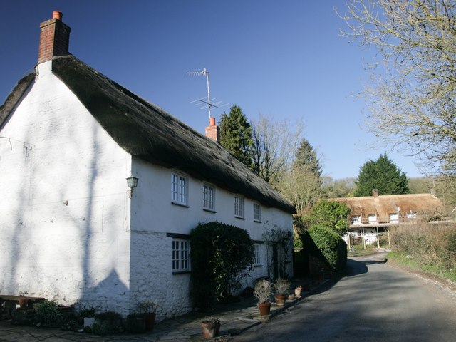
Watcombe Bottom Images

Images are sourced within 2km of 50.823761/-2.406439 or Grid Reference ST7102. Thanks to Geograph Open Source API. All images are credited.

Cross dyke on Higher Hill Cross dykes apparently formed prehistoric land boundaries. There are quite a few on this ridgeway in this beautiful part of Dorset.
Cross dyke on Higher Hill
Cross dykes apparently formed prehistoric land boundaries. There are quite a few on this ridgeway in this beautiful part of Dorset.
Benchmark, St John the Baptist Church, Plush Ordnance Survey benchmark, described on database at <span class="nowrap"><a title="http://www.bench-marks.org.uk/bm73594" rel="nofollow ugc noopener" href="http://www.bench-marks.org.uk/bm73594">Link</a><img style="margin-left:2px;" alt="External link" title="External link - shift click to open in new window" src="https://s1.geograph.org.uk/img/external.png" width="10" height="10"/></span>. See also <a href="https://www.geograph.org.uk/photo/4833952">ST7102 : St John the Baptist Church, Plush</a>.
Benchmark, St John the Baptist Church, Plush
Ordnance Survey benchmark, described on database at LinkExternal link. See also ST7102 : St John the Baptist Church, Plush.
St John the Baptist Church, Plush I'm not sure if this building is still used as a place of worship, but it can also be used as a concert hall and venue for weddings etc.
St John the Baptist Church, Plush
I'm not sure if this building is still used as a place of worship, but it can also be used as a concert hall and venue for weddings etc.
Triangle of trees on Plush Hill The footpath wends its way through this arable field, past a water tank and on to the trig point at Higher Hill.
Triangle of trees on Plush Hill
The footpath wends its way through this arable field, past a water tank and on to the trig point at Higher Hill.
Benchmark on Old Schoolhouse, Plush Ordnance Survey benchmark, described on database at <span class="nowrap"><a title="http://www.bench-marks.org.uk/bm73593" rel="nofollow ugc noopener" href="http://www.bench-marks.org.uk/bm73593">Link</a><img style="margin-left:2px;" alt="External link" title="External link - shift click to open in new window" src="https://s1.geograph.org.uk/img/external.png" width="10" height="10"/></span>. See also <a href="https://www.geograph.org.uk/photo/4834177">ST7102 : Former Schoolhouse, Plush</a>.
Benchmark on Old Schoolhouse, Plush
Ordnance Survey benchmark, described on database at LinkExternal link. See also ST7102 : Former Schoolhouse, Plush.
Former Schoolhouse, Plush There is an Ordnance Survey benchmark on this cottage. See <a href="https://www.geograph.org.uk/photo/4834176">ST7102 : Benchmark on Old Schoolhouse, Plush</a>.
Former Schoolhouse, Plush
There is an Ordnance Survey benchmark on this cottage. See ST7102 : Benchmark on Old Schoolhouse, Plush.
Cross dyke on Higher Hill Another prehistoric land boundary on this beautiful ridge.
Cross dyke on Higher Hill
Another prehistoric land boundary on this beautiful ridge.
Near summit of East Hill, Piddletrenthide Not that you'd really know you were on a hill. It's all arable crops!
Near summit of East Hill, Piddletrenthide
Not that you'd really know you were on a hill. It's all arable crops!
Church Hill - Wessex Ridgeway Looking west along bridleway towards Alton Pancras.
Church Hill - Wessex Ridgeway
Looking west along bridleway towards Alton Pancras.
View north from Higher Hill Nettlecombe Tout visible on the left of the photo.
View north from Higher Hill
Nettlecombe Tout visible on the left of the photo.
Celtic Enclosure on the edge of Watcombe Wood
Erstwhile Fox Inn, Folly Now a private residence, one of the only ones in the hamlet of Folly and situated between Plush and Mappowder.
Erstwhile Fox Inn, Folly
Now a private residence, one of the only ones in the hamlet of Folly and situated between Plush and Mappowder.
Tumulus, Plush Hill
Tumulus, Plush Hill
Water tank, Plush Hill There is supposed to be an Ordnance Survey benchmark on this structure, but i couldn't find it. It has perhaps got destroyed as parts of the rendering have crumbled.
Water tank, Plush Hill
There is supposed to be an Ordnance Survey benchmark on this structure, but i couldn't find it. It has perhaps got destroyed as parts of the rendering have crumbled.
Settlement on West Hill, near Plush
Higher Hill trigpoint
Benchmark on cottage, Alton Pancras Ordnance Survey benchmark on cottage in Alton Pancras, described on database at <span class="nowrap"><a title="http://www.bench-marks.org.uk/bm69121" rel="nofollow ugc noopener" href="http://www.bench-marks.org.uk/bm69121">Link</a><img style="margin-left:2px;" alt="External link" title="External link - shift click to open in new window" src="https://s1.geograph.org.uk/img/external.png" width="10" height="10"/></span>.
Benchmark on cottage, Alton Pancras
Ordnance Survey benchmark on cottage in Alton Pancras, described on database at LinkExternal link.
Old Direction Sign - Signpost in Plush, Piddletrenthide Parish Annulus and bar finial - 3 arms; Dorset halo with NGR by the UC road, in parish of Piddletrenthide (West Dorset District), Plush, on green opposite Brace of Pheasants PH.

Surveyed

Milestone Society National ID: DO_ST7102
Old Direction Sign - Signpost in Plush, Piddletrenthide Parish
Annulus and bar finial - 3 arms; Dorset halo with NGR by the UC road, in parish of Piddletrenthide (West Dorset District), Plush, on green opposite Brace of Pheasants PH. Surveyed Milestone Society National ID: DO_ST7102
Show me another place!

Watcombe Bottom is located at Grid Ref: ST7102 (Lat: 50.823761, Lng: -2.406439)

Unitary Authority: Dorset

Police Authority: Dorset

What 3 Words

///tripling.crawled.bitters. Near Puddletown, Dorset

Related Wikis

Plush, Dorset

Plush is a small village in the English county of Dorset. It lies within the civil parish of Piddletrenthide in the west of the county, and is approximately...

Ball Hill, Dorset

At 251 metres, Ball Hill is one of the highest hills in the county of Dorset, England, and is on the Wessex Ridgeway. == Location == The summit of Ball...

Alton Pancras

Alton Pancras is a small village and civil parish in Dorset, England. In the 2011 census the civil parish had a population of 175. The village church is...

Bookham Knoll

Bookham Knoll is a rounded hill, 211 metres (692 ft) high, about 1 kilometre southeast of the village of Buckland Newton in the county of Dorset in southern...

Nearby Amenities

Located within 500m of 50.823761,-2.406439
Material: wood
Power: pole
Source: bing
Switch: mechanical
Lat/Long: 50.8198705/-2.4072116
Material: wood
Power: pole
Source: bing
Lat/Long: 50.8203665/-2.4059416
Material: wood
Power: pole
Source: bing
Lat/Long: 50.8205695/-2.4106051
Material: wood
Power: pole
Source: bing
Lat/Long: 50.8206357/-2.4043886
Material: wood
Power: pole
Source: bing
Lat/Long: 50.820906/-2.4028706
Material: wood
Power: pole
Source: bing
Lat/Long: 50.821136/-2.4117037
Barrier: stile
Source: survey;gps
Lat/Long: 50.8224945/-2.4129798
Power: pole
Source: bing
Lat/Long: 50.8200284/-2.4094941
Power: pole
Source: bing
Lat/Long: 50.8211764/-2.4013455
Watcombe Plain
Place: locality
Source: OS_OpenData_StreetView
Lat/Long: 50.8256403/-2.4123037
Watcombe Bottom
Place: locality
Source: OS_OpenData_StreetView
Lat/Long: 50.8246847/-2.4074221
The data included in this document is from www.openstreetmap.org. The data is made available under ODbL.

Have you been to Watcombe Bottom?

Leave your review of Watcombe Bottom below (or comments, questions and feedback).