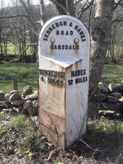
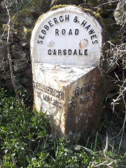
Garsdale

Valley in Yorkshire South Lakeland

England

Garsdale

Swarthgill Service Station
Swarthgill Service Station Credit: Anthony Parkes

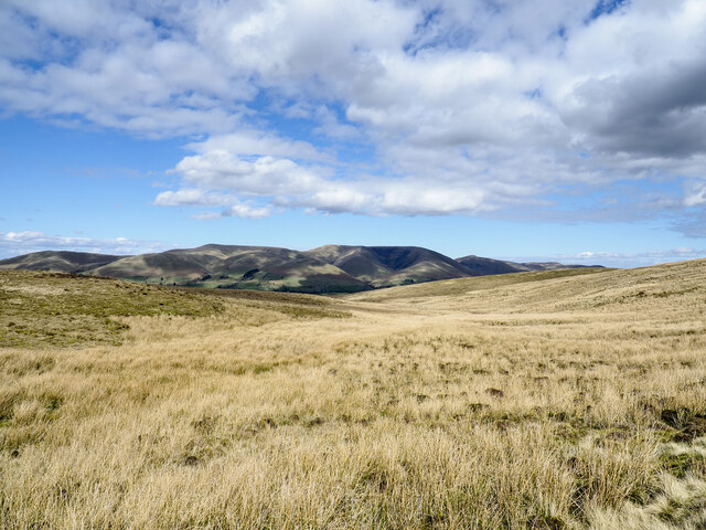
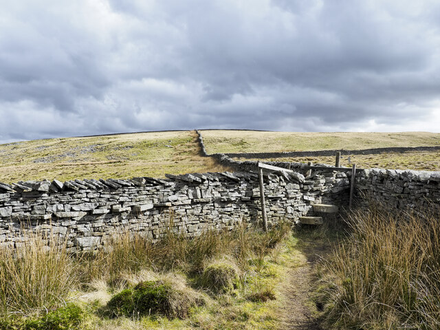
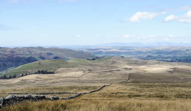
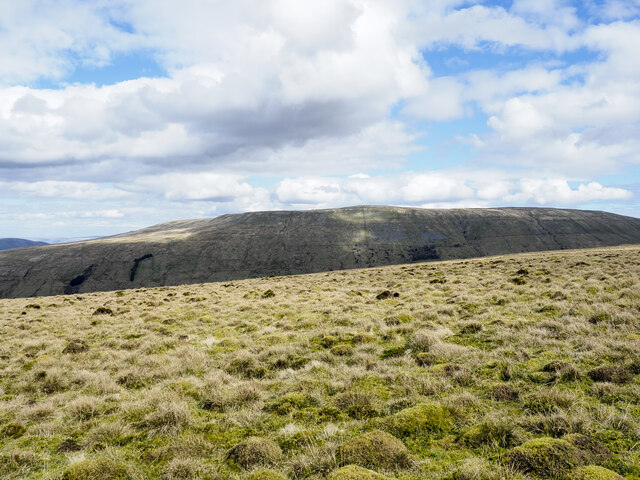
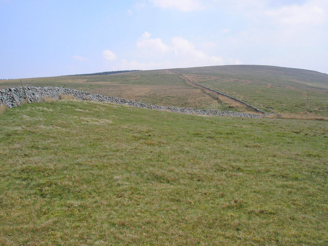
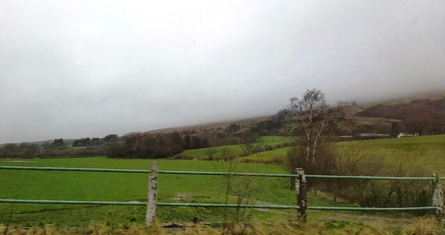
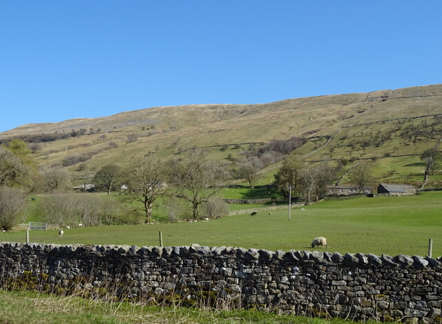
Garsdale is a picturesque valley located in the county of Yorkshire, England. Situated in the Yorkshire Dales National Park, it is surrounded by rolling hills, stunning landscapes, and abundant natural beauty. The valley is known for its tranquil atmosphere and unspoiled surroundings, making it a popular destination for those seeking a peaceful retreat.

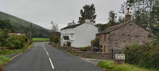
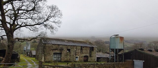
The main settlement within Garsdale is the small village of Garsdale Head. Despite its size, it offers a range of amenities, including a local pub and a railway station, which connects the valley to nearby towns and cities. The village is nestled amidst lush greenery, with charming stone houses and traditional architecture adding to its rural charm.

Garsdale is renowned for its impressive viaduct, which was built in the 19th century by the renowned engineer, Sir Joseph Locke. The structure spans the valley, providing breathtaking views of the surrounding countryside. It is not only a marvel of engineering but also a popular spot for photography enthusiasts and nature lovers alike.

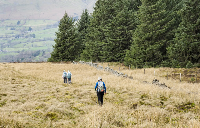
The valley is also home to a diverse range of wildlife, including birds, mammals, and various plant species. Garsdale offers ample opportunities for nature walks, hiking, and birdwatching, with several well-marked trails crisscrossing the area.

Overall, Garsdale is a hidden gem within the Yorkshire Dales, offering visitors a chance to escape the hustle and bustle of city life and immerse themselves in the tranquility of the countryside. Its natural beauty, charming village, and stunning viaduct make it a must-visit destination for those seeking a peaceful and idyllic getaway.

If you have any feedback on the listing, please let us know in the comments section below.
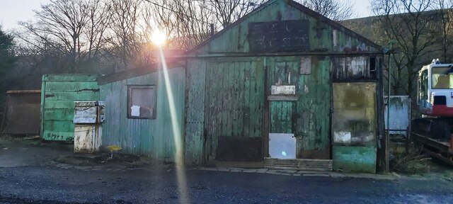
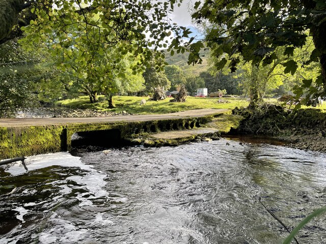
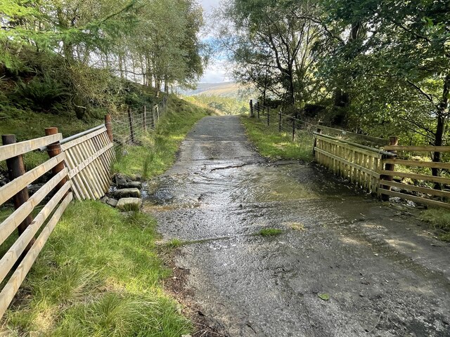
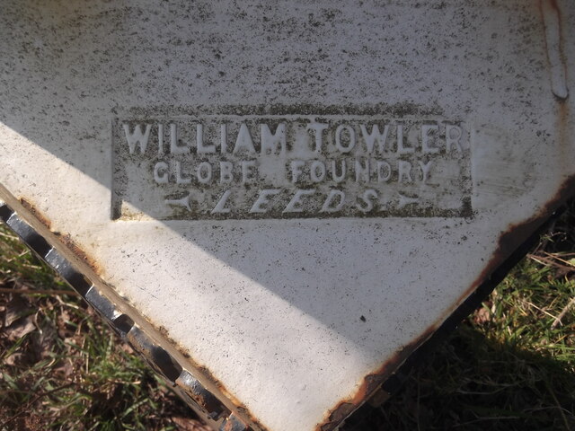
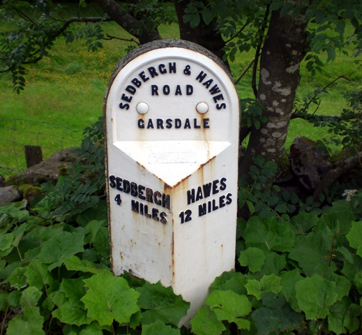
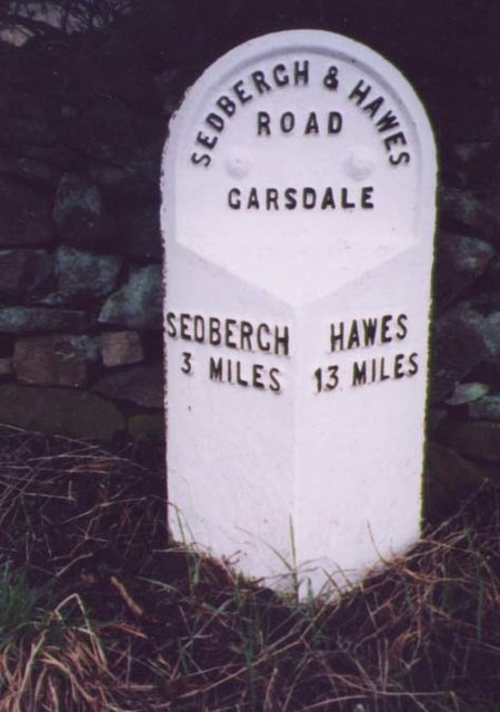
Garsdale Images

Images are sourced within 2km of 54.31145/-2.4427656 or Grid Reference SD7190. Thanks to Geograph Open Source API. All images are credited.

Swarthgill Service Station
Walking path beside coniferous plantation The walkers are descending on a track over moorland into Garsdale following an ascent to Aye Gill Pike.
Walking path beside coniferous plantation
The walkers are descending on a track over moorland into Garsdale following an ascent to Aye Gill Pike.
Little Winterscales Ford This irish bridge ford on the River Clough is found at Little Winterscales.
Little Winterscales Ford
This irish bridge ford on the River Clough is found at Little Winterscales.
Gillfeet Gill Ford This ford is found on the road crossing Gillfeet Gill.
Gillfeet Gill Ford
This ford is found on the road crossing Gillfeet Gill.
Old milestone This West Riding CC milestone on the A684 is on a narrow verge at Bellow End on the south side of the road.   Although now leaning slightly backwards it is set to almost its full height with 20cm of backing stone set into the ground.   Going down Garsdale the previous milestone, Hawes 11/Sedbergh 5 is the only one lost from this route which was ceded to Cumbria in 1974.
It is Grade II listed 1384040.
Old milestone
This West Riding CC milestone on the A684 is on a narrow verge at Bellow End on the south side of the road. Although now leaning slightly backwards it is set to almost its full height with 20cm of backing stone set into the ground. Going down Garsdale the previous milestone, Hawes 11/Sedbergh 5 is the only one lost from this route which was ceded to Cumbria in 1974. It is Grade II listed 1384040.
Old milestone Of the 8 remaining West Riding CC milestones from Ribblehead viaduct to Sedbergh, on the A684, this is the only one with a foundry name.   WILLIAM TOWLER/GLOBE FOUNDRY/LEEDS.
Old milestone
Of the 8 remaining West Riding CC milestones from Ribblehead viaduct to Sedbergh, on the A684, this is the only one with a foundry name. WILLIAM TOWLER/GLOBE FOUNDRY/LEEDS.
Old milestone The Hawes 13 milestone on the A684 has its back to a drystone wall near Nether House on the south side of the road.   615 of these milestones were set up for the West Riding County Council in 1893/94 not long after the formation of County Councils.   Gill and Frank Stead, stonemasons, of Mirfield won the contract which stated that the work had to be done in 12 months or they would incur a penalty.   Considering the size of the West Riding that was a tremendous feat but they succeeded.   The WRCC didn't always have stones erected on old tollroads.   They wanted to promote new trade routes.   It is Grade II listed 1384039.
Old milestone
The Hawes 13 milestone on the A684 has its back to a drystone wall near Nether House on the south side of the road. 615 of these milestones were set up for the West Riding County Council in 1893/94 not long after the formation of County Councils. Gill and Frank Stead, stonemasons, of Mirfield won the contract which stated that the work had to be done in 12 months or they would incur a penalty. Considering the size of the West Riding that was a tremendous feat but they succeeded. The WRCC didn't always have stones erected on old tollroads. They wanted to promote new trade routes. It is Grade II listed 1384039.
Valley of Holebeck Gill The shallow, upper valley of Holebeck Gill heading north to where it will meet the Clough River which drains Garsdale.
The Howgill Fells are in the distance beyond both the Clough River and the River Rawthey.
Valley of Holebeck Gill
The shallow, upper valley of Holebeck Gill heading north to where it will meet the Clough River which drains Garsdale. The Howgill Fells are in the distance beyond both the Clough River and the River Rawthey.
Stile with walls beyond The stile and other similar ones allow easy access along the ridge rising to Aye Gill Pike, the highest point along a ridge between Garsdale and Dentdale.
Stile with walls beyond
The stile and other similar ones allow easy access along the ridge rising to Aye Gill Pike, the highest point along a ridge between Garsdale and Dentdale.
Moorland of north-west ridge of Aye Gill Pike Aye Gill Pike is the high point of a long ridge oriented almost north-west to south east between two valleys, Garsdale and Dentdale. The broad western end of the ridge is seen here, descending towards Sedbergh.
Moorland of north-west ridge of Aye Gill Pike
Aye Gill Pike is the high point of a long ridge oriented almost north-west to south east between two valleys, Garsdale and Dentdale. The broad western end of the ridge is seen here, descending towards Sedbergh.
Moorland of, or above Copplethwaite The moorland is along the ridge north-west of Aye Gill Pike.
Baugh Fell is the hill beyond.
Moorland of, or above Copplethwaite
The moorland is along the ridge north-west of Aye Gill Pike. Baugh Fell is the hill beyond.
The slopes of Aye Gill Pike The track up the fell can be seen to the left of the wall.
The slopes of Aye Gill Pike
The track up the fell can be seen to the left of the wall.
Old Milestone by the A684 near Bellow End Metal plate attached to stone post by the A684, in parish of Garsdale (South Lakeland District), 20m West of Bellow Hill Turn, Thwaite Head Gill, on narrow verge, on South side of road. Sedburgh V iron casting, erected by the County Council in the 19th century. 

Inscription reads:-
: SEDBERGH / 4 MILES : : SEDBERGH & HAWES / ROAD / GARSDALE : : HAWES / 12 MILES : 

Grade II listed.
List Entry Number: 1384040 <span class="nowrap"><a title="https://historicengland.org.uk/listing/the-list/list-entry/1384040" rel="nofollow ugc noopener" href="https://historicengland.org.uk/listing/the-list/list-entry/1384040">Link</a><img style="margin-left:2px;" alt="External link" title="External link - shift click to open in new window" src="https://s1.geograph.org.uk/img/external.png" width="10" height="10"/></span>

Milestone Society National ID: YW_HWSB12
Old Milestone by the A684 near Bellow End
Metal plate attached to stone post by the A684, in parish of Garsdale (South Lakeland District), 20m West of Bellow Hill Turn, Thwaite Head Gill, on narrow verge, on South side of road. Sedburgh V iron casting, erected by the County Council in the 19th century. Inscription reads:- : SEDBERGH / 4 MILES : : SEDBERGH & HAWES / ROAD / GARSDALE : : HAWES / 12 MILES : Grade II listed. List Entry Number: 1384040 LinkExternal link Milestone Society National ID: YW_HWSB12
Old Milestone by the A684, Garsdale Milestone by the A684, in parish of Garsdale (Eden District), Ex. Yorkshire West Riding, near Nether House, back to drystone wall.

Inscription reads:-
: SEDBERGH / 3 MILES : : SEDBERGH & HAWES / ROAD / GARSDALE : : HAWES / 13 MILES :

Grade II listed.
List Entry Number: 1384039 <span class="nowrap"><a title="https://historicengland.org.uk/listing/the-list/list-entry/1384039" rel="nofollow ugc noopener" href="https://historicengland.org.uk/listing/the-list/list-entry/1384039">Link</a><img style="margin-left:2px;" alt="External link" title="External link - shift click to open in new window" src="https://s1.geograph.org.uk/img/external.png" width="10" height="10"/></span>

Milestone Society National ID: YW_HWSB13
Old Milestone by the A684, Garsdale
Milestone by the A684, in parish of Garsdale (Eden District), Ex. Yorkshire West Riding, near Nether House, back to drystone wall. Inscription reads:- : SEDBERGH / 3 MILES : : SEDBERGH & HAWES / ROAD / GARSDALE : : HAWES / 13 MILES : Grade II listed. List Entry Number: 1384039 LinkExternal link Milestone Society National ID: YW_HWSB13
Swarthgill House
Swarthgill House
Fields near Bellow End
Farm Buildings at Kiln Haw
Grazing, Garsdale Looking towards East Rackenthwaite.
Grazing, Garsdale
Looking towards East Rackenthwaite.
Show me another place!

Garsdale is located at Grid Ref: SD7190 (Lat: 54.31145, Lng: -2.4427656)

Division: West Riding

Administrative County: Cumbria

District: South Lakeland

Police Authority: Cumbria

What 3 Words

///troubles.hurry.deleting. Near Sedbergh, Cumbria

Nearby Locations

Garsdale Bellow Hill

Related Wikis

Aye Gill Pike

Aye Gill Pike is a Marilyn in the Yorkshire Dales, the highest point of the ridge of Rise Hill between Dentdale and Garsdale in Cumbria, England.

Baugh Fell

Baugh Fell (, or locally ) is a large, flat-topped hill in the northern Pennines of England. It lies in the north-western corner of the Yorkshire Dales...

Garsdale

Garsdale is a dale or valley in the south east of Cumbria, England, historically a part of the West Riding of Yorkshire. It is now within the Westmorland...

St Andrew's Church, Dent

St Andrew's Church is in the village of Dent, Cumbria, England. It is an active Anglican parish church in the Western Dales Mission Community in the deanery...

Nearby Amenities

Located within 500m of 54.31145,-2.4427656
Post Box
Post Box Type: lamp
Ref: LA10 32
Source: survey
Lat/Long: 54.3110059/-2.4411785
Generator Method: photovoltaic
Generator Orientation: south
Generator Output Electricity: yes
Generator Solar Modules: 38
Generator Source: solar
Generator Type: solar_photovoltaic_panel
Location: roof
Power: generator
Lat/Long: 54.3133085/-2.4398708
Barrier: cattle_grid
Lat/Long: 54.3114017/-2.4381448
Power: pole
Lat/Long: 54.3129747/-2.4394208
Power: pole
Lat/Long: 54.3144423/-2.4478631
Power: pole
Lat/Long: 54.314343/-2.4459252
Power: pole
Lat/Long: 54.3142851/-2.4447906
Power: pole
Lat/Long: 54.314048/-2.4437901
Power: pole
Lat/Long: 54.313689/-2.4423726
Power: pole
Lat/Long: 54.3133549/-2.4409872
Power: pole
Lat/Long: 54.3126445/-2.4380998
Power: pole
Lat/Long: 54.3121423/-2.4360345
Information: guidepost
Tourism: information
Lat/Long: 54.3113098/-2.4383808
Barrier: stile
Lat/Long: 54.3109299/-2.4417782
Information: guidepost
Tourism: information
Lat/Long: 54.3109245/-2.4418092
Information: guidepost
Tourism: information
Lat/Long: 54.3108865/-2.4415891
Barrier: stile
Lat/Long: 54.3108943/-2.44147
Power: pole
Lat/Long: 54.3116253/-2.4375014
Power: pole
Lat/Long: 54.3119244/-2.4371996
Power: pole
Lat/Long: 54.3123377/-2.4368379
Power: pole
Lat/Long: 54.3125225/-2.4355586
Power: pole
Lat/Long: 54.3136237/-2.4448461
Power: pole
Lat/Long: 54.3126902/-2.4449587
Power: pole
Lat/Long: 54.3117413/-2.4450713
Power: pole
Lat/Long: 54.3108637/-2.4451575
Power: pole
Lat/Long: 54.3106066/-2.4440676
Power: pole
Lat/Long: 54.3107519/-2.4446353
Power: pole
Lat/Long: 54.3109448/-2.4460151
Power: pole
Lat/Long: 54.31103/-2.4469254
Power: pole
Lat/Long: 54.311139/-2.447989
Power: pole
Lat/Long: 54.3114101/-2.4482118
The data included in this document is from www.openstreetmap.org. The data is made available under ODbL.

Have you been to Garsdale?

Leave your review of Garsdale below (or comments, questions and feedback).