The Den

Valley in Aberdeenshire

Scotland

The Den

Brae of Blackton Looking south from the road at Brae of Blackton
Brae of Blackton Credit: Ralph Greig

The Den, located in Aberdeenshire, Scotland, is a picturesque valley renowned for its stunning natural beauty and rich historical significance. This area, nestled between rolling hills and meandering rivers, is a popular destination for nature enthusiasts and history buffs alike.

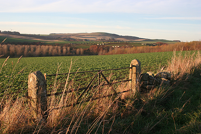
The Den is known for its lush greenery and diverse wildlife, making it a haven for outdoor activities such as hiking, cycling, and birdwatching. The valley is home to a wide range of plant and animal species, including red squirrels, otters, and various species of birds. The serene atmosphere and tranquil setting make it an ideal spot for those seeking relaxation and an escape from the bustling city life.

In addition to its natural attractions, The Den is steeped in history. The valley is dotted with ancient ruins and archaeological sites, providing a glimpse into Aberdeenshire's past. Visitors can explore the remains of old castles, such as the imposing Crathes Castle, or wander through the well-preserved stone circle at Sunhoney. These historical landmarks offer a fascinating insight into the region's ancient civilizations and serve as a reminder of the area's rich heritage.

The Den, Aberdeenshire, is a true gem of Scotland, offering visitors a unique blend of natural beauty and historical significance. Whether one seeks adventure in the great outdoors or wishes to immerse themselves in the region's captivating history, this valley has something for everyone.

If you have any feedback on the listing, please let us know in the comments section below.
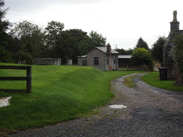
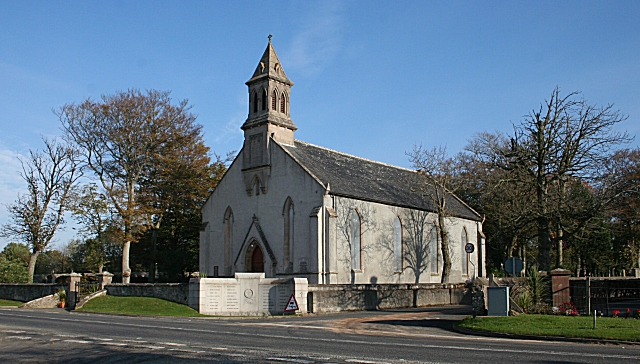
The Den Images

Images are sourced within 2km of 57.6097/-2.485874 or Grid Reference NJ7157. Thanks to Geograph Open Source API. All images are credited.

Brae of Blackton Looking south from the road at Brae of Blackton
Brae of Blackton
Looking south from the road at Brae of Blackton
Wood of Balchers Looking towards this small woodland from the access road
Wood of Balchers
Looking towards this small woodland from the access road
Driveway to Eden House at South Lodge Looking north-eastward.
Driveway to Eden House at South Lodge
Looking north-eastward.
Wall enclosed road approaching the remains of Eden Castle Looking south-westward.
Wall enclosed road approaching the remains of Eden Castle
Looking south-westward.
Minor road at Scatterty Looking south-westward.
Minor road at Scatterty
Looking south-westward.
Minor road heading towards Bogbraes Looking south-eastward. A full River Deveron can be seen on the right of the photograph.
Minor road heading towards Bogbraes
Looking south-eastward. A full River Deveron can be seen on the right of the photograph.
Old Milestone by the A947, Castleton, south of Banff By the A947, in parish of King Edward (District), South of Castleton Farm, at 'Road Narrows' sign for bridge.

Inscription reads:-
6
(To Banff)

Surveyed

Milestone Society National ID: AD_BFTR06
Old Milestone by the A947, Castleton, south of Banff
By the A947, in parish of King Edward (District), South of Castleton Farm, at 'Road Narrows' sign for bridge. Inscription reads:- 6 (To Banff) Surveyed Milestone Society National ID: AD_BFTR06
Old Milestone by the A947, north of King Edward School Stone post by the A947, in parish of King Edward (District), North of King Edward School, at 50mph sign, East side of road.

Inscription reads:-
5
(To Banff)

Surveyed

Milestone Society National ID: AD_BFTR05
Old Milestone by the A947, north of King Edward School
Stone post by the A947, in parish of King Edward (District), North of King Edward School, at 50mph sign, East side of road. Inscription reads:- 5 (To Banff) Surveyed Milestone Society National ID: AD_BFTR05
King Edward railway station (site), Aberdeenshire Opened in 1860 by the Banff Macduff & Turriff Extension Railway, later part of the Great North of Scotland Railway, on the line from Inveramsay to Macduff, this station closed to passengers in 1951 and completely in 1961.
View east towards the former forecourt, Plaidy and Inveramsay. The wooden station building appears to be a remarkable survivor. The track was to the left of it.
King Edward railway station (site), Aberdeenshire
Opened in 1860 by the Banff Macduff & Turriff Extension Railway, later part of the Great North of Scotland Railway, on the line from Inveramsay to Macduff, this station closed to passengers in 1951 and completely in 1961. View east towards the former forecourt, Plaidy and Inveramsay. The wooden station building appears to be a remarkable survivor. The track was to the left of it.
Minor road near to Foulzie Looking north-westward.
Minor road near to Foulzie
Looking north-westward.
Minor road approaching Bogside Wood Looking south-eastward.
Minor road approaching Bogside Wood
Looking south-eastward.
Wall-lined minor road heading towards Bogside Looking north-eastward.
Wall-lined minor road heading towards Bogside
Looking north-eastward.
King Edward Church
King Edward Church
Near Scatterty The crop in the nearer field looks like a brassica of some sort, and further away is a field of pig shelters. The distant mast is on the Hill of Alvah.
Near Scatterty
The crop in the nearer field looks like a brassica of some sort, and further away is a field of pig shelters. The distant mast is on the Hill of Alvah.
Mains of Eden The farm steading is dominated by the remains of Eden Castle.
Mains of Eden
The farm steading is dominated by the remains of Eden Castle.
Farm Building I wonder if the loft with the outside stair was the chaumer where the unmarried male farm servants slept?
Farm Building
I wonder if the loft with the outside stair was the chaumer where the unmarried male farm servants slept?
Hillhead of Eden Hillhead is the next farm south from Mains of Eden.
Hillhead of Eden
Hillhead is the next farm south from Mains of Eden.
Eden Castle The stark remains of Eden Castle stand beside Mains of Eden. Originally a seat of the Meldrum family, it was built in 1577. It was sold to the Leslies, and then passed into the ownership of the Earls of Fife.
Eden Castle
The stark remains of Eden Castle stand beside Mains of Eden. Originally a seat of the Meldrum family, it was built in 1577. It was sold to the Leslies, and then passed into the ownership of the Earls of Fife.
Show me another place!

The Den is located at Grid Ref: NJ7157 (Lat: 57.6097, Lng: -2.485874)

Unitary Authority: Aberdeenshire

Police Authority: North East

What 3 Words

///recapture.upstarts.tried. Near Banff, Aberdeenshire

Nearby Locations

The Den King Edward

Related Wikis

King Edward railway station

King Edward railway station was a railway station at King Edward, King Edward Parish, Aberdeenshire, Scotland on the rural branchline to Macduff. It was...

King Edward, Aberdeenshire

King Edward (Gaelic: Cinn Eadar) is a small village, parish and former feudal barony near the north coast of Scotland in Buchan midway between Turriff...

Eden Castle

Eden Castle is a castle near Banff in Aberdeenshire, Scotland. The castle was built in the latter half of the 16th century by the Meldrum family with renovation...

Castle of King Edward

The Castle of King Edward is a 13th-century ruined castle near King Edward, Aberdeenshire, Scotland, located 6 kilometres (3.7 mi) north of Turriff, where...

Nearby Amenities

Located within 500m of 57.6097,-2.485874
Speed Camera
Ref: 4012
Website: http://www.nescamp.co.uk/details?cid=107
Lat/Long: 57.6110248/-2.4781872
Historic: memorial
Lat/Long: 57.6103631/-2.4778384
Bus Stop
Church
Bus: yes
Naptan AtcoCode: 630022401
Naptan Bearing: N
Naptan CommonName: Church
Naptan Indicator: opp
Naptan NaptanCode: 23624686
Naptan Street: A947
Naptan Verified: no
Public Transport: platform
Source: naptan;bing;naptan_compare_tool
Lat/Long: 57.6105262/-2.4782258
Power: pole
Lat/Long: 57.6084539/-2.4808576
Power: pole
Lat/Long: 57.6079451/-2.4807691
Power: pole
Lat/Long: 57.6085239/-2.4797171
Power: pole
Lat/Long: 57.608601/-2.4785476
Power: pole
Lat/Long: 57.6101478/-2.4783119
Power: pole
Lat/Long: 57.6097852/-2.4796302
Power: pole
Lat/Long: 57.6094128/-2.4809748
Power: pole
Lat/Long: 57.6094736/-2.4809782
Power: pole
Lat/Long: 57.6102388/-2.4810676
Power: pole
Lat/Long: 57.6109517/-2.4811728
Power: pole
Lat/Long: 57.6116782/-2.4812779
Power: pole
Lat/Long: 57.6124066/-2.4813541
Power: pole
Lat/Long: 57.613166/-2.481452
Power: pole
Lat/Long: 57.6124958/-2.4800442
Power: pole
Lat/Long: 57.6072354/-2.4811119
Power: pole
Lat/Long: 57.6065632/-2.48146
Power: pole
Lat/Long: 57.6078095/-2.4896318
Power: pole
Lat/Long: 57.6089432/-2.4902406
Power: pole
Lat/Long: 57.6088024/-2.4908066
Power: pole
Lat/Long: 57.6054616/-2.4832946
Power: pole
Lat/Long: 57.605841/-2.4843367
Power: pole
Lat/Long: 57.6062323/-2.4853828
Power: pole
Lat/Long: 57.6065922/-2.4863682
Power: pole
Lat/Long: 57.6069966/-2.4874346
Power: pole
Lat/Long: 57.6074031/-2.4885293
Power: pole
Lat/Long: 57.608202/-2.4906681
Power: pole
Lat/Long: 57.6085977/-2.4917487
Power: pole
Lat/Long: 57.6090605/-2.4922849
Power: pole
Lat/Long: 57.6095071/-2.492811
Power: pole
Lat/Long: 57.6099103/-2.4932764
Power: pole
Lat/Long: 57.610461/-2.4939158
Power: pole
Lat/Long: 57.6057933/-2.4818073
The data included in this document is from www.openstreetmap.org. The data is made available under ODbL.

Have you been to The Den?

Leave your review of The Den below (or comments, questions and feedback).