Spruce Cleugh

Valley in East Lothian

Scotland

Spruce Cleugh

Ford near The Brunt The first of two fords on a windy road between Innerwick and Spott. The streams are culverted so the fords are usually dry.
Ford near The Brunt Credit: Andrew Smith

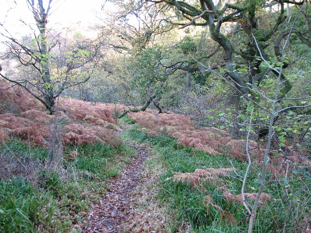
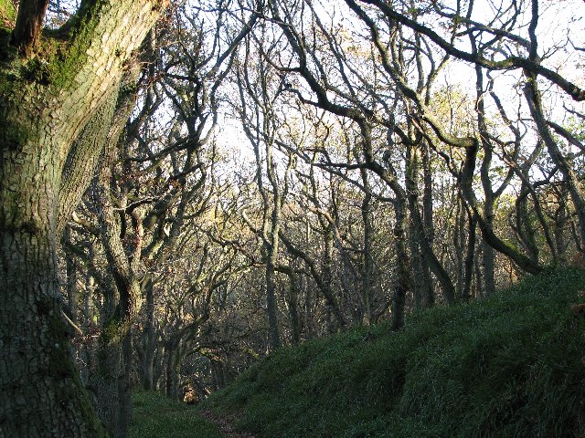
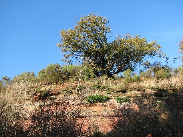
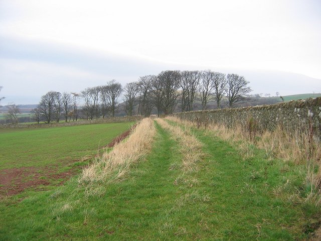
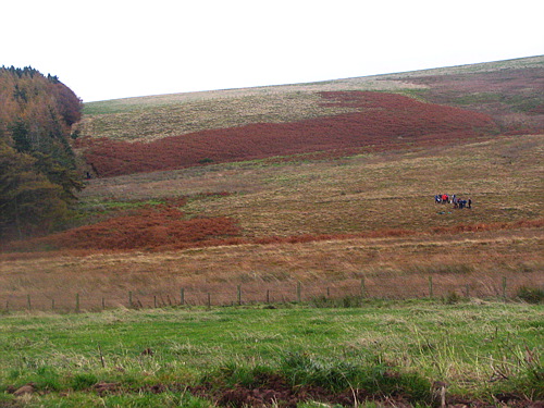
Spruce Cleugh is a picturesque valley located in East Lothian, Scotland. Nestled between rolling hills and lush greenery, the valley offers a tranquil and idyllic escape from the hustle and bustle of city life.

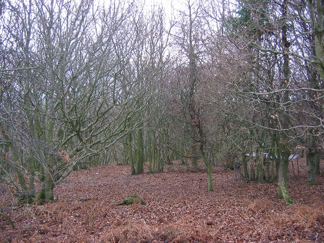
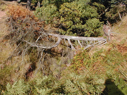
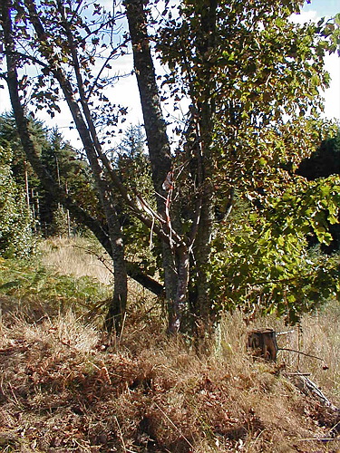
The name "Spruce Cleugh" refers to the abundance of spruce trees that can be found throughout the area. These magnificent trees, with their tall and slender trunks, add to the beauty and charm of the landscape. The valley is also home to a variety of other flora and fauna, creating a rich and diverse ecosystem.

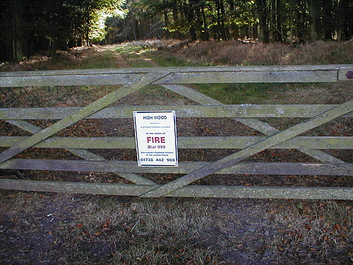
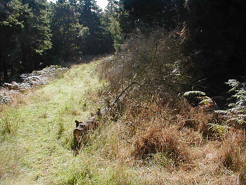
Spruce Cleugh is a popular destination for nature lovers and outdoor enthusiasts. The valley is crisscrossed by numerous walking trails, providing ample opportunities for hiking and exploring. The paths wind through dense forests, open meadows, and babbling brooks, offering breathtaking views at every turn.

In addition to its natural beauty, Spruce Cleugh is also known for its historical significance. The valley is dotted with ancient ruins and archaeological sites, which serve as a testament to the area's rich past. Visitors can discover the remnants of old settlements, stone circles, and even a medieval castle, adding a sense of mystery and intrigue to the surroundings.

Whether you are seeking a peaceful retreat in nature, an adventure in the great outdoors, or an opportunity to delve into history, Spruce Cleugh in East Lothian is a destination that has it all.

If you have any feedback on the listing, please let us know in the comments section below.

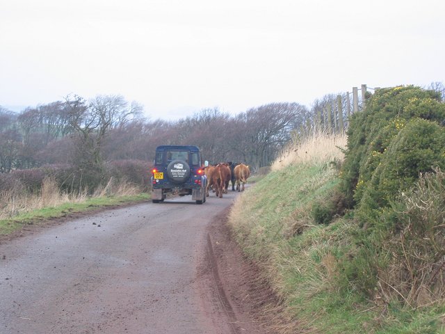
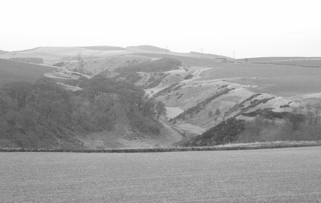
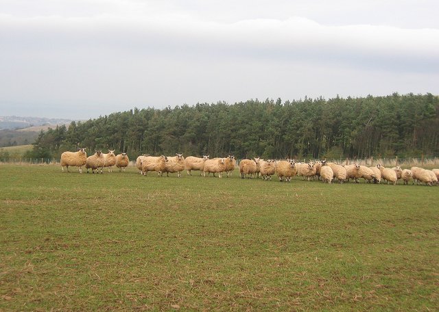
Spruce Cleugh Images

Images are sourced within 2km of 55.948235/-2.5182876 or Grid Reference NT6772. Thanks to Geograph Open Source API. All images are credited.

Ford near The Brunt The first of two fords on a windy road between Innerwick and Spott. The streams are culverted so the fords are usually dry.
Ford near The Brunt
The first of two fords on a windy road between Innerwick and Spott. The streams are culverted so the fords are usually dry.
Woodhall Dean Nature reserve managed by the Scottish Wildlife Trust.
Woodhall Dean
Nature reserve managed by the Scottish Wildlife Trust.
Oak wood Oak trees at Woodhall Dean.
Oak wood
Oak trees at Woodhall Dean.
Newly planted field The trees are in the square to the north.
Newly planted field
The trees are in the square to the north.
Oak tree on cliff In Woodhall Dean.  The cliff, on one side of a short ravine has probably been created by an old river.
Oak tree on cliff
In Woodhall Dean. The cliff, on one side of a short ravine has probably been created by an old river.
Field margin, Spott. Near West Mains, some of the wall around Spott House. View NE
Field margin, Spott.
Near West Mains, some of the wall around Spott House. View NE
Driving, The Brunt. Cattle being driven down to Spott Home Farm along the Brunt Road.
Driving, The Brunt.
Cattle being driven down to Spott Home Farm along the Brunt Road.
A cleugh under the Brunt. Steep sided glen behind the Brunt. View W towards Deucharie Dod.
A cleugh under the Brunt.
Steep sided glen behind the Brunt. View W towards Deucharie Dod.
Oak Wood. Wood at the Brunt, marked by the OS as simply "Oak Wood", pheasant rearing stuff in there and obvious signs of coppicing.
Oak Wood.
Wood at the Brunt, marked by the OS as simply "Oak Wood", pheasant rearing stuff in there and obvious signs of coppicing.
Brunt Hill. Windswept sheep on Brunt Hill. It was blowing a gale, and I was glad to get through the shelterbelt in the background for a rest from the battering.
Brunt Hill.
Windswept sheep on Brunt Hill. It was blowing a gale, and I was glad to get through the shelterbelt in the background for a rest from the battering.
Brunt Hill The summit. (225m)
Brunt Hill
The summit. (225m)
Valley of the Dry Burn An old glacial overflow channel on the north side of the Lammermuir Hills. Torness Power Station in the background.
Valley of the Dry Burn
An old glacial overflow channel on the north side of the Lammermuir Hills. Torness Power Station in the background.
Windblown tree Wind blown tree at the edge of the High Wood. It has fallen across a wee stream gulley.
Windblown tree
Wind blown tree at the edge of the High Wood. It has fallen across a wee stream gulley.
Gate into the High Wood Gate into the High Wood
Gate into the High Wood
Turbine Blade A wind turbine blade for the wind farm at Crystal Rigg being delivered. The roads had to be widened to allow the lorries to come up.
Turbine Blade
A wind turbine blade for the wind farm at Crystal Rigg being delivered. The roads had to be widened to allow the lorries to come up.
High Wood On the lower track through the High Wood. Not sure why this tree had been marked. Some of this area is now felled.
High Wood
On the lower track through the High Wood. Not sure why this tree had been marked. Some of this area is now felled.
Woodland Path Path through the High Wood. is wood is a mix of old deciduous and newer coniferous trees
Woodland Path
Path through the High Wood. is wood is a mix of old deciduous and newer coniferous trees
Moor beside High Wood Looking up along the edge of High Wood, with swathes of bracken across the moor. The children in the photo are doing a challenge walk.
Moor beside High Wood
Looking up along the edge of High Wood, with swathes of bracken across the moor. The children in the photo are doing a challenge walk.
Show me another place!

Spruce Cleugh is located at Grid Ref: NT6772 (Lat: 55.948235, Lng: -2.5182876)

Unitary Authority: East Lothian

Police Authority: The Lothians and Scottish Borders

What 3 Words

///quicksand.spearhead.formed. Near Dunbar, East Lothian

Nearby Locations

Spruce Cleugh

Related Wikis

Spott, East Lothian

Spott is a small village on the eastern fringes of East Lothian in Scotland, just over 2 miles (3.2 km) south-west of Dunbar. The village straddles an...

Battle of Dunbar (1296)

The Battle of Dunbar was the only significant field action of the campaign of 1296 during the beginning of the First War of Scottish Independence. ��2...

Innerwick

Innerwick (Scottish Gaelic: Inbhir Mhuice) is a coastal civil parish and small village, which lies in the east of East Lothian, five miles (eight kilometres...

Battle of Dunbar (1650)

The Battle of Dunbar was fought between the English New Model Army, under Oliver Cromwell, and a Scottish army commanded by David Leslie on 3 September...

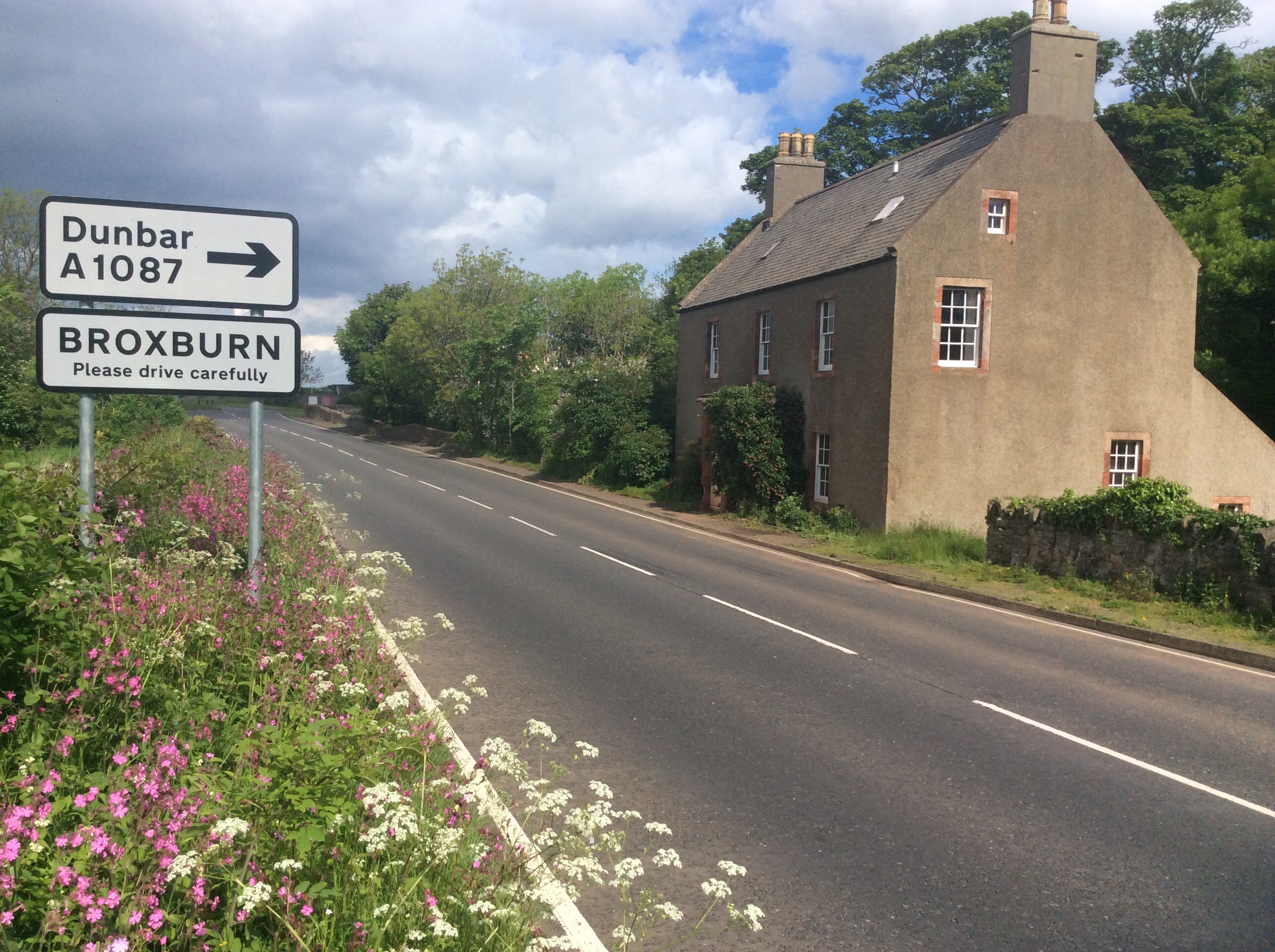
Broxburn, East Lothian

Broxburn is a hamlet consisting of a handful of scattered houses which serve the Broxmouth estate in East Lothian, Scotland. It is named after the stream...

Pressmennan Lake

Pressmennan Lake is a lake in East Lothian in Scotland. It is an artificial reservoir constructed in 1819 by a Mr Nesbit who dammed the streams flowing...
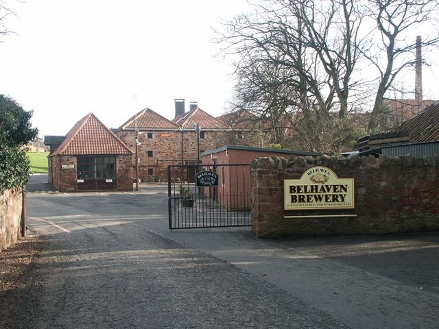
Belhaven Brewery

Belhaven Brewery is a brewery based in Belhaven, Scotland. The brewery dates from 1719, at least; by 2005 it had become the largest and oldest surviving...
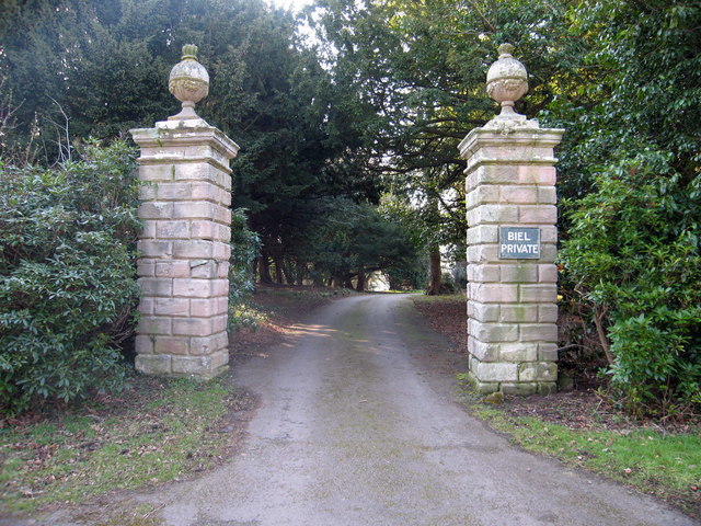
Biel, East Lothian

Biel is a village in East Lothian, Scotland, UK, to the south of Dunbar, off the B6370 road. It is situated on the Biel Estate, close to Biel House....

Nearby Amenities

Located within 500m of 55.948235,-2.5182876
Power: tower
Source: bing
Lat/Long: 55.9525765/-2.5187257
Bench
Lat/Long: 55.9463943/-2.5157404
The data included in this document is from www.openstreetmap.org. The data is made available under ODbL.

Have you been to Spruce Cleugh?

Leave your review of Spruce Cleugh below (or comments, questions and feedback).