Littledale

Valley in Cumberland Eden

England

Littledale

Grazing land near Kirkland Grazing land near Kirkland, the track leads to Cross Fell.
Grazing land near Kirkland Credit: Colin Kinnear

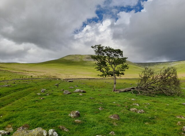
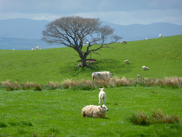
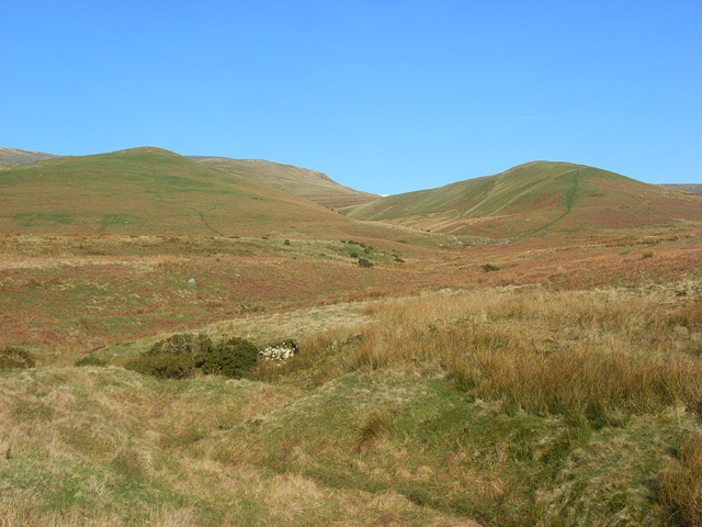
Littledale is a picturesque valley located in Cumberland, a historical county in the northwest of England. Situated amidst the rugged beauty of the Lake District National Park, Littledale offers a serene and tranquil environment for visitors and locals alike.

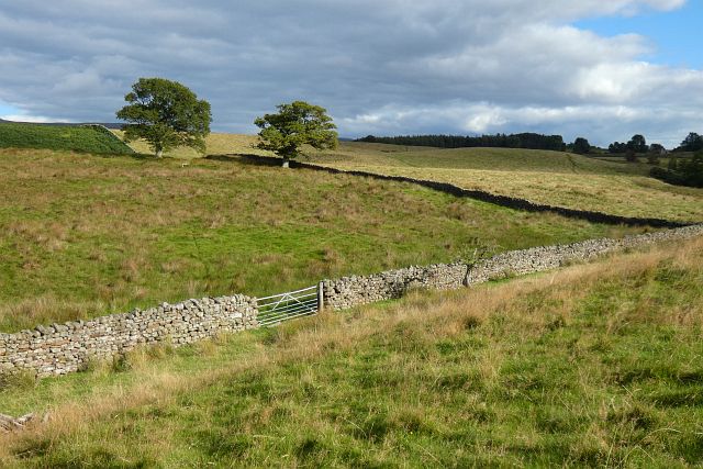
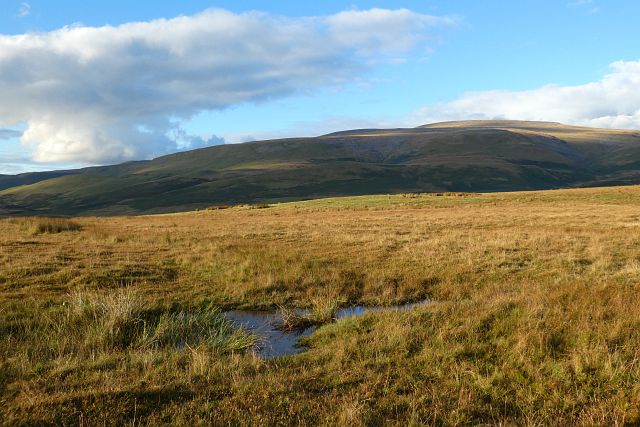
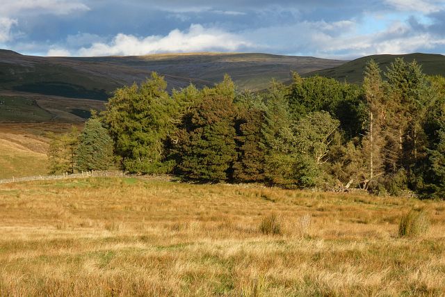
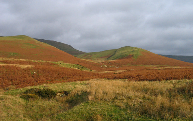
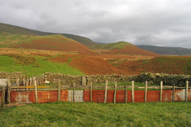
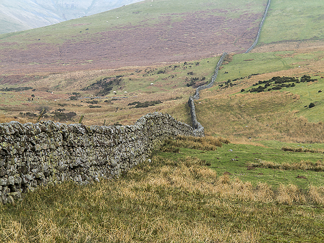
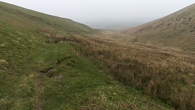
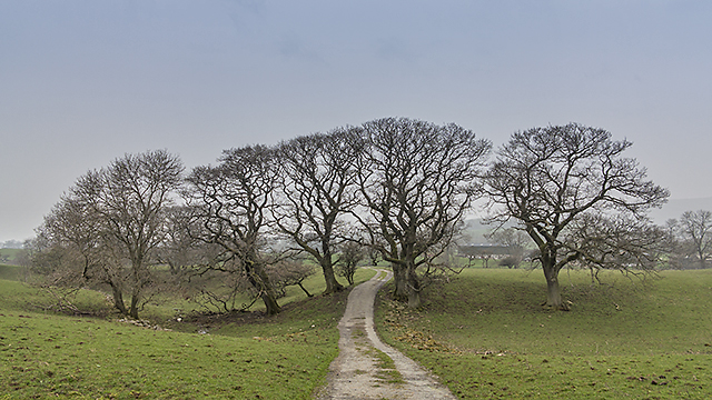
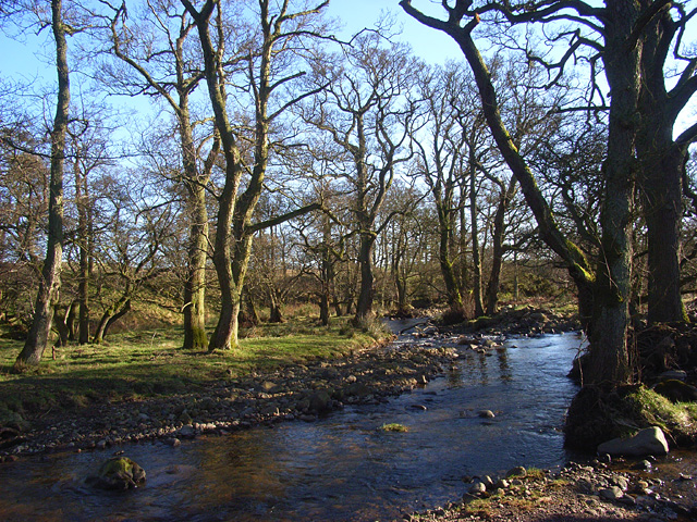
Nestled between rolling hills and surrounded by lush greenery, Littledale is renowned for its unspoiled natural landscapes. The valley is traversed by the River Derwent, which meanders through the heart of the region, providing stunning views and opportunities for water-based activities such as fishing and boating.

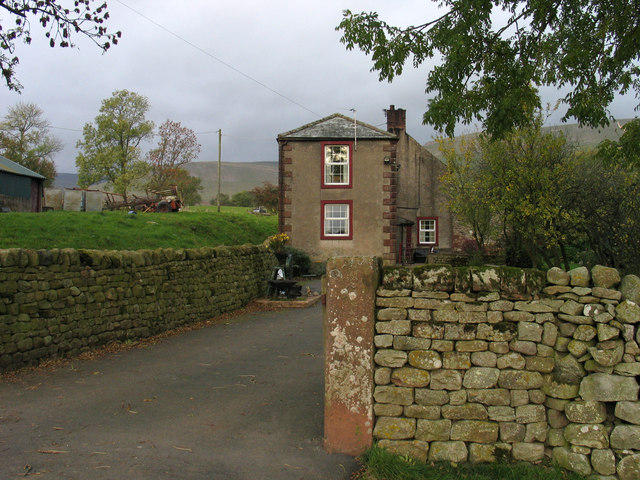
The area is predominantly rural, with scattered farmhouses and quaint cottages dotting the landscape. The village of Littledale itself is small but charming, with a handful of traditional stone buildings and a cozy pub where visitors can unwind and enjoy the warm hospitality of the locals.

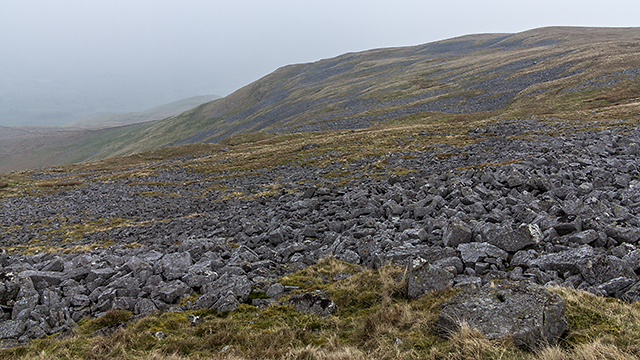
Outdoor enthusiasts are drawn to Littledale for its excellent hiking and walking trails that cater to all abilities. The surrounding fells and mountains offer breathtaking vistas, with popular routes including the ascent of Skiddaw and the picturesque Catbells.

Littledale's proximity to the Lake District also means that visitors have easy access to a wealth of attractions and amenities, including the bustling market town of Keswick, renowned for its theaters, museums, and lively festivals.

In summary, Littledale, Cumberland is a hidden gem in the heart of the Lake District, offering a peaceful retreat for nature lovers and those seeking a break from the hustle and bustle of city life. With its stunning landscapes, charming villages, and excellent outdoor pursuits, Littledale is a true haven for anyone seeking solace in the beauty of the English countryside.

If you have any feedback on the listing, please let us know in the comments section below.

Littledale Images

Images are sourced within 2km of 54.682346/-2.5126664 or Grid Reference NY6732. Thanks to Geograph Open Source API. All images are credited.

Grazing land near Kirkland Grazing land near Kirkland, the track leads to Cross Fell.
Grazing land near Kirkland
Grazing land near Kirkland, the track leads to Cross Fell.
Pasture, Milburn Viewed from just outside of the access land crossed by the footpath south of Wythwaite.
Pasture, Milburn
Viewed from just outside of the access land crossed by the footpath south of Wythwaite.
Moorland, Milburn On Red Carle with Cross Fell in the background.
Moorland, Milburn
On Red Carle with Cross Fell in the background.
Wood and moorland, Milburn The north-western edge of Hill Plantation is seen from Red Carle.
Wood and moorland, Milburn
The north-western edge of Hill Plantation is seen from Red Carle.
Moorland, Milburn From the north-western shoulder of Burney Hill, Cross Fell and intervening slopes are caught in late sunshine.
Moorland, Milburn
From the north-western shoulder of Burney Hill, Cross Fell and intervening slopes are caught in late sunshine.
Valley of Littledale Beck Grumply Hill lies to the right of the valley of Littledale; the green line of the bridleway descending the hill can be seen.
Valley of Littledale Beck
Grumply Hill lies to the right of the valley of Littledale; the green line of the bridleway descending the hill can be seen.
Sheep pens at foot of Littledale Littledale is the valley descending through the centre of the image where Grumply Hill lies to the right. The main slope above is the south-western flank of Cross Fell.
Sheep pens at foot of Littledale
Littledale is the valley descending through the centre of the image where Grumply Hill lies to the right. The main slope above is the south-western flank of Cross Fell.
Baron's Hill Baron's Hill lies close to the small settlement of Kirkland at the western foot of Cross Fell.
Baron's Hill
Baron's Hill lies close to the small settlement of Kirkland at the western foot of Cross Fell.
Wildboar Scar A view along Wildboar Scar from the path which leads from Wythwaite to the coll between Cross Fell and Little Dun Fell.
Wildboar Scar
A view along Wildboar Scar from the path which leads from Wythwaite to the coll between Cross Fell and Little Dun Fell.
Drystone wall near Kirkland Beck A drystone wall on the lower slopes of Wildboar Nook. Cloud and smog have blanketed much of the UK when this image was taken, limiting visibility. Land use here is predominantly agricultural.
Drystone wall near Kirkland Beck
A drystone wall on the lower slopes of Wildboar Nook. Cloud and smog have blanketed much of the UK when this image was taken, limiting visibility. Land use here is predominantly agricultural.
Path north west of Grumply Hill A path above Littledale Beck skirting the north west flank of Grumply Hill - this leads from Wythwaite to the coll between Little Dun Fell and Cross Fell.
Path north west of Grumply Hill
A path above Littledale Beck skirting the north west flank of Grumply Hill - this leads from Wythwaite to the coll between Little Dun Fell and Cross Fell.
Path near Wythwaite A path leading from Wythwaite to Kirkland, viewed here south of the farm at Ranbeck.
Path near Wythwaite
A path leading from Wythwaite to Kirkland, viewed here south of the farm at Ranbeck.
Farmland at Littledale Rough pasture at Littledale, with the remains of last year's bracken growth much in evidence. Low cloud and smog has covered much of the UK when this image was taken, limiting visibility.
Farmland at Littledale
Rough pasture at Littledale, with the remains of last year's bracken growth much in evidence. Low cloud and smog has covered much of the UK when this image was taken, limiting visibility.
Crowdundle Beck and woodland, Milburn Where it is crossed by the footpath between Kirkland and Milburn
Crowdundle Beck and woodland, Milburn
Where it is crossed by the footpath between Kirkland and Milburn
Pasture, Kirkland, Culgaith The eastern fells of the Lake District are in the background.
Pasture, Kirkland, Culgaith
The eastern fells of the Lake District are in the background.
Littledale. Kirkland, Culgaith The low hill to the right is Grumply Hill with Wild Boar Scar rising to its left.
Littledale. Kirkland, Culgaith
The low hill to the right is Grumply Hill with Wild Boar Scar rising to its left.
Kirkdale, Kirkland, Culgaith The upper part of the valley of Kirkland Beck on Cross Fell's western flank.
Kirkdale, Kirkland, Culgaith
The upper part of the valley of Kirkland Beck on Cross Fell's western flank.
Mudgill Sike, Milburn Snow-capped Cross Fell is in the background.
Mudgill Sike, Milburn
Snow-capped Cross Fell is in the background.
Show me another place!

Littledale is located at Grid Ref: NY6732 (Lat: 54.682346, Lng: -2.5126664)

Administrative County: Cumbria

District: Eden

Police Authority: Cumbria

What 3 Words

///shippers.shed.funnels. Near Appleby-in-Westmorland, Cumbria

Nearby Locations

Littledale

Related Wikis

Kirkland, Culgaith

Kirkland is a village in the Eden district of the English county of Cumbria. It is in the historic county of Cumberland. There is a fell called Kirkland...

Cross Fell

Cross Fell is the highest mountain in the Pennines of Northern England and the highest point in England outside the Lake District. It is located in the...

Milburn, Cumbria

Milburn is a small village and civil parish in the Eden district of Cumbria, England. It is located on the northern side of the Eden Valley, about 9 miles...

Blencarn

Blencarn is a small village located in the Eden District of Cumbria, England. The village is situated at the foot of the Pennines. In Blencarn there is...

Nearby Amenities

Located within 500m of 54.682346,-2.5126664
Ele: 412.1
Man Made: survey_point
Source: NPE
Lat/Long: 54.6806212/-2.5098698
Moray Hill
Ele: 390
Natural: peak
Lat/Long: 54.6833815/-2.5160292
Grumply Hill
Ele: 412.1
Natural: peak
Source: NPE
Lat/Long: 54.680572/-2.5098702
Ford: yes
Lat/Long: 54.6855153/-2.516617
Littledale
Place: locality
Lat/Long: 54.6827868/-2.5127145
The data included in this document is from www.openstreetmap.org. The data is made available under ODbL.

Have you been to Littledale?

Leave your review of Littledale below (or comments, questions and feedback).