Horsepool Bottom

Valley in Gloucestershire Forest of Dean

England

Horsepool Bottom

Jubilee Road, Mitcheldean Looking north towards Plump Hill.
Jubilee Road, Mitcheldean Credit: Jonathan Billinger

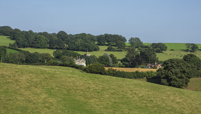
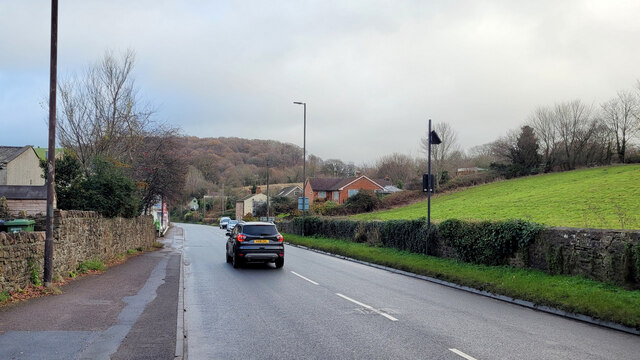
Horsepool Bottom is a picturesque valley located in the county of Gloucestershire, England. Nestled in the heart of the Cotswolds, this idyllic valley is renowned for its natural beauty and tranquil surroundings.

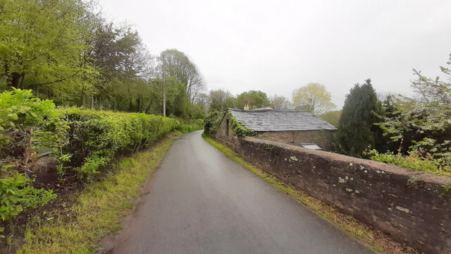
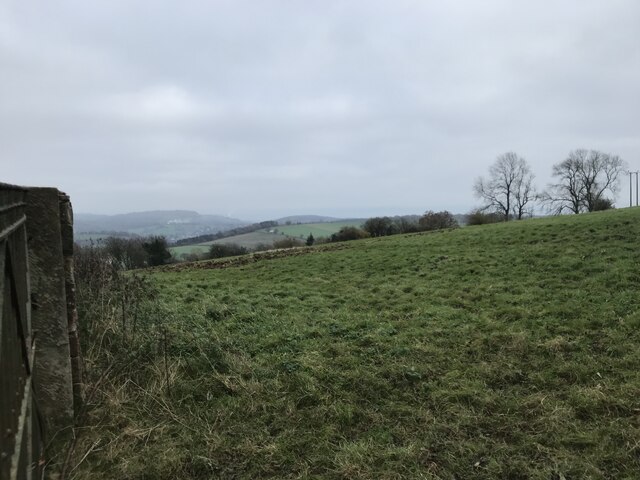
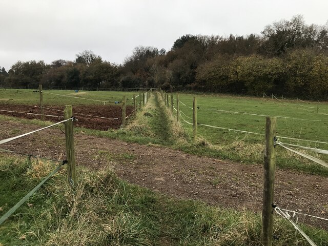
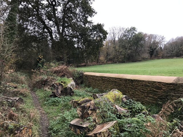
The valley is characterized by rolling hills, lush green meadows, and meandering streams that flow through the landscape. The area is dotted with traditional stone cottages and farmhouses, adding to its rustic charm. Horsepool Bottom is predominantly rural, with agriculture playing a significant role in the local economy.

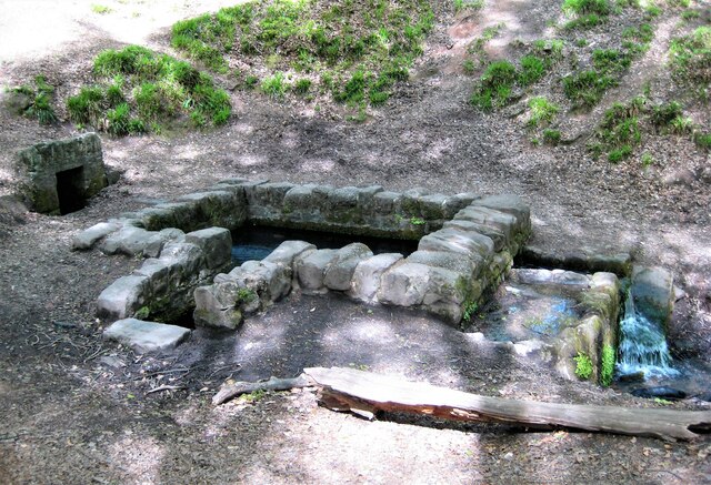
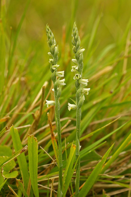
Wildlife enthusiasts will find themselves in paradise in Horsepool Bottom. The valley is home to a diverse range of flora and fauna, including rare species such as the hazel dormouse and the small blue butterfly. The surrounding woodlands provide an ideal habitat for various bird species, making it a haven for birdwatchers.

Horsepool Bottom offers numerous opportunities for outdoor activities and exploration. The valley is intersected by several walking trails, allowing visitors to immerse themselves in the stunning scenery. Hiking and cycling are popular pastimes in the area, with routes catering to all levels of fitness and ability.

For those seeking a peaceful retreat, Horsepool Bottom provides a serene and tranquil atmosphere. The valley's unspoiled beauty and unassuming charm make it an ideal destination for nature lovers and those looking to escape the hustle and bustle of city life.

In summary, Horsepool Bottom in Gloucestershire is a hidden gem in the Cotswolds, offering a perfect blend of natural beauty, wildlife, and outdoor activities. Whether you're seeking a peaceful retreat or an adventure in nature, this valley has something to offer everyone.

If you have any feedback on the listing, please let us know in the comments section below.

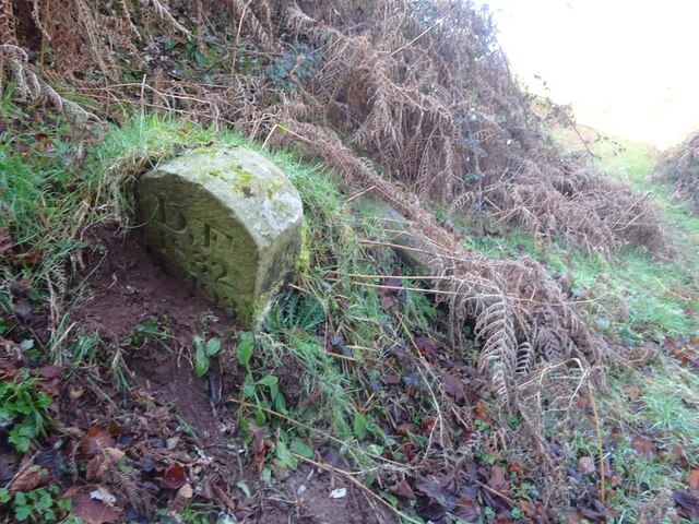
Horsepool Bottom Images

Images are sourced within 2km of 51.845724/-2.4839553 or Grid Reference SO6616. Thanks to Geograph Open Source API. All images are credited.

Jubilee Road, Mitcheldean Looking north towards Plump Hill.
Jubilee Road, Mitcheldean
Looking north towards Plump Hill.
View towards Abenhall Looking east from Jubilee Road with the tower of Abenhall church visible in the late afternoon sunshine.
View towards Abenhall
Looking east from Jubilee Road with the tower of Abenhall church visible in the late afternoon sunshine.
St Anthony's Well Image of the historic well in woodland North-west of Flaxley.
St Anthony's Well
Image of the historic well in woodland North-west of Flaxley.
Grassy hillside
Grassy hillside
Between paddocks
Between paddocks
Overgrown pathway
Overgrown pathway
Repaired wall
Repaired wall
A4136 Gloucester Road, Mitcheldean A Sunday morning in December.
A4136 Gloucester Road, Mitcheldean
A Sunday morning in December.
Machinery in the woods Various pieces of equipment litter the woodland at the end of Jubilee Lane.
Machinery in the woods
Various pieces of equipment litter the woodland at the end of Jubilee Lane.
Toll House, Gloucester Road A Toll House, now an extension of Forest House. At the junction of Gloucester Road, Merrin Street, New Road and Abbenhall Road. Served Huntley and Mitcheldean Turnpike Trust.
In the wall next to the lamppost is the milestone see <a href="https://www.geograph.org.uk/photo/6035328">SO6618 : Old Milestone by the A4136, Gloucester Road, Mitcheldean</a>. Gloucestershire HER Nᴼ. 5863 see <span class="nowrap"><a title="https://www.heritagegateway.org.uk/Gateway/Results_Single.aspx?uid=5863&resourceID=108" rel="nofollow ugc noopener" href="https://www.heritagegateway.org.uk/Gateway/Results_Single.aspx?uid=5863&resourceID=108">Link</a><img style="margin-left:2px;" alt="External link" title="External link - shift click to open in new window" src="https://s1.geograph.org.uk/img/external.png" width="10" height="10"/></span>

Milestone Society National ID: GL.MDE01
Toll House, Gloucester Road
A Toll House, now an extension of Forest House. At the junction of Gloucester Road, Merrin Street, New Road and Abbenhall Road. Served Huntley and Mitcheldean Turnpike Trust. In the wall next to the lamppost is the milestone see SO6618 : Old Milestone by the A4136, Gloucester Road, Mitcheldean. Gloucestershire HER Nᴼ. 5863 see LinkExternal link Milestone Society National ID: GL.MDE01
Toll House, A4136, Plump Hill Within the parish of Mitcheldean. The frontage was replaced in 1893 when the building was re-named Grove Cottage. The visible parts of the side and rear are clearly much older and would have been the building depicted on 1877 maps as the Plumphill Gate (TP) when it had a part of the building extending to the road. The flat roof extension is modern. Served the Huntley and Mitcheldean Turnpike Trust.

Inscription: Grove Cottage / 1893

Milestone Society National ID: GL.MIT
Toll House, A4136, Plump Hill
Within the parish of Mitcheldean. The frontage was replaced in 1893 when the building was re-named Grove Cottage. The visible parts of the side and rear are clearly much older and would have been the building depicted on 1877 maps as the Plumphill Gate (TP) when it had a part of the building extending to the road. The flat roof extension is modern. Served the Huntley and Mitcheldean Turnpike Trust. Inscription: Grove Cottage / 1893 Milestone Society National ID: GL.MIT
Boundary Stone, Shapridge An original Forest of Dean boundary stone in the garden of a modern house near Abinghall and Mitcheldean.

Inscription: D. F. / 1832 / Nᴼ. 194

Milestone Society National ID: GL_DFLIMI194em
Boundary Stone, Shapridge
An original Forest of Dean boundary stone in the garden of a modern house near Abinghall and Mitcheldean. Inscription: D. F. / 1832 / Nᴼ. 194 Milestone Society National ID: GL_DFLIMI194em
Boundary Stone, Shapridge Slowly descending the slope beside Gloucestershire footpath DMD35, just North of a gate. The slope is subsiding gently East.

Inscription: D. F. / 1832 / Nᴼ. 193

Milestone Society National ID: GL_DFLIMI193em
Boundary Stone, Shapridge
Slowly descending the slope beside Gloucestershire footpath DMD35, just North of a gate. The slope is subsiding gently East. Inscription: D. F. / 1832 / Nᴼ. 193 Milestone Society National ID: GL_DFLIMI193em
Boundary Stone, Shapridge A Forest of Dean boundary stone at the left hand end of a bridge parapet on the NE verge of the road. The coping stones of the parapet are at 91.2 m Above Sea Level.

Inscription: D. F. / 2009 / Nᴼ. 192

Milestone Society National ID: GL_DFLIMI192em
Boundary Stone, Shapridge
A Forest of Dean boundary stone at the left hand end of a bridge parapet on the NE verge of the road. The coping stones of the parapet are at 91.2 m Above Sea Level. Inscription: D. F. / 2009 / Nᴼ. 192 Milestone Society National ID: GL_DFLIMI192em
Boundary Stone, Horsepool Bottom A Forest of Dean boundary stone in a field adjacent to Jubilee Road 1km South of Mitcheldean.

Inscription: D. F / 1832 / Nᴼ. 189

Milestone Society National ID: GL_DFMITC189em
Boundary Stone, Horsepool Bottom
A Forest of Dean boundary stone in a field adjacent to Jubilee Road 1km South of Mitcheldean. Inscription: D. F / 1832 / Nᴼ. 189 Milestone Society National ID: GL_DFMITC189em
Boundary Stone, Horsepool Bottom A Forest of Dean boundary Stone just off Gloucestershire footpath DMD34, which runs NE from Jubilee Road.

Inscription: D. F / 1832 / Nᴼ. 187

Milestone Society National ID: GL_DFMITC187em
Boundary Stone, Horsepool Bottom
A Forest of Dean boundary Stone just off Gloucestershire footpath DMD34, which runs NE from Jubilee Road. Inscription: D. F / 1832 / Nᴼ. 187 Milestone Society National ID: GL_DFMITC187em
Boundary Stone, Mitcheldean Forest of Dean boundary stone in the bank of Jubilee Road, adjacent to "Groveville". The owner of the house informed it had disappeared about 2011 and returned about 2 years later when it was re-set and the inscription re-cut.

Inscription: D. F. / 1832 / Nᴼ. 184

Milestone Society National ID: GL_DFMITC184em
Boundary Stone, Mitcheldean
Forest of Dean boundary stone in the bank of Jubilee Road, adjacent to "Groveville". The owner of the house informed it had disappeared about 2011 and returned about 2 years later when it was re-set and the inscription re-cut. Inscription: D. F. / 1832 / Nᴼ. 184 Milestone Society National ID: GL_DFMITC184em
Abenhall Church The church in Abenhall, with a footpath sign in the foreground.
Abenhall Church
The church in Abenhall, with a footpath sign in the foreground.
Show me another place!

Horsepool Bottom is located at Grid Ref: SO6616 (Lat: 51.845724, Lng: -2.4839553)

Administrative County: Gloucestershire

District: Forest of Dean

Police Authority: Gloucestershire

What 3 Words

///riskiest.lifeguard.sank. Near Mitcheldean, Gloucestershire

Related Wikis

Westbury Brook Ironstone Mine

Westbury Brook Ironstone Mine (grid reference SO662166) is a 15.69-hectare (38.8-acre) biological Site of Special Scientific Interest in Gloucestershire...

Edgehills Quarry

Edgehills Quarry (grid reference SO660167) is a 0.4-hectare (0.99-acre) geological Site of Special Scientific Interest in Gloucestershire, notified in...

Gun's Mills, Flaxley

Gun's Mills, at Flaxley, in the Forest of Dean, Gloucestershire, England, was a major industrial site from the 17th century. Originally built as an armaments...

Plump Hill Dolomite Quarry

Plump Hill Dolomite Quarry (grid reference SO661171) is a 4.5-hectare (11-acre) nature reserve in Gloucestershire in the Forest of Dean.The site is managed...

Nearby Amenities

Located within 500m of 51.845724,-2.4839553
Fixme: incomplete
Lat/Long: 51.845954/-2.4887108
The data included in this document is from www.openstreetmap.org. The data is made available under ODbL.

Have you been to Horsepool Bottom?

Leave your review of Horsepool Bottom below (or comments, questions and feedback).