Cross Clough

Valley in Yorkshire Ribble Valley

England

Cross Clough

Looking up Beatrix Fell from the path
Looking up Beatrix Fell from the path Credit: shikari

Cross Clough is a picturesque valley located in Yorkshire, England. Nestled amidst the rolling hills of the Yorkshire Dales, it is known for its stunning natural beauty and tranquil atmosphere. The valley stretches for approximately 5 miles, with the River Cross running through its heart.

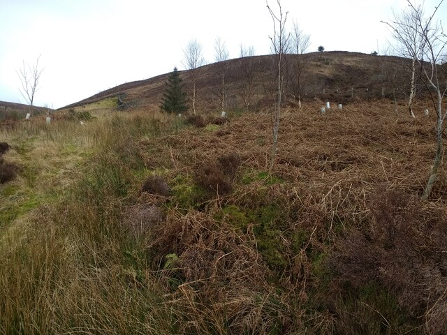
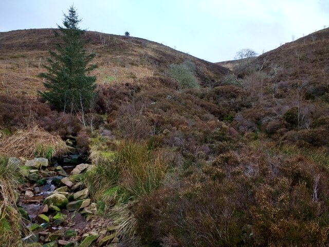
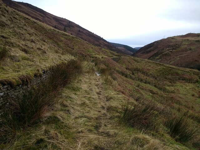
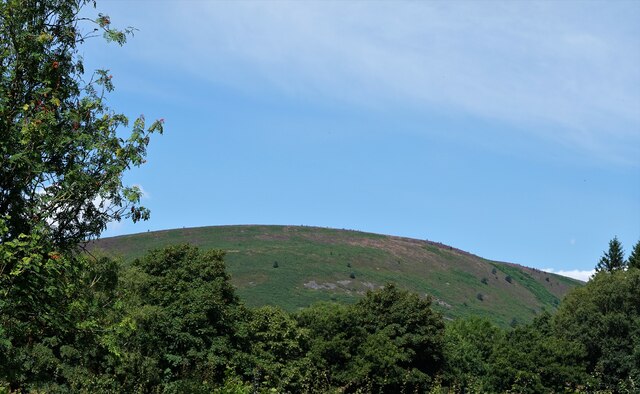
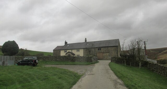
The landscape of Cross Clough is characterized by steep slopes covered in lush green vegetation, dotted with charming stone cottages and grazing sheep. The valley offers breathtaking views, with its towering cliffs and cascading waterfalls adding to its allure. Visitors can enjoy peaceful walks along the riverbank, taking in the sights and sounds of nature.

The flora and fauna of Cross Clough are diverse and abundant. The valley is home to a variety of plant species, including wildflowers, ferns, and mosses, creating a vibrant and colorful environment. Birdwatchers will delight in the array of avian species that call this valley home, such as the Eurasian wren, European goldfinch, and the common blackbird.

Cross Clough also has historical significance, with evidence of human presence dating back to ancient times. There are remnants of old settlements and stone circles, hinting at the valley's rich past. The area is steeped in folklore and legends, adding an air of mystique to its already captivating atmosphere.

Overall, Cross Clough is a hidden gem in Yorkshire, offering visitors a chance to escape the hustle and bustle of modern life and immerse themselves in the tranquility of nature. Whether it's for a leisurely stroll, wildlife spotting, or simply soaking in the breathtaking views, Cross Clough is a must-visit destination for nature enthusiasts and those seeking a peaceful retreat.

If you have any feedback on the listing, please let us know in the comments section below.

Cross Clough Images

Images are sourced within 2km of 53.969649/-2.5264669 or Grid Reference SD6552. Thanks to Geograph Open Source API. All images are credited.

Looking up Beatrix Fell from the path
Stony Clough from the path
Looking south along the path The retaining wall on the left holds a water pipeline
Looking south along the path
The retaining wall on the left holds a water pipeline
View down the Brennand Valley from the aqueduct near Well Springs Clough intake
Staple Oak Fell From the car park at Dunsop Bridge.
Staple Oak Fell
From the car park at Dunsop Bridge.
The River Dunsop. Scenic walk alongside the river.
The River Dunsop.
Scenic walk alongside the river.
Track below Calder Moor Breast Heading up the Dunsop valley.
Track below Calder Moor Breast
Heading up the Dunsop valley.
Footbridge across the River Dunsop. Heading for rougher ground.
Footbridge across the River Dunsop.
Heading for rougher ground.
Brennand Farm Remote farmstead high in the hills.
Brennand Farm
Remote farmstead high in the hills.
Track to Lower Brennand Heading back to Dunsop Bridge.
Track to Lower Brennand
Heading back to Dunsop Bridge.
Footbridge over the River Dunsop The bridge offers a dry alternative to the ford <a href="https://www.geograph.org.uk/photo/4903255">SD6550 : Ford for horses across the River Dunsop</a> for walkers.
Footbridge over the River Dunsop
The bridge offers a dry alternative to the ford SD6550 : Ford for horses across the River Dunsop for walkers.
Ford for horses across the River Dunsop The footbridge at this point <a href="https://www.geograph.org.uk/photo/4903253">SD6550 : Footbridge over the River Dunsop</a> is too narrow for horses, so they have to use the ford.
Ford for horses across the River Dunsop
The footbridge at this point SD6550 : Footbridge over the River Dunsop is too narrow for horses, so they have to use the ford.
Clear felled area, Staple Oak Fell Forestry operations had recently cleared a large area at the south of this conifer plantation on the eastern slope of the fell.
Clear felled area, Staple Oak Fell
Forestry operations had recently cleared a large area at the south of this conifer plantation on the eastern slope of the fell.
Marshy area in the Dunsop Valley One large tree (some type of willow?) growing in an area of marsh within the Dunsop flood plain.
Marshy area in the Dunsop Valley
One large tree (some type of willow?) growing in an area of marsh within the Dunsop flood plain.
Last perches standing A handful of tree trunks have been left standing, mostly stripped of their branches, in an area of otherwise cleared conifer plantation.  Birds had found a perch in the tops of two of them.
Last perches standing
A handful of tree trunks have been left standing, mostly stripped of their branches, in an area of otherwise cleared conifer plantation. Birds had found a perch in the tops of two of them.
New planting near Bishop's House While the area around it had been cleared of trees, this field immediately behind the house <a href="https://www.geograph.org.uk/photo/2805976">SD6551 : Bishops House, Dunsop Bridge</a> had been recently planted.
New planting near Bishop's House
While the area around it had been cleared of trees, this field immediately behind the house SD6551 : Bishops House, Dunsop Bridge had been recently planted.
Logpiles near Bishop's House Timber from recent felling operations <a href="https://www.geograph.org.uk/photo/4903262">SD6551 : Clear felled area, Staple Oak Fell</a> stockpiled near the road ready for transporting out of the area.
Logpiles near Bishop's House
Timber from recent felling operations SD6551 : Clear felled area, Staple Oak Fell stockpiled near the road ready for transporting out of the area.
Cleared plantation on the western slope of Beatrix Fell Viewed from the bottom of the Dunsop Valley.
Cleared plantation on the western slope of Beatrix Fell
Viewed from the bottom of the Dunsop Valley.
Show me another place!

Cross Clough is located at Grid Ref: SD6552 (Lat: 53.969649, Lng: -2.5264669)

Division: West Riding

Administrative County: Lancashire

District: Ribble Valley

Police Authority: Lancashire

What 3 Words

///sobbed.encourage.little. Near Waddington, Lancashire

Nearby Locations

Cross Clough

Related Wikis

Sykes Smelt Mill

Sykes Smelt Mill was a mediaeval mill located between Sykes and Hareden in Bowland Forest High, Lancashire, England. It stood on the banks of Langden Brook...

Bowland Forest High

Bowland Forest High is a civil parish in the Ribble Valley district of Lancashire, England, covering some 20,000 acres (80 km2) of the Forest of Bowland...

Dunsop Bridge

Dunsop Bridge is a village in the civil parish of Bowland Forest High, in the borough of Ribble Valley, Lancashire, England, 9 miles (14 km) north-west...

Dunsop Bridge (structure)

Dunsop Bridge is a bridge in the English village of the same name. The structure, which dates to the early 19th century, crosses the River Dunsop. A Grade...

Nearby Amenities

Located within 500m of 53.969649,-2.5264669
Waterway: weir
Lat/Long: 53.9731972/-2.5306943
Waterway: weir
Lat/Long: 53.970951/-2.5306087
Waterway: weir
Lat/Long: 53.9708547/-2.5305893
Waterway: weir
Lat/Long: 53.9707464/-2.5305813
Waterway: weir
Lat/Long: 53.9730615/-2.5307114
Waterway: weir
Lat/Long: 53.9733154/-2.5306839
Board Type: hiking
Information: board
Tourism: information
Lat/Long: 53.9709447/-2.5312903
Man Made: manhole
Manhole: water
Lat/Long: 53.9710303/-2.5308783
Footholme Borehole
Pipeline: borehole
Lat/Long: 53.9708669/-2.5308595
Power: pole
Lat/Long: 53.9706612/-2.5308783
The data included in this document is from www.openstreetmap.org. The data is made available under ODbL.

Have you been to Cross Clough?

Leave your review of Cross Clough below (or comments, questions and feedback).