Relton's Cleugh

Valley in Northumberland

England

Relton's Cleugh

Moorland, Knaresdale
Moorland, Knaresdale Credit: Andrew Smith

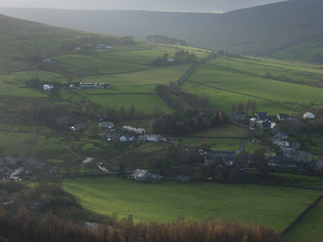
Relton's Cleugh is a picturesque valley located in Northumberland, England. Situated in the northern part of the county, this valley offers breathtaking natural beauty and a tranquil atmosphere. It is a popular destination for hikers, nature enthusiasts, and those seeking a peaceful retreat away from the hustle and bustle of city life.

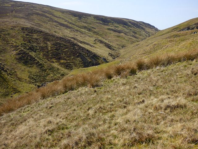
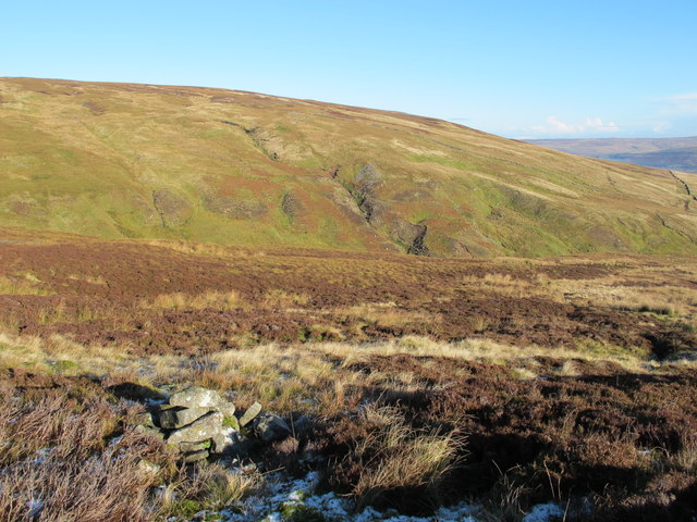
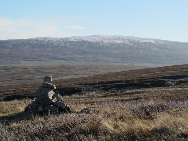
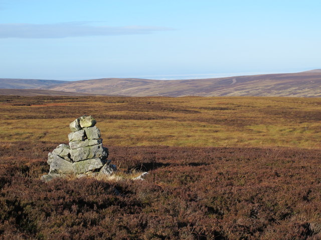
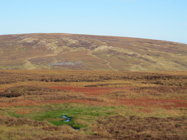
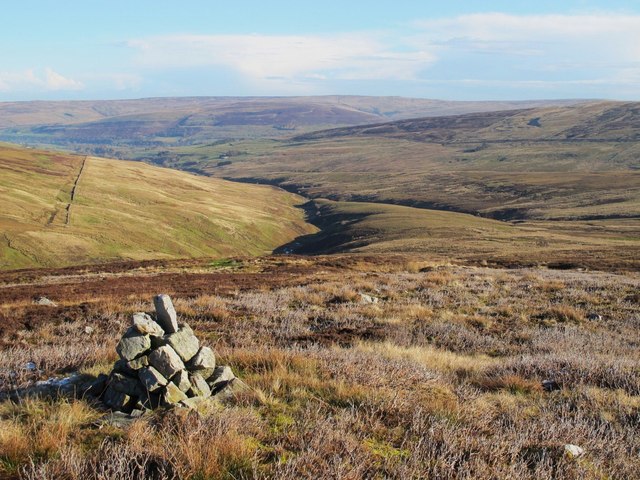
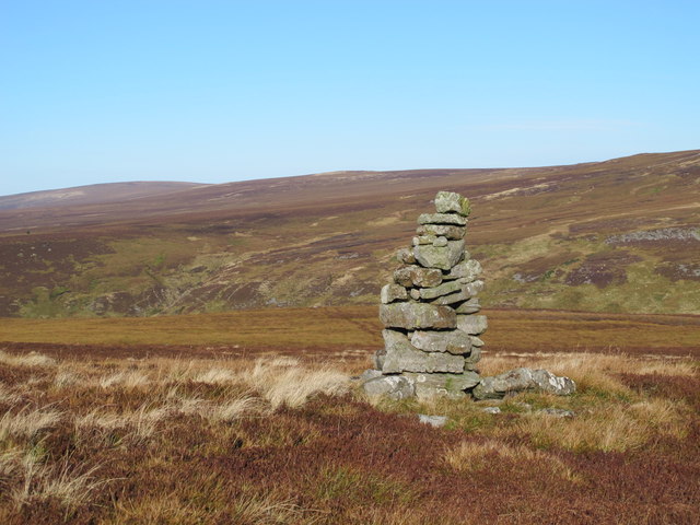
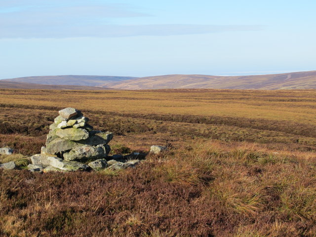
The valley is characterized by its rolling hills, lush green meadows, and meandering streams. It is home to a diverse range of flora and fauna, including wildflowers, ferns, and various bird species. The landscape is dotted with ancient trees and rock formations, adding to the area's charm and beauty.

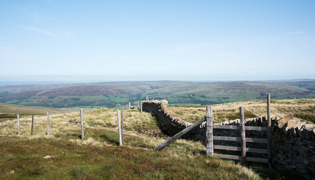
Relton's Cleugh is crisscrossed by a network of walking trails, allowing visitors to explore the valley at their own pace. These paths offer stunning views of the surrounding countryside and provide opportunities for spotting wildlife along the way. The valley is also known for its numerous waterfalls, which cascade down from the hillsides, creating a peaceful and soothing atmosphere.

The area has a rich history, with evidence of human settlement dating back thousands of years. Archaeological sites, including ancient stone circles and burial mounds, can be found within the valley, providing a glimpse into the lives of past inhabitants.

Overall, Relton's Cleugh is a hidden gem in Northumberland, offering a tranquil escape and an opportunity to connect with nature. Whether it's a leisurely walk, birdwatching, or simply enjoying the serene surroundings, this valley has something to offer for everyone.

If you have any feedback on the listing, please let us know in the comments section below.

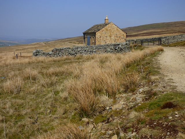
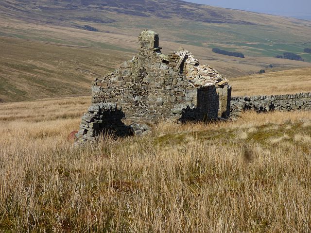
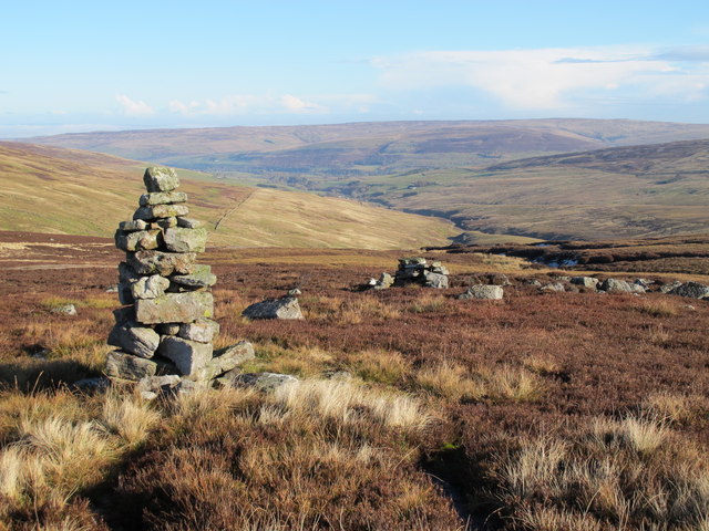
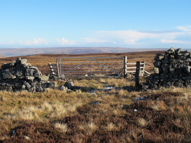
Relton's Cleugh Images

Images are sourced within 2km of 54.83266/-2.5508431 or Grid Reference NY6448. Thanks to Geograph Open Source API. All images are credited.

Moorland, Knaresdale
De Havilland Venom WR557 Wreckage of De Havilland Venom
This plane crashed on 4th March 1957. Sadly the pilot Flight Lieutenant W.F. Marshall died in the crash. The aircraft had taken off from RAF Silloth. Wing NO WR557.
De Havilland Venom WR557
Wreckage of De Havilland Venom This plane crashed on 4th March 1957. Sadly the pilot Flight Lieutenant W.F. Marshall died in the crash. The aircraft had taken off from RAF Silloth. Wing NO WR557.
De Havilland Venom WR557 Wreckage of De Havilland Venom Farlam Curric, Crogin Fell
De Havilland Venom WR557
Wreckage of De Havilland Venom Farlam Curric, Crogin Fell
Junction of wall and fence north of Grey Nag The junction is along the north ridge of Grey Nag. The near fence seems to be a replacement of a stretch of wall that has been removed; a few remaining stones can be seen beyond the fence posts.
The distant moorland is on the east side of the valley of the River South Tyne.
Junction of wall and fence north of Grey Nag
The junction is along the north ridge of Grey Nag. The near fence seems to be a replacement of a stretch of wall that has been removed; a few remaining stones can be seen beyond the fence posts. The distant moorland is on the east side of the valley of the River South Tyne.
Pillar of peat on north ridge of Grey Nag Peat banks with a broad, separate pillar lying to the east of the ridge crest, north of the top of Grey Nag.
Whitfield Moor and Ayle Common are in the distance.
Pillar of peat on north ridge of Grey Nag
Peat banks with a broad, separate pillar lying to the east of the ridge crest, north of the top of Grey Nag. Whitfield Moor and Ayle Common are in the distance.
Shooters' hut, Knaresdale A more solid replacement of the structure seen in <a title="https://www.geograph.org.uk/photo/1896590" href="https://www.geograph.org.uk/photo/1896590">Link</a> .
Shooters' hut, Knaresdale
A more solid replacement of the structure seen in Link .
High Shield, Knaresdale The hut is seen in a more ruinous state than in, for example, <a title="https://www.geograph.org.uk/photo/608140" href="https://www.geograph.org.uk/photo/608140">Link</a> and <a title="https://www.geograph.org.uk/photo/1896661" href="https://www.geograph.org.uk/photo/1896661">Link</a> .
High Shield, Knaresdale
The hut is seen in a more ruinous state than in, for example, Link and Link .
Moorland, Knaresdale The northern ridge of Grey Nag.
Moorland, Knaresdale
The northern ridge of Grey Nag.
Currick on Gilling Brigg Looking roughly NE down the valley of Gelt Burn towards the valley of the River South Tyne around Slaggyford with Williamston Common beyond.
Currick on Gilling Brigg
Looking roughly NE down the valley of Gelt Burn towards the valley of the River South Tyne around Slaggyford with Williamston Common beyond.
Gillingbrigg Gate On the Northumberland/Cumbria border "ridge" NNW of Broad Mea.
Gillingbrigg Gate
On the Northumberland/Cumbria border "ridge" NNW of Broad Mea.
Currick on Gilling Brigg Looking towards the cleugh of Michaelly Sike running up the steep hillside below Three Pikes.
Currick on Gilling Brigg
Looking towards the cleugh of Michaelly Sike running up the steep hillside below Three Pikes.
Currick on Gilling Brigg Looking across the cleughs of Scythesand Sike and Knar Burn towards a snow-covered Grey Nag in <a href="https://www.geograph.org.uk/gridref/NY6647">NY6647</a>.
Currick on Gilling Brigg
Looking across the cleughs of Scythesand Sike and Knar Burn towards a snow-covered Grey Nag in NY6647.
Currick near Gillingbrigg Gate Looking across the cleugh of New Water towards Middle Top (half left) on the ridge above Geltsdale Middle.
Currick near Gillingbrigg Gate
Looking across the cleugh of New Water towards Middle Top (half left) on the ridge above Geltsdale Middle.
Gilling Brigg Looking NNE across the cleugh of Gelt Burn towards Three Pikes.
Gilling Brigg
Looking NNE across the cleugh of Gelt Burn towards Three Pikes.
Gilling Brigg above Guy's Middle
Gilling Brigg above the cleugh of Gelt Burn
Gilling Brigg above Butt Hill Looking across the cleugh of New Water towards Middle Top in <a href="https://www.geograph.org.uk/gridref/NY5952">NY5952</a>.
Gilling Brigg above Butt Hill
Looking across the cleugh of New Water towards Middle Top in NY5952.
Show me another place!

Relton's Cleugh is located at Grid Ref: NY6448 (Lat: 54.83266, Lng: -2.5508431)

Unitary Authority: Northumberland

Police Authority: Northumbria

What 3 Words

///torn.teaching.nourished. Near Alston, Cumbria

Nearby Locations

Broad Mea Relton's Cleugh

Related Wikis

Aules Hill Meadows

Aules Hill Meadows is the name given to a Site of Special Scientific Interest (SSSI) in Northumberland, England. The site, listed since 1992, is a set...

Black Fell (Pennines)

Black Fell is a hill in the North Pennines, England. It is located just north of the A686 road, west of Alston and is one of the most northerly parts of...

Slaggyford railway station

Slaggyford was a railway station on the Alston Line, which ran between Haltwhistle and Alston. The station served the village of Slaggyford in Northumberland...

Slaggyford

Slaggyford is a village in the civil parish of Knaresdale with Kirkhaugh, in Northumberland, England about 5 miles (8 km) north of Alston, Cumbria. It...

Nearby Amenities

Located within 500m of 54.83266,-2.5508431
Hunting Stand
Lat/Long: 54.8302848/-2.5566
Hunting Stand
Lat/Long: 54.8300695/-2.5571387
Natural: sinkhole
Lat/Long: 54.8367271/-2.5528889
Natural: sinkhole
Lat/Long: 54.8368983/-2.5528263
Natural: sinkhole
Lat/Long: 54.8367992/-2.5526021
Natural: sinkhole
Lat/Long: 54.836604/-2.5527116
Natural: sinkhole
Lat/Long: 54.8364238/-2.5528263
Natural: sinkhole
Lat/Long: 54.8363067/-2.5529724
Natural: sinkhole
Lat/Long: 54.8362556/-2.5530819
Natural: sinkhole
Lat/Long: 54.8360724/-2.5532331
Natural: sinkhole
Lat/Long: 54.8359312/-2.5532957
Natural: sinkhole
Lat/Long: 54.8368172/-2.5520441
The data included in this document is from www.openstreetmap.org. The data is made available under ODbL.

Have you been to Relton's Cleugh?

Leave your review of Relton's Cleugh below (or comments, questions and feedback).