Wooscombe Bottom

Valley in Somerset

England

Wooscombe Bottom

Direction Sign – Signpost on Redlynch Lane, Chewton Keynsham Located on the southwest side of the T junction of Chewton Road and Redlynch Lane in Chewton Keynsham, Compton Dando parish. 3 arms and pyramid finial. All three arms can be seen in <a title="https://www.geograph.org.uk/photo/6594047" href="https://www.geograph.org.uk/photo/6594047">Link</a> and  <a title="https://www.geograph.org.uk/photo/4822892" href="https://www.geograph.org.uk/photo/4822892">Link</a> , were gone by July 2019 and have now been restored, along with the finial. 

Milestone Society National ID: SO_ST6566
Direction Sign – Signpost on Redlynch Lane, Chewton Keynsham Credit: Roadside Relics

Wooscombe Bottom is a picturesque valley located in Somerset, England. Nestled amidst the rolling hills of the beautiful countryside, this idyllic valley offers a tranquil escape from the hustle and bustle of city life.

The valley is characterized by its lush green meadows, scattered with wildflowers and dotted with charming farmhouses. The meandering Wooscombe River flows through the valley, adding to its natural beauty. Its crystal-clear waters provide a habitat for a variety of wildlife, including otters, kingfishers, and herons.

The surrounding landscape is dominated by undulating hills, offering breathtaking panoramic views of the valley. The area is a paradise for hikers and nature enthusiasts, with numerous scenic walking trails that crisscross the valley. These trails lead visitors through dense woodlands, where they can spot a range of flora and fauna.

Wooscombe Bottom is also home to a number of historic landmarks. The ruins of an ancient monastery can be found on the outskirts of the valley, providing a glimpse into its rich past. Additionally, there are several quaint villages nearby, each with their own unique charm and character.

Visitors to Wooscombe Bottom can enjoy a range of outdoor activities, such as picnicking by the river, fishing, or simply taking in the peaceful surroundings. The valley truly offers a serene and enchanting experience for all who venture into its midst.

If you have any feedback on the listing, please let us know in the comments section below.

Wooscombe Bottom Images

Images are sourced within 2km of 51.388167/-2.5187316 or Grid Reference ST6465. Thanks to Geograph Open Source API. All images are credited.

Direction Sign – Signpost on Redlynch Lane, Chewton Keynsham Located on the southwest side of the T junction of Chewton Road and Redlynch Lane in Chewton Keynsham, Compton Dando parish. 3 arms and pyramid finial. All three arms can be seen in <a title="https://www.geograph.org.uk/photo/6594047" href="https://www.geograph.org.uk/photo/6594047">Link</a> and  <a title="https://www.geograph.org.uk/photo/4822892" href="https://www.geograph.org.uk/photo/4822892">Link</a> , were gone by July 2019 and have now been restored, along with the finial. 

Milestone Society National ID: SO_ST6566
Direction Sign – Signpost on Redlynch Lane, Chewton Keynsham
Located on the southwest side of the T junction of Chewton Road and Redlynch Lane in Chewton Keynsham, Compton Dando parish. 3 arms and pyramid finial. All three arms can be seen in Link and Link , were gone by July 2019 and have now been restored, along with the finial. Milestone Society National ID: SO_ST6566
A pipe to the magic pool The parapet of the modern bridge over the Chew is temporarily fitted with a pipe to a pool in the private garden below. Signs invite a cash contribution to a charitable cause, which seems popular.
A pipe to the magic pool
The parapet of the modern bridge over the Chew is temporarily fitted with a pipe to a pool in the private garden below. Signs invite a cash contribution to a charitable cause, which seems popular.
Cycling marker in Woollard On creation of the National Cycle Network, the Royal Bank of Scotland helped fund 1,000 mileposts across the country. Apart from the mileage to local villages, the central shaft seems to include a strata of buried earth featuring prehistoric creatures and bits of motor cars.
Cycling marker in Woollard
On creation of the National Cycle Network, the Royal Bank of Scotland helped fund 1,000 mileposts across the country. Apart from the mileage to local villages, the central shaft seems to include a strata of buried earth featuring prehistoric creatures and bits of motor cars.
Santa is coming - through the hedge! An unexpected and unusual form of seasonal decoration, set in a private dwelling's hedge. It even has a solar powered light.
Santa is coming - through the hedge!
An unexpected and unusual form of seasonal decoration, set in a private dwelling's hedge. It even has a solar powered light.
Lots to take in Much has been made of road networks being plastered with various distracting signs and adverts, but the casual walker may have a similar feeling. The warning for blue-green algae in the water might be the most important.
Lots to take in
Much has been made of road networks being plastered with various distracting signs and adverts, but the casual walker may have a similar feeling. The warning for blue-green algae in the water might be the most important.
Rickety wooden footbridge near Publow The footpath should go over this small wooden structure, but as the surrounding ground is open it appears rather superfluous.
Rickety wooden footbridge near Publow
The footpath should go over this small wooden structure, but as the surrounding ground is open it appears rather superfluous.
A little Christmas lighting The road signs in Woollard are part of the celebrations.
A little Christmas lighting
The road signs in Woollard are part of the celebrations.
Small bridge
Small bridge
Meadow and trees
Meadow and trees
Two tracks to Keynsham Leading up from the old stone bridge over the Chew, the track splits into two. Both end up along the B3116 Wellsway.
Two tracks to Keynsham
Leading up from the old stone bridge over the Chew, the track splits into two. Both end up along the B3116 Wellsway.
Ordnance Survey Cut Mark This OS cut mark can be found on Chew Cottage. It marks a point 28.313m above mean sea level.
Ordnance Survey Cut Mark
This OS cut mark can be found on Chew Cottage. It marks a point 28.313m above mean sea level.
Ordnance Survey Cut Mark This OS cut mark can be found on Boundary House. It marks a point 30.029m above mean sea level.
Ordnance Survey Cut Mark
This OS cut mark can be found on Boundary House. It marks a point 30.029m above mean sea level.
Ordnance Survey Cut Mark This OS cut mark can be found on the SW angle of St Mary's Church. It marks a point 25.853m above mean sea level.
Ordnance Survey Cut Mark
This OS cut mark can be found on the SW angle of St Mary's Church. It marks a point 25.853m above mean sea level.
Ordnance Survey Cut Mark This OS cut mark can be found on the west parapet of the bridge on Culverhay Road. It marks a point 22.442m above mean sea level.
Ordnance Survey Cut Mark
This OS cut mark can be found on the west parapet of the bridge on Culverhay Road. It marks a point 22.442m above mean sea level.
Ordnance Survey Rivet This damaged  OS rivet can be found on the south parapet of the bridge. It marks a point 27.655m above mean sea level.
Ordnance Survey Rivet
This damaged OS rivet can be found on the south parapet of the bridge. It marks a point 27.655m above mean sea level.
Fayre Day Compton Dando village fayre is under way. Plenty of stalls, classic cars and all sorts of fun to be had this afternoon.
Fayre Day
Compton Dando village fayre is under way. Plenty of stalls, classic cars and all sorts of fun to be had this afternoon.
Open for light refreshments The village hall offers some tasty home cooking and tea on the day of the fair. All proceeds to the parish.
Open for light refreshments
The village hall offers some tasty home cooking and tea on the day of the fair. All proceeds to the parish.
A drowned crown On the day of the village fair, a golden crown rests in the stream by the hall. Has some king befallen trouble of perhaps a child's toy?
A drowned crown
On the day of the village fair, a golden crown rests in the stream by the hall. Has some king befallen trouble of perhaps a child's toy?
Show me another place!

Wooscombe Bottom is located at Grid Ref: ST6465 (Lat: 51.388167, Lng: -2.5187316)

Unitary Authority: Bath and North East Somerset

Police Authority: Avon and Somerset

What 3 Words

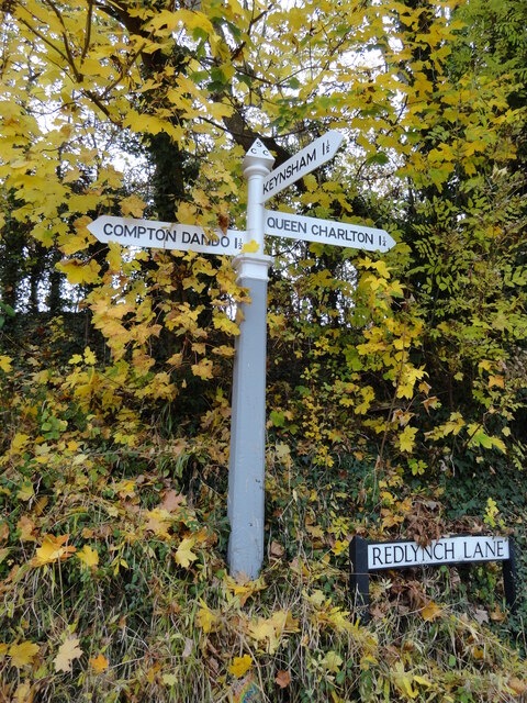
///throw.major.canny. Near Compton Dando, Somerset

Related Wikis

Church of St Mary, Compton Dando

== Location == The Anglican Church of St Mary in Compton Dando within the English county of Somerset dates from the 14th century. It is a Grade II* listed...

Compton Dando

Compton Dando is a small village and civil parish on the River Chew in the affluent Chew Valley in England. It is in the Bath and North East Somerset council...

Woollard

Woollard is a small village on the River Chew in the affluent Chew Valley in England. It is in the Bath and North East Somerset council area and the ceremonial...

Church of St Margaret, Queen Charlton

The Anglican Church of St Margaret in Queen Charlton, Somerset, England, dates from the late 12th century. It has been designated by English Heritage as...

Nearby Amenities

Located within 500m of 51.388167,-2.5187316
Barrier: kissing_gate
Lat/Long: 51.3856478/-2.5173578
Barrier: stile
Lat/Long: 51.3842714/-2.515346
Power: pole
Lat/Long: 51.3901182/-2.5215152
Power: pole
Lat/Long: 51.3911475/-2.5226015
Power: pole
Lat/Long: 51.3853377/-2.5152496
Power: pole
Lat/Long: 51.3855955/-2.516132
Power: pole
Lat/Long: 51.3858667/-2.5170949
Power: pole
Lat/Long: 51.3863889/-2.5176501
Power: pole
Lat/Long: 51.3870116/-2.5182965
Power: pole
Lat/Long: 51.3882268/-2.5195786
Power: pole
Lat/Long: 51.3896646/-2.5210431
Barrier: kissing_gate
Lat/Long: 51.3866924/-2.5237616
Barrier: stile
Lat/Long: 51.3865176/-2.5237562
Barrier: stile
Material: wood
Stile: ladder
Lat/Long: 51.3857518/-2.5173485
The data included in this document is from www.openstreetmap.org. The data is made available under ODbL.

Have you been to Wooscombe Bottom?

Leave your review of Wooscombe Bottom below (or comments, questions and feedback).