Folds Clough

Valley in Yorkshire Ribble Valley

England

Folds Clough

Sluice valve at Well Springs Clough intake
Sluice valve at Well Springs Clough intake Credit: shikari

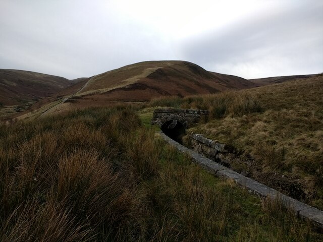
Folds Clough is a picturesque valley located in the county of Yorkshire, England. Nestled within the stunning landscape of the Pennines, Folds Clough offers visitors a tranquil escape from the bustling city life. The valley is situated near the small village of Marsden and is known for its natural beauty and awe-inspiring views.

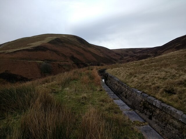
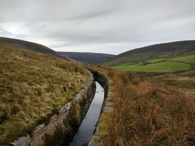
Lush green hills surround Folds Clough, creating a stunning backdrop for outdoor enthusiasts. The valley is home to a meandering stream that flows through the landscape, adding to its charm. The stream is often flanked by vibrant wildflowers, enhancing the beauty of the valley even further.

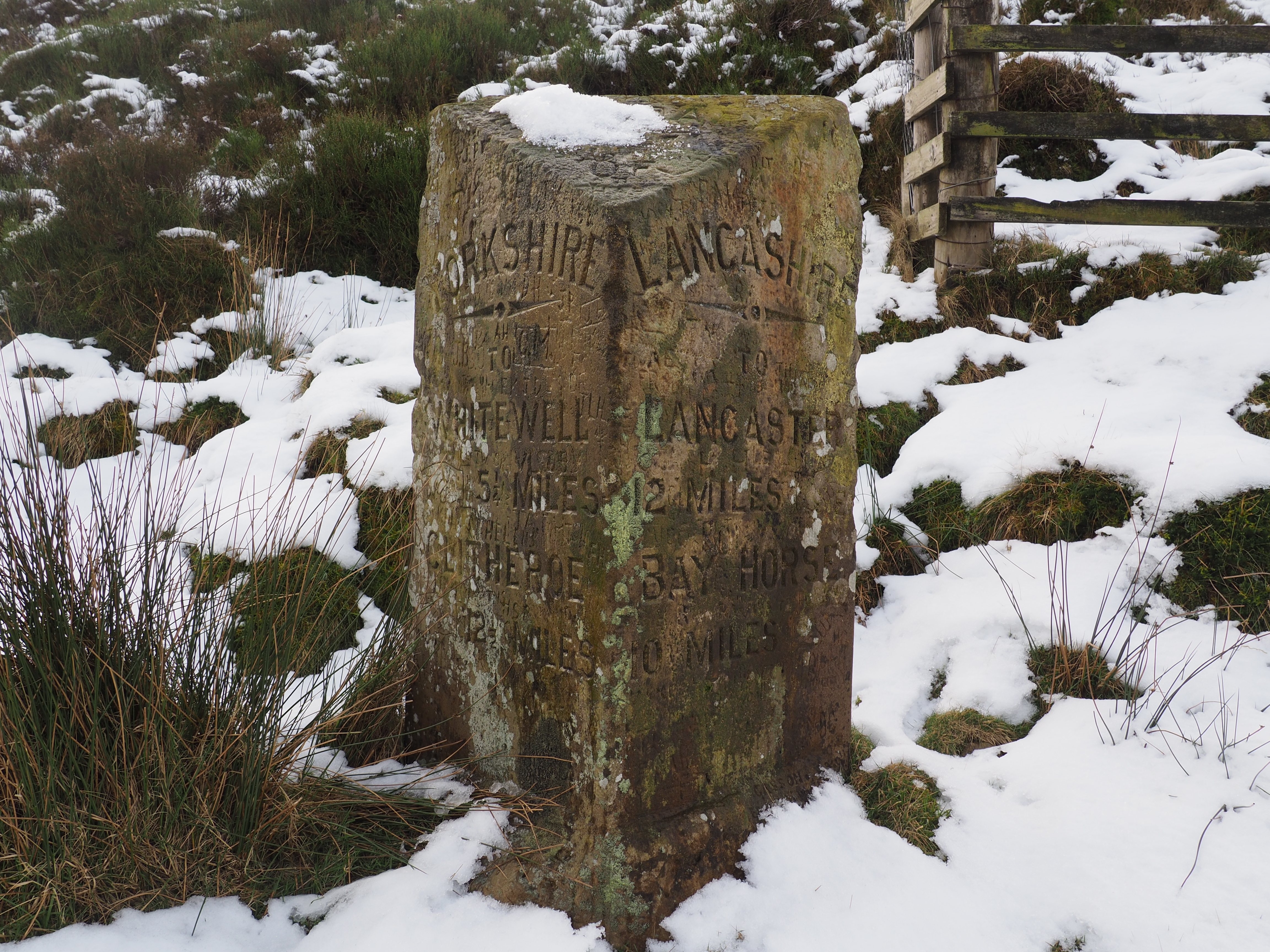
Folds Clough is a popular destination for hikers and nature lovers. The valley offers a variety of walking trails, ranging from easy strolls to more challenging hikes, catering to all levels of fitness and experience. Exploring these trails allows visitors to immerse themselves in the tranquility of the countryside and appreciate the diverse flora and fauna that call Folds Clough their home.

The valley also boasts historical significance, with remnants of old mills and reservoirs dotted throughout the landscape. These remnants serve as a reminder of the area's rich industrial heritage.

Visitors to Folds Clough can enjoy a peaceful picnic by the stream, take in the breathtaking views from various viewpoints, or simply unwind in the serene atmosphere. The valley offers an escape from the chaos of modern life, inviting visitors to connect with nature and appreciate the beauty of Yorkshire's countryside.

If you have any feedback on the listing, please let us know in the comments section below.

Folds Clough Images

Images are sourced within 2km of 53.987876/-2.552593 or Grid Reference SD6354. Thanks to Geograph Open Source API. All images are credited.

Sluice valve at Well Springs Clough intake
Overgrown weir and spillway at Well Springs Clough intake
Backfilled intake well grating at Well Springs Clough intake
Overgrown and still-functioning weirs at Well Springs Clough intake
View down below the weirs at Well Springs Clough intake
Looking along the aqueduct connecting to Well Springs Clough intake
Land used for game trapping above Well Springs Clough intake The intake is now disused.
Land used for game trapping above Well Springs Clough intake
The intake is now disused.
Looking at the aqueduct connected to Well Springs Clough intake
Looking at the aqueduct near to to Well Springs Clough intake
Looking at the aqueduct as it goes underground towards Well Springs Clough intake
View down the Brennand Valley from the aqueduct near Well Springs Clough intake
Track bridge from Folds Clough aqueduct
The track up Brown Bank on the opposite side of Folds Clough
Aqueduct on the east side of Folds Clough
Covered section of aqueduct on the east side of Folds Clough
Aqueduct on the east side of Folds Clough
Covered section of aqueduct on the east side of Folds Clough
Overgrown section of aqueduct on the east side of Folds Clough
Show me another place!

Folds Clough is located at Grid Ref: SD6354 (Lat: 53.987876, Lng: -2.552593)

Division: West Riding

Administrative County: Lancashire

District: Ribble Valley

Police Authority: Lancashire

What 3 Words

///beads.kings.paints. Near Waddington, Lancashire

Related Wikis

Brennand Farm

Brennand Farm is often claimed to be the true centre of Great Britain. The centre, as calculated by Ordnance Survey as the centroid of the two-dimensional...

Grey Stone of Trough

The Grey Stone of Trough is an historic boundary marker in Bowland Forest High, in the Trough of Bowland, Lancashire, England. A Grade II listed structure...

Trough of Bowland

The Trough of Bowland is a valley and high pass in the Forest of Bowland Area of Outstanding Natural Beauty, Lancashire, England. The pass, reaching 968...

Wolfhole Crag

Wolfhole Crag is an isolated and seldom-visited hill in the Forest of Bowland in Lancashire, England. It has an elevation of 527 m (1,729 ft) and a prominence...

Nearby Amenities

Located within 500m of 53.987876,-2.552593
Man Made: manhole
Manhole: water
Lat/Long: 53.9854489/-2.5544788
Man Made: manhole
Manhole: water
Lat/Long: 53.985504/-2.5535068
Pipeline: valve
Lat/Long: 53.9855225/-2.5533619
Ford: yes
Lat/Long: 53.9850036/-2.5546824
Ford: yes
Lat/Long: 53.9846468/-2.5500022
Ford: yes
Lat/Long: 53.9844953/-2.5518357
Ford: yes
Lat/Long: 53.9849636/-2.558307
Man Made: manhole
Manhole: water
Lat/Long: 53.9853437/-2.557029
Lee End
Place: locality
Lat/Long: 53.9892651/-2.5514047
Brown Bank
Place: locality
Lat/Long: 53.9870452/-2.5572562
Pipeline: valve
Lat/Long: 53.9879491/-2.5521969
Pipeline: valve
Lat/Long: 53.9848148/-2.5519405
Fixme: Unfinished
Lat/Long: 53.9855192/-2.5526893
Pipeline: valve
Lat/Long: 53.9855733/-2.5527008
Barrier: stile
Material: wood
Stile: stepover
Lat/Long: 53.9855078/-2.5530232
Barrier: stile
Material: wood
Stile: stepover
Lat/Long: 53.9855119/-2.5531956
Man Made: manhole
Manhole: water
Lat/Long: 53.9855716/-2.5531549
Man Made: manhole
Manhole: water
Lat/Long: 53.9855603/-2.5531795
Pipeline: valve
Lat/Long: 53.9855032/-2.5533627
The data included in this document is from www.openstreetmap.org. The data is made available under ODbL.

Have you been to Folds Clough?

Leave your review of Folds Clough below (or comments, questions and feedback).