Fog Hill Clough

Valley in Yorkshire Ribble Valley

England

Fog Hill Clough

Track to Langden Castle The track above Langden Intake reaches into the heart of the Bowland Fells.
Track to Langden Castle Credit: Oliver Dixon

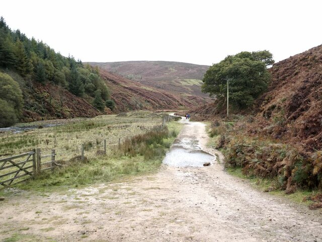
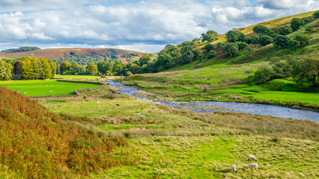
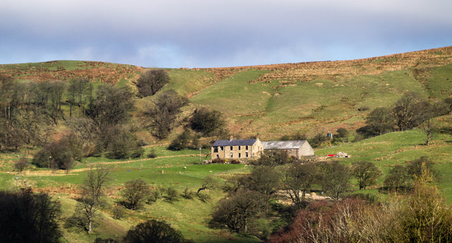
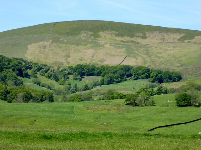
Fog Hill Clough, situated in the picturesque county of Yorkshire in northern England, is a stunning valley renowned for its natural beauty and tranquil ambiance. Nestled within the expansive Yorkshire Dales National Park, this captivating landscape offers visitors a unique blend of rugged terrain, lush greenery, and a sense of serenity that is unmatched.

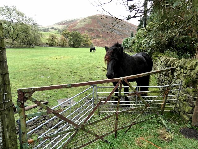
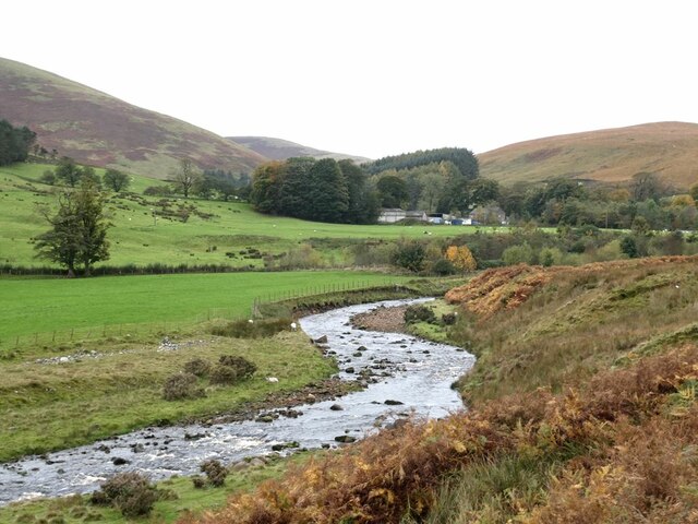
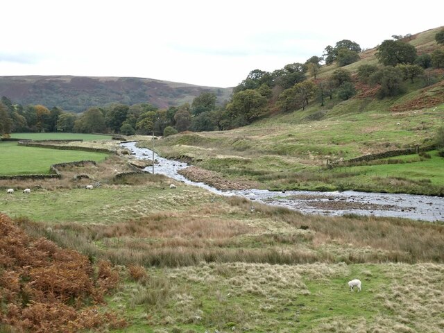
At over 2,000 feet above sea level, Fog Hill Clough boasts panoramic views of the surrounding hills and valleys, providing a breathtaking vista for nature enthusiasts and hikers alike. The valley is characterized by its steep slopes, carved out by ancient glaciers, which are now covered in a rich tapestry of heather, grasses, and wildflowers. This diverse flora attracts a wide array of wildlife, including red grouse, curlews, and the occasional elusive mountain hare.

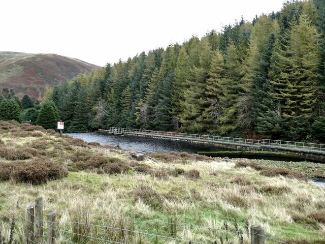
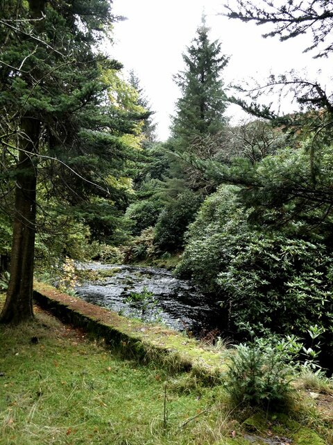
The picturesque River Wharfe, meandering through the valley floor, adds to the allure of Fog Hill Clough. Its crystal-clear waters flow gently over rocky outcrops, creating a soothing and idyllic soundscape that further enhances the overall tranquility of the area.

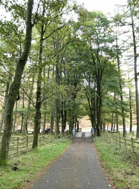
Visitors to Fog Hill Clough can explore a myriad of walking trails that cater to all levels of fitness and ability. From leisurely strolls along the riverbank to more strenuous hikes up the surrounding hills, there is something for everyone to enjoy. The valley also offers ample opportunities for birdwatching, photography, and picnicking amid the breathtaking scenery.

In conclusion, Fog Hill Clough in Yorkshire is an enchanting valley that captivates visitors with its rugged beauty, diverse flora and fauna, and peaceful atmosphere. It is a haven for nature lovers and outdoor enthusiasts seeking solace in the midst of Yorkshire's stunning natural landscape.

If you have any feedback on the listing, please let us know in the comments section below.

Fog Hill Clough Images

Images are sourced within 2km of 53.944378/-2.5538306 or Grid Reference SD6349. Thanks to Geograph Open Source API. All images are credited.

Track to Langden Castle The track above Langden Intake reaches into the heart of the Bowland Fells.
Track to Langden Castle
The track above Langden Intake reaches into the heart of the Bowland Fells.
Langden Intake Lagoon Part of the infrastructure for the Preston water supply.
Langden Intake Lagoon
Part of the infrastructure for the Preston water supply.
Settling tanks at  Langden Intake Part of the infrastructure for the Preston water supply.
Settling tanks at Langden Intake
Part of the infrastructure for the Preston water supply.
Horses in field near Langden Intake Sykes Nab <a href="https://www.geograph.org.uk/gridref/SD6351">SD6351</a> in the background.
Horses in field near Langden Intake
Sykes Nab SD6351 in the background.
Langden Brook The well-wooded stretch of the Brook below Langden Intake.
Langden Brook
The well-wooded stretch of the Brook below Langden Intake.
Service road from Langden Intake The tree-lined service road from the Preston waterworks crosses the Losterdale Brook by a reinforced bridge.
Service road from Langden Intake
The tree-lined service road from the Preston waterworks crosses the Losterdale Brook by a reinforced bridge.
Langden Brook Hareden Farm can be seen in the mouth of the side valley.
Langden Brook
Hareden Farm can be seen in the mouth of the side valley.
Langden Brook
Langden Brook
Looking east along Langden Brook
New Hey Farm View of New Hey Farm.
New Hey Farm
View of New Hey Farm.
Mellor Knoll From a footpath near Burholme Farm.
Mellor Knoll
From a footpath near Burholme Farm.
Dry stone wall near Dunsop Bridge The hill in the right background is Mellor Knoll, and to the left, Totridge.
Dry stone wall near Dunsop Bridge
The hill in the right background is Mellor Knoll, and to the left, Totridge.
Mellor Knoll From the Whitewell to Dunsop Bridge road.
Mellor Knoll
From the Whitewell to Dunsop Bridge road.
Path through Felled Forest on Whitemore Evidence of the plantation having been replanted, after previous felling.
Path through Felled Forest on Whitemore
Evidence of the plantation having been replanted, after previous felling.
Young trees at Whitemore Soon the view up the Hodder Valley from this part of the bridleway will be lost as the conifers shoot upwards again.
Young trees at Whitemore
Soon the view up the Hodder Valley from this part of the bridleway will be lost as the conifers shoot upwards again.
Cattle below Mellor Knoll By the bridleway which traverses the broad flat col between the knoll and Totridge Fell.
Cattle below Mellor Knoll
By the bridleway which traverses the broad flat col between the knoll and Totridge Fell.
Foxgloves on Mellor Knoll Growing in a surprisingly wet area of landslip features on the northern slope of the knoll. Looking up towards the Trough of Bowland.
Foxgloves on Mellor Knoll
Growing in a surprisingly wet area of landslip features on the northern slope of the knoll. Looking up towards the Trough of Bowland.
Direction Sign – Signpost at Dunsop Bridge Located on the west side of a T junction on Trough Road southwest of Dunsop Bridge and north of fingerpost YW_6549B / milestone YW_XBOWa, in Bowland Forest Low parish. 3 arms and annulus and bar finial. See also <a title="https://www.geograph.org.uk/photo/6688725," href="https://www.geograph.org.uk/photo/6688725,">Link</a> <a title="https://www.geograph.org.uk/photo/4465685" href="https://www.geograph.org.uk/photo/4465685">Link</a> and <a title="https://www.geograph.org.uk/photo/2327981" href="https://www.geograph.org.uk/photo/2327981">Link</a>.

Milestone Society National ID: YW_SD6549A
Direction Sign – Signpost at Dunsop Bridge
Located on the west side of a T junction on Trough Road southwest of Dunsop Bridge and north of fingerpost YW_6549B / milestone YW_XBOWa, in Bowland Forest Low parish. 3 arms and annulus and bar finial. See also Link Link and Link. Milestone Society National ID: YW_SD6549A
Show me another place!

Fog Hill Clough is located at Grid Ref: SD6349 (Lat: 53.944378, Lng: -2.5538306)

Division: West Riding

Administrative County: Lancashire

District: Ribble Valley

Police Authority: Lancashire

What 3 Words

///punctual.crafted.annoys. Near Waddington, Lancashire

Related Wikis

Sykes Smelt Mill

Sykes Smelt Mill was a mediaeval mill located between Sykes and Hareden in Bowland Forest High, Lancashire, England. It stood on the banks of Langden Brook...

Bowland Forest High milestone

The Bowland Forest High milestone is an historic milestone marker in the English parish of Bowland Forest High, in the Trough of Bowland, Lancashire. A...

Dunsop Bridge (structure)

Dunsop Bridge is a bridge in the English village of the same name. The structure, which dates to the early 19th century, crosses the River Dunsop. A Grade...

Bowland Forest High

Bowland Forest High is a civil parish in the Ribble Valley district of Lancashire, England, covering some 20,000 acres (80 km2) of the Forest of Bowland...

Nearby Amenities

Located within 500m of 53.944378,-2.5538306
Fog Hill Ford
Ford: yes
Lat/Long: 53.9474752/-2.5580442
Power: pole
Lat/Long: 53.9480968/-2.5495615
Power: pole
Lat/Long: 53.9479545/-2.5504777
Power: pole
Lat/Long: 53.9477343/-2.5512794
Power: pole
Lat/Long: 53.9473209/-2.5528269
Power: pole
Lat/Long: 53.9471382/-2.5534555
Power: pole
Lat/Long: 53.9469944/-2.5540511
Power: pole
Lat/Long: 53.9468086/-2.5547434
Power: pole
Lat/Long: 53.9475187/-2.5520865
Ford: yes
Lat/Long: 53.9431039/-2.5514036
Ford: yes
Lat/Long: 53.943775/-2.5510884
Ford: yes
Lat/Long: 53.9437694/-2.5508751
The data included in this document is from www.openstreetmap.org. The data is made available under ODbL.

Have you been to Fog Hill Clough?

Leave your review of Fog Hill Clough below (or comments, questions and feedback).