Black Cleugh

Valley in Northumberland

England

Black Cleugh

View from north of Kielder to radome on Deadwater Fell Believed to be Deadwater Fell top centre.
View from north of Kielder to radome on Deadwater Fell Credit: Chris

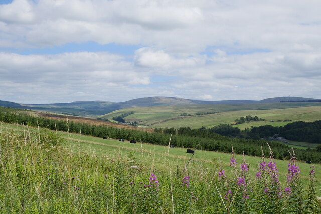
Black Cleugh is a picturesque valley located in Northumberland, England. Situated in the northern part of the county, it is known for its stunning natural beauty and historical significance. The valley is nestled between the Cheviot Hills and the Scottish border, offering breathtaking views of the surrounding countryside.

The name "Black Cleugh" refers to a small stream that runs through the valley, adding to its charm. The stream is flanked by lush green meadows and wooded areas, creating a serene and idyllic atmosphere. The valley is also home to a diverse range of wildlife, including various bird species, mammals, and plants, making it a haven for nature enthusiasts and photographers.

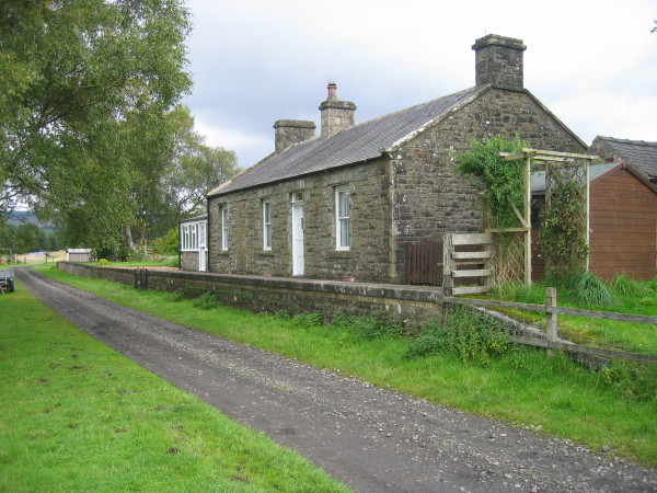
In addition to its natural splendor, Black Cleugh boasts a rich history. It was once a bustling mining area, with evidence of old coal pits and abandoned mine works still visible today. The remains of stone cottages and other structures from the mining era can also be found in the valley, serving as a reminder of its industrial past.

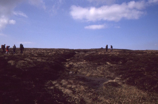
For outdoor enthusiasts, Black Cleugh offers ample opportunities for hiking, cycling, and exploring. There are numerous walking trails that wind through the valley and up into the Cheviot Hills, providing stunning panoramic views of the surrounding landscape. Additionally, the valley is intersected by several country roads, making it easily accessible for visitors.

Overall, Black Cleugh is a hidden gem in Northumberland, offering a perfect blend of natural beauty and historical significance. Whether one seeks tranquility in nature or wishes to delve into the region's past, this valley is a must-visit destination for all.

If you have any feedback on the listing, please let us know in the comments section below.
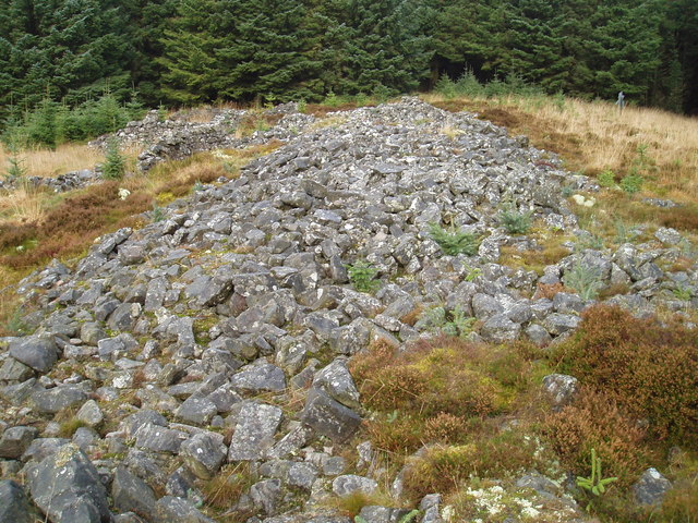
Black Cleugh Images

Images are sourced within 2km of 55.275599/-2.5894647 or Grid Reference NY6298. Thanks to Geograph Open Source API. All images are credited.

View from north of Kielder to radome on Deadwater Fell Believed to be Deadwater Fell top centre.
View from north of Kielder to radome on Deadwater Fell
Believed to be Deadwater Fell top centre.
Carlin Tooth, Peel Fell and Deadwater Fell These are the respective distant summits, left to right, as viewed from the trackbed of the former Waverley Route.

This photograph was taken during the Coronavirus (COVID-19) pandemic of 2020/21/22.
Carlin Tooth, Peel Fell and Deadwater Fell
These are the respective distant summits, left to right, as viewed from the trackbed of the former Waverley Route. This photograph was taken during the Coronavirus (COVID-19) pandemic of 2020/21/22.
Ravenshill Moor
Ravenshill Moor
Rock outcrop, Deadwater Fell
Electricity cable transmission testing rig
Deadwater Fell, eastern flank
Archer Cleugh View of Archer Cleugh.
Archer Cleugh
View of Archer Cleugh.
Ride, Peel Fell Ascent of Peel Fell through Kielder Forest. The ride soon reaches open country.

The event was a tenth anniversary celebration of the first traverse of Scotland's main watershed, between rivers flowing to the North Sea and Atlantic, by Dave Hewitt in 1987.
Ride, Peel Fell
Ascent of Peel Fell through Kielder Forest. The ride soon reaches open country. The event was a tenth anniversary celebration of the first traverse of Scotland's main watershed, between rivers flowing to the North Sea and Atlantic, by Dave Hewitt in 1987.
Peel Fell Approaching the cairn, one of two 602m spot heights on this very boggy hill.  Like Cheviot, the high point is just over the border in England.  Celebrating the first traverse of the east-west watershed of Scotland by Dave Hewitt in 1987 with some irony as only a few of us actually walked as far as the border on this day.
Peel Fell
Approaching the cairn, one of two 602m spot heights on this very boggy hill. Like Cheviot, the high point is just over the border in England. Celebrating the first traverse of the east-west watershed of Scotland by Dave Hewitt in 1987 with some irony as only a few of us actually walked as far as the border on this day.
Skellys Riggin Towards the top of the steep  mountain bike trail which runs downhill from the summit of Deadwater Fell. This trail is classified as "black" - "suitable for expert mountain bike users, used to physically demanding routes".  The antennae and radome are clearly seen at the summit <a href="https://www.geograph.org.uk/gridref/NY6297">NY6297</a> beyond.
Skellys Riggin
Towards the top of the steep mountain bike trail which runs downhill from the summit of Deadwater Fell. This trail is classified as "black" - "suitable for expert mountain bike users, used to physically demanding routes". The antennae and radome are clearly seen at the summit NY6297 beyond.
Antenna on Deadwater Fell The southernmost of a number of antennae on the summit of Deadwater Fell.
Antenna on Deadwater Fell
The southernmost of a number of antennae on the summit of Deadwater Fell.
The road up Deadwater Fell A family group of mountain bikers towards the end of a tough climb.
The road up Deadwater Fell
A family group of mountain bikers towards the end of a tough climb.
The road up Deadwater Fell Two mountain bikers towards the end of a tough climb.
The road up Deadwater Fell
Two mountain bikers towards the end of a tough climb.
The road up Deadwater Fell Two mountain bikers towards the end of a tough climb. The  radome and other structures are clearly seen at the summit <a href="https://www.geograph.org.uk/gridref/NY6297">NY6297</a> beyond.
The road up Deadwater Fell
Two mountain bikers towards the end of a tough climb. The radome and other structures are clearly seen at the summit NY6297 beyond.
Specere A sculptural shelter by David Adjaye near the summit of Deadwater Fell. Its unusual triangular form provides shelter from the prevailing westerly winds, whilst the slits in the wall fame views to the east and south over the forest and Kielder Water.  The radome can be seen beyond.
Specere
A sculptural shelter by David Adjaye near the summit of Deadwater Fell. Its unusual triangular form provides shelter from the prevailing westerly winds, whilst the slits in the wall fame views to the east and south over the forest and Kielder Water. The radome can be seen beyond.
The radome on Deadwater Fell A flight safety navigational aid on the summit of Deadwater Fell.
The radome on Deadwater Fell
A flight safety navigational aid on the summit of Deadwater Fell.
Equipment on Deadwater Fell Part of the measuring equipment used in an experiment to determine the amount of atmospheric icing on structures. See <a href="https://www.geograph.org.uk/photo/570489">NY6297 : Deadwater Fell</a> for details.
Equipment on Deadwater Fell
Part of the measuring equipment used in an experiment to determine the amount of atmospheric icing on structures. See NY6297 : Deadwater Fell for details.
Brick hut on Deadwater Fell One of two huts on the summit in conjunction with the radome, antennae and other equipment nearby.
Brick hut on Deadwater Fell
One of two huts on the summit in conjunction with the radome, antennae and other equipment nearby.
Show me another place!

Black Cleugh is located at Grid Ref: NY6298 (Lat: 55.275599, Lng: -2.5894647)

Unitary Authority: Northumberland

Police Authority: Northumbria

What 3 Words

///fragments.soaps.patrol. Near Rochester, Northumberland

Nearby Locations

Black Cleugh

Related Wikis

Deadwater railway station

Deadwater railway station is a closed railway station situated on the border between England and Scotland at the head of the North Tyne River. The station...

Deadwater, Northumberland

Deadwater is a small settlement in Northumberland, England, about 3 miles (5 km) north west of Kielder, Northumberland, on the English side of the border...

Kielder Forest Star Camp

The Kielder Forest Star Camp is an annual star party held each autumn and spring in Kielder Forest. The five night event is based on the Kielder Campsite...

Kielder railway station

Kielder railway station is a closed railway station that served the village hamlet of Kielder, Northumberland. == History == Kielder railway station was...

Kielder

Kielder is a small, remote village in western Northumberland, England. Located at the head of Kielder Water and in the north west of Kielder Forest, the...

Butteryhaugh

Butteryhaugh is a village in Northumberland, in England. It is situated a short distance to the south-east of Kielder. Although a separate "village" from...

Devil's Lapful

Devil's Lapful is an archaeological site in Northumberland, England, in Kielder Forest about 0.8 miles (1.3 km) south-east of Kielder. The site, a Neolithic...

Saughtree

Saughtree is a hamlet in the Scottish Borders at the junction of the B6357 and an unnamed road from Kielder village in Northumberland, England. It is at...

Nearby Amenities

Located within 500m of 55.275599,-2.5894647
Deadwater Moor
Place: locality
Lat/Long: 55.2715617/-2.5870113
High Todhole
Place: locality
Lat/Long: 55.2738687/-2.5873444
Little Wirchet
Place: locality
Lat/Long: 55.2743556/-2.595182
Low Todhole
Place: locality
Lat/Long: 55.2768934/-2.5926725
The data included in this document is from www.openstreetmap.org. The data is made available under ODbL.

Have you been to Black Cleugh?

Leave your review of Black Cleugh below (or comments, questions and feedback).