Trough Scar

Valley in Yorkshire Ribble Valley

England

Trough Scar

Fallen tree In a strip of woodland alongside the River Marshaw Wyre to the west of the Forest of Bowland.
Fallen tree Credit: Oliver Dixon

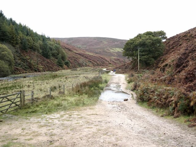
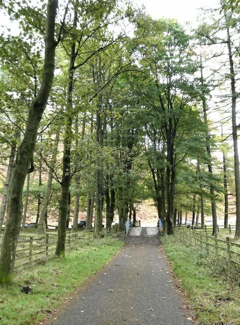
Trough Scar is a picturesque valley located in the county of Yorkshire, England. Situated in the Yorkshire Dales National Park, it is a stunning natural landscape that attracts visitors from far and wide.

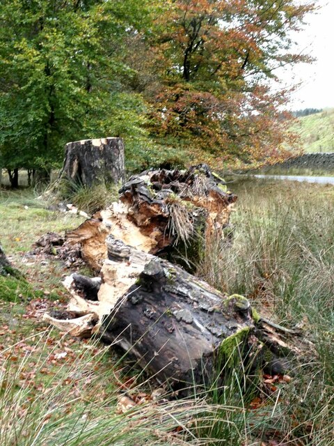
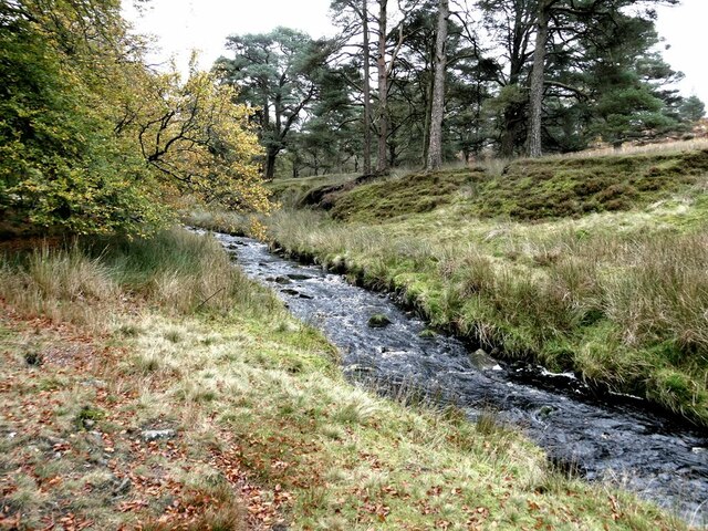
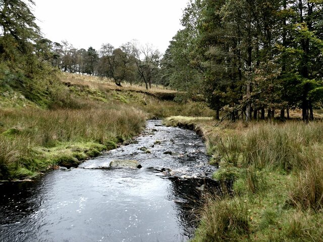
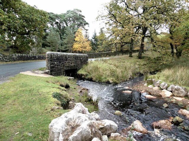
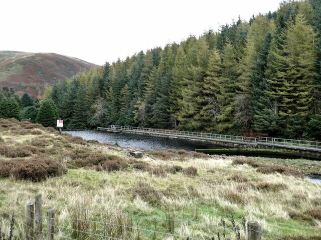
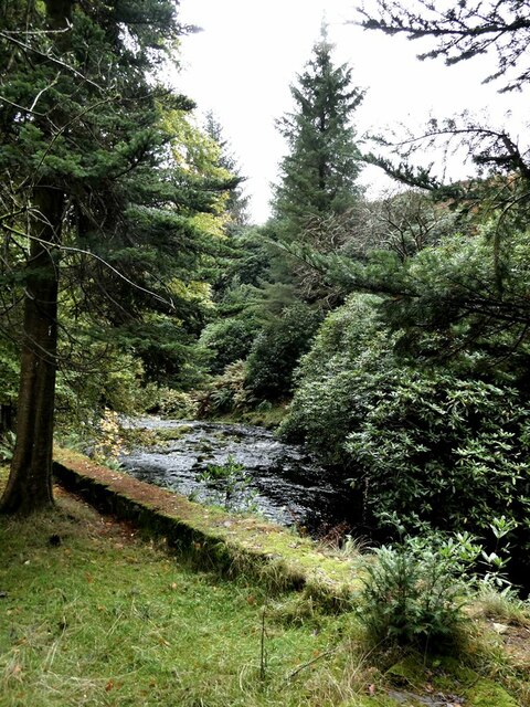
The valley is characterized by its deep, narrow shape, with steep sides rising up on either side. It is carved out by the Trough Scar Beck, a small river that meanders through the valley, adding to its charm. The beck is fed by numerous smaller streams and waterfalls that cascade down the sides of the valley, creating a beautiful and tranquil atmosphere.

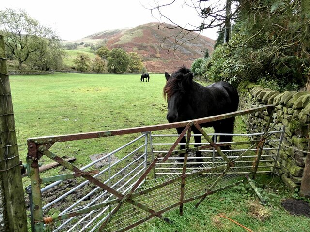
Trough Scar is known for its rich biodiversity and is home to a variety of plant and animal species. The valley is covered with lush greenery, including meadows, woodlands, and wildflowers, making it an ideal habitat for many wildlife species. Visitors can often spot birds, butterflies, and small mammals while exploring the valley.

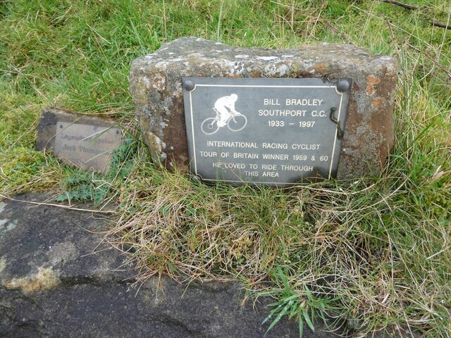
The area is also a popular destination for outdoor enthusiasts, offering a range of activities such as hiking, cycling, and wildlife watching. There are several well-marked trails that lead through the valley, providing stunning views of the surrounding countryside. Additionally, the valley is dotted with quaint villages and historic landmarks, adding to its appeal.

Overall, Trough Scar is a true gem in the Yorkshire Dales, offering visitors a chance to immerse themselves in nature's beauty and experience the tranquility of this idyllic valley.

If you have any feedback on the listing, please let us know in the comments section below.

Trough Scar Images

Images are sourced within 2km of 53.970682/-2.5737689 or Grid Reference SD6252. Thanks to Geograph Open Source API. All images are credited.

Fallen tree In a strip of woodland alongside the River Marshaw Wyre to the west of the Forest of Bowland.
Fallen tree
In a strip of woodland alongside the River Marshaw Wyre to the west of the Forest of Bowland.
River Marshaw Wyre In a strip of woodland alongside the river to the west of the Forest of Bowland.
River Marshaw Wyre
In a strip of woodland alongside the river to the west of the Forest of Bowland.
River Marshaw Wyre In a strip of woodland alongside the river to the west of the Forest of Bowland.
River Marshaw Wyre
In a strip of woodland alongside the river to the west of the Forest of Bowland.
Trough Bridge Where the road from the Trough of Bowland crosses the River Marshaw Wyre. Trough Brook enters the river from the right.
Trough Bridge
Where the road from the Trough of Bowland crosses the River Marshaw Wyre. Trough Brook enters the river from the right.
Track to Langden Castle The track above Langden Intake reaches into the heart of the Bowland Fells.
Track to Langden Castle
The track above Langden Intake reaches into the heart of the Bowland Fells.
Langden Intake Lagoon Part of the infrastructure for the Preston water supply.
Langden Intake Lagoon
Part of the infrastructure for the Preston water supply.
Settling tanks at  Langden Intake Part of the infrastructure for the Preston water supply.
Settling tanks at Langden Intake
Part of the infrastructure for the Preston water supply.
Horses in field near Langden Intake Sykes Nab <a href="https://www.geograph.org.uk/gridref/SD6351">SD6351</a> in the background.
Horses in field near Langden Intake
Sykes Nab SD6351 in the background.
Langden Brook The well-wooded stretch of the Brook below Langden Intake.
Langden Brook
The well-wooded stretch of the Brook below Langden Intake.
Cyclists' memorials at the Trough of Bowland About the year 2000 give or take a year, I cycled up to the Trough of Bowland to witness the Tour of Britain passing through. Amongst the many cyclists assembled there, I witnessed a small group intent on inaugurating this memorial stone. It never occurred to me to photograph this event (it was of course before Geograph days) and indeed I had no idea of the significance of the event.

This understated memorial reads 

Bill Bradley, Southport CC, 1933-1997
International Racing Cyclist
Tour of Britain winner 1959 and 1960
He loved to ride through the area

An even more modest memorial stone has subsequently been added to the left of the original memorial. It reads:

Legendary Cyclist 
Jack Thompson
1912-2003

Up until 2010, the second stone rested on top of the original - see <a href="https://www.geograph.org.uk/photo/1900323">SD6253 : Cyclists' memorials, Trough of Bowland</a>, but by 2012 it had been moved to the side <a href="https://www.geograph.org.uk/photo/2960819">SD6253 : Memorial stones, Trough of Bowland</a>.
Cyclists' memorials at the Trough of Bowland
About the year 2000 give or take a year, I cycled up to the Trough of Bowland to witness the Tour of Britain passing through. Amongst the many cyclists assembled there, I witnessed a small group intent on inaugurating this memorial stone. It never occurred to me to photograph this event (it was of course before Geograph days) and indeed I had no idea of the significance of the event. This understated memorial reads Bill Bradley, Southport CC, 1933-1997 International Racing Cyclist Tour of Britain winner 1959 and 1960 He loved to ride through the area An even more modest memorial stone has subsequently been added to the left of the original memorial. It reads: Legendary Cyclist Jack Thompson 1912-2003 Up until 2010, the second stone rested on top of the original - see SD6253 : Cyclists' memorials, Trough of Bowland, but by 2012 it had been moved to the side SD6253 : Memorial stones, Trough of Bowland.
Cyclists' memorials at the Trough of Bowland Just visible above the low wall are the understated memorials to two distinguished cyclists. For details, see <a href="https://www.geograph.org.uk/photo/7002538">SD6253 : Cyclists' memorials at the Trough of Bowland</a>.
Cyclists' memorials at the Trough of Bowland
Just visible above the low wall are the understated memorials to two distinguished cyclists. For details, see SD6253 : Cyclists' memorials at the Trough of Bowland.
Cattle grid at the Trough of Bowland A famous mountain road between Clitheroe and Lancaster.
Cattle grid at the Trough of Bowland
A famous mountain road between Clitheroe and Lancaster.
Service road from Langden Intake The tree-lined service road from the Preston waterworks crosses the Losterdale Brook by a reinforced bridge.
Service road from Langden Intake
The tree-lined service road from the Preston waterworks crosses the Losterdale Brook by a reinforced bridge.
Aqueduct manhole west of Brennand screen chamber
View across the Brennand valley
View across the Brennand valley to Birk Clough
Aqueduct manhole west of Brennand screen chamber
Show me another place!

Trough Scar is located at Grid Ref: SD6252 (Lat: 53.970682, Lng: -2.5737689)

Division: West Riding

Administrative County: Lancashire

District: Ribble Valley

Police Authority: Lancashire

What 3 Words

///brains.kinder.named. Near Bay Horse, Lancashire

Related Wikis

Trough of Bowland

The Trough of Bowland is a valley and high pass in the Forest of Bowland Area of Outstanding Natural Beauty, Lancashire, England. The pass, reaching 968...

Grey Stone of Trough

The Grey Stone of Trough is an historic boundary marker in Bowland Forest High, in the Trough of Bowland, Lancashire, England. A Grade II listed structure...

Sykes Smelt Mill

Sykes Smelt Mill was a mediaeval mill located between Sykes and Hareden in Bowland Forest High, Lancashire, England. It stood on the banks of Langden Brook...

Forest of Bowland

The Forest of Bowland, also known as the Bowland Fells and formerly the Chase of Bowland, is an area of gritstone fells, deep valleys and peat moorland...

National nature reserves in Lancashire

National nature reserves in Lancashire in England are established by Natural England. There are two national nature reserves in Lancashire, both of which...

Brennand Farm

Brennand Farm is often claimed to be the true centre of Great Britain. This is about seven kilometres north-west of Dunsop Bridge - which has the nearest...

Bowland Forest High milestone

The Bowland Forest High milestone is an historic milestone marker in the English parish of Bowland Forest High, in the Trough of Bowland, Lancashire. A...

Bowland Forest High

Bowland Forest High is a civil parish in the Ribble Valley district of Lancashire, England, covering some 20,000 acres (80 km2) of the Forest of Bowland...

Nearby Amenities

Located within 500m of 53.970682,-2.5737689
Trough of Bowland
Mountain Pass: yes
Lat/Long: 53.9729449/-2.5777822
Parking
Access: yes
Fee: no
Parking: street_side
Lat/Long: 53.9726032/-2.5774742
Barrier: cattle_grid
Lat/Long: 53.972171/-2.5769471
Passing Place
Lat/Long: 53.967506/-2.569752
The data included in this document is from www.openstreetmap.org. The data is made available under ODbL.

Have you been to Trough Scar?

Leave your review of Trough Scar below (or comments, questions and feedback).