Black Cleugh
Valley in Cumberland Eden
England
Black Cleugh
Black Cleugh, Cumberland Valley, is a picturesque region located in the county of Cumberland, England. Situated within the heart of the beautiful Cumberland Valley, Black Cleugh is known for its stunning natural landscapes and rich history.
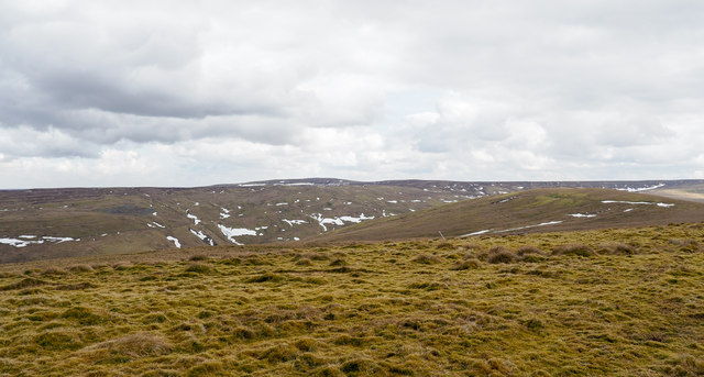
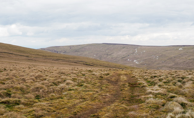
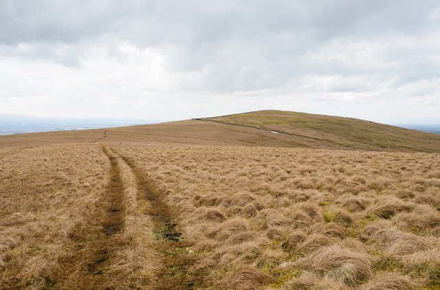
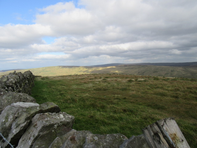
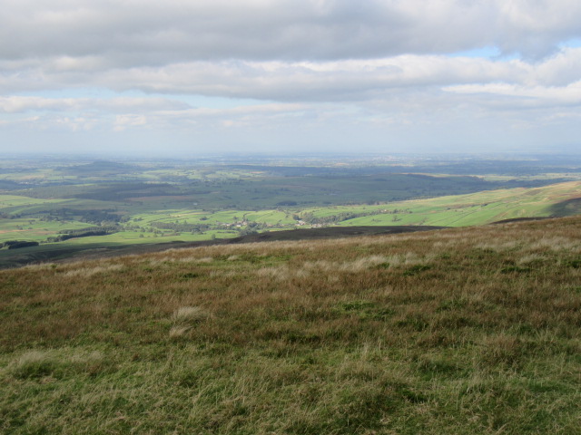
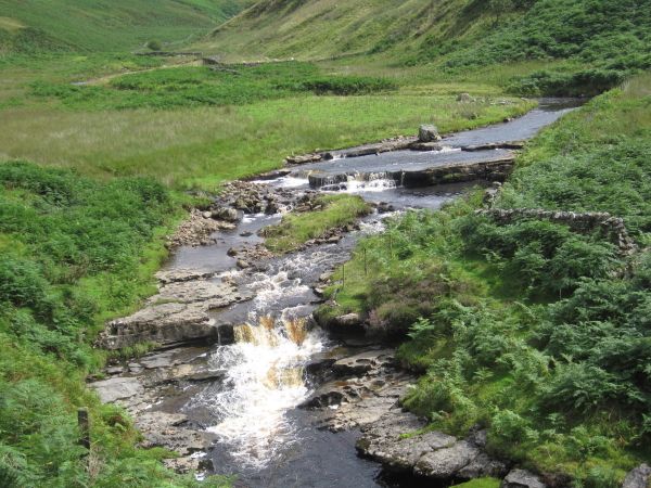
The valley itself is characterized by its rolling hills, verdant meadows, and meandering streams, creating a captivating backdrop for outdoor enthusiasts and nature lovers. Black Cleugh, in particular, is renowned for its rugged beauty, with its dramatic cliffs and dense forests adding to its allure.
The area has a long and fascinating history, with evidence of human habitation dating back thousands of years. The remnants of ancient settlements, burial mounds, and stone circles can be found scattered throughout the region, providing intriguing insights into the lives of its early inhabitants.
In addition to its natural and historical significance, Black Cleugh offers a range of activities and attractions for visitors. Hiking and walking trails crisscross the valley, providing opportunities to explore its scenic wonders on foot. The area is also a haven for wildlife, with various species of birds, mammals, and flora thriving in its diverse ecosystem.
For those seeking a taste of local culture, nearby villages and towns offer quaint shops, traditional pubs, and charming bed and breakfast accommodations. Visitors can also indulge in the region's culinary delights, with local farmers' markets and restaurants showcasing the finest produce and traditional dishes of Cumberland.
In summary, Black Cleugh, Cumberland Valley, offers a captivating blend of natural beauty, historical significance, and cultural charm, making it a must-visit destination for those seeking an authentic English countryside experience.
If you have any feedback on the listing, please let us know in the comments section below.
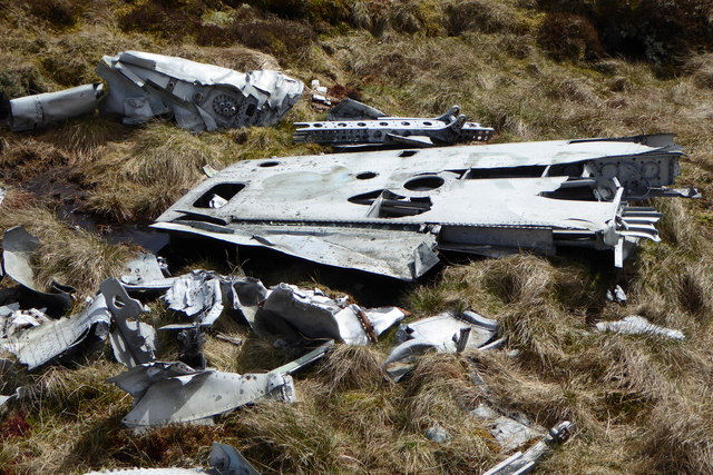
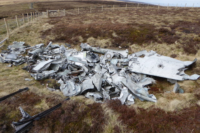
Black Cleugh Images
Images are sourced within 2km of 54.824036/-2.588345 or Grid Reference NY6247. Thanks to Geograph Open Source API. All images are credited.


Black Cleugh is located at Grid Ref: NY6247 (Lat: 54.824036, Lng: -2.588345)
Administrative County: Cumbria
District: Eden
Police Authority: Cumbria
What 3 Words
///waltzes.cobras.puzzles. Near Alston, Cumbria
Nearby Locations
Related Wikis

Black Fell (Pennines)
Black Fell is a hill in the North Pennines, England. It is located just north of the A686 road, west of Alston and is one of the most northerly parts of...

Croglin
Croglin is the name of a village, former civil parish, beck (stream), and grange now in the parish of Ainstable, in the Westmorland and Furness district...

Renwick, Cumbria
Renwick, formerly known as Ravenwick, is a small village and former civil parish, now in the parish of Kirkoswald, in the Eden district, in the county...

Busk, Cumbria
Busk is a hamlet in Cumbria, England. It is located 3.7 miles (6.0 km) by road to the east of Kirkoswald. == See also == List of places in Cumbria ��2...
Nearby Amenities
Located within 500m of 54.824036,-2.588345Have you been to Black Cleugh?
Leave your review of Black Cleugh below (or comments, questions and feedback).