Brade Rakes Clough

Valley in Yorkshire Ribble Valley

England

Brade Rakes Clough

Grouse Butt, Higher Dry Clough Grouse butt used as a hide / wind break for grouse shooting. This particular one is lower down the hillside than the series of grouse butts indicated on the 1:25k OS map.
Grouse Butt, Higher Dry Clough Credit: Robin

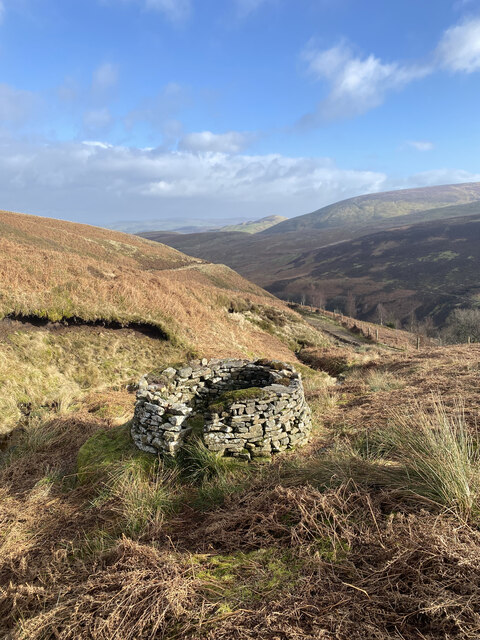
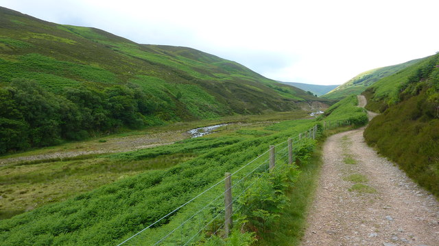
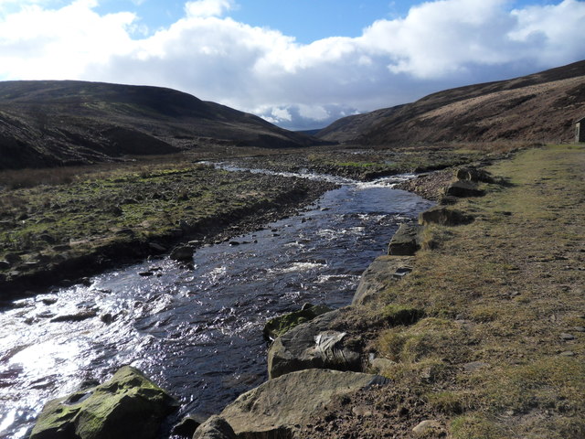
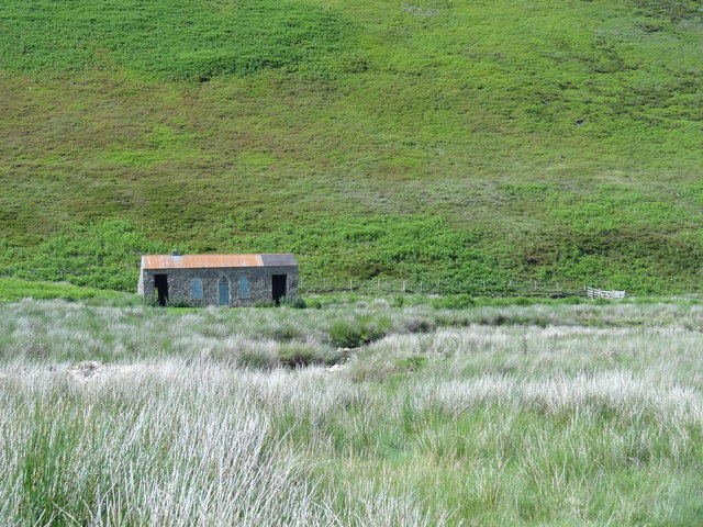
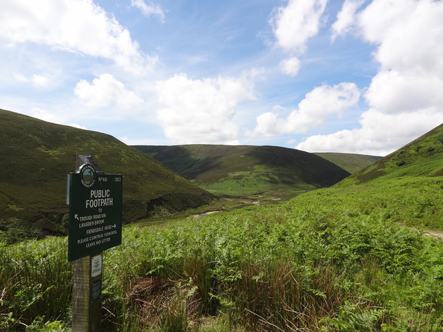
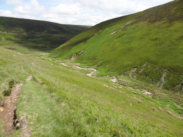
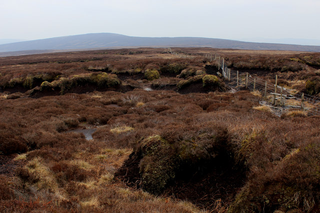
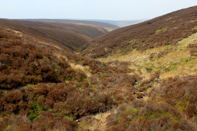
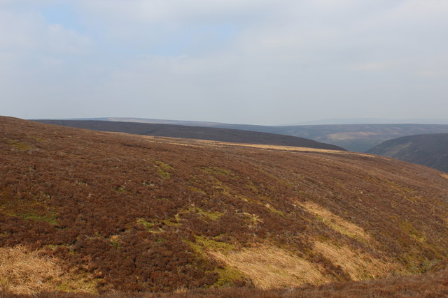
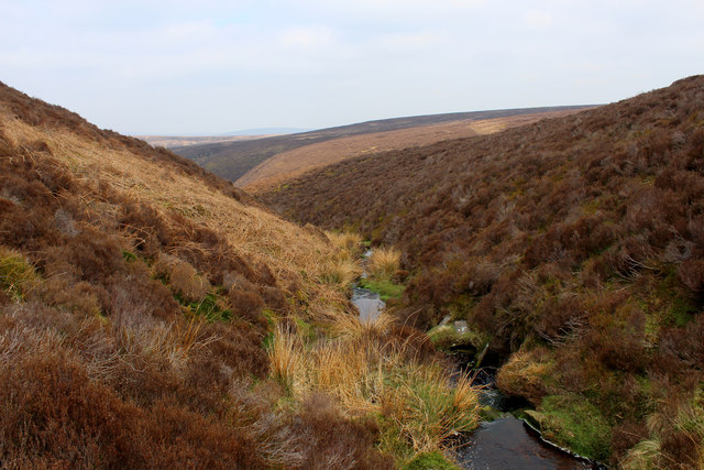
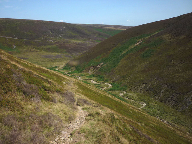
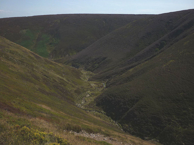
Brade Rakes Clough is a picturesque valley located in Yorkshire, England. The valley is surrounded by rolling hills and lush greenery, creating a peaceful and serene atmosphere. The Clough is home to a variety of wildlife, including birds, deer, and other small mammals, making it a popular spot for nature enthusiasts and birdwatchers.

The valley is also known for its beautiful walking trails, which offer stunning views of the surrounding countryside. Visitors can explore the meandering paths that wind through the valley, taking in the sights and sounds of nature along the way. The Brade Rakes Clough is a popular destination for hikers, walkers, and cyclists looking to escape the hustle and bustle of city life and immerse themselves in the beauty of the natural world.

In addition to its natural beauty, Brade Rakes Clough has a rich history, with evidence of ancient settlements and Roman occupation in the surrounding area. The valley is a peaceful retreat for those looking to connect with nature and explore the history of the Yorkshire countryside.

If you have any feedback on the listing, please let us know in the comments section below.

Brade Rakes Clough Images

Images are sourced within 2km of 53.937504/-2.5893991 or Grid Reference SD6149. Thanks to Geograph Open Source API. All images are credited.

Grouse Butt, Higher Dry Clough Grouse butt used as a hide / wind break for grouse shooting. This particular one is lower down the hillside than the series of grouse butts indicated on the 1:25k OS map.
Grouse Butt, Higher Dry Clough
Grouse butt used as a hide / wind break for grouse shooting. This particular one is lower down the hillside than the series of grouse butts indicated on the 1:25k OS map.
United Utilities Building Along Langden Valley
Langden Brook
Langden Brook
Langden Brook near the confluence with Little Harden Clough Little Harden Clough joins Langden Brook from the south (left). The words clough and brook both derive from Old English but the former term, which refers to a steep stream and its ravine, seems more restricted to the north of England. There was heavy snow in Lancashire the day before this photo was taken but not even a flake is visible today.
Langden Brook near the confluence with Little Harden Clough
Little Harden Clough joins Langden Brook from the south (left). The words clough and brook both derive from Old English but the former term, which refers to a steep stream and its ravine, seems more restricted to the north of England. There was heavy snow in Lancashire the day before this photo was taken but not even a flake is visible today.
Langden Castle OS map days "Langden Castle (ruin)" but it's not a castle and it's not a ruin.  Probably originally a shooting lodge.  not sure what it's used for now but it's well secured.
Langden Castle
OS map days "Langden Castle (ruin)" but it's not a castle and it's not a ruin. Probably originally a shooting lodge. not sure what it's used for now but it's well secured.
The path towards Fiendsdale Head Peaks and Northern Footpaths Society signpost no. 418
The path towards Fiendsdale Head
Peaks and Northern Footpaths Society signpost no. 418
Fiendsdale meanders Fiendsdale Water meanders before it joins Langden Beck.
Fiendsdale meanders
Fiendsdale Water meanders before it joins Langden Beck.
Bleadale Water Tributary Headwaters Following the watershed on Saddle Fell has its problems.  This is one of them, a mass of soft wet peat in the form of groughs and haggs, which form pools of sluggish puddles, that gradually trickle northwards to form the headwaters of Bleadale Water.
Bleadale Water Tributary Headwaters
Following the watershed on Saddle Fell has its problems. This is one of them, a mass of soft wet peat in the form of groughs and haggs, which form pools of sluggish puddles, that gradually trickle northwards to form the headwaters of Bleadale Water.
Below Bleadale Grains Several narrow watercourses meet down here to form a tributary headwater for Bleadale Water.
Below Bleadale Grains
Several narrow watercourses meet down here to form a tributary headwater for Bleadale Water.
A Southern Bowland View
A View from beside a Tributary of Bleadale Water This took a fair bit of effort, fighting through knee high heather to negotiate myself into the extreme south eastern corner of this square.
A View from beside a Tributary of Bleadale Water
This took a fair bit of effort, fighting through knee high heather to negotiate myself into the extreme south eastern corner of this square.
The path up Fiendsdale Nab A steep and sweaty climb today during the prolonged drought of summer 2018.
The path up Fiendsdale Nab
A steep and sweaty climb today during the prolonged drought of summer 2018.
Fiendsdale The middle section of this wild moorland clough. Due to the prolonged drought there is very little water in the brook and the heather bloom has been virtually burnt off.
Fiendsdale
The middle section of this wild moorland clough. Due to the prolonged drought there is very little water in the brook and the heather bloom has been virtually burnt off.
Beasley's Steady An area of tough heather moorland dropping towards the head of Bleadale.
Beasley's Steady
An area of tough heather moorland dropping towards the head of Bleadale.
Relics at the memorial A few small pieces of twisted alloy at <a href="https://www.geograph.org.uk/photo/4264062">SD6150 : New air crash memorial, Langden Valley</a>. Presumably, they are aircraft wreckage collected from one or all of the crash sites.
Relics at the memorial
A few small pieces of twisted alloy at SD6150 : New air crash memorial, Langden Valley. Presumably, they are aircraft wreckage collected from one or all of the crash sites.
Langden Castle Fancy shooting hut, Forest of Bowland.
Langden Castle
Fancy shooting hut, Forest of Bowland.
Old Boundary Marker War Department Boundary Marker against a fence 2000 metres east-northeast of Fair Snape Fell trig point. Bowland Forest High parish. Inscribed W ↑ D / No 31. See also <a title="https://www.geograph.org.uk/photo/1828232" href="https://www.geograph.org.uk/photo/1828232">Link</a>.

Milestone Society National ID: LA_WDCHIP31em
Old Boundary Marker
War Department Boundary Marker against a fence 2000 metres east-northeast of Fair Snape Fell trig point. Bowland Forest High parish. Inscribed W ↑ D / No 31. See also Link. Milestone Society National ID: LA_WDCHIP31em
Wreckage of P51 Mustang AP208 - Holdron Moss 29 year old Flying Officer Sholto Paton Marlatt RCAF serving with No. 4 (RAF) Squadron was a long way from his home city of Vancouver, British Columbia, Canada when he took off on the morning of Sunday 29th November 1942. His Squadron was based at RAF Clifton near York and was assigned to Army co-operation duties and on this day F/O Marlatt was detailed to undertake a photographic sortie. His aircraft had apparently not deviated from its course when only some 20 minutes later it struck the bleak and mist shrouded moorland at Holdron Moss near Dunsop Bridge in the Trough of Bowland. The aircraft ploughed into the moor at cruising speed, shattering on impact and killing the unfortunate Canadian pilot instantly.
Wreckage of P51 Mustang AP208 - Holdron Moss
29 year old Flying Officer Sholto Paton Marlatt RCAF serving with No. 4 (RAF) Squadron was a long way from his home city of Vancouver, British Columbia, Canada when he took off on the morning of Sunday 29th November 1942. His Squadron was based at RAF Clifton near York and was assigned to Army co-operation duties and on this day F/O Marlatt was detailed to undertake a photographic sortie. His aircraft had apparently not deviated from its course when only some 20 minutes later it struck the bleak and mist shrouded moorland at Holdron Moss near Dunsop Bridge in the Trough of Bowland. The aircraft ploughed into the moor at cruising speed, shattering on impact and killing the unfortunate Canadian pilot instantly.
Show me another place!

Brade Rakes Clough is located at Grid Ref: SD6149 (Lat: 53.937504, Lng: -2.5893991)

Division: West Riding

Administrative County: Lancashire

District: Ribble Valley

Police Authority: Lancashire

What 3 Words

///detergent.courier.dull. Near Longridge, Lancashire

Nearby Locations

Brade Rakes Clough

Related Wikis

Forest of Bowland

The Forest of Bowland, also known as the Bowland Fells and formerly the Chase of Bowland, is an area of gritstone fells, deep valleys and peat moorland...

Sykes Smelt Mill

Sykes Smelt Mill was a mediaeval mill located between Sykes and Hareden in Bowland Forest High, Lancashire, England. It stood on the banks of Langden Brook...

Trough of Bowland

The Trough of Bowland is a valley and high pass in the Forest of Bowland Area of Outstanding Natural Beauty, Lancashire, England. The pass, reaching 968...

Grey Stone of Trough

The Grey Stone of Trough is an historic boundary marker in Bowland Forest High, in the Trough of Bowland, Lancashire, England. A Grade II listed structure...

Nearby Amenities

Located within 500m of 53.937504,-2.5893991
Ford: yes
Lat/Long: 53.9364637/-2.5937124
Hunting Stand
Hunting Stand: grouse_butt
Lat/Long: 53.9340083/-2.5853614
Hunting Stand
Hunting Stand: grouse_butt
Lat/Long: 53.934383/-2.5858521
The data included in this document is from www.openstreetmap.org. The data is made available under ODbL.

Have you been to Brade Rakes Clough?

Leave your review of Brade Rakes Clough below (or comments, questions and feedback).