Barrow Hill

Settlement in Derbyshire Chesterfield

England

Barrow Hill

Ringwood Park A park between Brimington and Staveley.
Ringwood Park Credit: Bill Boaden

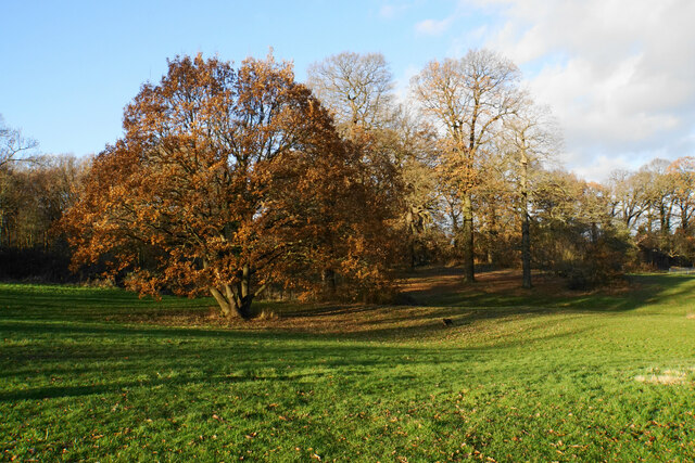
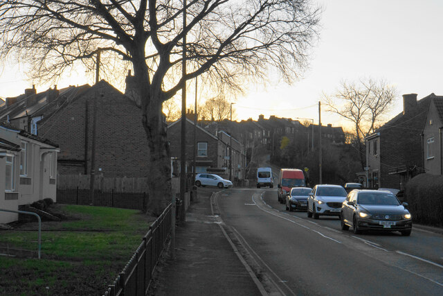
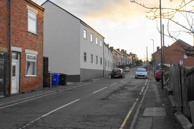
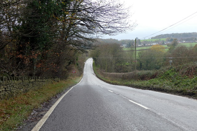
Barrow Hill is a small village located in Derbyshire, England. Situated just east of Chesterfield, it is a rural area known for its picturesque landscapes and tranquil atmosphere. The village is nestled in the valley of the River Rother, surrounded by rolling hills and lush green fields.

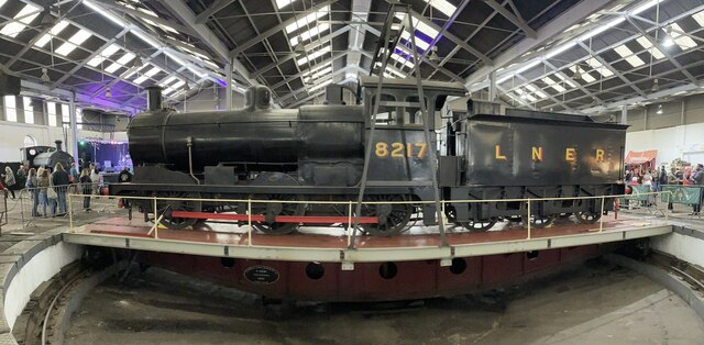
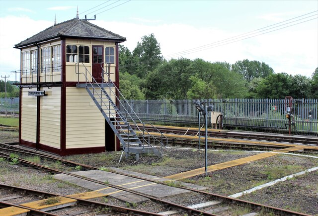
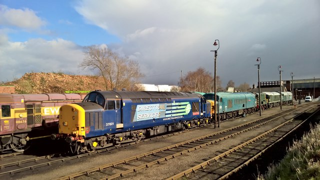
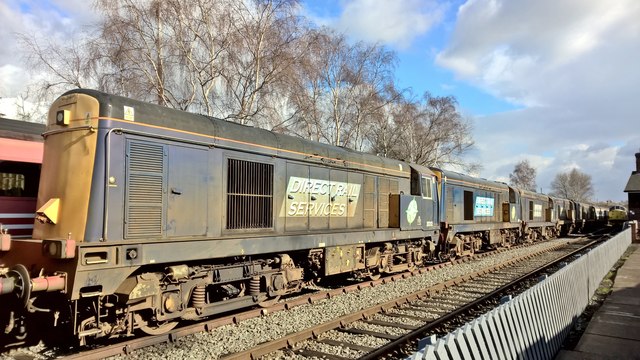
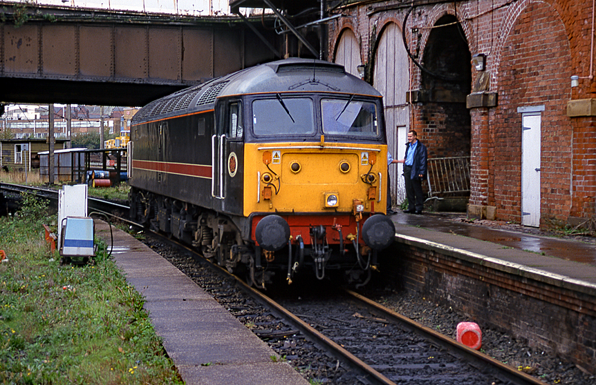
Barrow Hill is best known for its historic railway heritage. The Barrow Hill Roundhouse, built in 1870, is the last surviving operational roundhouse in England. The roundhouse was originally used for steam locomotive repairs and maintenance, but today it serves as a museum and a venue for various railway events, including steam train rides and model railway exhibitions. It is a popular destination for railway enthusiasts and visitors interested in the history of the locomotive industry.

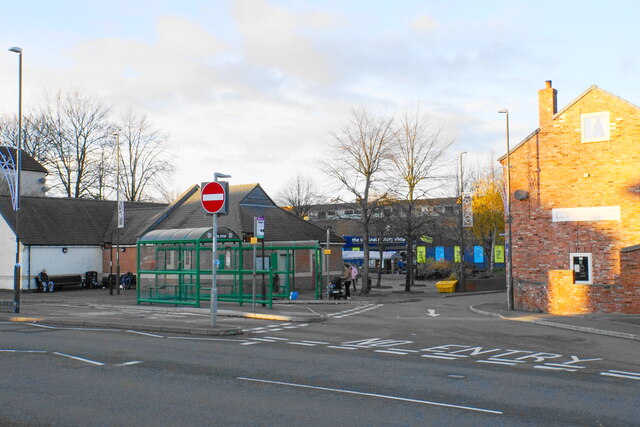
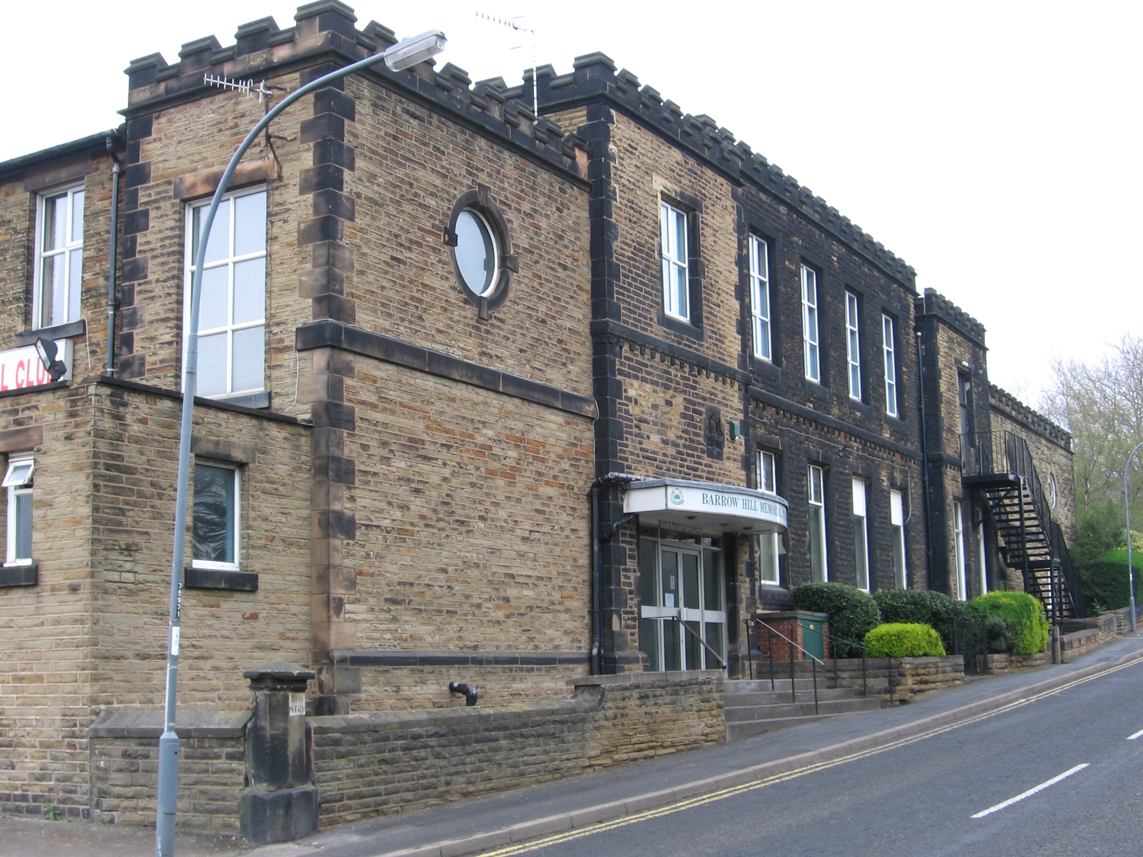
In addition to its railway heritage, Barrow Hill offers a range of amenities for residents and visitors. The village has a primary school, a local pub, and a few shops, providing essential services to the community. The surrounding countryside offers opportunities for outdoor activities such as hiking, cycling, and fishing, attracting nature lovers and outdoor enthusiasts.

Barrow Hill enjoys good transport links, with the A619 road connecting it to nearby towns and cities. The village is also served by a local bus service, providing convenient access to surrounding areas.

Overall, Barrow Hill is a charming village with a rich railway history, offering a peaceful and idyllic setting for residents and visitors to enjoy the natural beauty of the Derbyshire countryside.

If you have any feedback on the listing, please let us know in the comments section below.
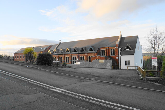
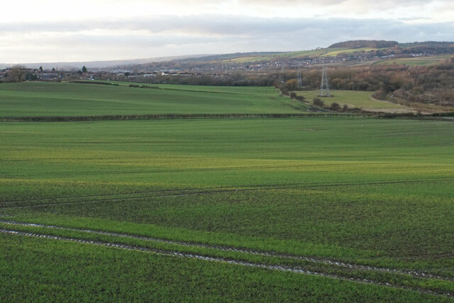
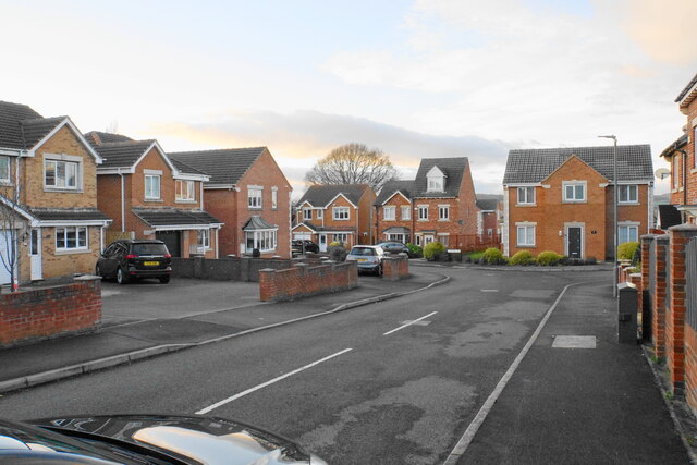
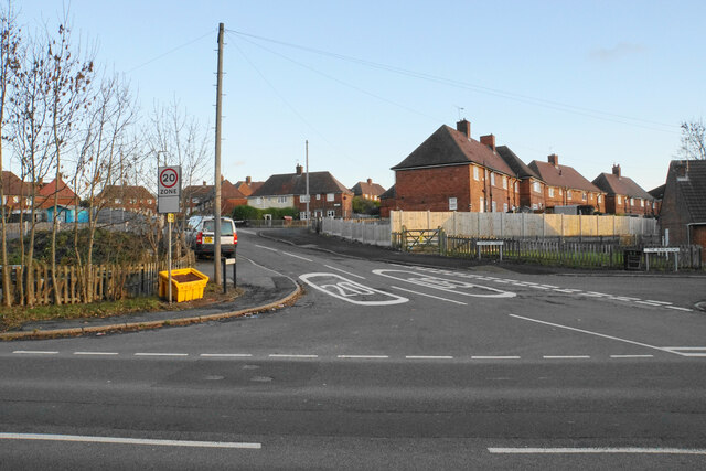
Barrow Hill Images

Images are sourced within 2km of 53.276904/-1.376096 or Grid Reference SK4175. Thanks to Geograph Open Source API. All images are credited.

Ringwood Park A park between Brimington and Staveley.
Ringwood Park
A park between Brimington and Staveley.
Market Street bus stop The main stop for the town centre, at the end of High Street where it meets Market Street.
Market Street bus stop
The main stop for the town centre, at the end of High Street where it meets Market Street.
Chesterfield Road, Middlecroft The A619 heading up Troughbrook Hill. The view is affected by low winter sun.
Chesterfield Road, Middlecroft
The A619 heading up Troughbrook Hill. The view is affected by low winter sun.
Middlecroft Road Access to a large area of housing off the A619.
Middlecroft Road
Access to a large area of housing off the A619.
St Joseph's Court A former Catholic church converted to a housing development.
St Joseph's Court
A former Catholic church converted to a housing development.
Farmland in the Rother valley The south side of the valley, below the A619 and the housing of Middlecroft.
Farmland in the Rother valley
The south side of the valley, below the A619 and the housing of Middlecroft.
Martindale Close A fairly recent housing development.
Martindale Close
A fairly recent housing development.
Division Street Access to housing off the A619.
Division Street
Access to housing off the A619.
The A619 at Middlecroft Passing through housing on the fringes of Staveley.
The A619 at Middlecroft
Passing through housing on the fringes of Staveley.
Steam train at the Beer Festival A steam train on at the May 2022 Barrow Hill Beer Festival. This is held inside the railway Roundhouse.
Steam train at the Beer Festival
A steam train on at the May 2022 Barrow Hill Beer Festival. This is held inside the railway Roundhouse.
Signal box at Barrow Hill
Looking down a large Brick Hole Taken on the site of the former Staveley Works
Looking down a large Brick Hole
Taken on the site of the former Staveley Works
Aerial view of the former Chemicals Works at Staveley Heavily overgrown site, once a busy chemical works. Rhodia LTD.
Aerial view of the former Chemicals Works at Staveley
Heavily overgrown site, once a busy chemical works. Rhodia LTD.
Railway bridge over Whittington Road The railway goes to the Barrow Hill Roundhouse Railway Museum
Railway bridge over Whittington Road
The railway goes to the Barrow Hill Roundhouse Railway Museum
Whittington Road A minor road between Barrow Hill and New Whittington
Whittington Road
A minor road between Barrow Hill and New Whittington
Springwell Hill A minor road between Nether Handley and New Whittington
Springwell Hill
A minor road between Nether Handley and New Whittington
Not quite the end of the line... Old diesel locomotives dating from the late 1950s lined up at Barrow Hill. The Direct Rail Services Class 37 appears to be still active. The 45, 40, 24 and 07s look less serviceable.
Not quite the end of the line...
Old diesel locomotives dating from the late 1950s lined up at Barrow Hill. The Direct Rail Services Class 37 appears to be still active. The 45, 40, 24 and 07s look less serviceable.
Class 20 line up at Barrow Hill These six Direct Rail Services locomotives were designed in the 1950s and have been active for almost 60 years. They may now be being cannibalised to keep the remainder in service to haul an occasional train.
Class 20 line up at Barrow Hill
These six Direct Rail Services locomotives were designed in the 1950s and have been active for almost 60 years. They may now be being cannibalised to keep the remainder in service to haul an occasional train.
Show me another place!

Barrow Hill is located at Grid Ref: SK4175 (Lat: 53.276904, Lng: -1.376096)

Administrative County: Derbyshire

District: Chesterfield

Police Authority: Derbyshire

What 3 Words

///fired.post.nest. Near Staveley, Derbyshire

Nearby Locations

Barrow Hill

Related Wikis

Barrow Hill, Derbyshire

Barrow Hill is a village in Derbyshire, England, north-east of Chesterfield in the civil parish of Staveley. It was formerly the site of Barrow Hill railway...

Barrow Hill railway station

Barrow Hill railway station is a former railway station in the village of Barrow Hill in northern Derbyshire, England. == History == The station was originally...

Barrow Hill Engine Shed

Barrow Hill Roundhouse, until 1948 known as Staveley Engine Shed, is a former Midland Railway roundhouse in Barrow Hill, near Staveley and Chesterfield...

Harry Needle Railroad Company

The Harry Needle Railroad Company (HNRC) is a railway spot-hire company, based at Barrow Hill Engine Shed in Derbyshire. Prior to 2010 the company also...

Nearby Amenities

Located within 500m of 53.276904,-1.376096
Barrow Hill
Place: village
Wikidata: Q4863879
Lat/Long: 53.2739492/-1.3761454
Post Office
Barrow Hill Post Office
Addr City: Chesterfield
Addr Country: GB
Addr Housenumber: 22
Addr Postcode: S43 2NL
Addr Street: Station Road
Addr Suburb: Barrow Hill
Opening Hours: Mo-Fr 09:00-15:00
Ref Pol Id: 14987
Lat/Long: 53.2755281/-1.3717502
Post Box
Collection Times: Mo-Fr 16:00; Sa 11:30
Post Box Type: wall
Ref: S43 97
Royal Cypher: GR
Royal Cypher Wikidata: Q33102273
Lat/Long: 53.2755897/-1.3717158
Post Box
Collection Times: Mo-Fr 09:00; Sa 07:00
Post Box Type: lamp
Ref: S43 252D
Royal Cypher: EIIR
Royal Cypher Wikidata: Q33102113
Lat/Long: 53.2736137/-1.3771489
Turning Circle
Lat/Long: 53.2775076/-1.3739366
Bench
Check Date: 2021-04-22
Lat/Long: 53.2734404/-1.3751294
Bus Stop
Bus: yes
Public Transport: platform
Lat/Long: 53.2736066/-1.3773396
Bus Stop
Bus: yes
Ele: 54.6802979
Public Transport: platform
Lat/Long: 53.2732335/-1.3775004
Barrier: cycle_barrier
Ele: 65.4951172
Lat/Long: 53.2730865/-1.3748822
Ele: 65.7353516
Lat/Long: 53.2729439/-1.3745771
Railway: buffer_stop
Lat/Long: 53.2742304/-1.380057
Railway: buffer_stop
Lat/Long: 53.2745017/-1.3811076
Staveley Passenger Junction
Historic Railway: junction
Railway: site
Lat/Long: 53.2727908/-1.3791331
Bench
Ele: 82.0000000
Lat/Long: 53.2775541/-1.3688793
Bus Stop
Ele: 80.0000000
Naptan AtcoCode: 1000DBHS6727
Naptan NaptanCode: dbsjajmd
Lat/Long: 53.277583/-1.3688096
Birdis
Description: Off Licence
Ele: 83.0000000
Shop: convenience
Lat/Long: 53.2748099/-1.3726854
Barrier: bollard
Foot: yes
Lat/Long: 53.2749165/-1.3728798
Community Centre
Barrow Hill Memorial Hall
Ele: 64.0000000
Lat/Long: 53.2734575/-1.3765458
Railway: buffer_stop
Lat/Long: 53.2742837/-1.3801043
Roundhouse Halt
Public Transport: station
Railway: station
Usage: tourism
Website: https://www.barrowhill.org/
Lat/Long: 53.2746594/-1.3813376
Barrier: block
Lat/Long: 53.2797511/-1.3788409
Barrier: bollard
Foot: yes
Lat/Long: 53.2754699/-1.3744784
Barrier: bollard
Foot: yes
Lat/Long: 53.2754745/-1.3733159
Generator Method: photovoltaic
Generator Output Electricity: yes
Generator Source: solar
Generator Type: solar_photovoltaic_panel
Location: roof
Power: generator
Lat/Long: 53.2758819/-1.3742453
Generator Method: photovoltaic
Generator Output Electricity: yes
Generator Source: solar
Generator Type: solar_photovoltaic_panel
Location: roof
Power: generator
Lat/Long: 53.2759043/-1.3742024
Generator Method: photovoltaic
Generator Output Electricity: yes
Generator Source: solar
Generator Type: solar_photovoltaic_panel
Location: roof
Power: generator
Lat/Long: 53.2753766/-1.3756669
Generator Method: photovoltaic
Generator Output Electricity: yes
Generator Source: solar
Generator Type: solar_photovoltaic_panel
Location: roof
Power: generator
Lat/Long: 53.2754179/-1.3757142
Generator Method: photovoltaic
Generator Output Electricity: yes
Generator Source: solar
Generator Type: solar_photovoltaic_panel
Location: roof
Power: generator
Lat/Long: 53.277589/-1.3737173
Generator Method: photovoltaic
Generator Output Electricity: yes
Generator Source: solar
Generator Type: solar_photovoltaic_panel
Location: roof
Power: generator
Lat/Long: 53.2758269/-1.3721782
Generator Method: photovoltaic
Generator Output Electricity: yes
Generator Source: solar
Generator Type: solar_photovoltaic_panel
Location: roof
Power: generator
Lat/Long: 53.2758661/-1.3721744
Generator Method: photovoltaic
Generator Output Electricity: yes
Generator Source: solar
Generator Type: solar_photovoltaic_panel
Location: roof
Power: generator
Lat/Long: 53.2758242/-1.3722445
Barrier: stile
Lat/Long: 53.2798386/-1.3786365
Railway: buffer_stop
Lat/Long: 53.2745917/-1.3808397
The data included in this document is from www.openstreetmap.org. The data is made available under ODbL.

Have you been to Barrow Hill?

Leave your review of Barrow Hill below (or comments, questions and feedback).