Tail Clough

Valley in Lancashire Lancaster

England

Tail Clough

Autumn colours In a strip of woodland alongside the River Marshaw to the west of the Forest of Bowland.
Autumn colours Credit: Oliver Dixon

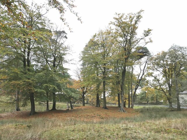
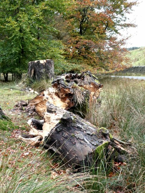
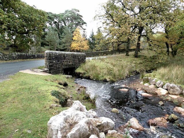
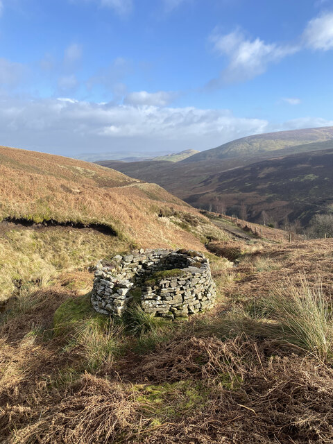
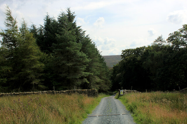
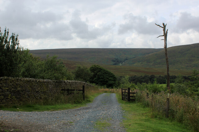
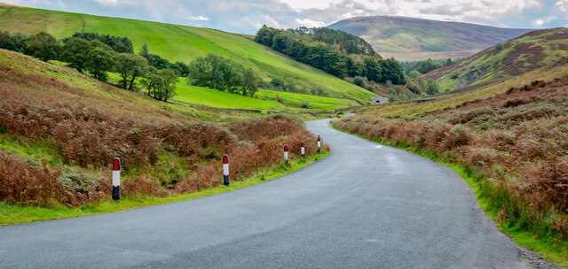
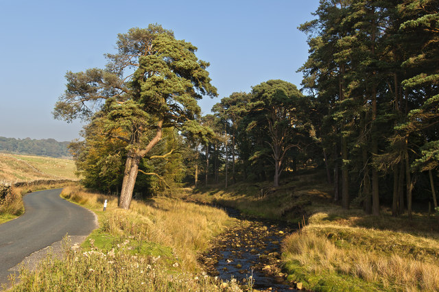
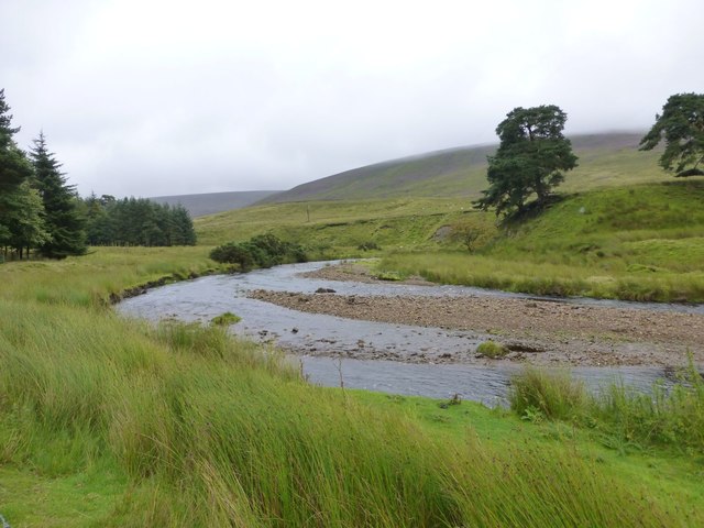
Tail Clough is a small valley located in Lancashire, England. The valley is situated in the picturesque countryside, surrounded by rolling hills and lush greenery. It is a peaceful and tranquil area, perfect for those looking to escape the hustle and bustle of city life.

The valley is home to a variety of wildlife, including birds, rabbits, and deer. It is a popular spot for birdwatchers and nature enthusiasts, who come to admire the diverse range of species that call Tail Clough home.

The valley is crisscrossed by a network of walking trails, making it a popular destination for hikers and outdoor enthusiasts. The trails offer stunning views of the surrounding countryside, with plenty of opportunities to spot wildlife along the way.

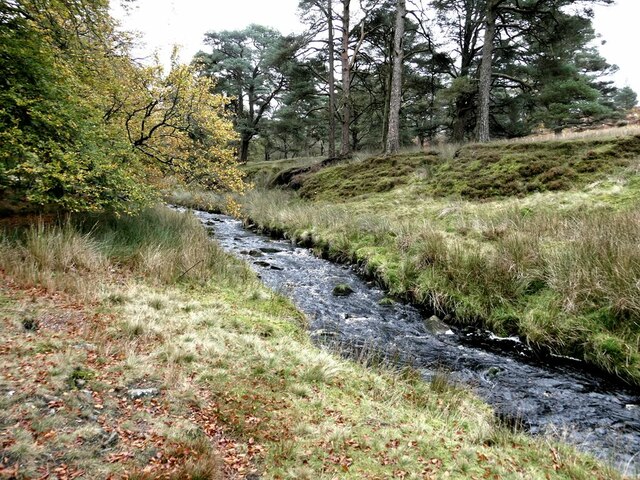
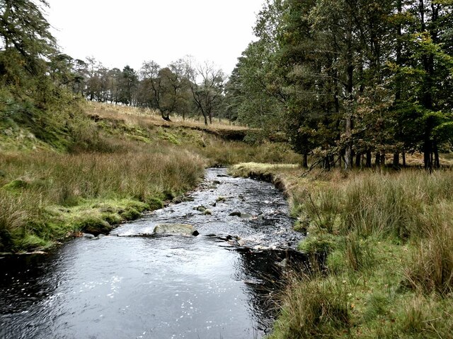
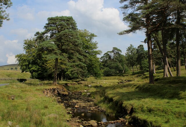
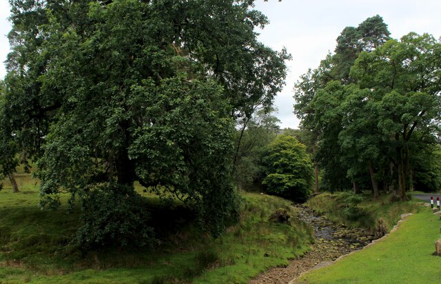
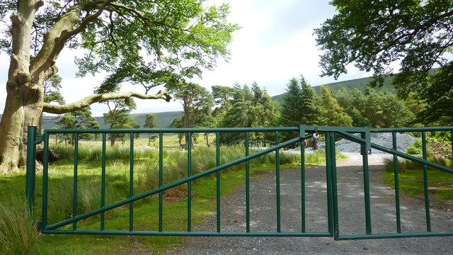
Visitors to Tail Clough can also enjoy picnicking by the river, fishing in the clear waters, or simply relaxing and taking in the natural beauty of the area. With its peaceful atmosphere and stunning scenery, Tail Clough is a hidden gem in Lancashire that is well worth a visit.

If you have any feedback on the listing, please let us know in the comments section below.

Tail Clough Images

Images are sourced within 2km of 53.966688/-2.6002526 or Grid Reference SD6052. Thanks to Geograph Open Source API. All images are credited.

Autumn colours In a strip of woodland alongside the River Marshaw to the west of the Forest of Bowland.
Autumn colours
In a strip of woodland alongside the River Marshaw to the west of the Forest of Bowland.
Fallen tree In a strip of woodland alongside the River Marshaw Wyre to the west of the Forest of Bowland.
Fallen tree
In a strip of woodland alongside the River Marshaw Wyre to the west of the Forest of Bowland.
River Marshaw Wyre In a strip of woodland alongside the river to the west of the Forest of Bowland.
River Marshaw Wyre
In a strip of woodland alongside the river to the west of the Forest of Bowland.
River Marshaw Wyre In a strip of woodland alongside the river to the west of the Forest of Bowland.
River Marshaw Wyre
In a strip of woodland alongside the river to the west of the Forest of Bowland.
Trough Bridge Where the road from the Trough of Bowland crosses the River Marshaw Wyre. Trough Brook enters the river from the right.
Trough Bridge
Where the road from the Trough of Bowland crosses the River Marshaw Wyre. Trough Brook enters the river from the right.
Cyclists' memorials at the Trough of Bowland About the year 2000 give or take a year, I cycled up to the Trough of Bowland to witness the Tour of Britain passing through. Amongst the many cyclists assembled there, I witnessed a small group intent on inaugurating this memorial stone. It never occurred to me to photograph this event (it was of course before Geograph days) and indeed I had no idea of the significance of the event.

This understated memorial reads 

Bill Bradley, Southport CC, 1933-1997
International Racing Cyclist
Tour of Britain winner 1959 and 1960
He loved to ride through the area

An even more modest memorial stone has subsequently been added to the left of the original memorial. It reads:

Legendary Cyclist 
Jack Thompson
1912-2003

Up until 2010, the second stone rested on top of the original - see <a href="https://www.geograph.org.uk/photo/1900323">SD6253 : Cyclists' memorials, Trough of Bowland</a>, but by 2012 it had been moved to the side <a href="https://www.geograph.org.uk/photo/2960819">SD6253 : Memorial stones, Trough of Bowland</a>.
Cyclists' memorials at the Trough of Bowland
About the year 2000 give or take a year, I cycled up to the Trough of Bowland to witness the Tour of Britain passing through. Amongst the many cyclists assembled there, I witnessed a small group intent on inaugurating this memorial stone. It never occurred to me to photograph this event (it was of course before Geograph days) and indeed I had no idea of the significance of the event. This understated memorial reads Bill Bradley, Southport CC, 1933-1997 International Racing Cyclist Tour of Britain winner 1959 and 1960 He loved to ride through the area An even more modest memorial stone has subsequently been added to the left of the original memorial. It reads: Legendary Cyclist Jack Thompson 1912-2003 Up until 2010, the second stone rested on top of the original - see SD6253 : Cyclists' memorials, Trough of Bowland, but by 2012 it had been moved to the side SD6253 : Memorial stones, Trough of Bowland.
Cyclists' memorials at the Trough of Bowland Just visible above the low wall are the understated memorials to two distinguished cyclists. For details, see <a href="https://www.geograph.org.uk/photo/7002538">SD6253 : Cyclists' memorials at the Trough of Bowland</a>.
Cyclists' memorials at the Trough of Bowland
Just visible above the low wall are the understated memorials to two distinguished cyclists. For details, see SD6253 : Cyclists' memorials at the Trough of Bowland.
Cattle grid at the Trough of Bowland A famous mountain road between Clitheroe and Lancaster.
Cattle grid at the Trough of Bowland
A famous mountain road between Clitheroe and Lancaster.
Grouse Butt, Higher Dry Clough Grouse butt used as a hide / wind break for grouse shooting. This particular one is lower down the hillside than the series of grouse butts indicated on the 1:25k OS map.
Grouse Butt, Higher Dry Clough
Grouse butt used as a hide / wind break for grouse shooting. This particular one is lower down the hillside than the series of grouse butts indicated on the 1:25k OS map.
Marshaw Wyre looking Upstream The river near Tower Lodge, enclosed by a delightful strip of woodland along side the Trough Road in Bowland
Marshaw Wyre looking Upstream
The river near Tower Lodge, enclosed by a delightful strip of woodland along side the Trough Road in Bowland
Marshaw Wyre looking Downstream River in a delightful strip of woodland beside the Trough Road. Further downstream the watercourse will unite with the Tarnbrook Wyre, to become the plain old Wyre. It enters the Irish Sea at Fleetwood.
Marshaw Wyre looking Downstream
River in a delightful strip of woodland beside the Trough Road. Further downstream the watercourse will unite with the Tarnbrook Wyre, to become the plain old Wyre. It enters the Irish Sea at Fleetwood.
Tower Lodge Located on the Trough Road beside the Marshaw Wyre river.
Built as the lodge house for the uncompleted Wyresdale Tower Shooting House, and now a Grade II Listed Building.
The Wyre Way long distance footpath passes up the track to the left, giving access to the fells around Tarnbrook.
Tower Lodge
Located on the Trough Road beside the Marshaw Wyre river. Built as the lodge house for the uncompleted Wyresdale Tower Shooting House, and now a Grade II Listed Building. The Wyre Way long distance footpath passes up the track to the left, giving access to the fells around Tarnbrook.
Wyre Way descending into Tower Plantation Adopted a well appointed track that descends through plantation to Tower Lodge on the Trough Road
Wyre Way descending into Tower Plantation
Adopted a well appointed track that descends through plantation to Tower Lodge on the Trough Road
Descending towards Tower Plantation
Looking down the Trough of Bowland Road
Gate to Marshaw Wyre
Trough Beck
Trough Beck
Marshaw Wyre Hawthornthwaite Fell rising to the right.
Marshaw Wyre
Hawthornthwaite Fell rising to the right.
Show me another place!

Tail Clough is located at Grid Ref: SD6052 (Lat: 53.966688, Lng: -2.6002526)

Administrative County: Lancashire

District: Lancaster

Police Authority: Lancashire

What 3 Words

///happy.shredding.buildings. Near Bay Horse, Lancashire

Nearby Locations

Tail Clough Marshaw Fell

Related Wikis

Grey Stone of Trough

The Grey Stone of Trough is an historic boundary marker in Bowland Forest High, in the Trough of Bowland, Lancashire, England. A Grade II listed structure...

National nature reserves in Lancashire

National nature reserves in Lancashire in England are established by Natural England. There are two national nature reserves in Lancashire, both of which...

Trough of Bowland

The Trough of Bowland is a valley and high pass in the Forest of Bowland Area of Outstanding Natural Beauty, Lancashire, England. The pass, reaching 968...

Forest of Bowland

The Forest of Bowland, also known as the Bowland Fells and formerly the Chase of Bowland, is an area of gritstone fells, deep valleys and peat moorland...

Nearby Amenities

Located within 500m of 53.966688,-2.6002526
Turning Circle
Lat/Long: 53.9697484/-2.6053791
Turning Circle
Lat/Long: 53.9654631/-2.6075658
The data included in this document is from www.openstreetmap.org. The data is made available under ODbL.

Have you been to Tail Clough?

Leave your review of Tail Clough below (or comments, questions and feedback).