Deepdale

Valley in Cumberland Carlisle

England

Deepdale

Old Water Bridge Old Water flows into the River Gelt about a mile further on. The structure in the foreground is not an old sheep fold but a dry stone wall built to keep sheep away from a water intake point.
Old Water Bridge Credit: Malcolm Jones

Deepdale is a picturesque valley located in the county of Cumberland, in the northwest of England. It is nestled within the beautiful Lake District National Park, renowned for its stunning landscapes and outdoor activities. The valley is situated near the village of Grasmere, a popular tourist destination known for its connection to the poet William Wordsworth.

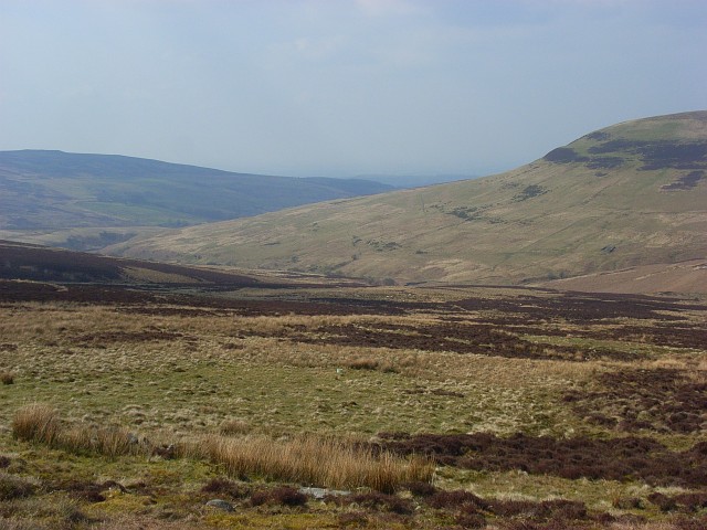
Deepdale offers visitors a serene and tranquil environment, surrounded by rolling hills and dense forests. The valley is traversed by a meandering river, adding to its natural charm. The area is home to a diverse range of flora and fauna, making it a haven for nature enthusiasts and wildlife lovers.

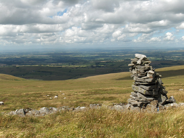
The valley provides numerous opportunities for outdoor pursuits, with walking and hiking trails that cater to all levels of fitness. The surrounding hills offer panoramic views of the countryside, making it a favorite spot for photography enthusiasts. Fishing is also a popular activity in the river, with anglers drawn to its abundant trout and salmon.

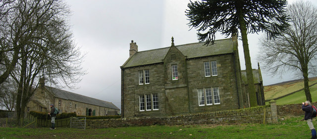
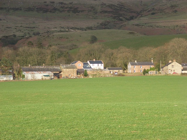
Deepdale is dotted with quaint cottages and farmhouses, adding to its rustic charm. It offers a peaceful retreat away from the hustle and bustle of urban life, making it an ideal destination for those seeking relaxation and rejuvenation.

In conclusion, Deepdale in Cumberland is a breathtaking valley situated within the Lake District National Park. With its stunning natural landscapes, abundant wildlife, and various outdoor activities, it is a must-visit destination for nature lovers and outdoor enthusiasts alike.

If you have any feedback on the listing, please let us know in the comments section below.

Deepdale Images

Images are sourced within 2km of 54.87059/-2.6357391 or Grid Reference NY5953. Thanks to Geograph Open Source API. All images are credited.

Old Water Bridge Old Water flows into the River Gelt about a mile further on. The structure in the foreground is not an old sheep fold but a dry stone wall built to keep sheep away from a water intake point.
Old Water Bridge
Old Water flows into the River Gelt about a mile further on. The structure in the foreground is not an old sheep fold but a dry stone wall built to keep sheep away from a water intake point.
Bridleway leading to Middle Top and Lord's Seat Track leading from Water Works below Geltsdale House meets a bridleway to the left is Old Water Bridge.
Bridleway leading to Middle Top and Lord's Seat
Track leading from Water Works below Geltsdale House meets a bridleway to the left is Old Water Bridge.
Bridleway below Tarnmonath Fell This bridleway leads from Old Water Bridge to Gairs.
Bridleway below Tarnmonath Fell
This bridleway leads from Old Water Bridge to Gairs.
Waterfall in New Water Very unusual to get a good vantage point directly facing a waterfall. Not marked on OS 50K map.
Waterfall in New Water
Very unusual to get a good vantage point directly facing a waterfall. Not marked on OS 50K map.
New Water Rapids Rapids with quite steep descent downstream of waterfall. Must result from a change in rock strata.
New Water Rapids
Rapids with quite steep descent downstream of waterfall. Must result from a change in rock strata.
Pumping Station at Geltsdale View up to the Water Pumping Station at Geltsdale.
Pumping Station at Geltsdale
View up to the Water Pumping Station at Geltsdale.
Ford across Old Water at Geltsdale Pumping Station Ford across Old Water at Geltsdale Pumping Station.
Ford across Old Water at Geltsdale Pumping Station
Ford across Old Water at Geltsdale Pumping Station.
The east side of Cumrew Fell
Moorland, Geltsdale The view across the top of the valley of Tarnmonath Beck.
Moorland, Geltsdale
The view across the top of the valley of Tarnmonath Beck.
Old Water, Geltsdale This is one of the two main watercourses that join to form the Gelt. The other one is New Water, but I don't know why it is considered to be new.
Old Water, Geltsdale
This is one of the two main watercourses that join to form the Gelt. The other one is New Water, but I don't know why it is considered to be new.
Moorland, Geltsdale The top of the small valley of Deepdale is on the slope on this side of the valley. Tarnmonath Fell is on the other side of the main valley.
Moorland, Geltsdale
The top of the small valley of Deepdale is on the slope on this side of the valley. Tarnmonath Fell is on the other side of the main valley.
Geltsdale Looking down on the point where Old Water and Tarnmonath Beck meet - the western edge of the grid-square.
Geltsdale
Looking down on the point where Old Water and Tarnmonath Beck meet - the western edge of the grid-square.
Sheepfold, Tarnmonath Fell The small square enclosure is clearly marked on the 1:25000 map. The shooting cabin, however, is no longer here. There is though a new one higher up the valley of Tarnmonath Beck. Here we are looking across the foot of that valley.
Sheepfold, Tarnmonath Fell
The small square enclosure is clearly marked on the 1:25000 map. The shooting cabin, however, is no longer here. There is though a new one higher up the valley of Tarnmonath Beck. Here we are looking across the foot of that valley.
Valley of Tarnmonath Beck Looking up from its confluence with Old Water. The Ordnance Survey spell the name of the stream differently. I take this to be a typo since the fell to the left is Tarnmonath Fell.
Valley of Tarnmonath Beck
Looking up from its confluence with Old Water. The Ordnance Survey spell the name of the stream differently. I take this to be a typo since the fell to the left is Tarnmonath Fell.
Old Water, Geltsdale This is just below the waterfall marked on the 1:25000 map and above the confluence with Deepdale. The stream is about a mile above its confluence with New Water which forms the River Gelt.
Old Water, Geltsdale
This is just below the waterfall marked on the 1:25000 map and above the confluence with Deepdale. The stream is about a mile above its confluence with New Water which forms the River Gelt.
Waterfall, Old Water, Geltsdale This is the largest fall on this stretch of an unfrequented stream of upper Geltsdale.
Waterfall, Old Water, Geltsdale
This is the largest fall on this stretch of an unfrequented stream of upper Geltsdale.
Old Water, Geltsdale A section of small cascades above the waterfall marked on the 1:25000 map.
Old Water, Geltsdale
A section of small cascades above the waterfall marked on the 1:25000 map.
Moorland, Geltsdale Looking across the valleys of Old Water and Tarnmonath Beck. The sheepfold just beneath the line of the shadow is just inside the western edge of the grid-square, see <a href="https://www.geograph.org.uk/photo/781596">NY5953 : Sheepfold, Tarnmonath Fell</a>.
Moorland, Geltsdale
Looking across the valleys of Old Water and Tarnmonath Beck. The sheepfold just beneath the line of the shadow is just inside the western edge of the grid-square, see NY5953 : Sheepfold, Tarnmonath Fell.
Show me another place!

Deepdale is located at Grid Ref: NY5953 (Lat: 54.87059, Lng: -2.6357391)

Administrative County: Cumbria

District: Carlisle

Police Authority: Cumbria

What 3 Words

///speeding.arranges.pitching. Near Brampton, Cumbria

Nearby Locations

Deepdale

Related Wikis

Geltsdale

Geltsdale is a hamlet and former civil parish, now in the parish of Castle Carrock, in the Cumberland district, in the ceremonial county of Cumbria, England...

Geltsdale & Glendue Fells

Geltsdale & Glendue Fells is a Site of Special Scientific Interest in the North Pennines, England. The site has an area of 8059 ha, partly in Cumbria...

Cold Fell (Pennines)

Cold Fell is a mountain in the northern Pennines, in Cumbria, England. Lying among the northernmost uplands of the North Pennines AONB, it is the most...

Albyfield

Albyfield is a hamlet in Cumbria, England.

Carlatton and Cumrew

Carlatton and Cumrew are civil parishes in Cumbria, England with a common parish council.The Eastern boundary of this rural parish is Cardunneth Pike in...

Cumrew

Cumrew is a small village and civil parish in north-east Cumbria, England. About 7 miles (11 km) south of Brampton and 13 miles (21 km) east of Carlisle...

Geltsdale Reservoir railway

The Geltsdale Reservoir railway was a 3 ft (914 mm) narrow gauge industrial railway used during the construction of Castle Carrock Reservoir near Carlisle...

Newbiggin, Ainstable

Newbiggin is a small hamlet in Cumbria, England. Cumrew beck flows north-west through Newbiggin eventually joining the Eden close to Armathwaite. The village...

Nearby Amenities

Located within 500m of 54.87059,-2.6357391
King's Forest of Geltside
Place: locality
Lat/Long: 54.8710874/-2.630638
Ford: yes
Lat/Long: 54.8736551/-2.6387265
Deepdale
Place: locality
Lat/Long: 54.8704105/-2.6366481
The data included in this document is from www.openstreetmap.org. The data is made available under ODbL.

Have you been to Deepdale?

Leave your review of Deepdale below (or comments, questions and feedback).