Minto Glen

Valley in Roxburghshire

Scotland

Minto Glen

Ruberslaw Parish Church, Minto Minto was a planned village, designed and laid out by William Playfair for the 2nd Earl of Minto. The Church – a Victorian building in the Gothic style – was built as part of the plan and was completed in 1831, replacing a much earlier mediaeval building which stood a short distance to the east and which was recorded as far back as 1275.
Ruberslaw Parish Church, Minto Credit: Colin Kinnear

Minto Glen, located in Roxburghshire, Scotland, is a picturesque valley renowned for its natural beauty and rich history. Nestled amidst the rolling hills and lush greenery of the Scottish Borders, it offers a tranquil escape for nature lovers and history enthusiasts alike.

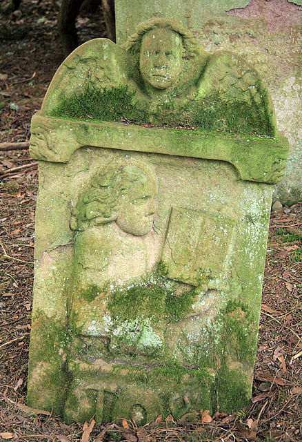
The glen is named after the Minto family, who have owned the surrounding lands since the 12th century. The Minto House, a grand mansion built in the 18th century, is an architectural gem that stands as a testament to the area's historical significance.

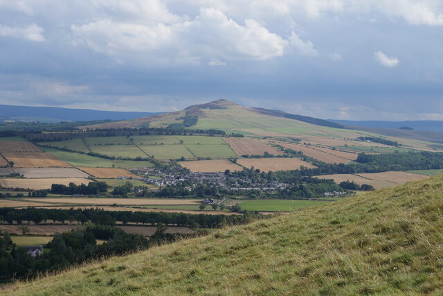
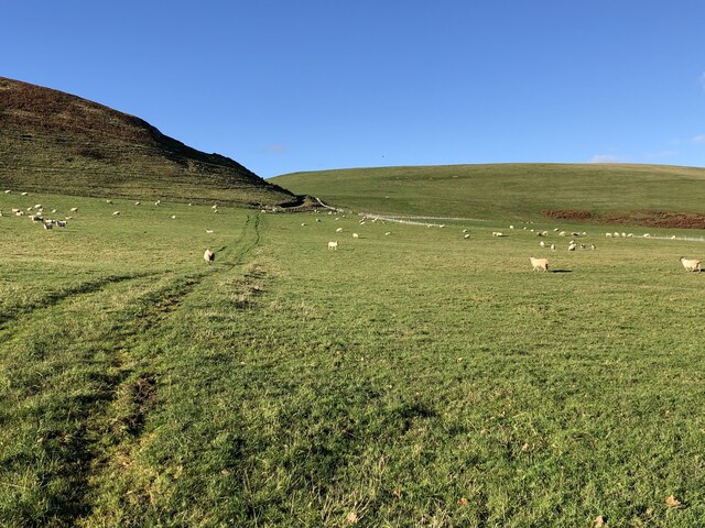
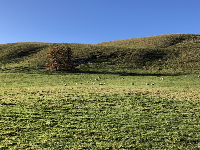
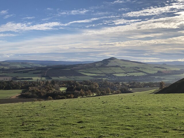
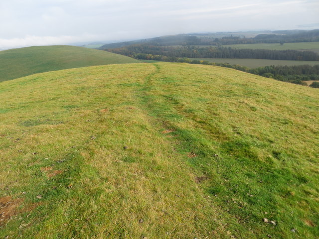
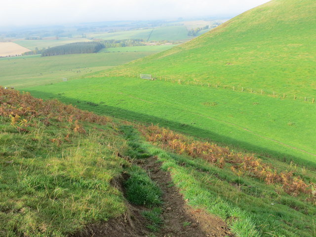
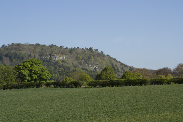
The glen is characterized by its diverse landscape, featuring meandering rivers, dense forests, and open meadows. It is home to a wide variety of wildlife, including deer, birds, and small mammals, making it a haven for nature enthusiasts and birdwatchers.

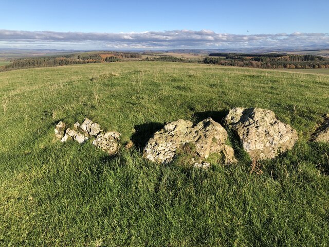
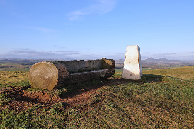
Visitors to Minto Glen can explore its numerous walking trails, which offer stunning views of the surrounding countryside. The glen's well-maintained paths cater to all levels of fitness, ensuring that everyone can enjoy the beauty of the area at their own pace. The Minto Crags, a series of rocky outcrops, are a popular spot for rock climbing and offer breathtaking vistas of the glen and beyond.

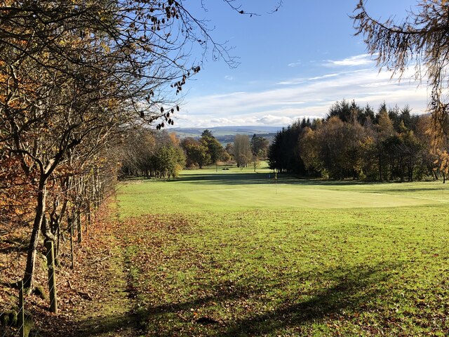
In addition to its natural beauty, Minto Glen offers a range of recreational activities. The Minto Golf Club, established in 1928, provides golfers with an opportunity to enjoy a challenging round amidst stunning scenery. The glen also hosts various events throughout the year, including traditional Highland games and music festivals, showcasing the rich cultural heritage of the region.

Overall, Minto Glen is a hidden gem in Roxburghshire, offering a perfect blend of natural splendor and historical charm. It is a must-visit destination for those seeking an authentic Scottish experience.

If you have any feedback on the listing, please let us know in the comments section below.
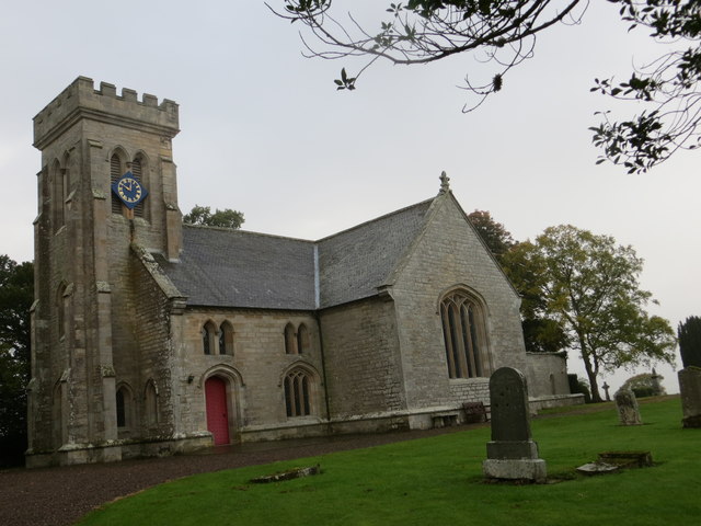
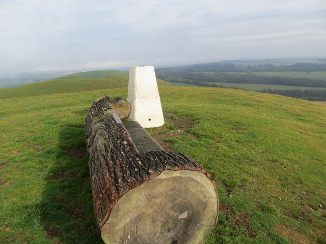
Minto Glen Images

Images are sourced within 2km of 55.473901/-2.673845 or Grid Reference NT5720. Thanks to Geograph Open Source API. All images are credited.

Ruberslaw Parish Church, Minto Minto was a planned village, designed and laid out by William Playfair for the 2nd Earl of Minto. The Church – a Victorian building in the Gothic style – was built as part of the plan and was completed in 1831, replacing a much earlier mediaeval building which stood a short distance to the east and which was recorded as far back as 1275.
Ruberslaw Parish Church, Minto
Minto was a planned village, designed and laid out by William Playfair for the 2nd Earl of Minto. The Church – a Victorian building in the Gothic style – was built as part of the plan and was completed in 1831, replacing a much earlier mediaeval building which stood a short distance to the east and which was recorded as far back as 1275.
On the Minto Hills Descending the southern Minto Hill with a view to Denholm, the imposing Rubers Law and the distant Cheviot Hills.

This photograph was taken during the Coronavirus (COVID-19) pandemic of 2020/21/22.
On the Minto Hills
Descending the southern Minto Hill with a view to Denholm, the imposing Rubers Law and the distant Cheviot Hills. This photograph was taken during the Coronavirus (COVID-19) pandemic of 2020/21/22.
Minto Golf Course
Minto Golf Course
Path, Minto Hills A tractor track heads for the col from which either top is easily reached.
Path, Minto Hills
A tractor track heads for the col from which either top is easily reached.
Minto Hills A pair of summits somewhat out of character with their surroundings. Made of rock of a volcanic origin, ash infilling volcanic vents.
Minto Hills
A pair of summits somewhat out of character with their surroundings. Made of rock of a volcanic origin, ash infilling volcanic vents.
Cairn, Minto Hills A ring of stones at the North top summit.
Cairn, Minto Hills
A ring of stones at the North top summit.
View of Rubers Law from the Minto Hills Teviotdale igneous features.
View of Rubers Law from the Minto Hills
Teviotdale igneous features.
Hedge planting, Minto Hills The new hedges already planted are backed up with some hefty electric fences but there are gates.
Hedge planting, Minto Hills
The new hedges already planted are backed up with some hefty electric fences but there are gates.
Ordnance Survey Cut Mark with Bolt This can be found on the wall of Minto Parish Church.
For more detail see: <span class="nowrap"><a title="http://www.bench-marks.org.uk/bm72134" rel="nofollow ugc noopener" href="http://www.bench-marks.org.uk/bm72134">Link</a><img style="margin-left:2px;" alt="External link" title="External link - shift click to open in new window" src="https://s1.geograph.org.uk/img/external.png" width="10" height="10"/></span>
Ordnance Survey Cut Mark with Bolt
This can be found on the wall of Minto Parish Church. For more detail see: LinkExternal link
Minto Parish Church Looking from the north-east.
Minto Parish Church
Looking from the north-east.
A place to sit after climbing to Minto Hill Triangulation Pillar Looking northward.
A place to sit after climbing to Minto Hill Triangulation Pillar
Looking northward.
Path along the ridge of Minto Hill Looking northward.
Path along the ridge of Minto Hill
Looking northward.
Path descending the flank of Minto Hills Looking north-westward.
Path descending the flank of Minto Hills
Looking north-westward.
A symbolic gravestone at the site of the former Minto Old Parish Church This Memento Mori (remember you must die) portrait stone shows the deceased holding a book which denotes religious devotion. A winged soul above is a symbol of immortality representing the human soul rising to await Judgement Day, while the hammer, tongs and horseshoe below indicates that this is the grave of a blacksmith. Minto Old Parish Church was demolished in 1831, the same year that the present church was built. The stone is in a small group by an ancient yew tree <a href="https://www.geograph.org.uk/photo/766382">NT5720 : Old headstones at Minto</a>.
A symbolic gravestone at the site of the former Minto Old Parish Church
This Memento Mori (remember you must die) portrait stone shows the deceased holding a book which denotes religious devotion. A winged soul above is a symbol of immortality representing the human soul rising to await Judgement Day, while the hammer, tongs and horseshoe below indicates that this is the grave of a blacksmith. Minto Old Parish Church was demolished in 1831, the same year that the present church was built. The stone is in a small group by an ancient yew tree NT5720 : Old headstones at Minto.
Minto Hill trig point A log seat has been placed by the triangulation pillar. A plaque is inscribed:

Happy Memories
Bob Blake
Jackie Graham
Zach Fox
Minto Hill trig point
A log seat has been placed by the triangulation pillar. A plaque is inscribed: Happy Memories Bob Blake Jackie Graham Zach Fox
Hens resting A sign at Burncrooks Farm, Minto, indicating that there are no eggs for sale during the winter months.
Hens resting
A sign at Burncrooks Farm, Minto, indicating that there are no eggs for sale during the winter months.
The Minto Hills This view is from the A698. It shows the imposing Peel tower, just, towards the right hand end of the line of hills.
The Minto Hills
This view is from the A698. It shows the imposing Peel tower, just, towards the right hand end of the line of hills.
The Peel Tower on Minto Hill The tower has had a chequered history but was restored a few years ago.  You cannot enter the tower but the climb up to it offers superb views of the surrounding countryside. Normally it is a very muddy walk up but when we went after an April with almost no rain it was completely dry.
The Peel Tower on Minto Hill
The tower has had a chequered history but was restored a few years ago. You cannot enter the tower but the climb up to it offers superb views of the surrounding countryside. Normally it is a very muddy walk up but when we went after an April with almost no rain it was completely dry.
Show me another place!

Minto Glen is located at Grid Ref: NT5720 (Lat: 55.473901, Lng: -2.673845)

Unitary Authority: The Scottish Borders

Police Authority: The Lothians and Scottish Borders

What 3 Words

///swooned.harsh.herbs. Near Jedburgh, Scottish Borders

Nearby Locations

Minto Glen

Related Wikis

Craigmount School

Craigmount School was a private school originally for boys, but for most of its history for girls, in Edinburgh. It opened in 1874 and closed in 1966....

Minto, Scottish Borders

Minto is a village and parish in the Scottish Borders area of Scotland in Roxburghshire county. It is located 6 miles (10 kilometres) north-east of Hawick...
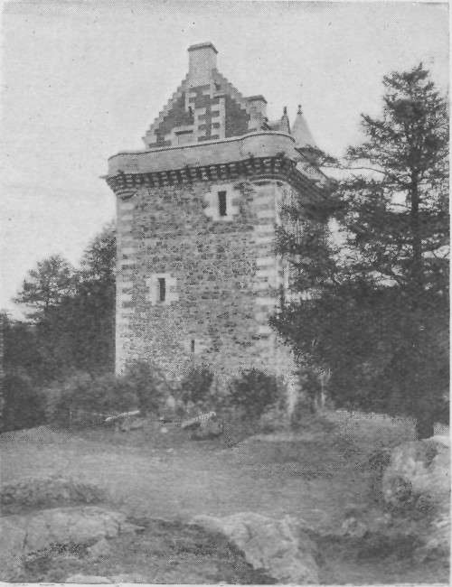
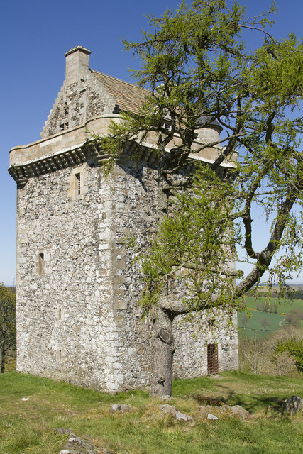
Fatlips Castle

Fatlips Castle is a peel tower in Roxburghshire, in the Scottish Borders. Situated at the top of Minto Crags, above the River Teviot, it was built in the...

Spittal-on-Rule

Spittal-on-Rule is a farm in the council area of Scottish Borders in Scotland. As the name suggests it is situated on the river Rule Water, and the Spittal...

Nearby Amenities

Located within 500m of 55.473901,-2.673845
Hill House
Place: isolated_dwelling
Lat/Long: 55.474631/-2.6758578
Minto Glen
Place: isolated_dwelling
Lat/Long: 55.4713161/-2.6738837
Minto House
Place: locality
Lat/Long: 55.4762858/-2.6787988
Barrier: cattle_grid
Lat/Long: 55.4767645/-2.6779001
Deanfoot
Place: hamlet
Lat/Long: 55.4719109/-2.6674123
Noexit: yes
Lat/Long: 55.4735899/-2.679652
Power: pole
Lat/Long: 55.4699961/-2.6771162
Power: pole
Lat/Long: 55.4705242/-2.6695776
Power: pole
Lat/Long: 55.4714177/-2.6702819
Power: pole
Lat/Long: 55.4721514/-2.6708603
Power: pole
Lat/Long: 55.4730487/-2.6712217
Power: pole
Lat/Long: 55.4739387/-2.671578
Power: pole
Lat/Long: 55.4744638/-2.6721965
Power: pole
Lat/Long: 55.4750335/-2.6728684
Power: pole
Lat/Long: 55.475586/-2.6735199
Power: pole
Lat/Long: 55.4761558/-2.6741842
Power: pole
Lat/Long: 55.4764832/-2.6752786
Power: pole
Lat/Long: 55.4768294/-2.6763908
Power: pole
Lat/Long: 55.4770385/-2.6774292
Power: pole
Lat/Long: 55.4717634/-2.6691424
Power: pole
Lat/Long: 55.4709324/-2.6719064
Power: pole
Lat/Long: 55.4752586/-2.671858
Power: pole
Lat/Long: 55.4755125/-2.6707382
Power: pole
Lat/Long: 55.4764746/-2.6775692
The data included in this document is from www.openstreetmap.org. The data is made available under ODbL.

Have you been to Minto Glen?

Leave your review of Minto Glen below (or comments, questions and feedback).