Layer Breton

Settlement in Essex Colchester

England

Layer Breton

St Mary's Church Layer Breton
St Mary's Church Layer Breton Credit: PAUL FARMER

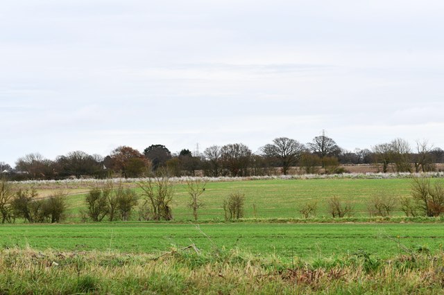
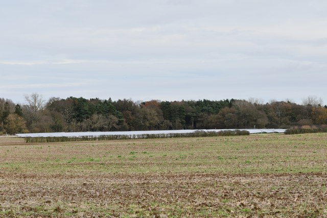
Layer Breton is a small village located in the county of Essex, England. Situated approximately 8 miles southeast of the town of Colchester, it is nestled in the picturesque countryside, surrounded by fields and farmland. The village is part of the larger civil parish of Layer-de-la-Haye.

Layer Breton is known for its peaceful and tranquil atmosphere, making it an ideal location for those seeking a quiet and idyllic rural setting. The village is home to a close-knit community, with a population of around 500 residents. It offers a sense of community spirit, with various local events and activities organized throughout the year.

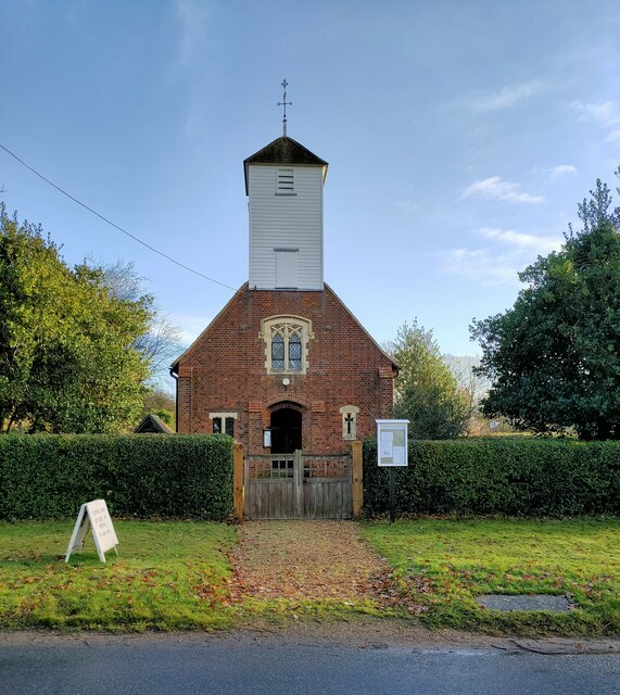
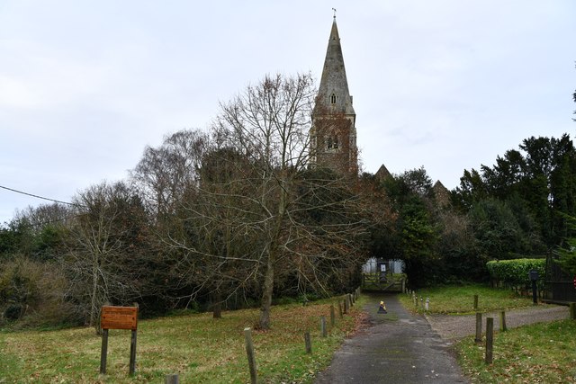
The village is also notable for its historical significance. It is home to St. Mary's Church, a Grade I listed building that dates back to the 12th century. The church features a stunning architecture, including a Norman tower and beautiful stained glass windows.

Despite its rural setting, Layer Breton is conveniently located near major transport links. The nearby A12 road provides easy access to Colchester and the surrounding areas, while Colchester North railway station is just a short drive away.

In terms of amenities, Layer Breton offers a few local businesses, including a village hall and a pub. However, for more extensive shopping and entertainment options, residents can easily access the nearby town of Colchester.

Layer Breton offers a charming and picturesque village lifestyle, with its rich history, peaceful surroundings, and strong sense of community.

If you have any feedback on the listing, please let us know in the comments section below.
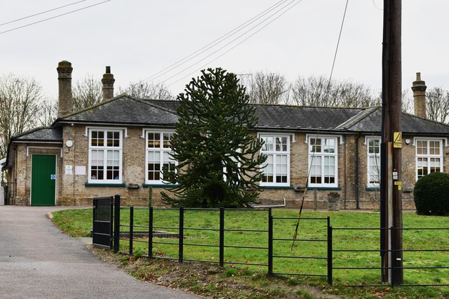
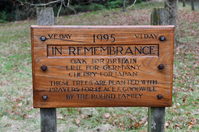
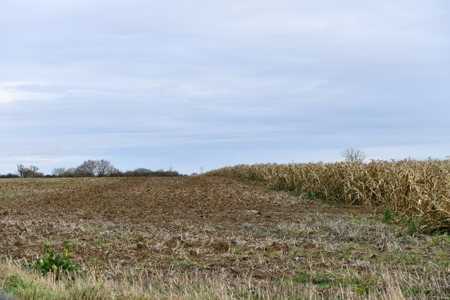
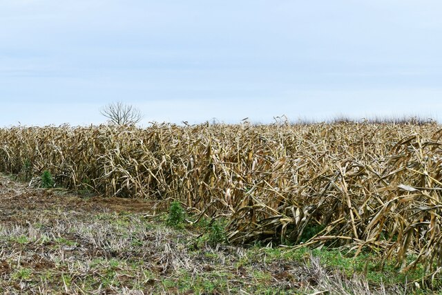
Layer Breton Images

Images are sourced within 2km of 51.830707/0.820595 or Grid Reference TL9418. Thanks to Geograph Open Source API. All images are credited.

St Mary's Church Layer Breton
Birch: Fields
Birch: Fields
Birch, St. Peter's Church: Western aspect occluded by trees
Birch: 'Linden House'
Birch Church of England Primary School
Birch: Plaque to show that three trees were planted in 1995 to remember V.E. Day and V.J. Day
Birch: Craxe's Green road junction
Birch: Unharvested maize crop
Birch: Harvested field
Layer Marney Tower.  Essex The magnificent Tudor gatehouse of this renowned Essex Mansion, built by Henry, the first Lord Marney, who never lived to see its completion.
Layer Marney Tower. Essex
The magnificent Tudor gatehouse of this renowned Essex Mansion, built by Henry, the first Lord Marney, who never lived to see its completion.
Tree and Red Campion The OS Map shows this area to be woodland I expect it has been cleared as part of the expansion of the Abberton Reservoir the <a href="https://www.geograph.org.uk/photo/2403426">TL9618 : Red Campion</a> is really taking advantage of the changed habitat.
Tree and Red Campion
The OS Map shows this area to be woodland I expect it has been cleared as part of the expansion of the Abberton Reservoir the TL9618 : Red Campion is really taking advantage of the changed habitat.
Red Campion Red Campion growing in abundance on newly cleared land take a closer look at <a href="https://www.geograph.org.uk/photo/2403434">TL9618 : Red Campion up Close</a>
Red Campion
Red Campion growing in abundance on newly cleared land take a closer look at TL9618 : Red Campion up Close
Red Campion up Close A Close up of <a href="https://www.geograph.org.uk/photo/2403426">TL9618 : Red Campion</a>
Red Campion up Close
A Close up of TL9618 : Red Campion
Trees & Red Campion It was such a shame I couldn't wait until the light improved imagine the scene with blue sky and bright sunshine!
Trees & Red Campion
It was such a shame I couldn't wait until the light improved imagine the scene with blue sky and bright sunshine!
Expanding Lake The fields are cleared prior to the expansion of Abberton Reservoir
Expanding Lake
The fields are cleared prior to the expansion of Abberton Reservoir
Abberton Work Camp A contractors depot for the expansion of Abberton Reservoir
Abberton Work Camp
A contractors depot for the expansion of Abberton Reservoir
Horse and cattle grid, Layer Marney
Show me another place!

Layer Breton is located at Grid Ref: TL9418 (Lat: 51.830707, Lng: 0.820595)

Administrative County: Essex

District: Colchester

Police Authority: Essex

What 3 Words

///crashing.beauty.offerings. Near Layer de la Haye, Essex

Related Wikis

Layer Breton

Layer Breton is a village and a civil parish in the City of Colchester district of Essex, England. According to the 2011 census there were 144 males and...

Birch, Essex

Birch is a village and civil parish in the City of Colchester district of Essex, England. It is located approximately 5 miles (8 km) south-west of Colchester...

Layer Marney Tower

Layer Marney Tower is an incomplete early Tudor country house, with gardens and parkland, dating from about 1523, in Layer Marney, Essex, England, between...

Layer Marney

Layer Marney is a village and civil parish in the City of Colchester district of Essex, England, near Tiptree. Layer Marney has a Tudor palace called Layer...

Smythe's Green

Smythe's Green is a hamlet on the B1022 road, in the Colchester district, in the county of Essex, England. It is located in between the villages of Tiptree...

Hardy's Green

Hardy's Green is a hamlet in civil parish of Birch in the Colchester district, in the county of Essex, England. Nearby settlements include the large town...

Layer de la Haye

Layer de la Haye (often spelled Layer-de-la-Haye; locally known just as Layer) is a village and civil parish in the City of Colchester district of Essex...
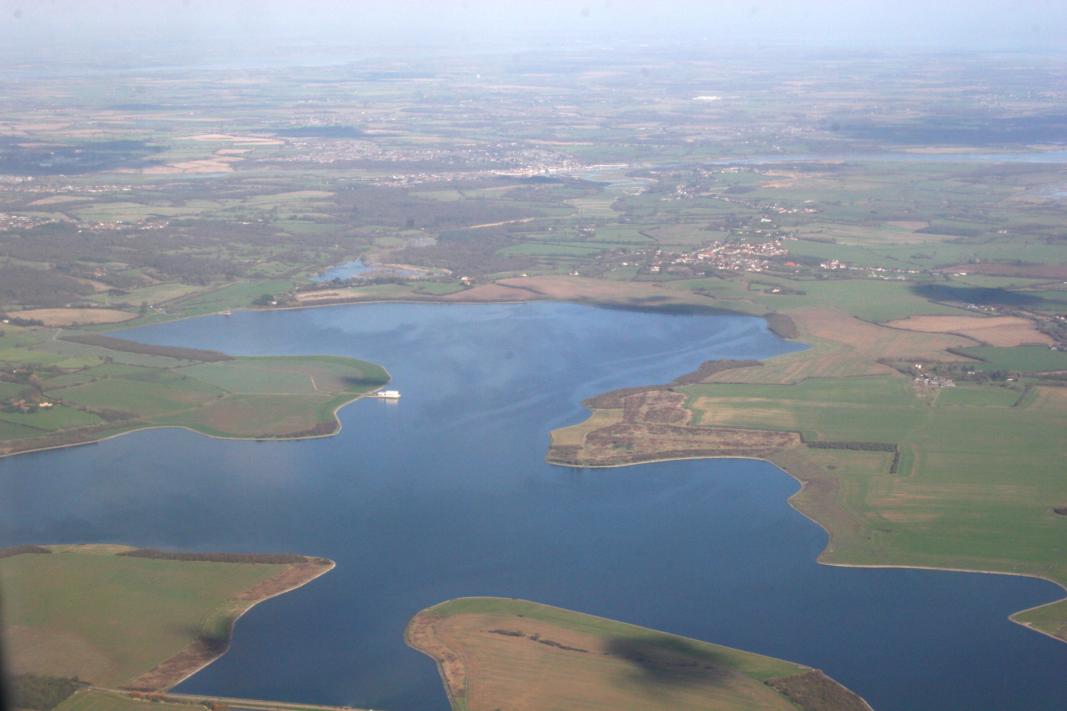
Abberton Reservoir

Abberton Reservoir is a pumped storage freshwater reservoir in eastern England near the Essex coast, with an area of 700 hectares (1,700 acres). Most of...

Nearby Amenities

Located within 500m of 51.830707,0.820595
Layer Breton
Place: village
Lat/Long: 51.8292218/0.8203433
Post Box
Brand: Royal Mail
Brand Wikidata: Q638098
Brand Wikipedia: en:Royal Mail
Operator: Royal Mail
Operator Wikidata: Q638098
Post Box Type: lamp
Ref: CO2 203
Lat/Long: 51.8280413/0.8220846
Bus Stop
Church
Bus: yes
Naptan AtcoCode: 150014010001
Naptan Bearing: S
Naptan BusStopType: CUS
Naptan CommonName: Church
Naptan Indicator: o/s
Naptan Landmark: Church
Naptan NaptanCode: esxdamjm
Naptan Street: Layer Breton Heath
Naptan Verified: no
Public Transport: platform
Source: naptan_import
Lat/Long: 51.8312857/0.8204465
Bus Stop
Layer Breton Heath
Bus: yes
Naptan AtcoCode: 150014010005
Naptan Bearing: N
Naptan BusStopType: CUS
Naptan CommonName: Layer Breton Heath
Naptan Crossing: Heath Road
Naptan Indicator: N-bound
Naptan Landmark: Layer Breton Heath
Naptan NaptanCode: esxgdjap
Naptan Street: Birch Street
Naptan Verified: no
Public Transport: platform
Source: naptan_import
Lat/Long: 51.8339921/0.8193528
Bus Stop
Church
Bus: yes
Naptan AtcoCode: 150014010007
Naptan Bearing: N
Naptan BusStopType: CUS
Naptan CommonName: Church
Naptan Indicator: Opp
Naptan Landmark: Church
Naptan NaptanCode: esxgdjda
Naptan Street: Layer Breton Heath
Naptan Verified: no
Public Transport: platform
Source: naptan_import
Lat/Long: 51.8309797/0.8204565
Bus Stop
The Old Meeting House
Bus: yes
Naptan AtcoCode: 150014010008
Naptan Bearing: N
Naptan BusStopType: CUS
Naptan CommonName: The Old Meeting House
Naptan Indicator: Opp
Naptan Landmark: The Old Meeting House
Naptan NaptanCode: esxgdjdg
Naptan Street: Layer Breton Hill
Naptan Verified: no
Public Transport: platform
Source: naptan_import
Lat/Long: 51.8281775/0.8218284
Bus Stop
The Old Meeting House
Bus: yes
Naptan AtcoCode: 1500140100Y8
Naptan Bearing: S
Naptan BusStopType: CUS
Naptan CommonName: The Old Meeting House
Naptan Indicator: Adj
Naptan Landmark: The Old Meeting House
Naptan NaptanCode: esxgtatd
Naptan Street: Layer Breton Hill
Naptan Verified: no
Public Transport: platform
Source: naptan_import
Lat/Long: 51.828219/0.8219386
Bus Stop
Layer Breton Heath
Bus: yes
Naptan AtcoCode: 150014011009
Naptan Bearing: W
Naptan BusStopType: CUS
Naptan CommonName: Layer Breton Heath
Naptan Crossing: Birch Street
Naptan Indicator: S-bound
Naptan Landmark: Layer Breton Heath
Naptan NaptanCode: esxgjdtj
Naptan Street: Heath Road
Naptan Verified: no
Public Transport: platform
Source: naptan_import
Lat/Long: 51.8337375/0.819845
Bus Stop
Hare and Hounds
Bus: yes
Naptan AtcoCode: 1500BIRCH1
Naptan Bearing: S
Naptan BusStopType: CUS
Naptan CommonName: Hare and Hounds
Naptan Indicator: o/s
Naptan Landmark: Hare and Hounds
Naptan NaptanCode: esxadtmg
Naptan Street: Birch Street
Naptan Verified: no
Public Transport: platform
Source: naptan_import
Lat/Long: 51.834628/0.8194651
Bus Stop
Hare and Hounds
Bus: yes
Naptan AtcoCode: 1500BIRCH1AA
Naptan Bearing: N
Naptan BusStopType: CUS
Naptan CommonName: Hare and Hounds
Naptan Indicator: Opp
Naptan Landmark: Hare and Hounds
Naptan NaptanCode: esxgpgpw
Naptan Street: Birch Street
Naptan Verified: no
Public Transport: platform
Source: naptan_import
Lat/Long: 51.8346038/0.8193475
Post Office
Birch Post Office
Addr Postcode: CO2 0PN
Brand: Post Office
Brand Wikidata: Q1783168
Ref Pol Id: 96151
Source: OS OpenData StreetView
Website: https://www.postoffice.co.uk/branch-finder/2274701/birch
Lat/Long: 51.8341903/0.8199281
Barrier: stile
Lat/Long: 51.8291956/0.817903
Barrier: stile
Lat/Long: 51.8275922/0.81753
Barrier: stile
Lat/Long: 51.8272359/0.816705
Barrier: stile
Lat/Long: 51.8281785/0.81776
Barrier: stile
Foot: yes
Motor Vehicle: no
Lat/Long: 51.833145/0.8175282
Colour: yellow
Marker: post
Material: plastic
Utility: gas
Lat/Long: 51.8322907/0.8199795
Colour: yellow
Marker: post
Material: concrete
Utility: gas
Lat/Long: 51.832326/0.8200877
Defibrillator
Access: yes
Defibrillator Location: on front left of pub viewed from road
Emergency: defibrillator
Indoor: no
Ref GB The Circuit: 5891DFF3-08AA-47A6-AF0C-AE7600A0599E
Lat/Long: 51.8341371/0.8198936
The data included in this document is from www.openstreetmap.org. The data is made available under ODbL.

Have you been to Layer Breton?

Leave your review of Layer Breton below (or comments, questions and feedback).