Deil's Den
Valley in Angus
Scotland
Deil's Den

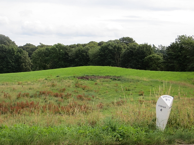
Deil's Den, located in the region of Angus in Scotland, is a picturesque valley known for its natural beauty and historical significance. Nestled within the stunning countryside, this enchanting destination has captivated visitors for centuries.
The valley derives its name from the Scottish word "deil," meaning devil, which alludes to the mystical and eerie atmosphere that permeates the area. Deil's Den is famed for its rocky cliffs, dense woodlands, and meandering streams, creating a scenic landscape that is a haven for nature enthusiasts and hikers.
One of the standout features of Deil's Den is its historical significance. The valley is home to an ancient Pictish fort, which dates back to the Iron Age. This fort, situated on top of a hill, offers panoramic views of the surrounding countryside, adding to the allure of the area. Archaeological studies have revealed remnants of Pictish artifacts, such as pottery and tools, providing valuable insights into the lives of the ancient inhabitants.
Deil's Den is also known for its rich biodiversity, with a diverse array of plant and animal species thriving in the area. The woodlands are teeming with native Scottish trees, including oak, birch, and rowan. Wildlife enthusiasts can spot various species, such as red deer, foxes, and a variety of bird species, including the elusive golden eagle.
Visitors to Deil's Den can explore the valley through a network of well-maintained trails, which offer a range of difficulty levels to suit all abilities. The serene atmosphere, coupled with the breathtaking natural beauty, makes Deil's Den an ideal destination for those seeking tranquility and a connection with nature.
If you have any feedback on the listing, please let us know in the comments section below.
Deil's Den Images
Images are sourced within 2km of 56.628853/-2.7544238 or Grid Reference NO5348. Thanks to Geograph Open Source API. All images are credited.


Deil's Den is located at Grid Ref: NO5348 (Lat: 56.628853, Lng: -2.7544238)
Unitary Authority: Angus
Police Authority: Tayside
What 3 Words
///ketchup.snowstorm.defeat. Near Letham, Angus
Nearby Locations
Related Wikis

Letham, Angus
Letham (Scots pronunciation: [ˈlɛθəm]) is a village in Angus, Scotland. Letham is the largest village in Angus, with a population of nearly 2,000. Situated...

Auldbar Road railway station
Auldbar Road railway station was located near the town of Guthrie in the Scottish county of Angus. == History == Opened by the Arbroath and Forfar Railway...

Guthrie Castle
Guthrie Castle is a castle and country house in Angus, Scotland. It is located in the village of Guthrie, 10 kilometres (6.2 mi) east of Forfar, and 29...

Bowriefauld
Bowriefauld is a village in Angus, Scotland.

Dunnichen
Dunnichen (Scots pronunciation: [dəˈnɪxən]; Scottish Gaelic: Dùn Eachain) is a small village in Angus, Scotland, situated between Letham and Forfar. It...

Guthrie railway station
Guthrie railway station served the village of Guthrie, Angus, Scotland from 1838 to 1955 on the Arbroath and Forfar Railway. == History == The station...

Guthrie, Angus
Guthrie is a village in Angus, Scotland, roughly at the centre point of the towns of Arbroath, Brechin and Forfar. The principal building in the village...

Gardyne Castle
Gardyne Castle is a 16th-century tower house in Angus, Scotland. It is located 2 kilometres (1.2 mi) south-west of Friockheim. The castle is still in use...
Nearby Amenities
Located within 500m of 56.628853,-2.7544238Have you been to Deil's Den?
Leave your review of Deil's Den below (or comments, questions and feedback).