Lawshall

Settlement in Suffolk Babergh

England

Lawshall

Barley field off Brand's Lane
Barley field off Brand's Lane Credit: Jonathan Thacker

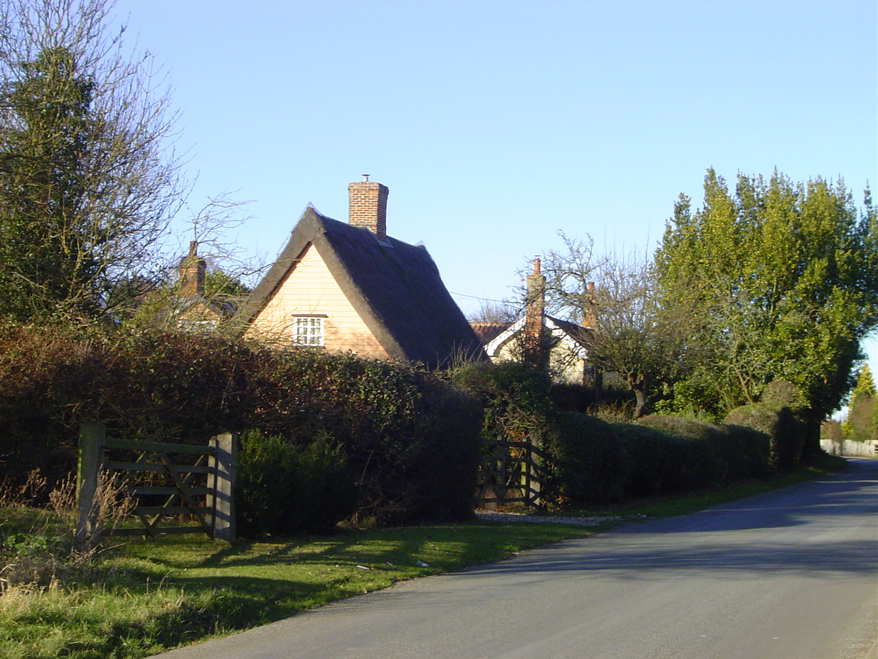
Lawshall is a small village located in the county of Suffolk, England. Situated approximately five miles south of Bury St Edmunds, it falls within the Babergh district. With a population of around 800 residents, Lawshall maintains a quaint and close-knit community atmosphere.

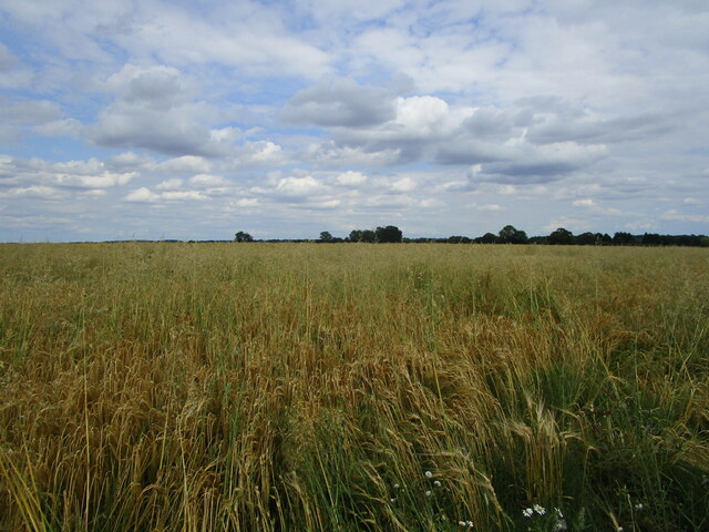
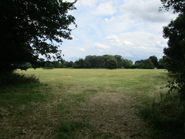
The village is known for its picturesque countryside surroundings, offering a serene and peaceful environment for residents and visitors alike. The landscape is characterized by rolling hills, meadows, and charming country lanes, making it a popular destination for outdoor enthusiasts and nature lovers.

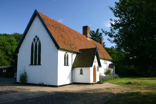
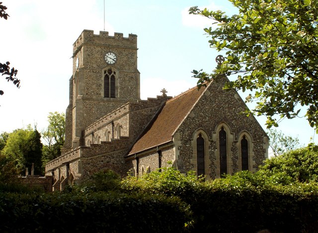
Lawshall boasts a rich history, with evidence of human habitation dating back to the Neolithic period. The village is home to several historical landmarks, including the Grade I listed St. Peter and St. Paul's Church, which dates back to the 14th century. The church's striking architecture and beautiful stained glass windows attract visitors from far and wide.

In terms of amenities, Lawshall offers a range of facilities to cater to the needs of its residents. These include a primary school, a village hall, a local pub, and a post office. The village also benefits from excellent transport links, with regular bus services connecting it to nearby towns and cities.

Overall, Lawshall is a charming village that embodies the beauty and tranquility of rural Suffolk. Its rich history, stunning landscapes, and welcoming community make it an idyllic place to live or visit.

If you have any feedback on the listing, please let us know in the comments section below.

Lawshall Images

Images are sourced within 2km of 52.162981/0.71139 or Grid Reference TL8555. Thanks to Geograph Open Source API. All images are credited.

Barley field off Brand's Lane
Church of All Saints, Lawshall A largely fifteenth century church <span class="nowrap"><a title="https://historicengland.org.uk/listing/the-list/list-entry/1036594" rel="nofollow ugc noopener" href="https://historicengland.org.uk/listing/the-list/list-entry/1036594">Link</a><img style="margin-left:2px;" alt="External link" title="External link - shift click to open in new window" src="https://s1.geograph.org.uk/img/external.png" width="10" height="10"/></span>
Church of All Saints, Lawshall
A largely fifteenth century church LinkExternal link
Grass field near Lawshall
Field of sugar beet by Brands Lane
Field by Brands Lane Looking towards Rowney Farm
Field by Brands Lane
Looking towards Rowney Farm
Field of sugar beet by Brands Lane
The approach to Hanningfields Farm
The village sign at Lawshall
Road junction in Lawshall This junction is actually a crossroads.  The road to the right is Melford Road with Bury Road off to the left.  Straight ahead is Lambs Lane and opposite is Golden Lane.
Road junction in Lawshall
This junction is actually a crossroads. The road to the right is Melford Road with Bury Road off to the left. Straight ahead is Lambs Lane and opposite is Golden Lane.
Donkey Lane, between Lawshall and Stanningfield
Dems at Castle Farm
Dems at Castle Farm
Ploughing Ploughing near to Brockley, Suffolk.
Ploughing
Ploughing near to Brockley, Suffolk.
Ploughed Field Ploughed field and footpath near to Brockley, Suffolk.
Ploughed Field
Ploughed field and footpath near to Brockley, Suffolk.
Open Fields Open fields near to Brockley, Suffolk.
Open Fields
Open fields near to Brockley, Suffolk.
Memorial To Johannes Bartholomeus Jat Van Mesdag WWII memorial to crashed Mustang pilot Johannes Bartholomeus Jat Van Mesdag at side of a country road near to Lawshall, Suffolk. For more info on this young airman see <span class="nowrap"><a title="http://www.aircrewremembered.com/van-mesdag-johannes.html" rel="nofollow ugc noopener" href="http://www.aircrewremembered.com/van-mesdag-johannes.html">Link</a><img style="margin-left:2px;" alt="External link" title="External link - shift click to open in new window" src="https://s1.geograph.org.uk/img/external.png" width="10" height="10"/></span> and for overall view see <a title="https://www.geograph.org.uk/photo/2595650" href="https://www.geograph.org.uk/photo/2595650">Link</a>
Memorial To Johannes Bartholomeus Jat Van Mesdag
WWII memorial to crashed Mustang pilot Johannes Bartholomeus Jat Van Mesdag at side of a country road near to Lawshall, Suffolk. For more info on this young airman see LinkExternal link and for overall view see Link
Airman's Memorial WWII memorial to crashed Mustang pilot Johannes Bartholomeus Jat Van Mesdag at side of a country road near to Lawshall, Suffolk. For more info on this young airman see <span class="nowrap"><a title="http://www.aircrewremembered.com/van-mesdag-johannes.html" rel="nofollow ugc noopener" href="http://www.aircrewremembered.com/van-mesdag-johannes.html">Link</a><img style="margin-left:2px;" alt="External link" title="External link - shift click to open in new window" src="https://s1.geograph.org.uk/img/external.png" width="10" height="10"/></span> and for close up view see <a title="https://www.geograph.org.uk/photo/2595635" href="https://www.geograph.org.uk/photo/2595635">Link</a>
Airman's Memorial
WWII memorial to crashed Mustang pilot Johannes Bartholomeus Jat Van Mesdag at side of a country road near to Lawshall, Suffolk. For more info on this young airman see LinkExternal link and for close up view see Link
Hanningfield Green Hanningfield Green, Suffolk.
Hanningfield Green
Hanningfield Green, Suffolk.
Haystack Interesting haystack near to Stanningfield, Suffolk.
Haystack
Interesting haystack near to Stanningfield, Suffolk.
Show me another place!

Lawshall is located at Grid Ref: TL8555 (Lat: 52.162981, Lng: 0.71139)

Administrative County: Suffolk

District: Babergh

Police Authority: Suffolk

What 3 Words

///jams.snacking.fondest. Near Glemsford, Suffolk

Nearby Locations

Lawshall

Related Wikis

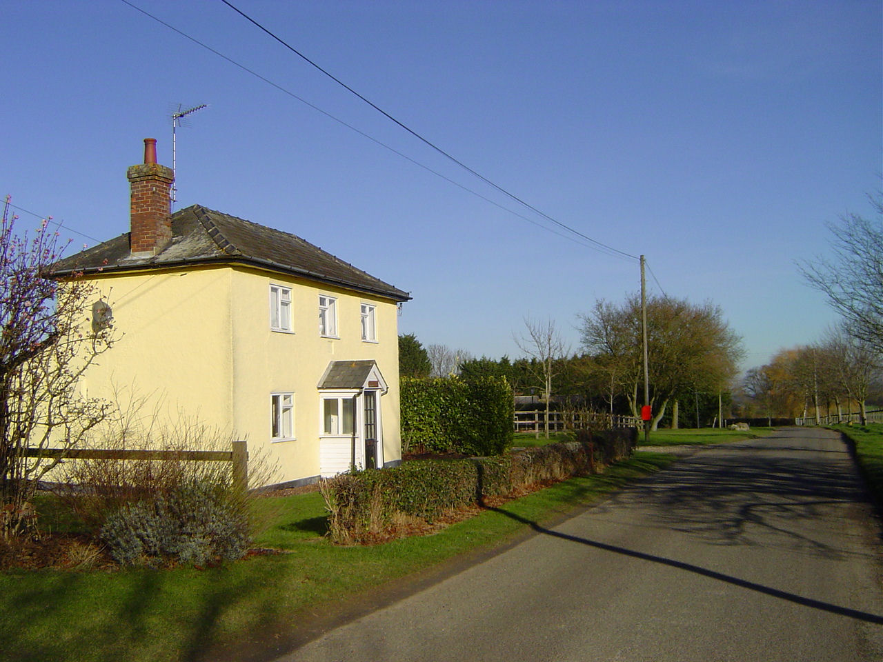
Lambs Lane, Lawshall

Lambs Lane is a nuclear settlement in the civil parish of Lawshall in the Babergh district in the county of Suffolk, England. In addition to Lambs Lane...

Harrow Green

Harrow Green is a hamlet in the civil parish of Lawshall in the Babergh district in the county of Suffolk, England. It is located between Lambs Lane and...

Coldham Cottage

The Church of Our Lady Immaculate and St Joseph, otherwise known as Coldham Cottage is the oldest continuing Roman Catholic church in Suffolk. It is in...

Coldham Hall

Coldham Hall is a Grade I listed building, built in 1574, that is located in the parish of Bradfield Combust with Stanningfield in Suffolk. The Hall is...
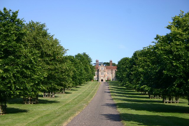
Lawshall Hall

Lawshall Hall is a Grade II* listed building, re-built in 1557, that is located in the parish of Lawshall in Suffolk. The Hall is adjacent to All Saints...

Lawshall

Lawshall is a village and civil parish in Suffolk, England. Located around a mile off the A134 between Bury St Edmunds and Sudbury, it is part of Babergh...

All Saints' Church, Lawshall

The Parish Church of All Saints' Lawshall, is an Anglican church in the village of Lawshall, Suffolk, England. It has been designated by English Heritage...

Hart's Green

Hart's Green is a hamlet in the civil parish of Lawshall in the Babergh District in the county of Suffolk, England. It is located between Stanningfield...
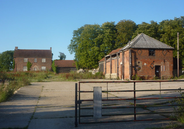
Nearby Amenities

Located within 500m of 52.162981,0.71139
Post Box
Operator: Royal Mail
Ref: IP29 2081
Lat/Long: 52.1599829/0.7082419
Bus Stop
Village Hall
Naptan AtcoCode: 390010441
Naptan Bearing: NW
Naptan CommonName: Village Hall
Naptan Indicator: adj
Naptan Landmark: Village Hall
Naptan NaptanCode: sufagdwt
Naptan Street: Harrow Green Road
Naptan Verified: no
Source: naptan_import
Lat/Long: 52.1597724/0.714517
Bus Stop
Village Hall
Naptan AtcoCode: 390010442
Naptan Bearing: SE
Naptan BusStopType: CUS
Naptan CommonName: Village Hall
Naptan Indicator: opp
Naptan Landmark: Village Hall
Naptan NaptanCode: sufagjad
Naptan Street: Harrow Green Road
Naptan Verified: no
Source: naptan_import
Lat/Long: 52.159797/0.7146208
Bus Stop
Shelter
Naptan AtcoCode: 390010762
Naptan Bearing: NE
Naptan CommonName: Shelter
Naptan Indicator: o/s
Naptan Landmark: Shelter
Naptan NaptanCode: sufjdpgj
Naptan Street: Bury Road
Naptan Verified: no
Source: naptan_import
Lat/Long: 52.1614508/0.709969
Bus Stop
Shelter
Naptan AtcoCode: 390010763
Naptan Bearing: SW
Naptan BusStopType: CUS
Naptan CommonName: Shelter
Naptan Indicator: opp
Naptan Landmark: Shelter
Naptan NaptanCode: sufjdpgm
Naptan Street: Bury Road
Naptan Verified: no
Source: naptan_import
Lat/Long: 52.1614644/0.7101129
Post Box
Ref: IP29 2081
Lat/Long: 52.159692/0.7149597
The data included in this document is from www.openstreetmap.org. The data is made available under ODbL.

Have you been to Lawshall?

Leave your review of Lawshall below (or comments, questions and feedback).