Black Cleuch

Valley in Roxburghshire

Scotland

Black Cleuch

A valley of peace in Roxburghshire Near Skelfhill and Priesthaugh.
A valley of peace in Roxburghshire Credit: James Denham

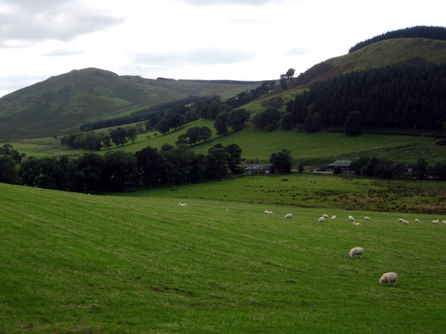
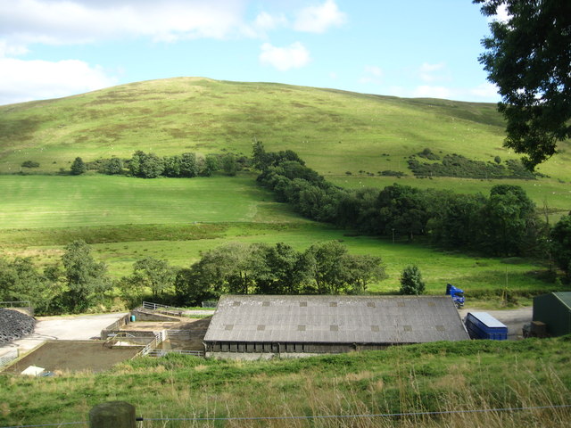
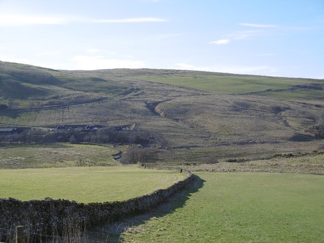
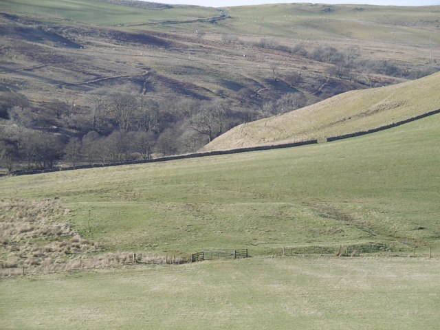
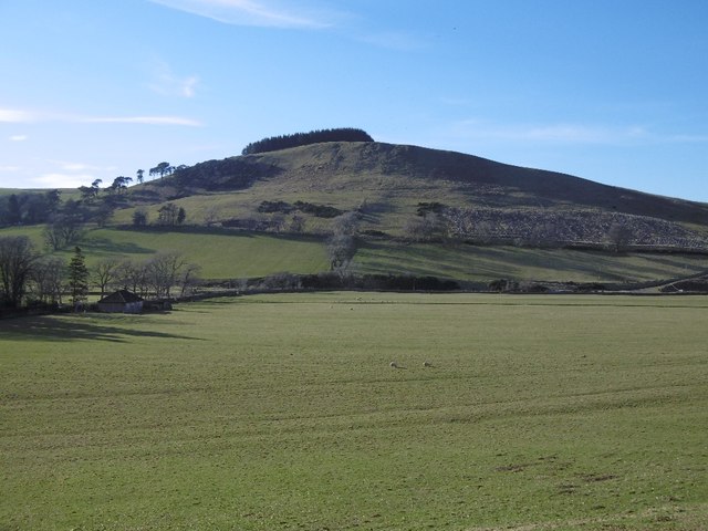
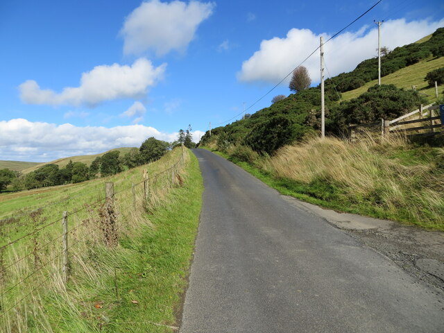
Black Cleuch is a picturesque valley located in the region of Roxburghshire, Scotland. Situated in the southern part of the country, it is surrounded by rolling hills and offers stunning views of the surrounding landscape. The valley stretches for approximately 2 miles, and its name originates from the Scottish Gaelic word "cleuch," meaning a narrow, steep-sided valley.

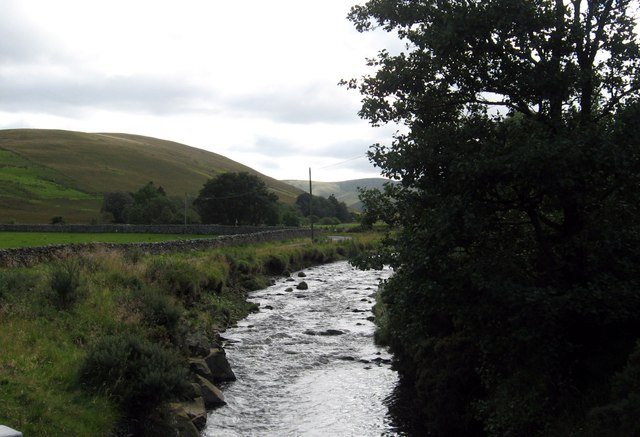
The natural beauty of Black Cleuch is enhanced by the presence of the Cleuch Burn, a small river that winds its way through the valley. The burn is fed by numerous streams that originate from the nearby hills, adding to the charm of the area with their gentle babbling and cascading waterfalls. The valley is also home to an abundance of wildlife, including various bird species, mammals, and insects, making it a popular spot for nature enthusiasts and birdwatchers.

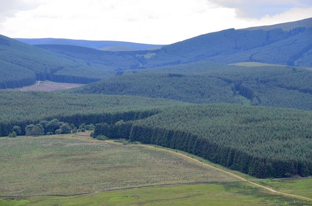
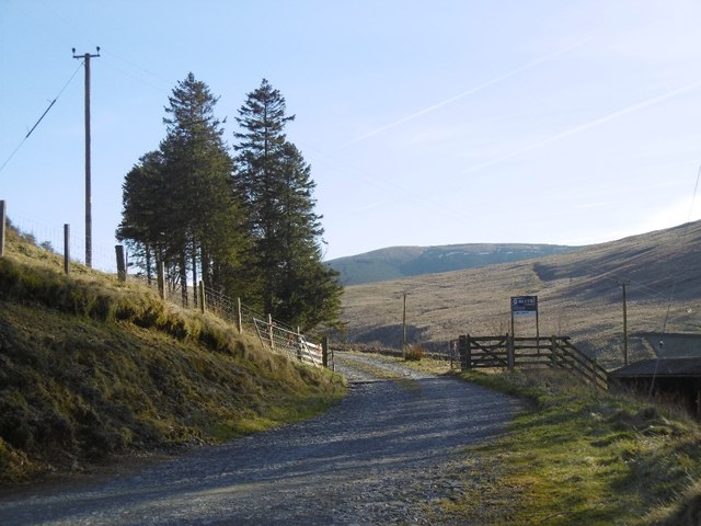
Black Cleuch is known for its peaceful atmosphere and tranquility, offering visitors the opportunity to escape the hustle and bustle of everyday life. The valley provides a serene setting for activities such as hiking and picnicking, with several walking trails that showcase the area's natural wonders. The surrounding hills also offer fantastic viewpoints, allowing visitors to admire the panoramic vistas of the valley and the Scottish countryside beyond.

In summary, Black Cleuch in Roxburghshire is a stunning valley that boasts natural beauty, a tranquil environment, and a variety of recreational opportunities. Whether it's the sound of the Cleuch Burn, the abundant wildlife, or the breathtaking views, this hidden gem offers a peaceful retreat for those seeking a connection with nature.

If you have any feedback on the listing, please let us know in the comments section below.

Black Cleuch Images

Images are sourced within 2km of 55.322842/-2.8364702 or Grid Reference NT4703. Thanks to Geograph Open Source API. All images are credited.

A valley of peace in Roxburghshire Near Skelfhill and Priesthaugh.
A valley of peace in Roxburghshire
Near Skelfhill and Priesthaugh.
Looking over industrial buildings to the beautiful hills beyond North of Priesthaugh. To the right of the buildings (out of shot) is a lovely private home which was formerly the Allan Water school.
Looking over industrial buildings to the beautiful hills beyond
North of Priesthaugh. To the right of the buildings (out of shot) is a lovely private home which was formerly the Allan Water school.
The Dod Burn Near Skelfhill Farm in Roxburghshire.
The Dod Burn
Near Skelfhill Farm in Roxburghshire.
Forestry around Peelbraehope This view from the summit of Penchrise Pen shows just a small part of the forestry plantations in this area. Left of centre is the clearing at Peelbraehope (see <a href="https://www.geograph.org.uk/photo/671029">NT4804 : Peelbraehope</a>) with the track from Barns to Hawkhass coming in from the lower right.
Forestry around Peelbraehope
This view from the summit of Penchrise Pen shows just a small part of the forestry plantations in this area. Left of centre is the clearing at Peelbraehope (see NT4804 : Peelbraehope) with the track from Barns to Hawkhass coming in from the lower right.
Dyke, Priesthaugh Looking down to the Allan Water.
Dyke, Priesthaugh
Looking down to the Allan Water.
Settlement, Priesthaugh Earthworks beside the Allan Water.
Settlement, Priesthaugh
Earthworks beside the Allan Water.
Priesthaugh Field at the head of the Allan Water.
Priesthaugh
Field at the head of the Allan Water.
Logging road exit, Priesthaugh
Minor road near to Priesthaugh Looking north-eastward.
Minor road near to Priesthaugh
Looking north-eastward.
Minor road beside Gray Coat Looking north-eastward.
Minor road beside Gray Coat
Looking north-eastward.
Farm drive leading to Skelfhill near Hawick
Priesthaugh Farm Taken from the forest track running along the Priesthaugh Burn. The distinctive shape of Skelfhill Pen is the hill in the background.
Priesthaugh Farm
Taken from the forest track running along the Priesthaugh Burn. The distinctive shape of Skelfhill Pen is the hill in the background.
Priesthaugh Burn Looking north from the east bank of Priesthaugh Burn towards the buildings of Priesthaugh Farm.
Priesthaugh Burn
Looking north from the east bank of Priesthaugh Burn towards the buildings of Priesthaugh Farm.
Priesthaugh-hill This isolated farmhouse sits at the foot of Cauld Cleuch, the burn which gives its name to the hill in the background, Cauldcleuch Head.
Priesthaugh-hill
This isolated farmhouse sits at the foot of Cauld Cleuch, the burn which gives its name to the hill in the background, Cauldcleuch Head.
Skelfhill Pen The view west from Holywell Rig, across the Skelfhill Burn to the shapely hill of Skelfhill Pen, a prominent landmark from many directions.
Skelfhill Pen
The view west from Holywell Rig, across the Skelfhill Burn to the shapely hill of Skelfhill Pen, a prominent landmark from many directions.
Skelfhill Fell Descending north from Skelfhill Fell towards Holwell Rig. The view to the north is expansive, including Hawick, Melrose and the Eildon Hills.
Skelfhill Fell
Descending north from Skelfhill Fell towards Holwell Rig. The view to the north is expansive, including Hawick, Melrose and the Eildon Hills.
A farm near Priesthaugh Viewed from the road to Skelfhill and close to Priesthaugh. Marked on the Explorer map as Allan Water Schoolhouse.
A farm near Priesthaugh
Viewed from the road to Skelfhill and close to Priesthaugh. Marked on the Explorer map as Allan Water Schoolhouse.
Fouledge This track, signposted as a path, passes by Fouledge near Skelfhill.
Fouledge
This track, signposted as a path, passes by Fouledge near Skelfhill.
Show me another place!

Black Cleuch is located at Grid Ref: NT4703 (Lat: 55.322842, Lng: -2.8364702)

Unitary Authority: The Scottish Borders

Police Authority: The Lothians and Scottish Borders

What 3 Words

///deals.retain.blissful. Near Teviothead, Scottish Borders

Related Wikis

Cauldcleuch Head

Cauldcleuch Head is a hill in an unnamed range of Roxburghshire hills north of Langholm, part of the Southern Uplands of Scotland. The highest hill in...

Maiden Paps (Hawick)

The Maiden Paps are twin hills near Hawick, in the Scottish Borders of the south east of Scotland, so named because they have the shape of human breasts...

Shankend

Shankend Manor was a sixteenth-century mansion located some six miles (ten kilometres) south of Hawick, close to Whitrope Siding in Scotland. It was constructed...

Shankend railway station

Shankend railway station served the hamlet of Shankend, Scottish Borders, Scotland from 1862 to 1969 on the Border Union Railway. == History == The station...

Nearby Amenities

Located within 500m of 55.322842,-2.8364702
Peel Brae
Place: locality
Lat/Long: 55.3268983/-2.8350267
Man Made: cairn
Lat/Long: 55.3260216/-2.8321889
The data included in this document is from www.openstreetmap.org. The data is made available under ODbL.

Have you been to Black Cleuch?

Leave your review of Black Cleuch below (or comments, questions and feedback).