Coire Breac

Valley in Angus

Scotland

Coire Breac

Little arch bridge over the Mill Burn Little stone bridge carrying the Glen Lethnot road over the Mill Burn.
Little arch bridge over the Mill Burn Credit: Scott Cormie

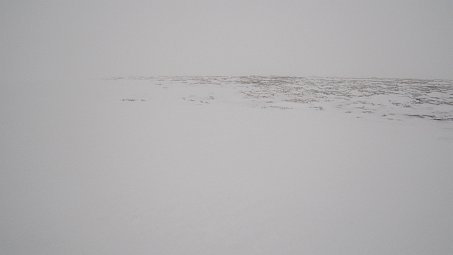
Coire Breac is a scenic valley located in the Angus region of Scotland. The valley is surrounded by majestic mountains and rolling hills, offering visitors breathtaking views of the surrounding landscape. The valley is known for its diverse wildlife, including red deer, golden eagles, and otters, making it a popular spot for nature enthusiasts and wildlife photographers.

Coire Breac is also home to a variety of plant species, with heather, bracken, and wildflowers dotting the landscape. The valley is crisscrossed by meandering streams and rivers, adding to its natural beauty. Hiking and walking trails wind through the valley, allowing visitors to explore its rugged terrain and discover hidden gems along the way.

The valley is steeped in history, with ancient ruins and archaeological sites scattered throughout the area. Visitors can learn about the rich cultural heritage of Coire Breac through guided tours and interpretive signage. Whether you're looking to enjoy a peaceful hike in nature or delve into the history of the region, Coire Breac has something to offer for everyone.

If you have any feedback on the listing, please let us know in the comments section below.

Coire Breac Images

Images are sourced within 2km of 56.858036/-2.8775167 or Grid Reference NO4674. Thanks to Geograph Open Source API. All images are credited.

Little arch bridge over the Mill Burn Little stone bridge carrying the Glen Lethnot road over the Mill Burn.
Little arch bridge over the Mill Burn
Little stone bridge carrying the Glen Lethnot road over the Mill Burn.
Glascorrie in Glen Lethnot Looking from the Glen Lethnot Road northwards to Glascorrie Cottage.
Glascorrie in Glen Lethnot
Looking from the Glen Lethnot Road northwards to Glascorrie Cottage.
West Knock A view to the north from West Knock, with the monument on the Hill of Rowan visible in the distance.
West Knock
A view to the north from West Knock, with the monument on the Hill of Rowan visible in the distance.
Road on Broom Craig A massive road runs up from near Hunthill Lodge to the electric fence on the watershed with Glen Esk just west of Black Hill's summit. There is a big ditch on one side which may be intentional, it collects snow and provides a route up to the snowfields for the estate's tracked vehicles.
Road on Broom Craig
A massive road runs up from near Hunthill Lodge to the electric fence on the watershed with Glen Esk just west of Black Hill's summit. There is a big ditch on one side which may be intentional, it collects snow and provides a route up to the snowfields for the estate's tracked vehicles.
Fence on Broom Craig Hill of Wirren and Glen Lethnot as seen from a broad ridge.
Fence on Broom Craig
Hill of Wirren and Glen Lethnot as seen from a broad ridge.
Road junction, Broom Craig Two big roads with snowfilled ditches used by tracked vehicles meet near the summit of Broom Craig. The road on the left runs down to the Mill Burn and straight on hits the tarred road near Hunthill Lodge.
Road junction, Broom Craig
Two big roads with snowfilled ditches used by tracked vehicles meet near the summit of Broom Craig. The road on the left runs down to the Mill Burn and straight on hits the tarred road near Hunthill Lodge.
Road on Black Hill At the moment the road is not used as much as the ditch beside it. The ditch is full of old snow and makes an alternative road for the estate's preferred track laying vehicles. 
Some thought has gone into this road. It is raised so does not collect snow, and the wide ditch is obviously a deliberate tactic for the track layers. Upland roads in Scotland are often crudely bulldozed with little engineering thought, this is quite different.
Road on Black Hill
At the moment the road is not used as much as the ditch beside it. The ditch is full of old snow and makes an alternative road for the estate's preferred track laying vehicles. Some thought has gone into this road. It is raised so does not collect snow, and the wide ditch is obviously a deliberate tactic for the track layers. Upland roads in Scotland are often crudely bulldozed with little engineering thought, this is quite different.
Black Hill bogs Black in a name is usually a warning, the colour often coming from peat. There is a lot of badly weathered bog on the col with Broom Craig. 
This is a colour image.
Black Hill bogs
Black in a name is usually a warning, the colour often coming from peat. There is a lot of badly weathered bog on the col with Broom Craig. This is a colour image.
Moorland, Glen Lethnot Snow covered heather on either side of the Smithy Burn. The black in this allegedly colour image is Black Craig across Glen Lethnot.
Moorland, Glen Lethnot
Snow covered heather on either side of the Smithy Burn. The black in this allegedly colour image is Black Craig across Glen Lethnot.
Black Hill Moorland between Glen Esk and Glen Lethnot seen from the small rise of Little Black Hill.
Black Hill
Moorland between Glen Esk and Glen Lethnot seen from the small rise of Little Black Hill.
Burn of Coire Breac An awkward one this - getting across the grid line involved standing on huge drift on a corrie headwall and assuming that the old snow was stable. There was a lot of avalanche debris in the corrie below. The view is down the burn towards Glen Lethnot and snow free terrain. Cloud has erased the top of Hill of Wirren.
Burn of Coire Breac
An awkward one this - getting across the grid line involved standing on huge drift on a corrie headwall and assuming that the old snow was stable. There was a lot of avalanche debris in the corrie below. The view is down the burn towards Glen Lethnot and snow free terrain. Cloud has erased the top of Hill of Wirren.
Coire Breac View from atop a snowdrift on the headwall of the corrie towards Shank of Cochlie
Coire Breac
View from atop a snowdrift on the headwall of the corrie towards Shank of Cochlie
Road, Black Hill Track vehicles use the snow filled ditch on the left and the road is graded so that snow blows off it.
Road, Black Hill
Track vehicles use the snow filled ditch on the left and the road is graded so that snow blows off it.
Road, Black Hill The road is almost clear of snow and has probably been built to blow clear easily. The Angus grouse moor estates have several track laying vehicles for work in the snow and these can use the snow catching ditch at the side of the road. There has been a lot of road building on the Angus moors in recent years.
Road, Black Hill
The road is almost clear of snow and has probably been built to blow clear easily. The Angus grouse moor estates have several track laying vehicles for work in the snow and these can use the snow catching ditch at the side of the road. There has been a lot of road building on the Angus moors in recent years.
Stile on Black Hill There is a double electric fence, degraded by snow but still an awkward obstacle, running along the Esk/Lethnot watershed. Crossing places are spaced, but you will rarely find yourself more than 1km from one.  On this occasion you could easily cross over in several places, thanks to the big snow drifts.
The fence was built to exclude deer, tick carriers, from the grouse moors.

The summit of Black Hill is north of the fence and this stile is nearby to the east.
Stile on Black Hill
There is a double electric fence, degraded by snow but still an awkward obstacle, running along the Esk/Lethnot watershed. Crossing places are spaced, but you will rarely find yourself more than 1km from one. On this occasion you could easily cross over in several places, thanks to the big snow drifts. The fence was built to exclude deer, tick carriers, from the grouse moors. The summit of Black Hill is north of the fence and this stile is nearby to the east.
Summit of Black Hill Bogs and rough stuff is well buried beneath deep consolidated snow, the snow had even rendered the infamous electric fence impotent. Nowhere near a whiteout, although misty, visibility was good enough for easy navigation.
Summit of Black Hill
Bogs and rough stuff is well buried beneath deep consolidated snow, the snow had even rendered the infamous electric fence impotent. Nowhere near a whiteout, although misty, visibility was good enough for easy navigation.
Peat hags between West Knock and Black Hill Perfect conditions for bog trotting - just walk above the peat on deep consolidated snow. Enough smugness, last time I was up on this ridge, the snow was a bit rotten and I had a very tough time.

Summer view: <a href="https://www.geograph.org.uk/photo/564704">NO4675 : Peat Haggs between West Knock and Black Hill</a>
Peat hags between West Knock and Black Hill
Perfect conditions for bog trotting - just walk above the peat on deep consolidated snow. Enough smugness, last time I was up on this ridge, the snow was a bit rotten and I had a very tough time. Summer view: NO4675 : Peat Haggs between West Knock and Black Hill
Electric fence crossing place The gate is a partial solution to getting over the electric fence which runs along the Esk/Lethnot watershed ridge. Unfortunately there are also electric fences running perpendicular to the main fence on the north side. This gate is fine as long as you plan on heading downhill or westward only.

The main fence was built to exclude deer. Recently the grouse shoots on the Braes of Angus have been improved and cutting the tick population through deer exclusion and sheep dipping has been one of the methods used. Being February the grouse were quite vocal.
Electric fence crossing place
The gate is a partial solution to getting over the electric fence which runs along the Esk/Lethnot watershed ridge. Unfortunately there are also electric fences running perpendicular to the main fence on the north side. This gate is fine as long as you plan on heading downhill or westward only. The main fence was built to exclude deer. Recently the grouse shoots on the Braes of Angus have been improved and cutting the tick population through deer exclusion and sheep dipping has been one of the methods used. Being February the grouse were quite vocal.
Show me another place!

Coire Breac is located at Grid Ref: NO4674 (Lat: 56.858036, Lng: -2.8775167)

Unitary Authority: Angus

Police Authority: Tayside

What 3 Words

///removed.hairstyle.script. Near Brechin, Angus

Nearby Locations

Coire Breac

Related Wikis

Five Glens of Angus

The Five Glens of Angus are the five Highland glens located in the western portion of the Angus region of Scotland. The five glens from westernmost to...

Tarfside

Tarfside is a small hamlet in Angus, Scotland. It is situated in Glen Esk, on the upper course of the River North Esk, around 8 miles north of Edzell,...

Loch Lee

National grid reference NO431800 Loch Lee is a loch in Angus, Scotland south of the Grampian Mountains that is fed by the Water of Lee and the Water of...

Invermark Castle

Invermark Castle is an oblong tower house dating from the 16th century, at the east of Loch Lee, Angus, Scotland. It is near the head of Glen Esk. ��2...

Nearby Amenities

Located within 500m of 56.858036,-2.8775167
Coire Breac
Natural: valley
Lat/Long: 56.8587587/-2.8808089
The data included in this document is from www.openstreetmap.org. The data is made available under ODbL.

Have you been to Coire Breac?

Leave your review of Coire Breac below (or comments, questions and feedback).