Cauld Cleuch
Valley in Roxburghshire
Scotland
Cauld Cleuch

Cauld Cleuch is a picturesque valley located in the historic county of Roxburghshire, in the southern part of Scotland. Situated in the Scottish Borders, it is nestled between the rolling hills of the Southern Uplands, offering breathtaking views and a tranquil atmosphere.
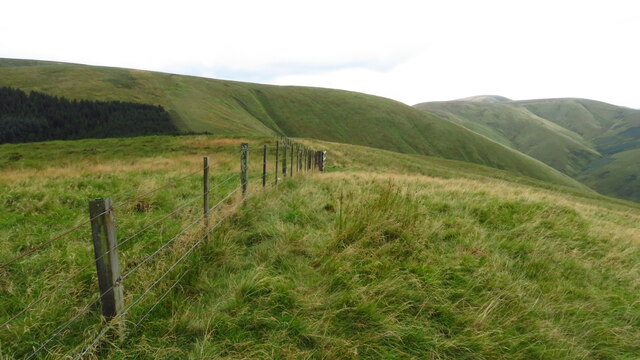
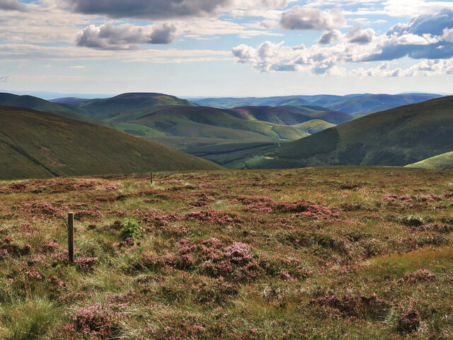
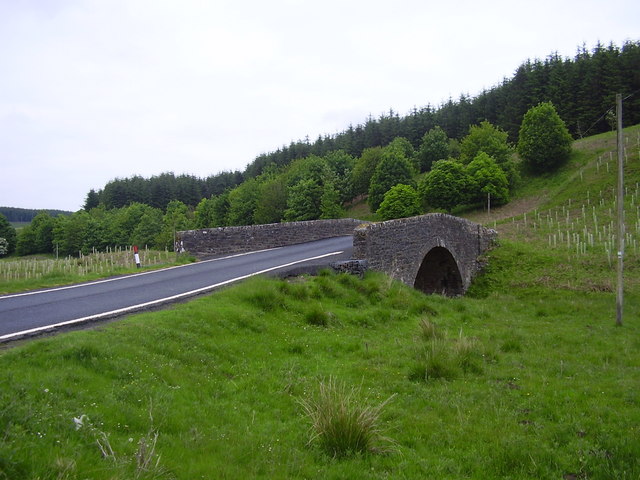
The valley stretches for approximately 3 miles and is characterized by its lush greenery, meandering streams, and diverse wildlife. It is renowned for its natural beauty and is a popular destination for nature lovers, hikers, and photographers. The surrounding hills provide a stunning backdrop, with their heather-covered slopes and scattered trees.
Cauld Cleuch is home to a variety of plant and animal species, making it a haven for biodiversity. Visitors may spot native wildlife such as red squirrels, roe deer, and various bird species including buzzards and kestrels. The streams that flow through the valley are teeming with trout, attracting fishing enthusiasts.
The area offers numerous walking trails, allowing visitors to explore the valley's beauty at their own pace. The trails range from leisurely strolls along the streams to more challenging hikes up the hills, providing options for all levels of fitness and interests.
Cauld Cleuch is also steeped in history, with remnants of ancient settlements and stone circles scattered throughout the valley. The valley's rich past adds to its allure and provides an opportunity for historical exploration.
Overall, Cauld Cleuch is a truly remarkable destination, offering a blend of natural beauty, wildlife, and historical significance that captivates all who visit.
If you have any feedback on the listing, please let us know in the comments section below.
Cauld Cleuch Images
Images are sourced within 2km of 55.307932/-2.8498305 or Grid Reference NT4601. Thanks to Geograph Open Source API. All images are credited.


Cauld Cleuch is located at Grid Ref: NT4601 (Lat: 55.307932, Lng: -2.8498305)
Unitary Authority: The Scottish Borders
Police Authority: The Lothians and Scottish Borders
What 3 Words
///hillsides.traders.hangs. Near Teviothead, Scottish Borders
Nearby Locations
Related Wikis

Cauldcleuch Head
Cauldcleuch Head is a hill in an unnamed range of Roxburghshire hills north of Langholm, part of the Southern Uplands of Scotland. The highest hill in...

Maiden Paps (Hawick)
The Maiden Paps are twin hills near Hawick, in the Scottish Borders of the south east of Scotland, so named because they have the shape of human breasts...

Dinley
Dinley is a hamlet in the Scottish Borders through which Hermitage Water flows. == Etymology == The first element, din, seems to be the Cumbric word for...
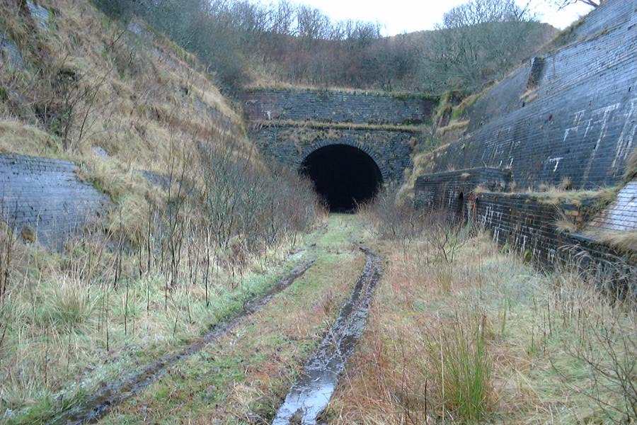
Whitrope Tunnel
The Whitrope Tunnel is a disused railway tunnel in the Scottish Borders, situated 12 miles (19 km) south of Hawick on the Waverley Route, close to Whitrope...

Waverley Route Heritage Association
Waverley Route Heritage Association is a heritage railway group involved with the history, heritage and preservation of the Waverley Route, based/centred...
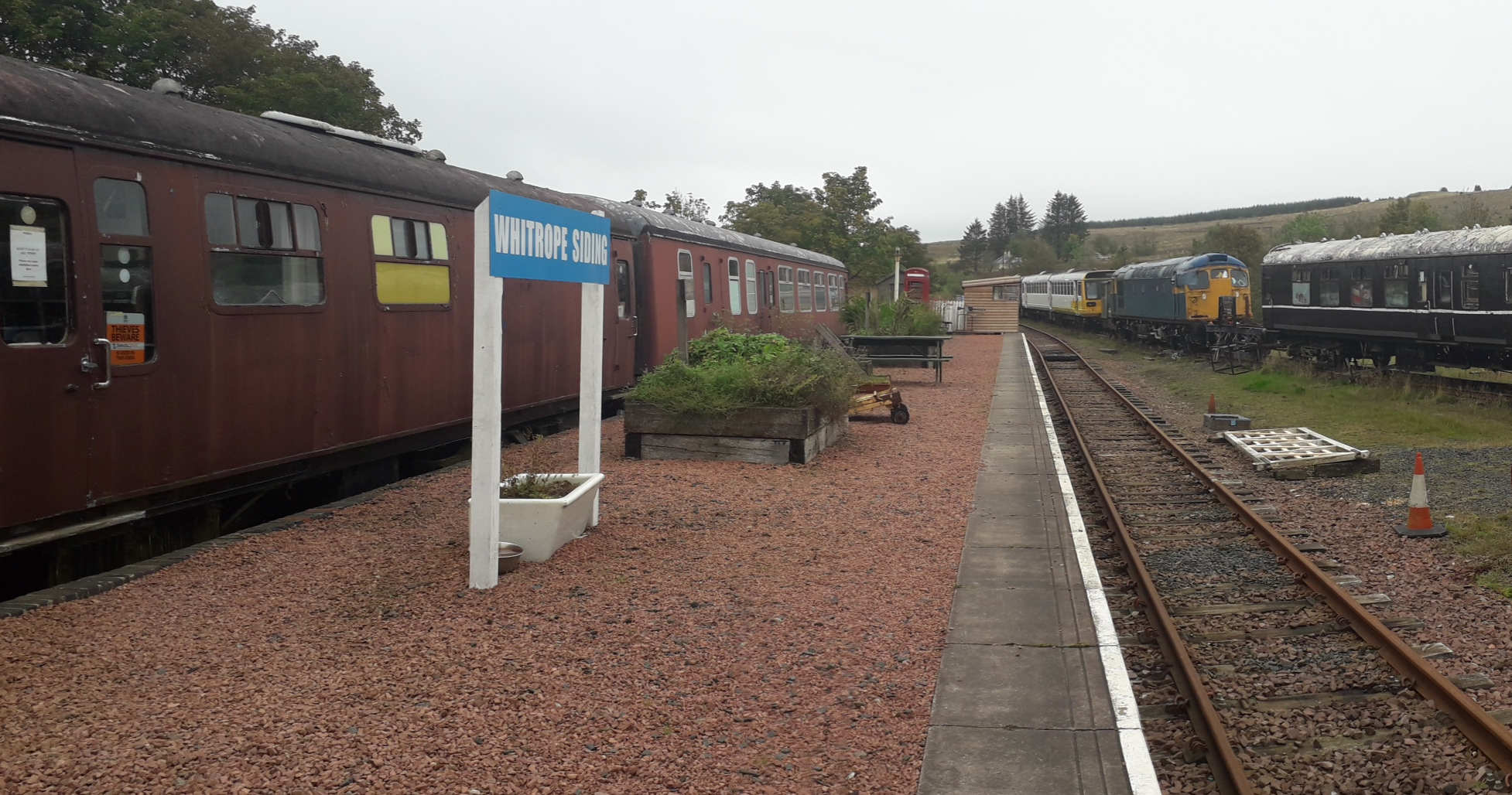
Whitrope Siding
Whitrope Siding was a trailing short siding or spur off the "up" (southbound) line, an associated trailing cross-over between up and down lines, a pair...
Whitrope
Whitrope is a densely forested, but sparsely populated area, high in the Southern Upland hills in the south central Scottish Borders in the former county...

Teviothead
Teviothead (Scottish Gaelic: Ceann Tìbhiot) is a small village and civil parish in Teviotdale in the Scottish Borders, known locally as Teviotheid. It...
Have you been to Cauld Cleuch?
Leave your review of Cauld Cleuch below (or comments, questions and feedback).