Common Cleuch

Valley in Roxburghshire

Scotland

Common Cleuch

Track to Gorrenberry Jubilee Wood The track follows the Billhope Burn.
Track to Gorrenberry Jubilee Wood Credit: wrobison

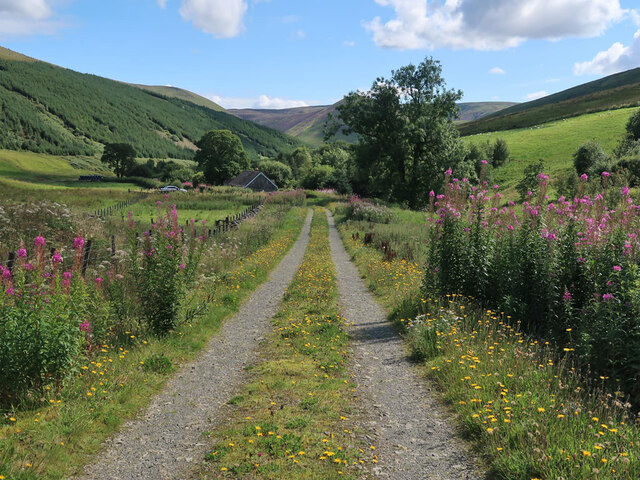
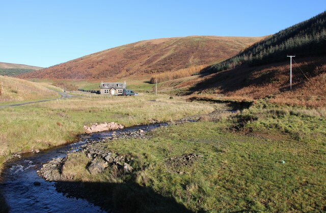
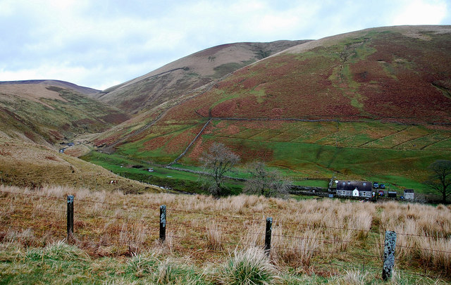
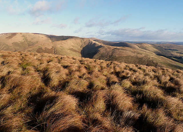
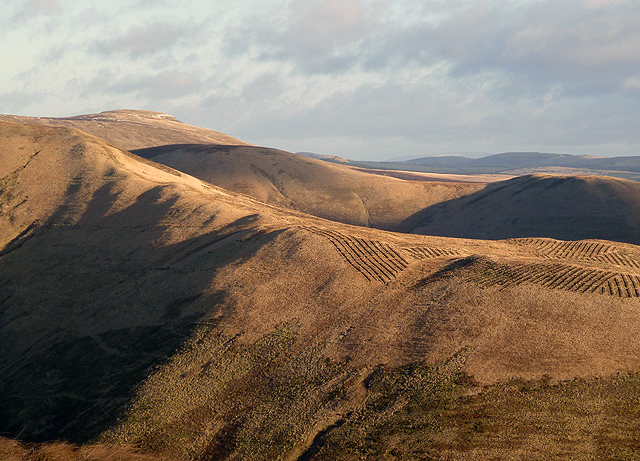
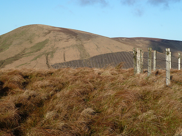
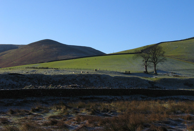
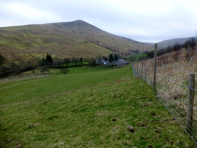
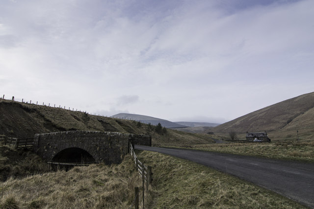
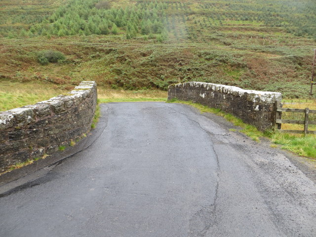
Common Cleuch is a picturesque valley located in Roxburghshire, Scotland. Situated in the southern part of the country, it is known for its stunning natural beauty and rich history. The valley stretches for approximately five miles and is surrounded by rolling hills and lush greenery.

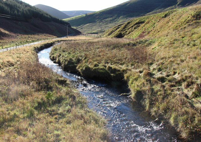
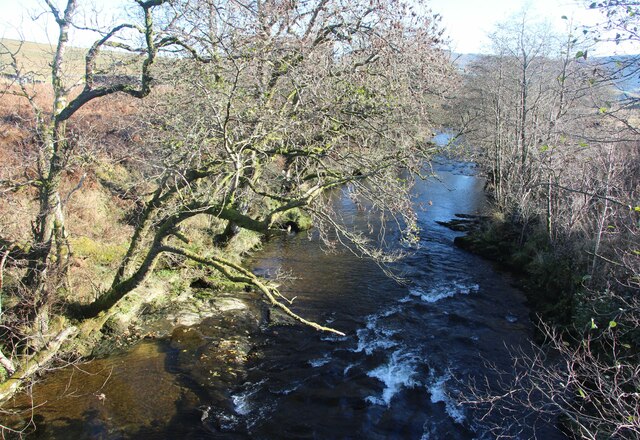
The name "Cleuch" originates from the Scottish Gaelic word for a narrow, steep-sided valley, which accurately describes the topography of the area. Common Cleuch is characterized by its deep, narrow gorge, carved out by the flowing waters of the Cleuch Burn. The burn cascades down the valley, creating beautiful waterfalls and tranquil pools along its course.

The valley is home to a diverse range of flora and fauna, with wildflowers dotting the landscape during the summer months. It also serves as a habitat for various bird species, making it a popular spot for birdwatching enthusiasts.

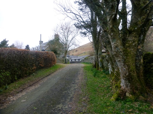
Common Cleuch has historical significance as well. The area was once a bustling mining community, with evidence of coal mining dating back to the 19th century. The remnants of old mine workings can still be seen in some parts of the valley, adding to its historical charm.

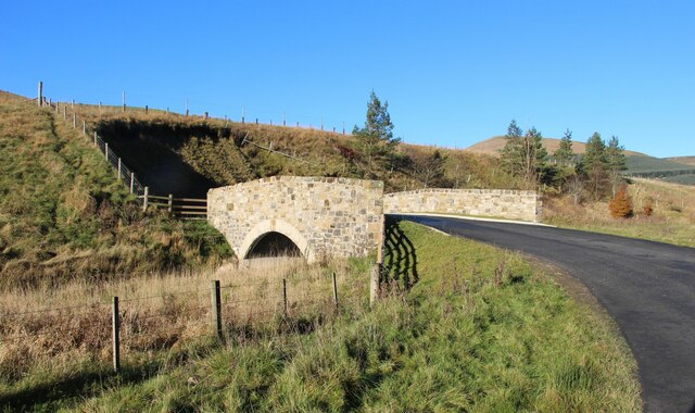
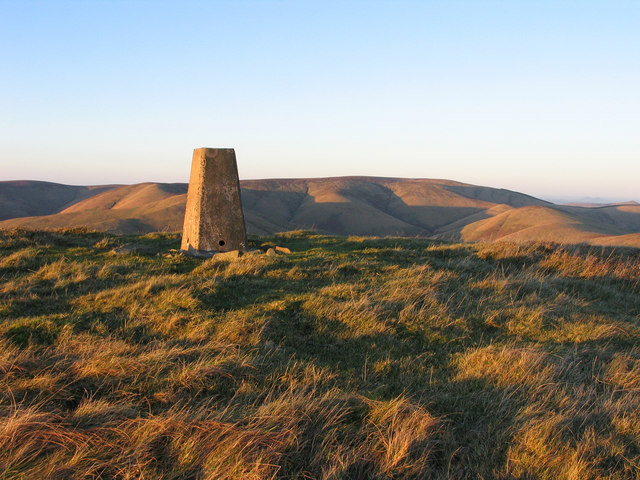
For outdoor enthusiasts, Common Cleuch offers numerous walking and hiking trails, allowing visitors to explore the valley and its surroundings. The trails vary in difficulty, catering to both casual strollers and more experienced hikers.

Overall, Common Cleuch is a captivating valley that combines natural beauty, historical remnants, and recreational opportunities, making it an appealing destination for nature lovers and history enthusiasts alike.

If you have any feedback on the listing, please let us know in the comments section below.

Common Cleuch Images

Images are sourced within 2km of 55.25917/-2.8593941 or Grid Reference NY4596. Thanks to Geograph Open Source API. All images are credited.

Track to Gorrenberry Jubilee Wood The track follows the Billhope Burn.
Track to Gorrenberry Jubilee Wood
The track follows the Billhope Burn.
Bridge Over Billhope Burn
Billhope Burn Road leads to Hermitage.
Billhope Burn
Road leads to Hermitage.
Billhope Burn and cottage
Hermitage Water at Gorrenberry
Billhope Burn Cottage tucked away under the slopes of Stob Fell and beside Billhope Burn.
Pretty location. Good track takes you north on to the fells to Pennygant Hill and Cauldcleugh Head,(619 m), which is classed as a Graham.
Billhope Burn
Cottage tucked away under the slopes of Stob Fell and beside Billhope Burn. Pretty location. Good track takes you north on to the fells to Pennygant Hill and Cauldcleugh Head,(619 m), which is classed as a Graham.
Rough grazing on Geordie's Hill This is near the summit of the hill looking over to Stob Fell.
Rough grazing on Geordie's Hill
This is near the summit of the hill looking over to Stob Fell.
New forestry planting on Stob-cleuch Edge This was viewed from Geordie’s Hill in early December.
New forestry planting on Stob-cleuch Edge
This was viewed from Geordie’s Hill in early December.
Geordie's Hill This is at the summit area of the hill looking over to Tudhope Hill.
Geordie's Hill
This is at the summit area of the hill looking over to Tudhope Hill.
Field beside the Twislehope Burn The field is on the foot of the east ridge of Geordie's Hill and has according to OS mapping an ancient settlement within, or partly within it. Cockplay Hill lies at the left side of the image in the valley of the Twislehope Burn.
Field beside the Twislehope Burn
The field is on the foot of the east ridge of Geordie's Hill and has according to OS mapping an ancient settlement within, or partly within it. Cockplay Hill lies at the left side of the image in the valley of the Twislehope Burn.
Slope north of Haregrain Rig A view north-west from an estate road on Haregrain Rig has the deeply shadowed valley of Caulker Grain at the left side of the image with Ewe Hill rising above it to the right.
Slope north of Haregrain Rig
A view north-west from an estate road on Haregrain Rig has the deeply shadowed valley of Caulker Grain at the left side of the image with Ewe Hill rising above it to the right.
Summit area of Din Fell Late afternoon, autumn sunshine tinges red the summit area of Din Fell and its trig point; Cauldcleuch Head is in the distance.
Summit area of Din Fell
Late afternoon, autumn sunshine tinges red the summit area of Din Fell and its trig point; Cauldcleuch Head is in the distance.
View Of Lane To Gorrenberry Beech hedge and trees near the top of the lane to Gorrenberry.
View Of Lane To Gorrenberry
Beech hedge and trees near the top of the lane to Gorrenberry.
View Towards Din Fell A view from the bottom edge Dod Plantation towards Gorrenberry and the hill Din Fell.
View Towards Din Fell
A view from the bottom edge Dod Plantation towards Gorrenberry and the hill Din Fell.
Billhope
Billhope
Bridge Over Billhope Burn at Billhope Looking eastward.
Bridge Over Billhope Burn at Billhope
Looking eastward.
Trees beside the Hermitage Water Scattered ashes beside the river near Gorrenberry.
Trees beside the Hermitage Water
Scattered ashes beside the river near Gorrenberry.
Din Fell Hill above the Hermitage Water.
Din Fell
Hill above the Hermitage Water.
Show me another place!

Common Cleuch is located at Grid Ref: NY4596 (Lat: 55.25917, Lng: -2.8593941)

Unitary Authority: The Scottish Borders

Police Authority: The Lothians and Scottish Borders

What 3 Words

///healthier.remodel.different. Near Teviothead, Scottish Borders

Nearby Locations

Green Cleuch Common Cleuch

Related Wikis

Dinley

Dinley is a hamlet in the Scottish Borders through which Hermitage Water flows. == Etymology == The first element, din, seems to be the Cumbric word for...

Hermitage Castle

Hermitage Castle is a semi-ruined castle in the border region of Scotland. It is under the care of Historic Scotland. The castle has a reputation, both...

Cauldcleuch Head

Cauldcleuch Head is a hill in an unnamed range of Roxburghshire hills north of Langholm, part of the Southern Uplands of Scotland. The highest hill in...

Hermitage, Scottish Borders

Hermitage is a village near Newcastleton, on the B6399, in the Scottish Borders area of Scotland. == See also == List of places in the Scottish Borders...

Hermitage Water

The Hermitage Water is a river in Liddesdale, in the Scottish Borders area of Scotland. Among its many feeder burns are Braidley Burn, Dinley Burn, Gorrenberry...

Ninestane Rig

Ninestane Rig (English: Nine Stone Ridge) is a small stone circle in Scotland near the English border. Located in Roxburghshire, near to Hermitage Castle...

Unthank, Dumfries and Galloway

Unthank is a village in Dumfries and Galloway, Scotland. == References == The geographic coordinates are from the Ordnance Survey.

Maiden Paps (Hawick)

The Maiden Paps are twin hills near Hawick, in the Scottish Borders of the south east of Scotland, so named because they have the shape of human breasts...

Nearby Amenities

Located within 500m of 55.25917,-2.8593941
Barrier: cattle_grid
Lat/Long: 55.2621541/-2.8651362
Power: pole
Lat/Long: 55.2592321/-2.8659228
Power: pole
Lat/Long: 55.2596892/-2.8667288
Power: pole
Lat/Long: 55.2623098/-2.8547913
Power: pole
Lat/Long: 55.2622511/-2.856259
Power: pole
Lat/Long: 55.2621762/-2.857683
Power: pole
Lat/Long: 55.2621029/-2.8591121
Power: pole
Lat/Long: 55.2620427/-2.8603661
Power: pole
Lat/Long: 55.261973/-2.8615827
Power: pole
Lat/Long: 55.2614301/-2.8624325
Power: pole
Lat/Long: 55.2608858/-2.8633079
Power: pole
Lat/Long: 55.2603385/-2.8641731
Power: pole
Lat/Long: 55.2597823/-2.8650615
Power: pole
Lat/Long: 55.2586693/-2.866806
The data included in this document is from www.openstreetmap.org. The data is made available under ODbL.

Have you been to Common Cleuch?

Leave your review of Common Cleuch below (or comments, questions and feedback).