Carsey Cleuch
Valley in Roxburghshire
Scotland
Carsey Cleuch

Carsey Cleuch is a picturesque valley located in Roxburghshire, a historical county in the Scottish Borders region of Scotland. It is situated amidst the rolling hills and lush green landscapes that characterize this part of the country. The valley is renowned for its natural beauty and tranquility, offering visitors a peaceful retreat away from the hustle and bustle of city life.
Surrounded by hills on all sides, Carsey Cleuch is home to a meandering river that flows through its heart, adding to the charm of the landscape. The valley is blanketed with vibrant wildflowers during the summer months, creating a kaleidoscope of colors that enchant visitors. The area is also known for its diverse wildlife, including various species of birds, small mammals, and even deer, making it a haven for nature lovers and wildlife enthusiasts.
For those looking to explore the valley, there are several walking trails that wind their way through the countryside, offering stunning views of the surrounding hills and the river. These trails provide opportunities for leisurely strolls or more challenging hikes, catering to individuals of all fitness levels.
In addition to its natural beauty, Carsey Cleuch is also home to a number of charming villages and hamlets, where visitors can experience the warmth and hospitality of the local community. Traditional cottages, quaint tea rooms, and welcoming pubs can be found scattered throughout the valley, providing a glimpse into rural Scottish life.
Overall, Carsey Cleuch is a hidden gem in Roxburghshire, offering visitors a chance to immerse themselves in the stunning natural landscapes and rich cultural heritage of the Scottish Borders.
If you have any feedback on the listing, please let us know in the comments section below.
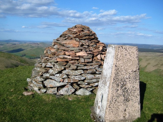
Carsey Cleuch Images
Images are sourced within 2km of 55.30443/-2.8673982 or Grid Reference NT4501. Thanks to Geograph Open Source API. All images are credited.


Carsey Cleuch is located at Grid Ref: NT4501 (Lat: 55.30443, Lng: -2.8673982)
Unitary Authority: The Scottish Borders
Police Authority: The Lothians and Scottish Borders
What 3 Words
///happier.century.conceals. Near Teviothead, Scottish Borders
Nearby Locations
Related Wikis

Cauldcleuch Head
Cauldcleuch Head is a hill in an unnamed range of Roxburghshire hills north of Langholm, part of the Southern Uplands of Scotland. The highest hill in...

Maiden Paps (Hawick)
The Maiden Paps are twin hills near Hawick, in the Scottish Borders of the south east of Scotland, so named because they have the shape of human breasts...

Dinley
Dinley is a hamlet in the Scottish Borders through which Hermitage Water flows. == Etymology == The first element, din, seems to be the Cumbric word for...

Teviothead
Teviothead (Scottish Gaelic: Ceann Tìbhiot) is a small village and civil parish in Teviotdale in the Scottish Borders, known locally as Teviotheid. It...
Caerlanrig
Caerlanrig - also spelled 'Carlenrig' - (Gaelic: Cathair Lannraig) is a hamlet in the parish of Cavers, Borders, Scotland, lying on the River Teviot, 6...

River Teviot
The River Teviot (; Scottish Gaelic: Abhainn Tìbhiot), or Teviot Water, is a river of the Scottish Borders area of Scotland, and is the largest tributary...

Hermitage Castle
Hermitage Castle is a semi-ruined castle in the border region of Scotland. It is under the care of Historic Scotland. The castle has a reputation, both...
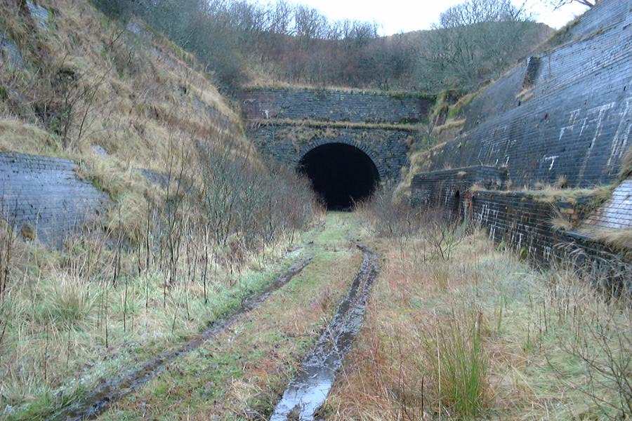
Whitrope Tunnel
The Whitrope Tunnel is a disused railway tunnel in the Scottish Borders, situated 12 miles (19 km) south of Hawick on the Waverley Route, close to Whitrope...
Have you been to Carsey Cleuch?
Leave your review of Carsey Cleuch below (or comments, questions and feedback).