Leap Linn

Valley in Roxburghshire

Scotland

Leap Linn

Muddy burn, Blind Moss A flat boggy area with a sluggish burn; cattle were grazing the pasture up to the left.
Muddy burn, Blind Moss Credit: Jim Barton

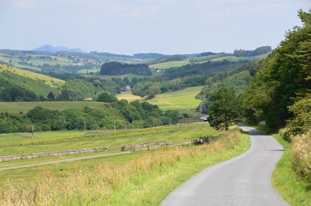
Leap Linn is a picturesque valley located in the county of Roxburghshire, Scotland. Situated amidst the Scottish Borders, this enchanting valley is renowned for its stunning natural beauty and tranquil atmosphere. The valley derives its name from the Leap Linn waterfall, which cascades down the rocky cliffs, creating a mesmerizing spectacle.

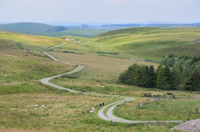
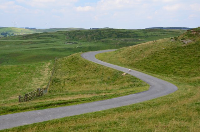
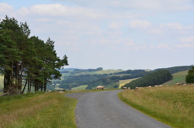
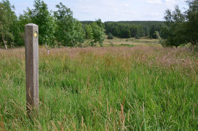
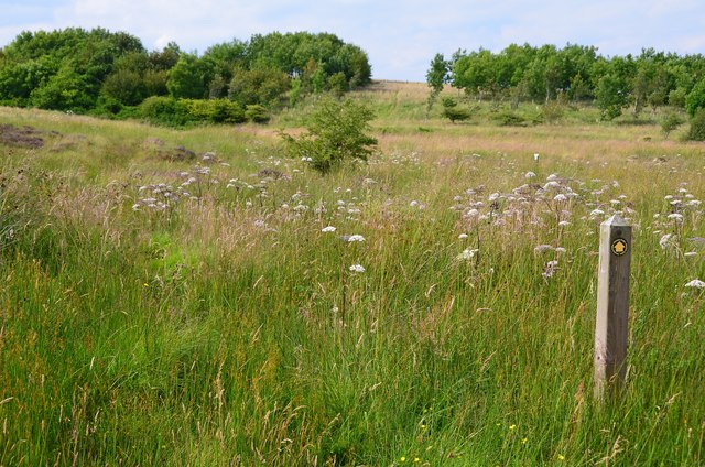
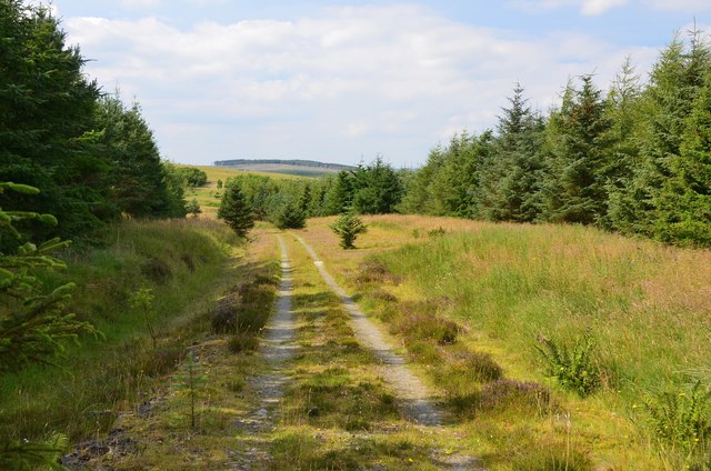
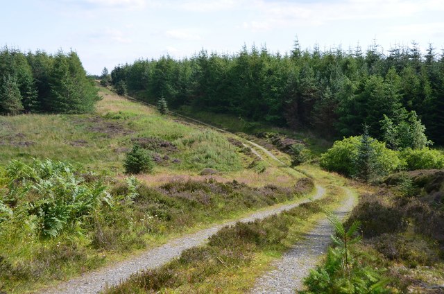
Surrounded by rolling hills and verdant landscapes, Leap Linn offers visitors a chance to immerse themselves in the splendor of nature. The valley is a haven for outdoor enthusiasts, boasting numerous walking and hiking trails that wind through the lush countryside. These trails provide breathtaking views of the surrounding countryside, and visitors can marvel at the diverse flora and fauna that inhabit the area.

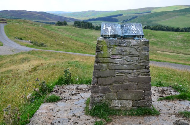
Leap Linn is also home to a rich history, with several ancient ruins and landmarks scattered throughout the valley. The remnants of old castles and historic buildings serve as a testament to the area's past and provide a glimpse into the region's cultural heritage.

In addition to its natural and historical attractions, Leap Linn offers a range of recreational activities for visitors. The valley is a popular spot for fishing, with its crystal-clear streams teeming with trout and salmon. The nearby river also provides opportunities for kayaking and canoeing, allowing visitors to experience the waterways from a different perspective.

Overall, Leap Linn in Roxburghshire is a hidden gem that captivates visitors with its scenic beauty, rich history, and abundance of outdoor activities. Whether one seeks adventure or seeks solace in nature, this valley provides an idyllic retreat for all who visit.

If you have any feedback on the listing, please let us know in the comments section below.

Leap Linn Images

Images are sourced within 2km of 55.46502/-2.8783549 or Grid Reference NT4419. Thanks to Geograph Open Source API. All images are credited.

Muddy burn, Blind Moss A flat boggy area with a sluggish burn; cattle were grazing the pasture up to the left.
Muddy burn, Blind Moss
A flat boggy area with a sluggish burn; cattle were grazing the pasture up to the left.
Winding track on Cringie Law The track leads to the Ogilvie Cairn on the minor road crossing from the Ale Water to the Borthwick Water. In the distance is the wind farm near Akermoor Loch.
Winding track on Cringie Law
The track leads to the Ogilvie Cairn on the minor road crossing from the Ale Water to the Borthwick Water. In the distance is the wind farm near Akermoor Loch.
Memorial cairn to W H Ogilvie William Henry Ogilvie (1869 - 1993) was born in Kelso and spent about 10 years in Australia, during which time he wrote much poetry about life in the outback. Some of his verse is inscribed on the memorial, along with a map of Australia. However, the open book shape also acts as a tempting perch for birds, with visible results. The nearby seat and plaque was unveiled in August 2009 - see <a href="https://www.geograph.org.uk/photo/1573654">NT4418 : A stone seat by the Will H Ogilvie cairn</a>.
Memorial cairn to W H Ogilvie
William Henry Ogilvie (1869 - 1993) was born in Kelso and spent about 10 years in Australia, during which time he wrote much poetry about life in the outback. Some of his verse is inscribed on the memorial, along with a map of Australia. However, the open book shape also acts as a tempting perch for birds, with visible results. The nearby seat and plaque was unveiled in August 2009 - see NT4418 : A stone seat by the Will H Ogilvie cairn.
Road by the Ogilvie cairn The moorland road that crosses from the valley of the Ale Water SW to the Borthwick Water; both are tributaries of the River Teviot.
Road by the Ogilvie cairn
The moorland road that crosses from the valley of the Ale Water SW to the Borthwick Water; both are tributaries of the River Teviot.
Sheep on the road The minor road descending to the Ale Water and Ashkirk.
Sheep on the road
The minor road descending to the Ale Water and Ashkirk.
Valley of the Ale Water The road to Ashkirk and the A7 with the Eildon Hills on the skyline.
Valley of the Ale Water
The road to Ashkirk and the A7 with the Eildon Hills on the skyline.
Marker post, path to forest tracks Evidently not a path that is much used, though the route is given in the 'Paths around Hawick' booklet.
Marker post, path to forest tracks
Evidently not a path that is much used, though the route is given in the 'Paths around Hawick' booklet.
Site of medieval settlement According to the 'Paths around Hawick' guide, this unplanted area E of Shielswood Loch was once the site of a medieval village.
Site of medieval settlement
According to the 'Paths around Hawick' guide, this unplanted area E of Shielswood Loch was once the site of a medieval village.
Forest track In the plantation between Ashkirk Loch and Shielswood Loch.
Forest track
In the plantation between Ashkirk Loch and Shielswood Loch.
Forest track, Moss Knowe Here crossing a small burn draining Blind Moss.
Forest track, Moss Knowe
Here crossing a small burn draining Blind Moss.
Mowing stripes on Cringie Law Pasture improvement off the Hill Road.
Mowing stripes on Cringie Law
Pasture improvement off the Hill Road.
Roadside tump Pile of earth with windswept webs in anticyclonic conditions.  At first I thought it was steaming fresh manure.
Roadside tump
Pile of earth with windswept webs in anticyclonic conditions. At first I thought it was steaming fresh manure.
A strip wood View past a shelterbelt to the new wind farm on Belmanshaws, between here and Ettrick Bridge,
A strip wood
View past a shelterbelt to the new wind farm on Belmanshaws, between here and Ettrick Bridge,
Ashkirk to Roberton road Just before sunset with not a lot of shorter wavelengths in the light.  Last day of anticyclonic weather before the gloom set in and normal November service resumed.
Ashkirk to Roberton road
Just before sunset with not a lot of shorter wavelengths in the light. Last day of anticyclonic weather before the gloom set in and normal November service resumed.
Todrig Burn and Leap Hill
Bridge, Todrig
Bridge, Todrig
Lang Hope A Nissen type building beside the Langhope Burn.
Lang Hope
A Nissen type building beside the Langhope Burn.
Road to Langhope A rather sparse ash wood on the steep slopes.
Road to Langhope
A rather sparse ash wood on the steep slopes.
Show me another place!

Leap Linn is located at Grid Ref: NT4419 (Lat: 55.46502, Lng: -2.8783549)

Unitary Authority: The Scottish Borders

Police Authority: The Lothians and Scottish Borders

What 3 Words

///thickens.unusually.president. Near Hawick, Scottish Borders

Nearby Locations

Leap Linn Leap Hill

Related Wikis

Salenside

Salenside is a village off the A7, on the Ale Water, near Ashkirk, in the Scottish Borders area of Scotland, in the former Selkirkshire. There was a Salenside...

Ashkirk

Ashkirk is a small village on the Ale Water, in the Scottish Borders area of Scotland. It is located just off the A7 road, approximately 6 miles (10 kilometres...

Woll

Woll is a village on the Ale Water, off the A7, in the Ettrick Forest, north of Hawick, and south of Selkirk in the Scottish Borders area of Scotland....

Harden Castle

Harden Castle is a 16th century tower house, about 3.5 miles (5.6 km) west of Hawick, Scottish Borders. It is alternatively known as Harden House or Harden...

Nearby Amenities

Located within 500m of 55.46502,-2.8783549
Barrier: cattle_grid
Source: survey
Lat/Long: 55.4635645/-2.8762434
Power: pole
Lat/Long: 55.4667667/-2.8713181
Power: pole
Lat/Long: 55.4664178/-2.8723249
Power: pole
Lat/Long: 55.4660602/-2.8732442
Power: pole
Lat/Long: 55.4656544/-2.874269
Power: pole
Lat/Long: 55.4651697/-2.8756234
Power: pole
Lat/Long: 55.4646982/-2.876795
Power: pole
Lat/Long: 55.463107/-2.8804206
Power: pole
Lat/Long: 55.4626399/-2.8816592
Power: pole
Lat/Long: 55.4621231/-2.8828462
The data included in this document is from www.openstreetmap.org. The data is made available under ODbL.

Have you been to Leap Linn?

Leave your review of Leap Linn below (or comments, questions and feedback).