Caudale

Valley in Westmorland Eden

England

Caudale

Cairn on Stony Cove Pike The summit of Caudale Moor.
Cairn on Stony Cove Pike Credit: steven ruffles

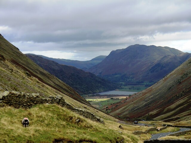
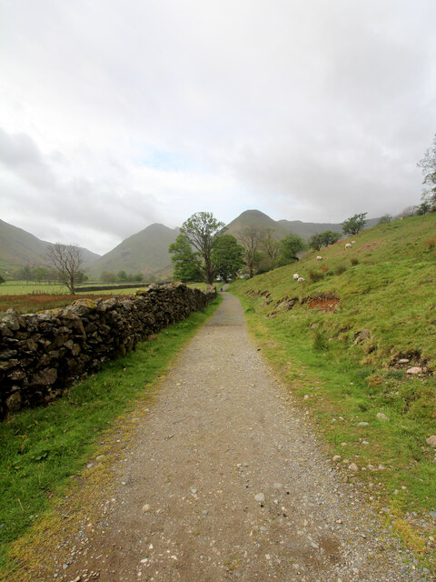
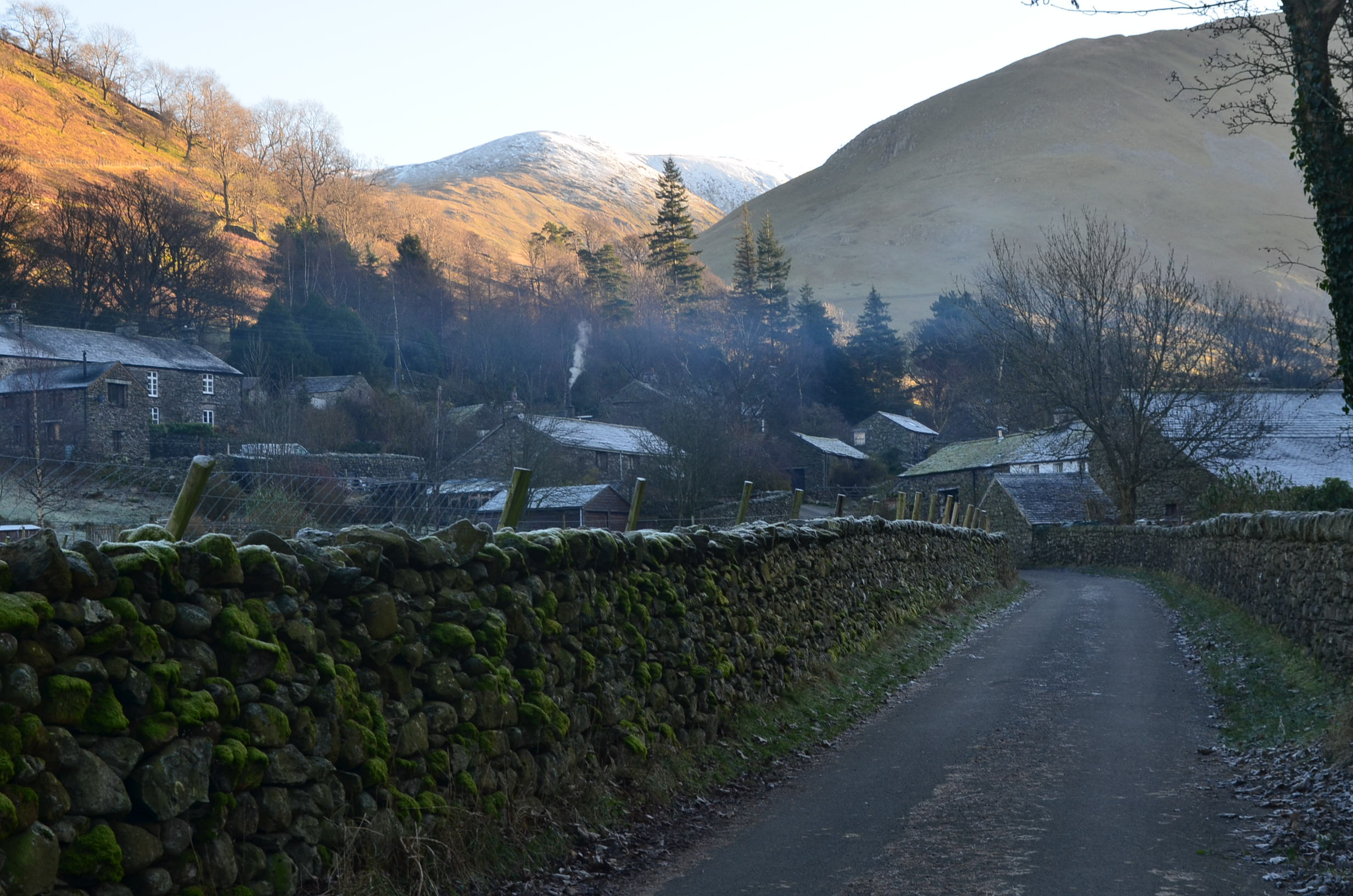
Caudale is a picturesque valley located in the county of Westmorland, in the north-west region of England. Nestled within the Lake District National Park, it is renowned for its stunning natural beauty and pristine landscapes. The valley is situated near the village of Troutbeck and is surrounded by majestic mountains, including High Street and Red Screes.

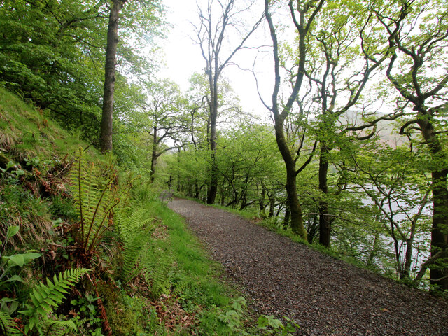
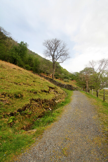
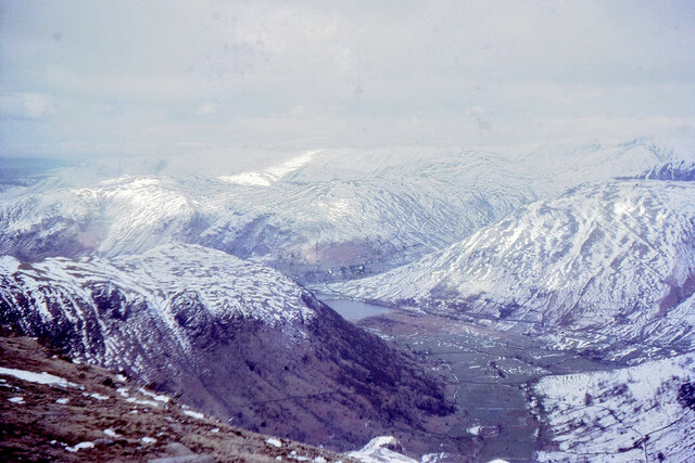
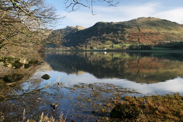
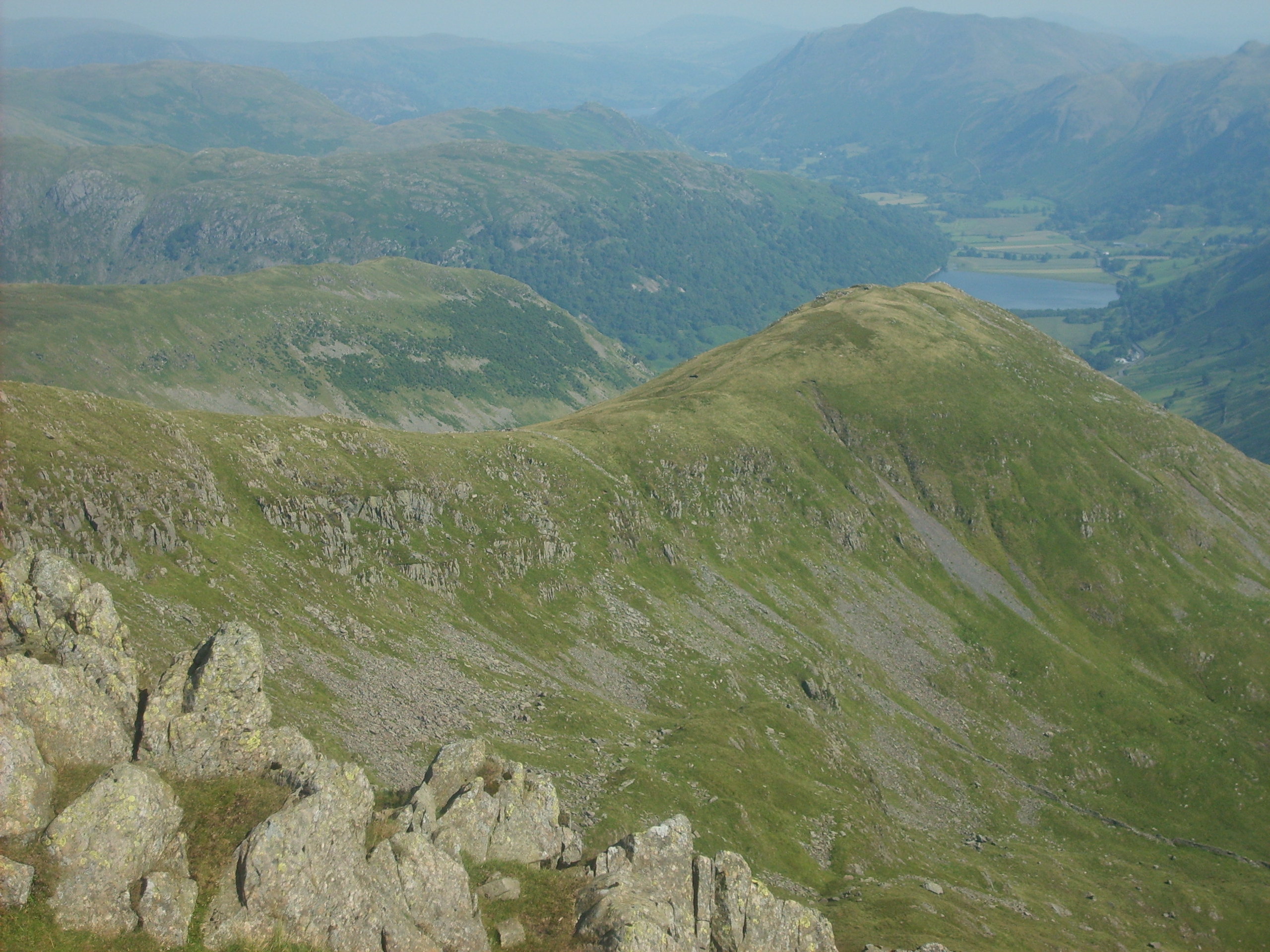
Caudale is characterized by its rolling hills, lush green meadows, and crystal-clear streams that flow through the valley. The area is a paradise for outdoor enthusiasts, offering numerous opportunities for hiking, walking, and mountain biking. The nearby Caudale Moor is a popular spot for hillwalking, offering breathtaking panoramic views of the surrounding countryside.

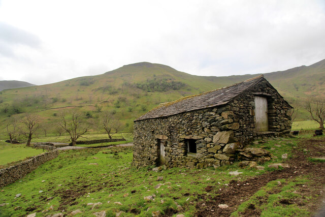
The valley is also home to several notable landmarks, including the ancient Roman road of High Street, which once connected the forts of Ambleside and Penrith. The remnants of old mining activities can be seen in the form of abandoned mines and quarries, adding to the valley's historical significance.

Caudale is a haven for wildlife, with a diverse range of flora and fauna. It is home to various bird species, including golden eagles, peregrine falcons, and red kites. The valley's rich biodiversity also supports a variety of wildflowers, such as bluebells and orchids, which bloom in abundance during the spring and summer months.

Overall, Caudale, Westmorland, offers a tranquil and idyllic setting for nature lovers and those seeking a peaceful retreat amidst the stunning landscapes of the Lake District.

If you have any feedback on the listing, please let us know in the comments section below.

Caudale Images

Images are sourced within 2km of 54.492244/-2.9148594 or Grid Reference NY4011. Thanks to Geograph Open Source API. All images are credited.

Cairn on Stony Cove Pike The summit of Caudale Moor.
Cairn on Stony Cove Pike
The summit of Caudale Moor.
Footpath from Cow Bridge The conceptualisation of a footpath being "to" or "from" a location depends on the direction of travel of the person doing the describing. Today we had started at Cow Bridge to ascend Fairfield via Dovedale, so this photo looking back qualifies as a "from" Cow Bridge. Equally, it passes Hartsop Hall before heading upwards and these could have been "to" if looking the other way, whilst Brothers' Water is definitely a "past" whichever direction one is walking.
Footpath from Cow Bridge
The conceptualisation of a footpath being "to" or "from" a location depends on the direction of travel of the person doing the describing. Today we had started at Cow Bridge to ascend Fairfield via Dovedale, so this photo looking back qualifies as a "from" Cow Bridge. Equally, it passes Hartsop Hall before heading upwards and these could have been "to" if looking the other way, whilst Brothers' Water is definitely a "past" whichever direction one is walking.
Stony Cove Pike A large summit plateau where it is difficult to work out where the highest point is. This view is east from a cairn which could well mark the summit. Thornthwaite Crag is the next fell, while High Street is behind in shadow.
Stony Cove Pike
A large summit plateau where it is difficult to work out where the highest point is. This view is east from a cairn which could well mark the summit. Thornthwaite Crag is the next fell, while High Street is behind in shadow.
Path on Stony Cove Pike The eastern end of the summit plateau before a steep descent to Threshthwaite Mouth. Straight ahead is Thornthwaite Crag, on the other side of the pass.
Path on Stony Cove Pike
The eastern end of the summit plateau before a steep descent to Threshthwaite Mouth. Straight ahead is Thornthwaite Crag, on the other side of the pass.
Stony Cove Pike Having climbed up from Threshthwaite Mouth, there is still a further gentle slog to get to the summit of Stony Cove Pike, though the summit is a large plateau.
Stony Cove Pike
Having climbed up from Threshthwaite Mouth, there is still a further gentle slog to get to the summit of Stony Cove Pike, though the summit is a large plateau.
The eastern end of Stony Cove Pike The eastern end of the summit plateau where it tapers away to the sudden drop down to Threshthwaite Mouth. In the background are some of the fells of the Kentmere Round.
The eastern end of Stony Cove Pike
The eastern end of the summit plateau where it tapers away to the sudden drop down to Threshthwaite Mouth. In the background are some of the fells of the Kentmere Round.
The Atkinson Memorial On Caudale Moor, commemorating the family which used to own the Kirkstone Pass Inn. The Helvellyn range is in the background.
The Atkinson Memorial
On Caudale Moor, commemorating the family which used to own the Kirkstone Pass Inn. The Helvellyn range is in the background.
Kirkstone Pass, Cumbria Looking down Kirkstone Pass towards Brothers water
Kirkstone Pass, Cumbria
Looking down Kirkstone Pass towards Brothers water
Footpath from Cow Bridge The conceptualisation of a footpath being "to" or "from" a location depends on the direction of travel of the person doing the describing. Today we had started at Cow Bridge to ascend Fairfield via Dovedale, so this photo looking back qualifies as a "from" Cow Bridge. Equally, it passes Hartsop Hall before heading upwards and these could have been "to" if looking the other way (as in <a href="https://www.geograph.org.uk/photo/7174575">NY3912 : Footpath to Hartsop Hall</a>). By this point, the path is no longer going "past" Brothers Water, though the wall from the gateway does drop down to the shore of same, at its most southerly point.
Footpath from Cow Bridge
The conceptualisation of a footpath being "to" or "from" a location depends on the direction of travel of the person doing the describing. Today we had started at Cow Bridge to ascend Fairfield via Dovedale, so this photo looking back qualifies as a "from" Cow Bridge. Equally, it passes Hartsop Hall before heading upwards and these could have been "to" if looking the other way (as in NY3912 : Footpath to Hartsop Hall). By this point, the path is no longer going "past" Brothers Water, though the wall from the gateway does drop down to the shore of same, at its most southerly point.
Footpath to Hartsop Hall The conceptualisation of a footpath being "to" or "from" a location depends on the direction of travel of the person doing the describing. Today we had started at Cow Bridge to ascend Fairfield via Dovedale, so this photo looking the way we are going counts as a "to". It's destination could equally well have been given as Dovedale, or Dove Crag (seen in the distance), or any of several places off that path (Black Crag was once such, back in my climbing days).
Footpath to Hartsop Hall
The conceptualisation of a footpath being "to" or "from" a location depends on the direction of travel of the person doing the describing. Today we had started at Cow Bridge to ascend Fairfield via Dovedale, so this photo looking the way we are going counts as a "to". It's destination could equally well have been given as Dovedale, or Dove Crag (seen in the distance), or any of several places off that path (Black Crag was once such, back in my climbing days).
Field barn at the foot of Dovedale The public footpath from Cow Bridge, past Hartsop Hall and on its way to the tops of the Fairfield massif breaks into CROW Access Land just before passing this field barn. The path has, by this time, downgraded from the hard surfaced highway that started out past Brothers Water and has become a more traditional muddy trod, inhabited (and polluted) by cows, so at least one can coem home with boots that look as though they've been somewhere.
Field barn at the foot of Dovedale
The public footpath from Cow Bridge, past Hartsop Hall and on its way to the tops of the Fairfield massif breaks into CROW Access Land just before passing this field barn. The path has, by this time, downgraded from the hard surfaced highway that started out past Brothers Water and has become a more traditional muddy trod, inhabited (and polluted) by cows, so at least one can coem home with boots that look as though they've been somewhere.
Dovedale from Dove Crag Dovedale and Brothers Water in early April snow cover 1966.
Dovedale from Dove Crag
Dovedale and Brothers Water in early April snow cover 1966.
Mark and William Atkinson's monument On John Bell's Banner, near Stony Cove Pike.
Mark and William Atkinson's monument
On John Bell's Banner, near Stony Cove Pike.
Descending from Caudale Moor In the distance, centre, is Windermere.
Descending from Caudale Moor
In the distance, centre, is Windermere.
Caudale Moor Summit Caudale Moor summit looking in the distance to Blencathra to the left and Place Fell to the far right
Caudale Moor Summit
Caudale Moor summit looking in the distance to Blencathra to the left and Place Fell to the far right
Ruined wall in mist and under snow The wall lies just south of Caudale Moor a hill top slightly lower than the main mountain summit, Stony Cove Pike.
Ruined wall in mist and under snow
The wall lies just south of Caudale Moor a hill top slightly lower than the main mountain summit, Stony Cove Pike.
Waterfalls above Smithy Brow
The Kirkstone pass road. One of the districts best sections of road.
The Kirkstone pass road.
One of the districts best sections of road.
Show me another place!

Caudale is located at Grid Ref: NY4011 (Lat: 54.492244, Lng: -2.9148594)

Administrative County: Cumbria

District: Eden

Police Authority: Cumbria

What 3 Words

///fulfilled.screening.swinging. Near Ambleside, Cumbria

Nearby Locations

Caudale

Related Wikis

Nearby Amenities

Located within 500m of 54.492244,-2.9148594
The Tongue
Is In: Cumbria
Place: locality
Lat/Long: 54.4930212/-2.9136033
Disused: yes
Man Made: adit
Lat/Long: 54.4886133/-2.9146401
Abandoned: yes
Direction: 100
Man Made: adit
Lat/Long: 54.4896619/-2.9180325
Abandoned: yes
Direction: 100
Man Made: adit
Lat/Long: 54.4892858/-2.9180191
The data included in this document is from www.openstreetmap.org. The data is made available under ODbL.

Have you been to Caudale?

Leave your review of Caudale below (or comments, questions and feedback).