Baraman's Cleuch

Valley in Dumfriesshire

Scotland

Baraman's Cleuch

White Hill and Whitehill Wood Looking across the square from the Unthank farm road on the A7.
White Hill and Whitehill Wood Credit: M J Richardson

The requested URL returned error: 429 Too Many Requests

If you have any feedback on the listing, please let us know in the comments section below.

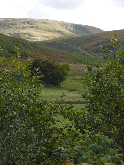
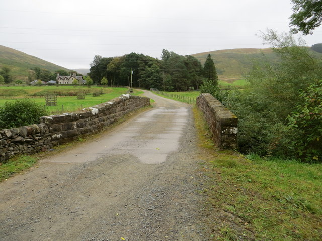
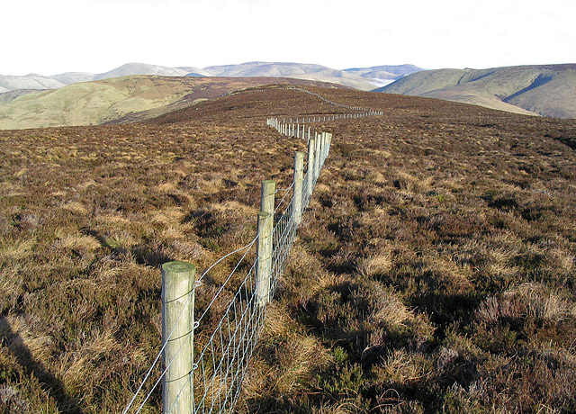
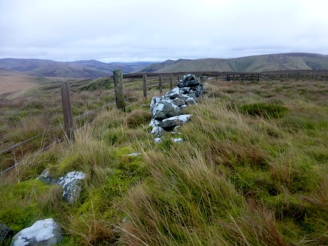
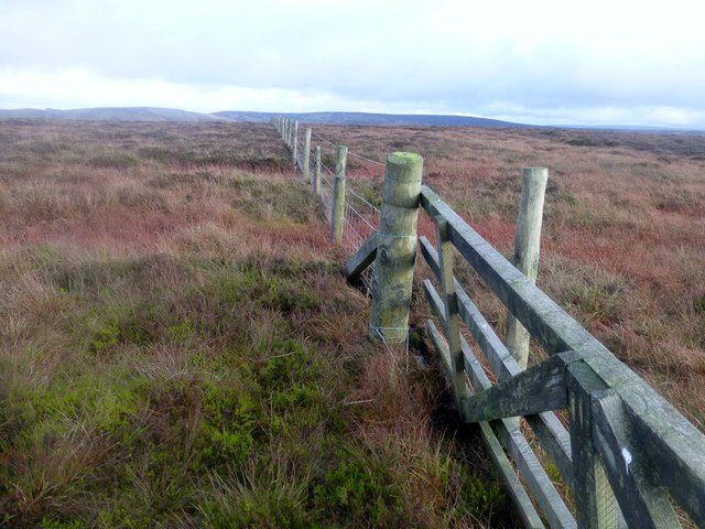
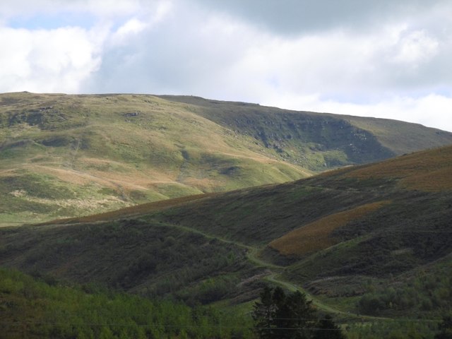
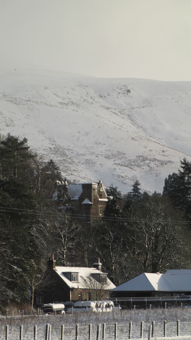
Baraman's Cleuch Images

Images are sourced within 2km of 55.226438/-2.9473106 or Grid Reference NY3992. Thanks to Geograph Open Source API. All images are credited.

White Hill and Whitehill Wood Looking across the square from the Unthank farm road on the A7.
White Hill and Whitehill Wood
Looking across the square from the Unthank farm road on the A7.
View towards Arkleton Hill A track climbs out of Ewesdale towards sunlit Arkleton Hill.
View towards Arkleton Hill
A track climbs out of Ewesdale towards sunlit Arkleton Hill.
Woodland, Whitehill The plantation here was cut down early in the 21st century and now the new growth is becoming obvious. As well as replanting the original wood, some of the nearby moorland north of the Mosspeeble Burn was also planted with trees.
Woodland, Whitehill
The plantation here was cut down early in the 21st century and now the new growth is becoming obvious. As well as replanting the original wood, some of the nearby moorland north of the Mosspeeble Burn was also planted with trees.
Young woodland, Mosspeeble There has been a lot of tree planting here in recent years.
Young woodland, Mosspeeble
There has been a lot of tree planting here in recent years.
The A7 heading for Hawick A rare stretch of the A7 with two lanes for the uphill (northbound) traffic, here coming to an end at the brow of the hill.
The A7 heading for Hawick
A rare stretch of the A7 with two lanes for the uphill (northbound) traffic, here coming to an end at the brow of the hill.
Old Milestone by the A7, north of Ewes Milestone by the A7, in parish of Ewes (Dunfermline District), 6 miles North of Langholm, on long straight opposite lay-by, on West side of road.

Apparently broken between April and July 2021.

Inscription reads:-
E67
(To Edinburgh)

Surveyed

Milestone Society National ID: DG_EDCL67
Old Milestone by the A7, north of Ewes
Milestone by the A7, in parish of Ewes (Dunfermline District), 6 miles North of Langholm, on long straight opposite lay-by, on West side of road. Apparently broken between April and July 2021. Inscription reads:- E67 (To Edinburgh) Surveyed Milestone Society National ID: DG_EDCL67
Bridge Over Ewes Water at Mosspeeble Looking eastward.
Bridge Over Ewes Water at Mosspeeble
Looking eastward.
Track from A7 to Mosspeeble Looking north-eastward.
Track from A7 to Mosspeeble
Looking north-eastward.
Ordnance Survey Flush Bracket S7372 This can be found on the wall of a building at Mosspeeble.
For more detail see : <span class="nowrap"><a title="http://www.bench-marks.org.uk/bm21033" rel="nofollow ugc noopener" href="http://www.bench-marks.org.uk/bm21033">Link</a><img style="margin-left:2px;" alt="External link" title="External link - shift click to open in new window" src="https://s1.geograph.org.uk/img/external.png" width="10" height="10"/></span>
Ordnance Survey Flush Bracket S7372
This can be found on the wall of a building at Mosspeeble. For more detail see : LinkExternal link
Ordnance Survey Cut Mark This can be found on the parapet of Mosspeeble Bridge.
For more detail see : <span class="nowrap"><a title="http://www.bench-marks.org.uk/bm62476" rel="nofollow ugc noopener" href="http://www.bench-marks.org.uk/bm62476">Link</a><img style="margin-left:2px;" alt="External link" title="External link - shift click to open in new window" src="https://s1.geograph.org.uk/img/external.png" width="10" height="10"/></span>
Ordnance Survey Cut Mark
This can be found on the parapet of Mosspeeble Bridge. For more detail see : LinkExternal link
White Hill Bagged trig first with Phil Cooper then White Hill TUMP, Salter Grain Hill, Pike Fell and Arkleton Hill after parking near Mosspeeble.
Name: White Hill
Hill number: 13947
Height: 378m / 1240ft
Parent (Ma/M): 1918  Roan Fell
Section: 28B: The River Tweed to the English Border
Area: Roxburgh
County/UA: Dumfries and Galloway (UA)
Class: Tump (300-399m)
Grid ref: NY396941 (est)
Drop: 64m
Col: 314m  NY402940
White Hill
Bagged trig first with Phil Cooper then White Hill TUMP, Salter Grain Hill, Pike Fell and Arkleton Hill after parking near Mosspeeble. Name: White Hill Hill number: 13947 Height: 378m / 1240ft Parent (Ma/M): 1918 Roan Fell Section: 28B: The River Tweed to the English Border Area: Roxburgh County/UA: Dumfries and Galloway (UA) Class: Tump (300-399m) Grid ref: NY396941 (est) Drop: 64m Col: 314m NY402940
White Hill Trig
White Hill Trig
A Viewback Towards Mosspeeble A view back down the hillside towards Mosspeeble.  This is a view of our route of ascent up White Hill.
A Viewback Towards Mosspeeble
A view back down the hillside towards Mosspeeble. This is a view of our route of ascent up White Hill.
Arkleton Hill This hill looks good from the A7 with Arkleton Craigs showing up well but the summit area is a bit of a plod through heather.
Arkleton Hill
This hill looks good from the A7 with Arkleton Craigs showing up well but the summit area is a bit of a plod through heather.
Salter Grain Hill Salter Grain Hill with a view towards Pike Fell.
Name: Salter Grain Hill
Hill number: 13977
Height: 365m / 1197ft
Parent (Ma/M): 1918  Roan Fell
Section: 28B: The River Tweed to the English Border
Area: Roxburgh
County/UA: Dumfries and Galloway (UA)
Class: Tump (300-399m)
Grid ref: NY404943 (est)
Drop: 38m
Col: 327m  NY405941
Salter Grain Hill
Salter Grain Hill with a view towards Pike Fell. Name: Salter Grain Hill Hill number: 13977 Height: 365m / 1197ft Parent (Ma/M): 1918 Roan Fell Section: 28B: The River Tweed to the English Border Area: Roxburgh County/UA: Dumfries and Galloway (UA) Class: Tump (300-399m) Grid ref: NY404943 (est) Drop: 38m Col: 327m NY405941
Pike Fell Bagged trig first with Phil Cooper then White Hill TUMP, Salter Grain Hill, Pike Fell and Arkleton Hill after parking near Mosspeeble.
Name: Pike Fell
Hill number: 5116
Height: 499m / 1637ft
Parent (Ma/M): 1918  Roan Fell
Section: 28B: The River Tweed to the English Border
County/UA: Dumfries and Galloway (UA)
Class: HuMP, Tump (400-499m)
Grid ref: NY 41282 93947
Summit feature: no feature: ground between wall and fence
Drop: 107m
Col: 392m  NY409932
Pike Fell
Bagged trig first with Phil Cooper then White Hill TUMP, Salter Grain Hill, Pike Fell and Arkleton Hill after parking near Mosspeeble. Name: Pike Fell Hill number: 5116 Height: 499m / 1637ft Parent (Ma/M): 1918 Roan Fell Section: 28B: The River Tweed to the English Border County/UA: Dumfries and Galloway (UA) Class: HuMP, Tump (400-499m) Grid ref: NY 41282 93947 Summit feature: no feature: ground between wall and fence Drop: 107m Col: 392m NY409932
Arkleton Hill Bagged trig first with Phil Cooper then White Hill TUMP, Salter Grain Hill, Pike Fell and Arkleton Hill after parking near Mosspeeble.
Name: Arkleton Hill
Hill number: 1926
Height: 521m / 1709ft
Parent (Ma/M): 1918  Roan Fell
Section: 28B: The River Tweed to the English Border
County/UA: Dumfries and Galloway (UA)
Class: HuMP, Donald Dewey, subMarilyn
Grid ref: NY 40507 92181
Summit feature: no feature: near fence junction
Drop: 146m
Col: 375m  NY421937
Arkleton Hill
Bagged trig first with Phil Cooper then White Hill TUMP, Salter Grain Hill, Pike Fell and Arkleton Hill after parking near Mosspeeble. Name: Arkleton Hill Hill number: 1926 Height: 521m / 1709ft Parent (Ma/M): 1918 Roan Fell Section: 28B: The River Tweed to the English Border County/UA: Dumfries and Galloway (UA) Class: HuMP, Donald Dewey, subMarilyn Grid ref: NY 40507 92181 Summit feature: no feature: near fence junction Drop: 146m Col: 375m NY421937
Black Cove Small corrie on Arkleton Hill. View from the A7 over Mosspeeble.
Black Cove
Small corrie on Arkleton Hill. View from the A7 over Mosspeeble.
Show me another place!

Baraman's Cleuch is located at Grid Ref: NY3992 (Lat: 55.226438, Lng: -2.9473106)

Unitary Authority: Dumfries and Galloway

Police Authority: Dumfries and Galloway

What 3 Words

///crunching.nosedive.mole. Near Bentpath, Dumfries & Galloway

Nearby Locations

Baraman's Cleuch

Related Wikis

Unthank, Dumfries and Galloway

Unthank is a village in Dumfries and Galloway, Scotland. == References == The geographic coordinates are from the Ordnance Survey.

Arkleton

Arkleton is a mansion and estate in the civil parish of Ewes, in Dumfries and Galloway, Scotland. Arkleton House was built in 1860/1884 and incorporates...

Ewesdale

Ewesdale is a glen and former lordship in Dumfries and Galloway, Scotland. The Ewes Water runs through the valley from its source at Mosspaul, until it...

Barntalloch Castle

Barntalloch Castle was a castle located at Staplegorton, in Dumfries and Galloway, Scotland. The castle was built in the 12th century by Galfrid de Coninsburgh...

Nearby Amenities

Located within 500m of 55.226438,-2.9473106
Barrier: stile
Lat/Long: 55.2239048/-2.948212
Straight Knowes
Place: locality
Lat/Long: 55.2223727/-2.9463091
The data included in this document is from www.openstreetmap.org. The data is made available under ODbL.

Have you been to Baraman's Cleuch?

Leave your review of Baraman's Cleuch below (or comments, questions and feedback).