Midge Cleuch
Valley in Selkirkshire
Scotland
Midge Cleuch
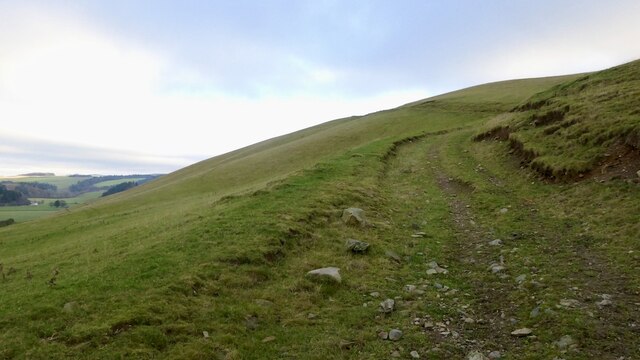
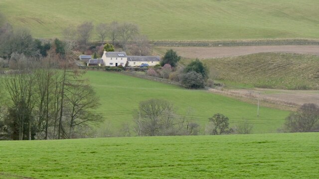
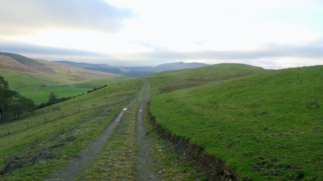
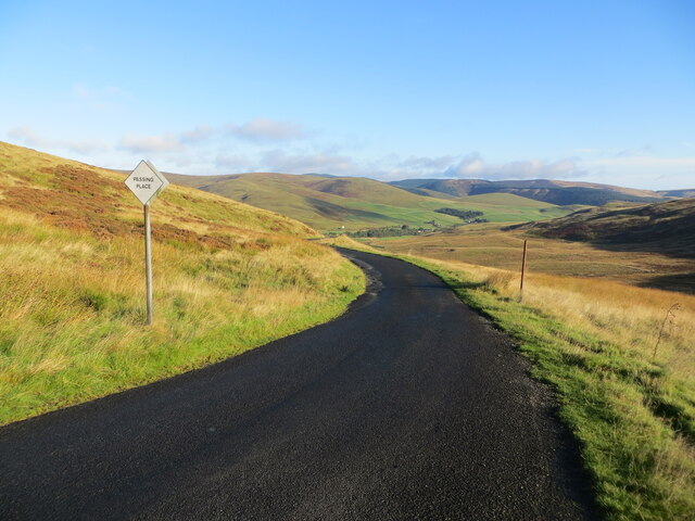
Midge Cleuch, located in Selkirkshire, is a picturesque valley nestled in the beautiful Scottish Borders region. The valley is surrounded by rolling hills, lush greenery, and offers breathtaking views of the surrounding countryside. It is a place of tranquility and natural beauty, attracting visitors from near and far.
Midge Cleuch is known for its diverse wildlife and rich biodiversity. The valley is home to numerous species of birds, including buzzards, kestrels, and pheasants, making it a haven for birdwatchers and nature enthusiasts. The meandering Midge Water, a small river that runs through the valley, adds to its charm and provides a habitat for various aquatic creatures.
The valley is also steeped in history, with ancient ruins and historical sites scattered throughout the area. The remnants of Midge Castle, a medieval stronghold, can still be seen today, adding a sense of intrigue and wonder to the landscape. The valley has also witnessed significant events in Scottish history, and there are numerous tales and legends associated with the area.
For outdoor enthusiasts, Midge Cleuch offers a range of activities. The valley is a popular destination for walkers and hikers, with numerous trails and paths that allow visitors to explore the surrounding countryside. Cyclists can also enjoy the undulating terrain and scenic routes that cut through the valley.
In summary, Midge Cleuch is a hidden gem in Selkirkshire, offering a blend of natural beauty, historical significance, and recreational opportunities. Whether one seeks solace in nature, wants to delve into history, or simply wants to indulge in outdoor activities, Midge Cleuch has something to offer for everyone.
If you have any feedback on the listing, please let us know in the comments section below.
Midge Cleuch Images
Images are sourced within 2km of 55.510601/-2.9807277 or Grid Reference NT3824. Thanks to Geograph Open Source API. All images are credited.


Midge Cleuch is located at Grid Ref: NT3824 (Lat: 55.510601, Lng: -2.9807277)
Unitary Authority: The Scottish Borders
Police Authority: The Lothians and Scottish Borders
What 3 Words
///candles.streak.padlock. Near Selkirk, Scottish Borders
Nearby Locations
Related Wikis

Kirkhope Tower
Kirkhope Tower is a Scottish Pele, located in the Ettrick Valley, in the historic county of Selkirkshire, now a division of the Scottish Borders. The tower...

Ettrickbridge
Ettrickbridge (Scottish Gaelic: Drochaid Eadaraig) is a village situated in the Scottish Borders region of Scotland, 7 miles (11 km) from the nearby town...

Selkirkshire
Selkirkshire or the County of Selkirk (Scottish Gaelic: Siorrachd Shalcraig) is a historic county and registration county of Scotland. It borders Peeblesshire...

Aikwood Tower
Aikwood Tower (formerly known as Oakwood Tower) is a 16th-century tower house in the Scottish Borders area of Scotland, 4 miles (6 kilometres) southwest...

Yarrow, Scottish Borders
Yarrow is a place and parish in the Scottish Borders area of Scotland and in the former county of Selkirkshire.The name "Yarrow" may derive from the Celtic...

Oakwood Roman Fort and Camp
Oakwood Roman Fort and Camp is a British archaeological site, a Roman fort and nearby Roman camp, about 3.5 miles (5.6 km) south-west of Selkirk in the...

Bowhill House
Bowhill House is a historic house near Bowhill at Selkirk in the Scottish Borders area of Scotland. It is a member of the Historic Houses Association,...

Bowhill, Scottish Borders
Bowhill is a village off the A708, in the Scottish Borders area of Scotland, near Selkirk, by the Yarrow Water Other places nearby include Bowhill House...
Nearby Amenities
Located within 500m of 55.510601,-2.9807277Have you been to Midge Cleuch?
Leave your review of Midge Cleuch below (or comments, questions and feedback).