Rabbithall Plantation

Downs, Moorland in Selkirkshire

Scotland

Rabbithall Plantation

Track over Howford Hill A waymarked route. This section has seen little recent use by agricultural vehicles.
Track over Howford Hill Credit: Richard Webb

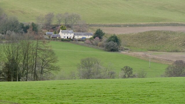
Rabbithall Plantation is a picturesque estate located in Selkirkshire, a historic county in the southern part of Scotland. Situated amidst the stunning Downs and Moorland landscapes, the plantation offers a serene and idyllic setting for nature enthusiasts and outdoor lovers.

Covering a vast area, Rabbithall Plantation is predominantly characterized by its diverse and rich vegetation. The plantation boasts a variety of trees, including oak, beech, and birch, which create a dense and verdant woodland. This lush habitat provides a haven for numerous bird species, making it a popular spot for birdwatching.

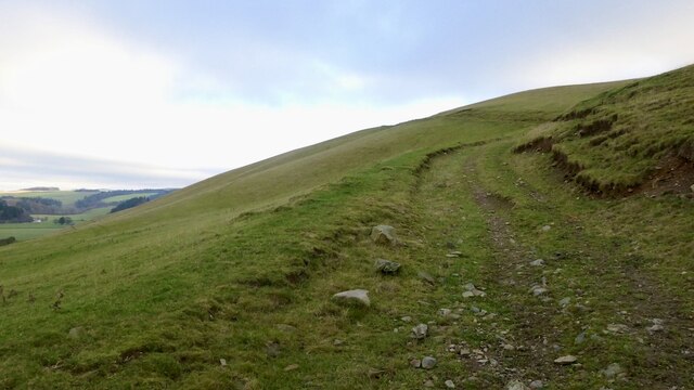
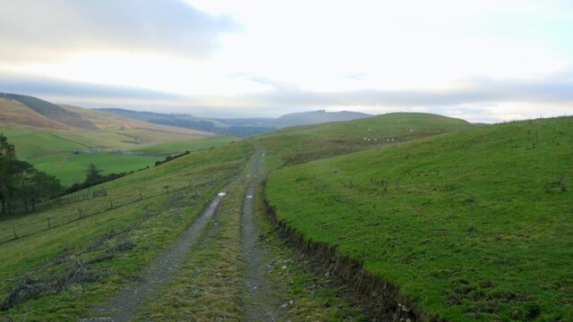
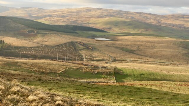
The estate's location on the Downs and Moorland offers visitors the opportunity to explore and appreciate the breathtaking scenery. Rolling hills, heather-covered moors, and tranquil streams are some of the natural features that can be found within the plantation. The area is also home to a wide range of wildlife, including deer, hares, and rabbits, hence the name "Rabbithall."

For those seeking outdoor activities, Rabbithall Plantation provides ample opportunities for walking, hiking, and cycling. The well-maintained trails allow visitors to immerse themselves in the beauty of the surroundings while enjoying the fresh air and peaceful ambiance.

In addition to its natural attractions, Rabbithall Plantation also offers amenities for visitors' convenience. There are picnic areas where families and friends can enjoy a leisurely outdoor meal, as well as information boards providing educational insights about the plantation's flora and fauna.

Overall, Rabbithall Plantation in Selkirkshire is a breathtaking destination that combines stunning natural landscapes, diverse wildlife, and recreational activities, making it an ideal spot for nature lovers and outdoor enthusiasts alike.

If you have any feedback on the listing, please let us know in the comments section below.

Rabbithall Plantation Images

Images are sourced within 2km of 55.506552/-2.978062 or Grid Reference NT3824. Thanks to Geograph Open Source API. All images are credited.

Track over Howford Hill A waymarked route. This section has seen little recent use by agricultural vehicles.
Track over Howford Hill
A waymarked route. This section has seen little recent use by agricultural vehicles.
Brockhill View across the hidden from sight Ettrick Water.
Brockhill
View across the hidden from sight Ettrick Water.
Road, Mid Hill Serving some buildings to the south and a quarry on Howford Hill.
Road, Mid Hill
Serving some buildings to the south and a quarry on Howford Hill.
Farm buildings beneath Howford Hill
Ettrick Bridge View from Helmburn Hill.
Ettrick Bridge
View from Helmburn Hill.
Summit, Helmburn Hill
A lost woodland The wee foreground hill was covered in pines until a few years ago. One of the few trees to survive the chainsaw blew down in the gale of 26th November 2021.
A lost woodland
The wee foreground hill was covered in pines until a few years ago. One of the few trees to survive the chainsaw blew down in the gale of 26th November 2021.
Field, Helmburn
Field, Helmburn
They have powerful electric fences around here The power line warning was obviously repositioned here. This is a new electric fence, solar powered but fortunately provisioned with gates. Electric fences are getting more and more common now and can be very awkward to deal with.
They have powerful electric fences around here
The power line warning was obviously repositioned here. This is a new electric fence, solar powered but fortunately provisioned with gates. Electric fences are getting more and more common now and can be very awkward to deal with.
Ditch and new electric fence, Helmburn
Rough grazing, Green Knowe Separated from the better quality farmland at Helmburn by a substantial dyke.
Rough grazing, Green Knowe
Separated from the better quality farmland at Helmburn by a substantial dyke.
Rough grazing, Helmburn
House under Howford Hill Farm cottage and gathering pens. View from Caver's Hill
House under Howford Hill
Farm cottage and gathering pens. View from Caver's Hill
Helmburn Hill View from Caver's Hill
Helmburn Hill
View from Caver's Hill
Recent clearfell, Caver's Hill At the foot of Caver's Hill. I suspect they may have got them in in time. There was a lot of fresh windthrow in the area, as with many places after "Arwen", a big gale on 26th November 2021.
Recent clearfell, Caver's Hill
At the foot of Caver's Hill. I suspect they may have got them in in time. There was a lot of fresh windthrow in the area, as with many places after "Arwen", a big gale on 26th November 2021.
Sheepy singletrack Sheep path along the route of an old road heading for Ettrickbridge. It is a waymarked route and horse riding is actively encouraged.
Sheepy singletrack
Sheep path along the route of an old road heading for Ettrickbridge. It is a waymarked route and horse riding is actively encouraged.
Under Howford Hill Cannot find a name for the house. There are some very good old tracks here including waymarked routes for horse riding - ie no locked gates!
Under Howford Hill
Cannot find a name for the house. There are some very good old tracks here including waymarked routes for horse riding - ie no locked gates!
Pond above Helmburn
Pond above Helmburn
Show me another place!

Rabbithall Plantation is located at Grid Ref: NT3824 (Lat: 55.506552, Lng: -2.978062)

Unitary Authority: The Scottish Borders

Police Authority: The Lothians and Scottish Borders

What 3 Words

///eyeful.incomes.cosmic. Near Selkirk, Scottish Borders

Related Wikis

Ettrickbridge

Ettrickbridge (Scottish Gaelic: Drochaid Eadaraig) is a village situated in the Scottish Borders region of Scotland, 7 miles (11 km) from the nearby town...

Kirkhope Tower

Kirkhope Tower is a Scottish Pele, located in the Ettrick Valley, in the historic county of Selkirkshire, now a division of the Scottish Borders. The tower...

Selkirkshire

Selkirkshire or the County of Selkirk (Scottish Gaelic: Siorrachd Shalcraig) is a historic county and registration county of Scotland. It borders Peeblesshire...

Aikwood Tower

Aikwood Tower (formerly known as Oakwood Tower) is a 16th-century tower house in the Scottish Borders area of Scotland, 4 miles (6 kilometres) southwest...

Oakwood Roman Fort and Camp

Oakwood Roman Fort and Camp is a British archaeological site, a Roman fort and nearby Roman camp, about 3.5 miles (5.6 km) south-west of Selkirk in the...

Yarrow, Scottish Borders

Yarrow is a place and parish in the Scottish Borders area of Scotland and in the former county of Selkirkshire.The name "Yarrow" may derive from the Celtic...

Bowhill House

Bowhill House is a historic house near Bowhill at Selkirk in the Scottish Borders area of Scotland. It is a member of the Historic Houses Association,...

Bowhill, Scottish Borders

Bowhill is a village off the A708, in the Scottish Borders area of Scotland, near Selkirk, by the Yarrow Water Other places nearby include Bowhill House...

Nearby Amenities

Located within 500m of 55.506552,-2.978062
Bus Stop
Cross Keys
Bus: yes
Naptan AtcoCode: 69001134
Naptan Bearing: W
Naptan CommonName: Cross Keys
Naptan Indicator: opp
Naptan Landmark: Cross Keys
Naptan NaptanCode: 72725364
Naptan Street: B7009
Operator: Scottish Borders Council
Public Transport: platform
Ref: 69001134
Source: NaPTAN
Lat/Long: 55.5084396/-2.9712602
Defibrillator
Defibrillator Location: On the outside wall of Kirkhope Parish Hall
Emergency: defibrillator
Opening Hours: 24/7
Lat/Long: 55.5085949/-2.972209
Addr Housename: Dormouse Cottage
Lat/Long: 55.5084043/-2.9733318
Pub
Cross Keys
Addr Postcode: TD7 5JN
Fhrs Id: 984407
Source Addr Postcode: FHRS Open Data
Lat/Long: 55.5085924/-2.9713485
Material: wood
Power: pole
Transformer: distribution
Lat/Long: 55.5039094/-2.9829262
Material: wood
Power: pole
Lat/Long: 55.5055757/-2.98438
Material: wood
Power: pole
Lat/Long: 55.504959/-2.9850975
Ford: yes
Lat/Long: 55.5040501/-2.9736619
Power: pole
Lat/Long: 55.5077984/-2.9853628
Power: pole
Lat/Long: 55.5075555/-2.9841455
Power: pole
Lat/Long: 55.5073174/-2.9830775
Power: pole
Lat/Long: 55.5070757/-2.981999
Power: pole
Lat/Long: 55.505466/-2.9829598
Power: pole
Lat/Long: 55.5060744/-2.9835401
Power: pole
Lat/Long: 55.5065875/-2.9827306
Power: pole
Lat/Long: 55.5077019/-2.9810424
Power: pole
Lat/Long: 55.5079508/-2.9795497
Power: pole
Lat/Long: 55.5081365/-2.9784355
Power: pole
Lat/Long: 55.5083341/-2.9773633
Power: pole
Lat/Long: 55.5086056/-2.9756835
Power: pole
Lat/Long: 55.5087782/-2.9746995
Power: pole
Lat/Long: 55.5089901/-2.9734444
Bus Stop
Kirkhope Farm Cottages
Bus: yes
Naptan AtcoCode: 69001818
Naptan Bearing: SW
Naptan CommonName: Kirkhope Farm Cottages
Naptan Indicator: opp
Naptan Landmark: Old School
Naptan NaptanCode: 72798969
Naptan Notes: reposition
Naptan Street: B7009
Operator: Scottish Borders Council
Public Transport: platform
Ref: 69001818
Source: NaPTAN
Lat/Long: 55.5039279/-2.9825614
The data included in this document is from www.openstreetmap.org. The data is made available under ODbL.

Have you been to Rabbithall Plantation?

Leave your review of Rabbithall Plantation below (or comments, questions and feedback).