Far Easedale
Valley in Westmorland South Lakeland
England
Far Easedale
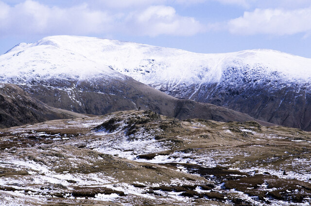
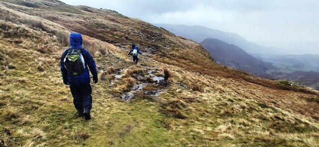
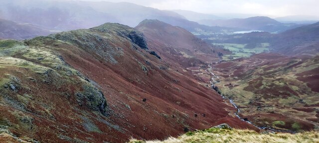
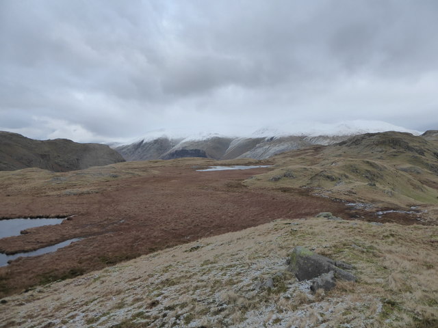
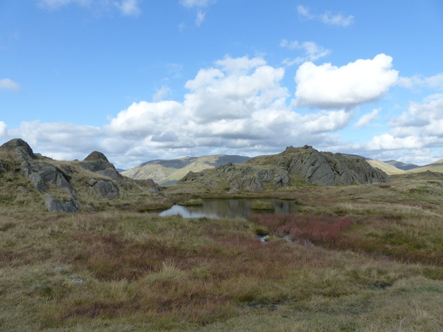
Far Easedale is a picturesque valley located in the district of Westmorland, England. Situated in the Lake District National Park, it is known for its stunning natural beauty and scenic landscapes. The valley is nestled between the towering fells of High Raise and Helm Crag, offering breathtaking views of the surrounding mountains and rolling green hills.
The valley is traversed by the sparkling waters of Far Easedale Beck, which meanders through the landscape, adding to the charm and tranquility of the area. The beck is home to various species of wildlife, including brown trout, which can be seen darting through the crystal-clear waters.
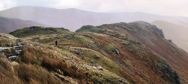
Far Easedale is a popular destination for hikers and nature enthusiasts, who are drawn to its extensive network of walking trails. The valley provides access to several notable peaks, including Sergeant Man and Tarn Crag, offering visitors the opportunity to experience the rugged beauty of the Lake District’s upland areas.
The valley is also renowned for its rich cultural heritage. Ruins of old stone barns and farmhouses can be found scattered throughout the valley, serving as a reminder of the area’s agricultural past. Additionally, the valley is dotted with ancient stone walls, which were traditionally used to mark boundaries and enclosures.
Overall, Far Easedale in Westmorland is a captivating destination that appeals to both nature lovers and history enthusiasts. Its idyllic setting, diverse wildlife, and impressive mountain vistas make it a must-visit location for those seeking a true taste of the Lake District’s natural splendor.
If you have any feedback on the listing, please let us know in the comments section below.
Far Easedale Images
Images are sourced within 2km of 54.474719/-3.0527699 or Grid Reference NY3109. Thanks to Geograph Open Source API. All images are credited.

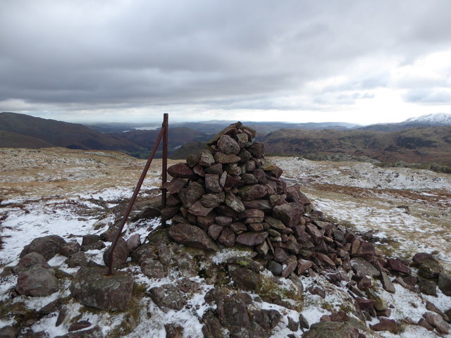
![Steel Fell Helm Crag, Gibson Knott, Calf Crag, Steel Fell and Butharlyp Howe with Smudge on a warmish grey day.
Name: Steel Fell [Dead Pike - Steel Fell]
Hill number: 2466
Height: 553m / 1814ft
Parent (Ma/M): 2396 High Raise [High Raise (High White Stones)]
Section: 34B: Lake District - Central & Western Fells
Area: Lake District - Central Fells
County/UA: Cumbria (CoU)
Class: Dewey, Wainwright, Birkett, Synge, Fellranger
Grid ref: NY 31943 11154
Summit feature: cairn
Drop: 80m
Col: 473m NY304110
Observations: cairn 80m E at NY 32023 11167 is 2m lower
Survey: Abney level](https://s3.geograph.org.uk/geophotos/04/69/48/4694807_5e9ab29c.jpg)


Far Easedale is located at Grid Ref: NY3109 (Lat: 54.474719, Lng: -3.0527699)
Administrative County: Cumbria
District: South Lakeland
Police Authority: Cumbria
What 3 Words
///staple.enforced.shrug. Near Ambleside, Cumbria
Nearby Locations
Related Wikis

Gibson Knott
Gibson Knott is a fell in the English Lake District, an intermediate height on the ridge between Greenburn and Far Easedale in the Central Fells. ��2...

Helm Crag
Helm Crag is a fell in the English Lake District situated in the Central Fells to the north of Grasmere. Despite its low height it sits prominently at...
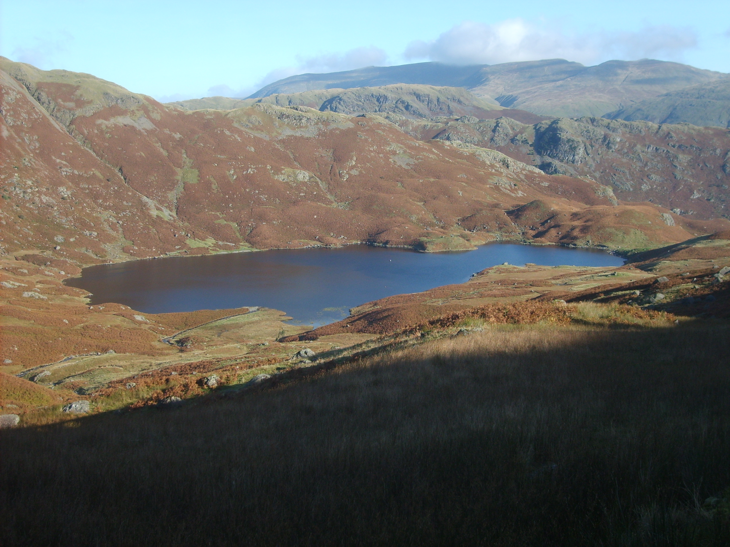
Easedale Tarn
Easedale Tarn is a tarn in the centre of the English Lake District, about two miles west of the village of Grasmere. It lies in a hollow between Tarn Crag...

Tarn Crag (Easedale)
Tarn Crag is a fell in the Central Fells of the English Lake District. Strictly the name refers only to the rock face looking down upon Easedale Tarn,...
Nearby Amenities
Located within 500m of 54.474719,-3.0527699Have you been to Far Easedale?
Leave your review of Far Easedale below (or comments, questions and feedback).