Bach Dingle

Valley in Herefordshire

England

Bach Dingle

New barn, near Little Bage This is a new barn built alongside the course of the old railway line which used to serve the Golden Valley. The barn is not yet shown on OS maps, it is located by the junction of Spoon Lane with Scar Lane.
New barn, near Little Bage Credit: Philip Halling

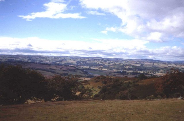
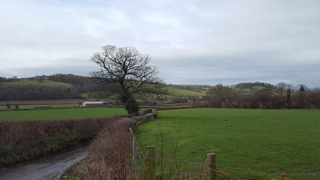
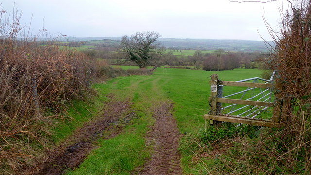
Bach Dingle is a picturesque valley located in Herefordshire, a county in the West Midlands region of England. Nestled amidst rolling hills and lush green countryside, this serene and idyllic location attracts visitors seeking tranquility and natural beauty.

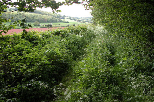
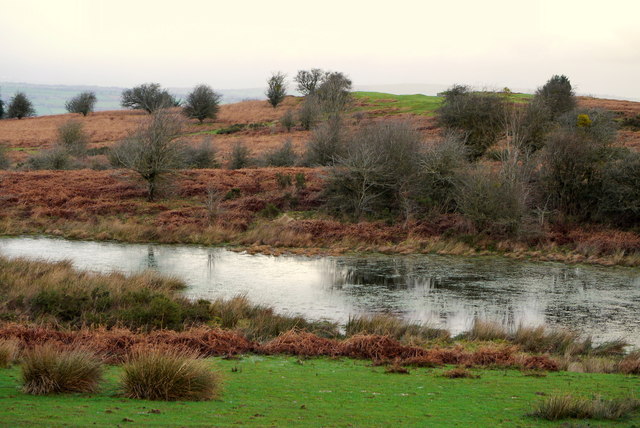
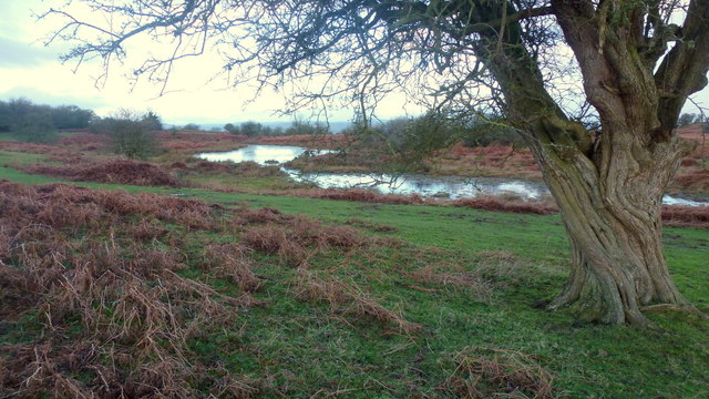
The valley is notable for its diverse ecosystem, with a variety of flora and fauna thriving in its fertile land. The meandering Bach River flows through the valley, enhancing its charm and providing a peaceful backdrop for leisurely walks or picnics along its banks. The area is also known for its rich biodiversity, with numerous species of birds, butterflies, and small mammals calling Bach Dingle their home.

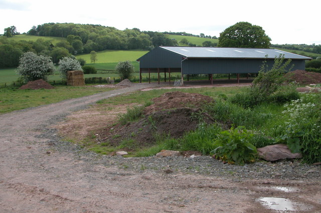
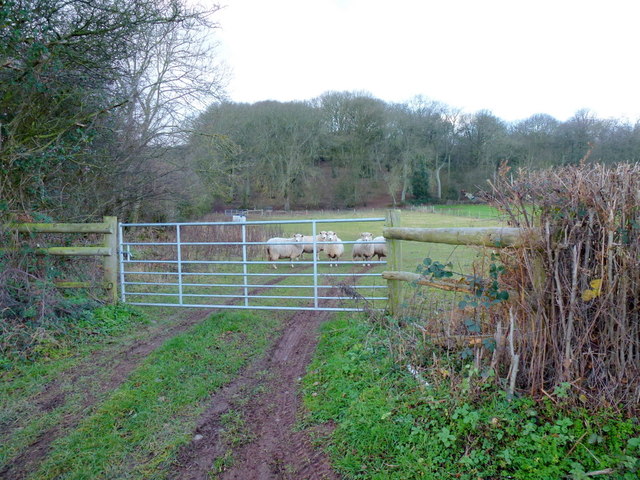
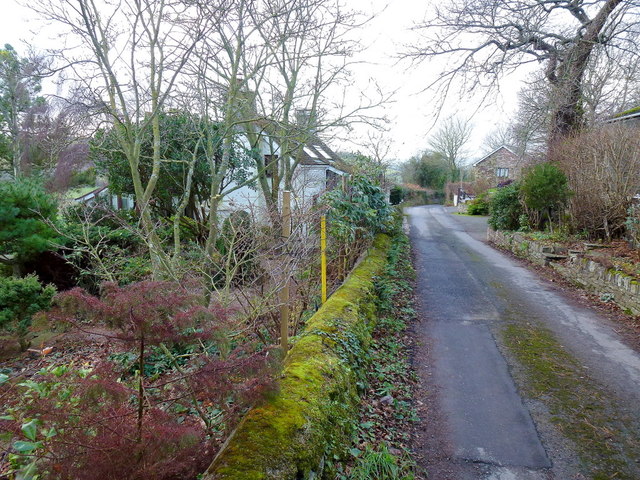
The landscape of Bach Dingle is characterized by its undulating hills and deep valleys, creating a visually stunning panorama. The valley is dotted with traditional stone buildings, adding to its rustic and timeless appeal. The surrounding countryside is predominantly used for agriculture, with fields of crops and grazing livestock contributing to the rural charm of the area.

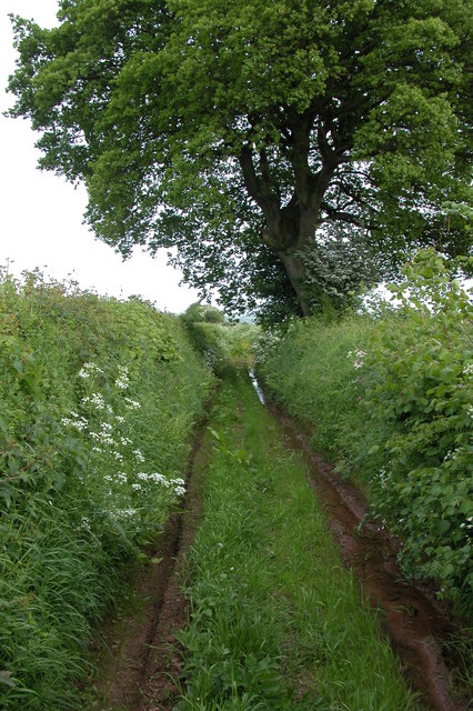
Visitors to Bach Dingle can explore the network of footpaths and trails that crisscross the valley, offering opportunities for hiking and exploring the surrounding countryside. The valley is also a popular destination for nature lovers and birdwatchers, who can observe a wide range of bird species in their natural habitat.

Overall, Bach Dingle in Herefordshire is a hidden gem that showcases the beauty of the English countryside. Its unspoiled landscapes, abundant wildlife, and peaceful atmosphere make it a perfect destination for those seeking a retreat from the hustle and bustle of modern life.

If you have any feedback on the listing, please let us know in the comments section below.

Bach Dingle Images

Images are sourced within 2km of 52.081556/-3.0387738 or Grid Reference SO2843. Thanks to Geograph Open Source API. All images are credited.

New barn, near Little Bage This is a new barn built alongside the course of the old railway line which used to serve the Golden Valley. The barn is not yet shown on OS maps, it is located by the junction of Spoon Lane with Scar Lane.
New barn, near Little Bage
This is a new barn built alongside the course of the old railway line which used to serve the Golden Valley. The barn is not yet shown on OS maps, it is located by the junction of Spoon Lane with Scar Lane.
Spoon Lane, Dorstone At its northern end Spoon Lane is used as access by the farmer to nearby fields, further on it is used less frequently.
Spoon Lane, Dorstone
At its northern end Spoon Lane is used as access by the farmer to nearby fields, further on it is used less frequently.
Spoon Lane, Dorstone Spoon Lane is a green lane in the Golden Valley to the north of the village of Dorstone. In the spring it becomes quite overgrown. Fortunately I wasn't wearing shorts!
Spoon Lane, Dorstone
Spoon Lane is a green lane in the Golden Valley to the north of the village of Dorstone. In the spring it becomes quite overgrown. Fortunately I wasn't wearing shorts!
Merbach Hill West side of the hill overlooking the Wye valley.
Merbach Hill
West side of the hill overlooking the Wye valley.
Sheep pasture To the west of the B4348.
Asper Wood is beyond.
Sheep pasture
To the west of the B4348. Asper Wood is beyond.
River Dore valley floor The Golden Valley is a dull mix of green and grey on this December afternoon.
River Dore valley floor
The Golden Valley is a dull mix of green and grey on this December afternoon.
Scar Cottage A hillside property connected to the Golden Valley by this narrow lane.
Scar Cottage
A hillside property connected to the Golden Valley by this narrow lane.
Spoon Lane What used to be the main route along the Golden Valley is now a green lane.
Spoon Lane
What used to be the main route along the Golden Valley is now a green lane.
Part of Merbach Hill in July What a spot. The weather is making statements off towards Wales and sunbeams and squalls contest territory.
Part of Merbach Hill in July
What a spot. The weather is making statements off towards Wales and sunbeams and squalls contest territory.
Scar Cottage, Scar Lane An extended old cottage on a very narrow country lane
Scar Cottage, Scar Lane
An extended old cottage on a very narrow country lane
Old Milepost by the B4348, Asper Wood, Dorstone Parish Cast iron post by the B4348, in parish of DORSTONE (District), below Asper Wood, in hedgerow 20m South of 4 field entrances, on West side of road. Hereford iron T-post, erected by the Chepstow District turnpike trust in the 19th century. 

Inscription reads:-
: TO / HAY / 5 / MILES : : DORSTON / PARISH : : TO / PETERCHH / 4 / MILES :

Herefordshire SMR listed. SMR Number: 56732 <span class="nowrap"><a title="https://www.heritagegateway.org.uk/Gateway/Results_Single.aspx?uid=MHE28488&resourceID=101" rel="nofollow ugc noopener" href="https://www.heritagegateway.org.uk/Gateway/Results_Single.aspx?uid=MHE28488&resourceID=101">Link</a><img style="margin-left:2px;" alt="External link" title="External link - shift click to open in new window" src="https://s1.geograph.org.uk/img/external.png" width="10" height="10"/></span>

Milestone Society National ID: HF_PCHY04.
Old Milepost by the B4348, Asper Wood, Dorstone Parish
Cast iron post by the B4348, in parish of DORSTONE (District), below Asper Wood, in hedgerow 20m South of 4 field entrances, on West side of road. Hereford iron T-post, erected by the Chepstow District turnpike trust in the 19th century. Inscription reads:- : TO / HAY / 5 / MILES : : DORSTON / PARISH : : TO / PETERCHH / 4 / MILES : Herefordshire SMR listed. SMR Number: 56732 LinkExternal link Milestone Society National ID: HF_PCHY04.
Minor country road Looking down from Scar Lane.
Minor country road
Looking down from Scar Lane.
Old Bridge Marker on the B4348 Bridge Marker set in the bridge parapet on West Brook, on the south side of the B4348 east of Brook House. Clifford parish.

Milestone Society National ID: HF_CLIFF03br
Old Bridge Marker on the B4348
Bridge Marker set in the bridge parapet on West Brook, on the south side of the B4348 east of Brook House. Clifford parish. Milestone Society National ID: HF_CLIFF03br
Old Bridge Marker on Middlewood Bridge Bridge Marker set in the parapet of Middlewood Bridge, West Brook, on the west side of Newton Lane. Clifford parish.

Milestone Society National ID: HF_CLIFF04br
Old Bridge Marker on Middlewood Bridge
Bridge Marker set in the parapet of Middlewood Bridge, West Brook, on the west side of Newton Lane. Clifford parish. Milestone Society National ID: HF_CLIFF04br
Old Bridge Marker on Middlewood Bridge Bridge Marker set in the parapet of Middlewood Bridge, Bach Brook, on the west side of Newton Lane. Clifford parish. 

Milestone Society National ID: HF_CLIFF05br
Old Bridge Marker on Middlewood Bridge
Bridge Marker set in the parapet of Middlewood Bridge, Bach Brook, on the west side of Newton Lane. Clifford parish. Milestone Society National ID: HF_CLIFF05br
Footpath to the West Brook The Wye valley occupies ground beyond the low hill in the middle distance.
Footpath to the West Brook
The Wye valley occupies ground beyond the low hill in the middle distance.
Pool on Little Mountain A piece of low moorland I last visited in the snow of January 2010; <a href="https://www.geograph.org.uk/photo/1657094">SO2842 : Walkers on Little Mountain</a>.
Pool on Little Mountain
A piece of low moorland I last visited in the snow of January 2010; SO2842 : Walkers on Little Mountain.
Little Mountain Common A piece of low moorland I last visited in the snow of January 2010; <a href="https://www.geograph.org.uk/photo/1657094">SO2842 : Walkers on Little Mountain</a>.
Little Mountain Common
A piece of low moorland I last visited in the snow of January 2010; SO2842 : Walkers on Little Mountain.
Show me another place!

Bach Dingle is located at Grid Ref: SO2843 (Lat: 52.081556, Lng: -3.0387738)

Unitary Authority: County of Herefordshire

Police Authority: West Mercia

What 3 Words

///shirtless.truth.flip. Near Dorstone, Herefordshire

Related Wikis

Westbrook railway station (England)

Westbrook railway station was a station to the northwest of Dorstone, Herefordshire, England. The station was opened in 1881, closed to passengers in 1941...

Greens Siding railway station

Greens Siding railway station was a station to the east of Clifford, Herefordshire, England. The station was opened in 1903, closed to passengers in 1941...

Dorstone Castle

Dorstone Castle was in the village of Dorstone in Herefordshire, England, located 6 miles to the east of Hay-on-Wye. == Motte and bailey == This was a...

Dorstone

Dorstone is a village within the Golden Valley, Herefordshire, England. There is a church and public house with restaurant. The Golden Valley area offers...

Have you been to Bach Dingle?

Leave your review of Bach Dingle below (or comments, questions and feedback).