Black Cleugh

Valley in Peeblesshire

Scotland

Black Cleugh

Forest and moor, White Hill Young plantation, an extension to the vast woodlands in the south west Moorfoot Hills.
Forest and moor, White Hill Credit: Richard Webb

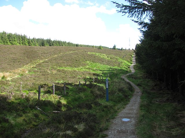
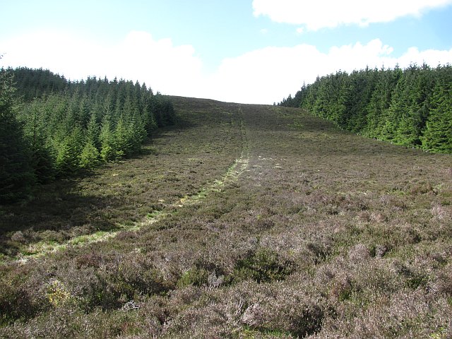
Black Cleugh is a picturesque valley located in Peeblesshire, Scotland. Nestled in the rolling hills of the Southern Uplands, this valley is renowned for its natural beauty and tranquil atmosphere.

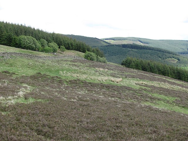
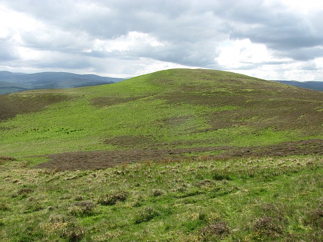
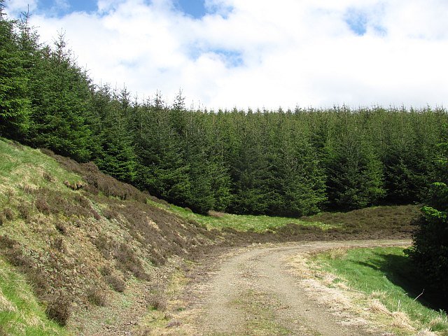
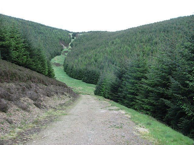
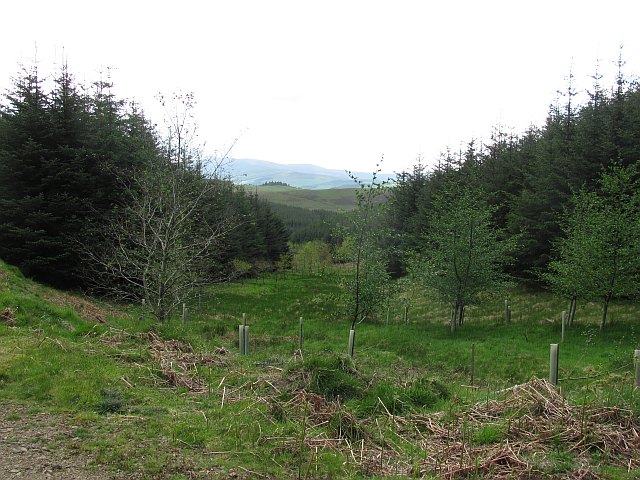
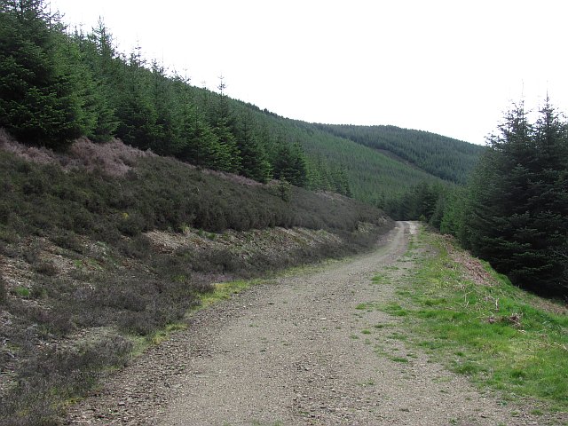
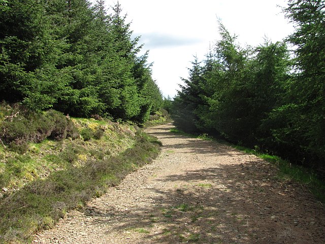
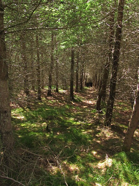
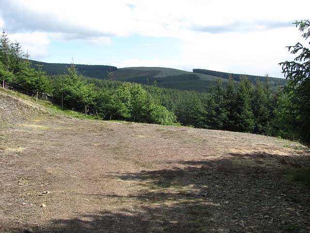
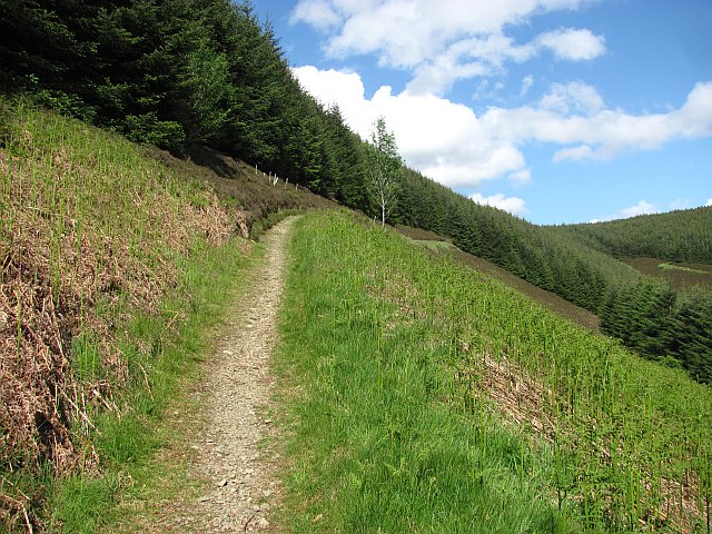
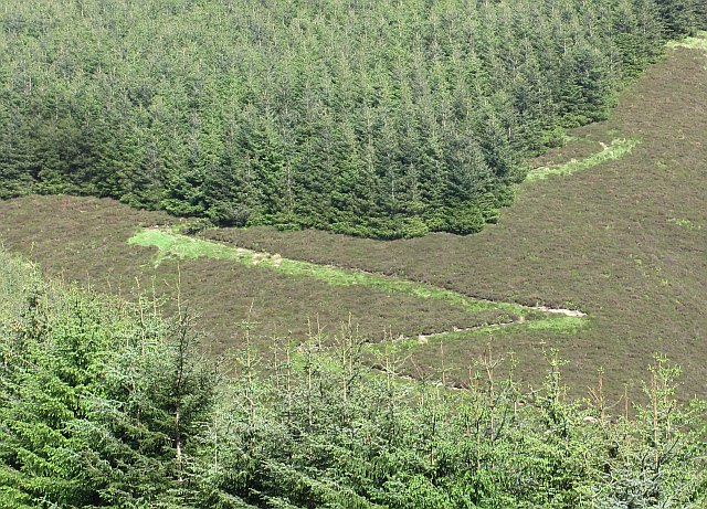
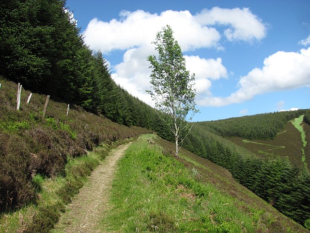
Covered in lush greenery and dotted with small streams, Black Cleugh offers a breathtaking landscape that attracts nature enthusiasts and hikers from all over. The valley is surrounded by towering mountains, creating a sense of isolation and serenity.

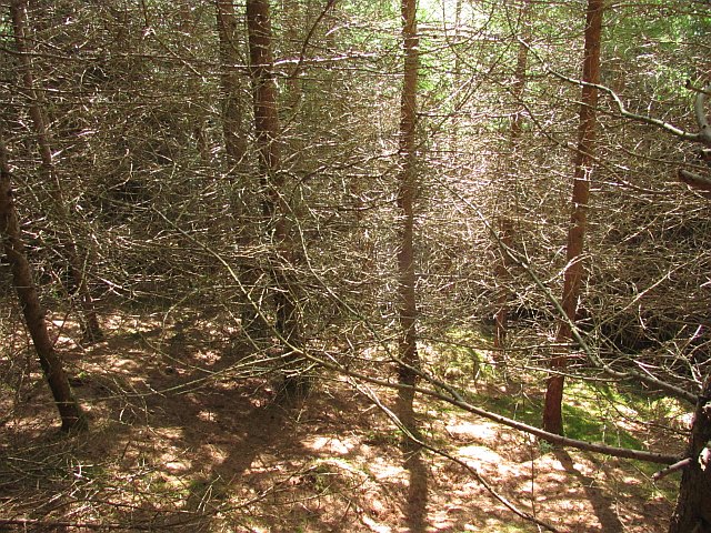
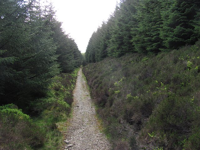
The area is rich in wildlife, with various species of birds, mammals, and plants inhabiting the valley. Red deer, rabbits, and foxes are commonly spotted, while the skies are frequented by buzzards and kestrels. The diverse flora includes heather, ferns, and wildflowers, providing a vibrant and colorful display throughout the seasons.

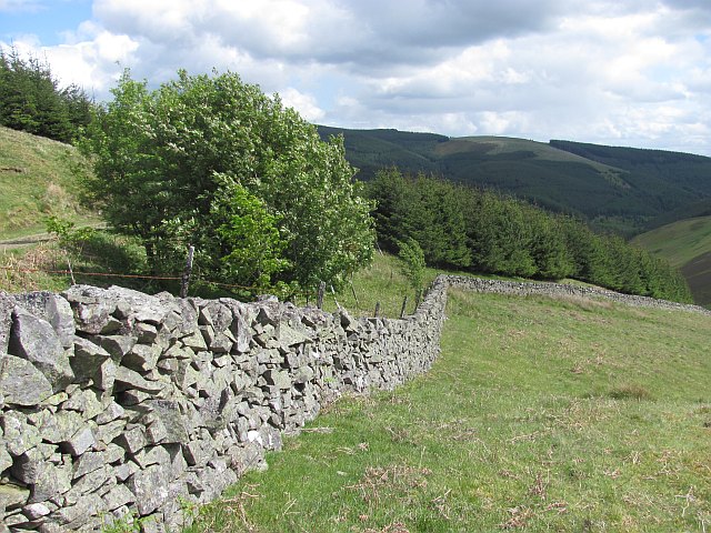
The valley also boasts an interesting history, with evidence of human habitation dating back centuries. Ruins of abandoned farms and stone circles can be found, offering a glimpse into the past. The remnants of old mining activities can also be seen, reminding visitors of the valley's industrial heritage.

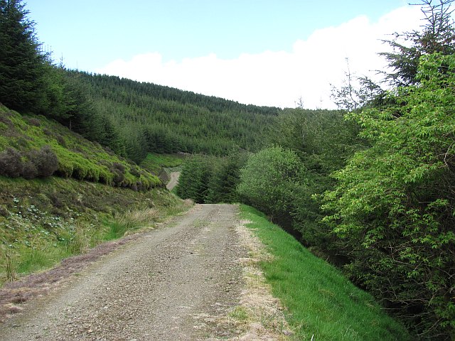
For outdoor enthusiasts, Black Cleugh offers numerous walking trails and paths, allowing visitors to explore the valley and take in its natural wonders. The nearby Black Cleugh Reservoir provides opportunities for fishing and boating, adding to the recreational options available.

In conclusion, Black Cleugh in Peeblesshire is a captivating valley that showcases the beauty of the Scottish countryside. With its stunning landscapes, abundant wildlife, and rich history, it is a haven for those seeking a peaceful retreat in nature.

If you have any feedback on the listing, please let us know in the comments section below.

Black Cleugh Images

Images are sourced within 2km of 55.699649/-3.1574903 or Grid Reference NT2745. Thanks to Geograph Open Source API. All images are credited.

Forest and moor, White Hill Young plantation, an extension to the vast woodlands in the south west Moorfoot Hills.
Forest and moor, White Hill
Young plantation, an extension to the vast woodlands in the south west Moorfoot Hills.
Collie Law Moorland summit in the Moorfoot Hills.
Collie Law
Moorland summit in the Moorfoot Hills.
Dyke, White Law Edge of the forest above Soonhope.
Dyke, White Law
Edge of the forest above Soonhope.
Logging road, Crookshope View along one of the forest roads which contour the steep sides of some of the Moorfoot Hill glens.
Logging road, Crookshope
View along one of the forest roads which contour the steep sides of some of the Moorfoot Hill glens.
Forest, Crookshope Sitka spruce plantations at the head of Crookshope beneath Whiteside Edge.
Forest, Crookshope
Sitka spruce plantations at the head of Crookshope beneath Whiteside Edge.
Forest road, Soonhope The upper reaches of the Soonhope Burn, clothed in a first generation Sitka spruce plantation.
Forest road, Soonhope
The upper reaches of the Soonhope Burn, clothed in a first generation Sitka spruce plantation.
Soonhope Burn A gap in the Sitka spruce for the burn, with some limited broadleaf planting.
Soonhope Burn
A gap in the Sitka spruce for the burn, with some limited broadleaf planting.
Forest road, Soonhope A road contours around the upper glen through seemingly endless Sitka plantations.
Forest road, Soonhope
A road contours around the upper glen through seemingly endless Sitka plantations.
Forest road, Soonhope This logging road in privately maintained forestry is shown ending near here with no connection with the road network in the neighbouring Forestry Commission woodland. No problem if on foot, bike or horesback as the roads almost meet and there is a short easy path connecting them.
Forest road, Soonhope
This logging road in privately maintained forestry is shown ending near here with no connection with the road network in the neighbouring Forestry Commission woodland. No problem if on foot, bike or horesback as the roads almost meet and there is a short easy path connecting them.
Inside the forest Larch and a cut path allow access to otherwise dense woodland, and that all important gridline.
Inside the forest
Larch and a cut path allow access to otherwise dense woodland, and that all important gridline.
Dense larch wood There is a way through - but you have to work at it.
Dense larch wood
There is a way through - but you have to work at it.
Road end (private) The roads in the private and Forestry Commission managed bits of Glentress Forest do not meet - but there is a gap in the trees where the shortest of paths takes you on to the next road over the boundary. It's like a spark across a gap, a huge "potential" builds up when forest roads are close to each other and paths form along the easiest route between them.
Road end (private)
The roads in the private and Forestry Commission managed bits of Glentress Forest do not meet - but there is a gap in the trees where the shortest of paths takes you on to the next road over the boundary. It's like a spark across a gap, a huge "potential" builds up when forest roads are close to each other and paths form along the easiest route between them.
Path, Tower Rig An open section of a path which pre-dates the conifers of Glentress Forest.
Path, Tower Rig
An open section of a path which pre-dates the conifers of Glentress Forest.
A zig-zag path A path climbing Dunslair Heights. It does not feature on the current mountain bike trail map, although it looks like a climbing track for bikes.
A zig-zag path
A path climbing Dunslair Heights. It does not feature on the current mountain bike trail map, although it looks like a climbing track for bikes.
Path, Tower Rig The path runs along a steep hillside.
Path, Tower Rig
The path runs along a steep hillside.
Top of the Tower Rig path Single track amongst heather and young Sitka spruce.
Top of the Tower Rig path
Single track amongst heather and young Sitka spruce.
Dunslair Heights The broad ridge to the north of Dunslair Heights. The path is used by the Glentress black route to climb to the summit.
Dunslair Heights
The broad ridge to the north of Dunslair Heights. The path is used by the Glentress black route to climb to the summit.
Wide ride, Shieldgreen Kips The Moorfoot Hills, north of Dunslair Heights; there is a broad ridge which is mainly forested. The unplanted area is deep in heather.
Wide ride, Shieldgreen Kips
The Moorfoot Hills, north of Dunslair Heights; there is a broad ridge which is mainly forested. The unplanted area is deep in heather.
Show me another place!

Black Cleugh is located at Grid Ref: NT2745 (Lat: 55.699649, Lng: -3.1574903)

Unitary Authority: The Scottish Borders

Police Authority: The Lothians and Scottish Borders

What 3 Words

///takers.mysteries.starts. Near Peebles, Scottish Borders

Related Wikis

Bowbeat Hill

Bowbeat Hill is a hill in the Moorfoot Hills range, part of the Southern Uplands of Scotland. It lends its name to Bowbeat Onshore Wind Farm built on the...

Glentress Forest

Glentress Forest is located near Peebles in the Scottish Borders, about 30 miles south of Edinburgh. Part of the Tweed Valley Forest Park along with Traquair...

Milkieston Rings

Milkieston Rings is a prehistoric site, a hillfort near the village of Eddleston and about 3 miles (5 km) north of Peebles, in the Scottish Borders, Scotland...

Eddleston

Eddleston (Scottish Gaelic: Baile Ghille Mhoire) is a small village and civil parish in the Scottish Borders area of Scotland. It lies 4 miles (6.4 km...

Nearby Amenities

Located within 500m of 55.699649,-3.1574903
Cardon Law
Ele: 588
Natural: peak
Wikidata: Q96472303
Lat/Long: 55.6993526/-3.1503512
Whiteside Edge
Ele: 547
Natural: peak
Lat/Long: 55.6965629/-3.1591154
The data included in this document is from www.openstreetmap.org. The data is made available under ODbL.

Have you been to Black Cleugh?

Leave your review of Black Cleugh below (or comments, questions and feedback).